1HappyHiker
Well-known member
At one time or another, nearly everyone on this Forum has done the hike up to North and Middle Sugarloaf off the Zealand Road.
Both of these little mountains offer a big bang for the buck in terms of views.
Meanwhile, poor little South Sugarloaf is trail-less and therefore doesn't get many visitors. Before the snow becomes completely useless in terms of bushwhacking, I wanted to pay a visit not only to South Sugarloaf, but also to a ledge to its south that is about 350 higher than the summit of South Sugarloaf. From that ledge, I was hoping to get a bird's-eye view of all 3 Sugarloaf mountains.
The whack up to South Sugarloaf went fine. The snow was far from being a hardened boiler plate, which would have been ideal. However, the snow was firm enough for some doable bushwhacking. There were occasional soft spots which resulted in unexpected plunges (a.k.a. "spruce traps"). However, for each plunge, self-extraction was an easy undertaking!
I'd been to South Sugarloaf once before in August 2008, and I recall being amazed at the orange/tan almost sand-like material on the summit area of this mountain. Geology (among many other areas) isn't one of my strong suits. Is this material what is sometimes referred to as "rotten granite"?
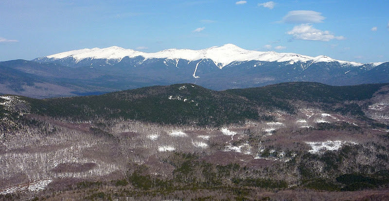
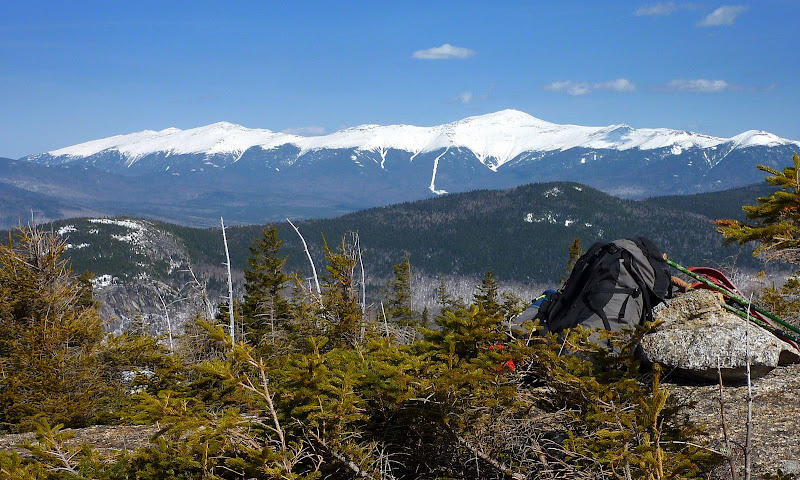
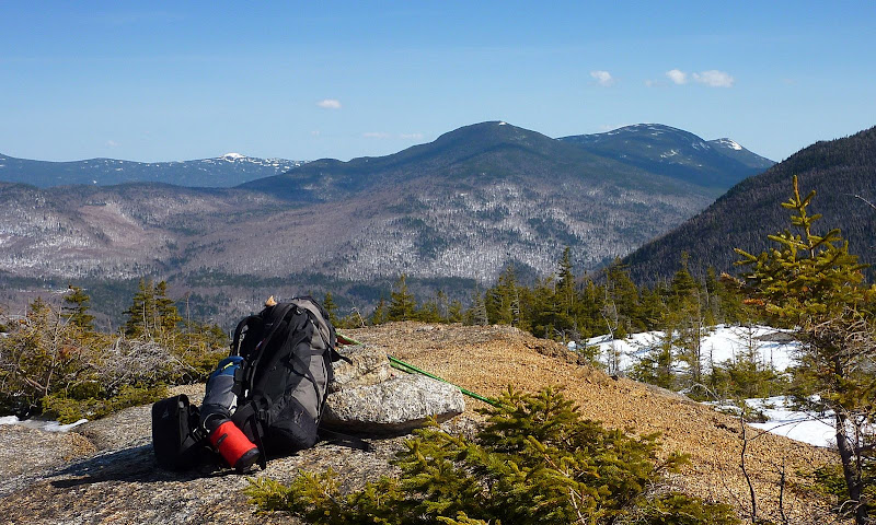
This orange/tan material is evident in a couple of the snapshots (shown below) which were taken from South Sugarloaf.
View of Presidential Range from South Sugarloaf
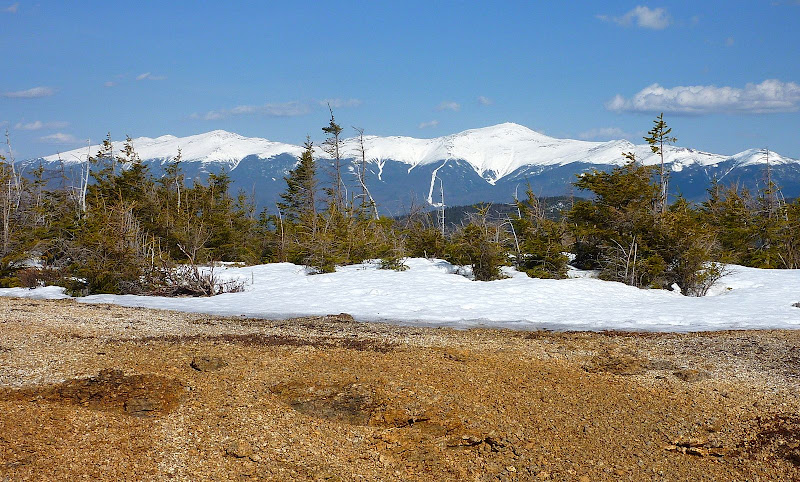
Another View of Presidential Range from South Sugarloaf
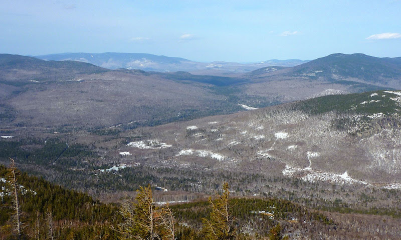
Tom, Field, Willey from South Sugarloaf
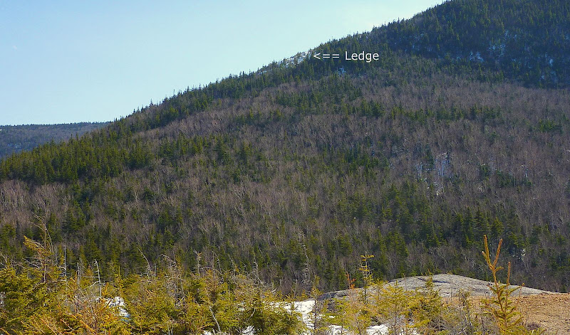
Okay . . . I spent far too much time basking in the warm sunshine on South Sugarloaf. And so now I started to wonder if I would have time to visit the ledge to the south. I could see it clearly from South Sugarloaf. It was taunting me to give it a try. The distance to the ledge was known (a short 0.3 mile, as the crow flies). But the great unknown was how many glitches might be encountered along the way.
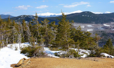
Below is a snapshot of the ledge as seen from South Sugarloaf.
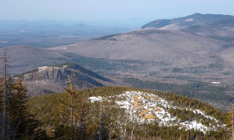
Finally, I talked myself into giving it a shot, and so I headed off in the direction of the ledge. It turned out to be a relatively short and easy whack. And, when I got out onto the ledge, I was rewarded with the view of the 3 Sugarloaf Mountains, all lined up in a row.
First in line, and just below me, was the orange/tan summit of South Sugarloaf, followed by Middle Sugarloaf with its massive south-facing cliff clearly visible. And just a bit beyond Middle Sugarloaf, I could see some of the rocky top of North Sugarloaf.
South, Middle and North Sugarloaf from a 3,360 ft. Ledge
So, with the type of weather we've been having, this might well have been my last snowshoe bushwhack for this season. But that's okay . . . there are plenty of days ahead for great hiking, both on and off trail!
1HappyHiker
Both of these little mountains offer a big bang for the buck in terms of views.
Meanwhile, poor little South Sugarloaf is trail-less and therefore doesn't get many visitors. Before the snow becomes completely useless in terms of bushwhacking, I wanted to pay a visit not only to South Sugarloaf, but also to a ledge to its south that is about 350 higher than the summit of South Sugarloaf. From that ledge, I was hoping to get a bird's-eye view of all 3 Sugarloaf mountains.
The whack up to South Sugarloaf went fine. The snow was far from being a hardened boiler plate, which would have been ideal. However, the snow was firm enough for some doable bushwhacking. There were occasional soft spots which resulted in unexpected plunges (a.k.a. "spruce traps"). However, for each plunge, self-extraction was an easy undertaking!
I'd been to South Sugarloaf once before in August 2008, and I recall being amazed at the orange/tan almost sand-like material on the summit area of this mountain. Geology (among many other areas) isn't one of my strong suits. Is this material what is sometimes referred to as "rotten granite"?
This orange/tan material is evident in a couple of the snapshots (shown below) which were taken from South Sugarloaf.
View of Presidential Range from South Sugarloaf

Another View of Presidential Range from South Sugarloaf

Tom, Field, Willey from South Sugarloaf

Okay . . . I spent far too much time basking in the warm sunshine on South Sugarloaf. And so now I started to wonder if I would have time to visit the ledge to the south. I could see it clearly from South Sugarloaf. It was taunting me to give it a try. The distance to the ledge was known (a short 0.3 mile, as the crow flies). But the great unknown was how many glitches might be encountered along the way.
Below is a snapshot of the ledge as seen from South Sugarloaf.

Finally, I talked myself into giving it a shot, and so I headed off in the direction of the ledge. It turned out to be a relatively short and easy whack. And, when I got out onto the ledge, I was rewarded with the view of the 3 Sugarloaf Mountains, all lined up in a row.
First in line, and just below me, was the orange/tan summit of South Sugarloaf, followed by Middle Sugarloaf with its massive south-facing cliff clearly visible. And just a bit beyond Middle Sugarloaf, I could see some of the rocky top of North Sugarloaf.
South, Middle and North Sugarloaf from a 3,360 ft. Ledge

So, with the type of weather we've been having, this might well have been my last snowshoe bushwhack for this season. But that's okay . . . there are plenty of days ahead for great hiking, both on and off trail!
1HappyHiker
Last edited:

