Additional 4k peak in VT

vftt.org

Help Support vftt.org:

This site may earn a commission from merchant affiliate links, including eBay, Amazon, and others.

RoySwkr

New member
Joined
Sep 4, 2003
Messages
4,467
Reaction score
285
http://mapper.acme.com/?ll=44.52616,-72.81512&z=16&t=T

A well-known peakbagger told me that someone was claiming that The Nose of Mt Mansfield should be a separate 4k peak, so I inquired for myself and this is what I found:

RS:
> Hi,
>
> I am trying to find the freestanding height of a pinnacle called The Nose
> on Mt Mansfield
>
> The USGS map shows "BM 3849" at the base of The Nose about .1 mi N of the
> summit, with a 4020 highest contour and no elevation of the summit marker
>
> NOAA marker PG1699 has a datasheet elevation of 4062.0 - is this
> comparable to the USGS elevation and if so why isn't there at 4040
> contour at least?


Dan Martin, NOAA:
>The height that is listed on the NOAA/NGS data sheet (4062.0 feet) is
>comparable to the USGS elevation. As it turns out, I was the one who
>observed the station and processed the data to publish that specific
>height as well as the updated published height for the summit mark on
>the chin (see description for "Mt Mansfield Highest Point" AE3691). The
>old height was published as 4393.2. My observations in 1996 show the
>height to be 4395.3 feet.

>In reading the description, it appears that the mark on the Nose is not
>at the highest point of the Nose, but is either 50 feet or 5 feet
>southeast of the highest point of the Nose. Both 50 feet and 5 feet are
>listed in the station recovery history. I am not sure why there is no
>spot elevation shown on the USGS quad map.

>As far as why the 4040 contour is missing, I have no answer. It is
>possible though that that contour was omitted since it cannot be shown
>on the east side of the nose. The east side of the nose is a nearly
>vertical cliff that contains the 4020 and 4040 contours. In that
>location, the two contours would plot on top of each other. However I
>agree that the 4040 contour should be plotted on the south, west, and
>north extents of the nose.

Hopefully when the AMC adds this peak they will delete the impostor South Hancock
 
Lin Neifert, USGS:

>My guess is that the 4040 contour was edited off the map due to the number of features in
>the area. With the cliff the contours would have been feathered together. Along with the
>road, it may have been confusing. An editor in the Cartography unit most likely removed
>them to create a readable map.
 
Kewl stuff! Based on the time it took to update to the latest lists, we might not be around anymore when it finally happens :eek::D
 
Works for me, A bunch of us hiked up to the Nose, even when it was officially closed cause the folks were working on the towers up there.... :)

Jay
 
Mansfield Nose

A few years ago I got the detailed topo data of the nose and col from the civil engineering firm working on the preliminary plan for the tower relocation job. It confirmed my suspicion that the nose seems to qualify as a 6th VT 4. I've kept quite about it, thinking that once the relocation was finished, and hopefully the nose was officially opened, the news would come out. I too have been up there, a great little hike with wonderful big steps coming down off the northwestern corner.
John
 
I hope so, that would make the nose my first 4K instead of my first failed attempt of a 4K. (trust me you don't want to know the details of why a 27 year old who did small hikes previously, learned after that hike in the rain & fog to learn a topo map.)

I found myself on the nose in the fog & upon getting back to park HQ at Underhill saw & understood the topo lines. Went back two weeks later for the Chin.
 
but jay,
the nose is closed....did you not see the signs?

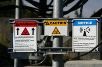
It is? I've only seen signs saying that the radiation exceeded Canadian standards for exposure. My understanding is that with the installation of the new digital towers, the hot zones the hot zones were not eliminated, as initially hoped for, but were significantly reduced.

It should be noted that the alpine flora has made a significant recovery since the closure of the Triangle Trail and that visitors should, as always, be extremely careful to remain on rocks.
 
I was on the Nose two weekends ago. There are lots of signs warning about radiation but nothing that says you're not permitted to be there. There are also some faded blue blazes.

Edit to add: it seemed obvious that there was once a trail down the northwest ridge of the nose, but I didn't attempt to follow it down nor find its lower end. Was that the Triangle Trail?


I don't recall whether I noticed any benchmarks on the Nose. this photo shows what I thought might be the highest point on the Nose, and seems to rule out a benchmark five feet to the southeast of that point. The triangle mark on the USGS topo is much more than 5 feet southeast of this point - 50 is a possibility though it's hard to be sure with a missing contour line.

And yes, that northeastern cliff is quite steep
cliff from below

wider view
 
Last edited:
It is? I've only seen signs saying that the radiation exceeded Canadian standards for exposure. My understanding is that with the installation of the new digital towers, the hot zones the hot zones were not eliminated, as initially hoped for, but were significantly reduced.

It should be noted that the alpine flora has made a significant recovery since the closure of the Triangle Trail and that visitors should, as always, be extremely careful to remain on rocks.

It was closed (a sawhorse across the trail) at the time cause there were actually workers climbing the towers that are there and the radiation signs too (but I would think that perhaps they were actually offline due to the workers???)

Jay
 
It was closed (a sawhorse across the trail) at the time cause there were actually workers climbing the towers that are there and the radiation signs too (but I would think that perhaps they were actually offline due to the workers???)

Jay

Yup,
i have only been up there twice this summer, but both times the nose was "closed". not an official closing of the nose, they were (and always seem to be) working on the towers.
 
I'm aware that the FKT for the Vermont 6ers, of 19 hours (trailhead to last summit), was set on 28 July 2007. I expect Jan Wellford will lower that time by quite a considerable amount, however, it should be noted that the record holders spent some time grazing at the Cabot outlet in Waterbury, significantly slowing their pace. All future record attempts should include a stop at the Cabot outlet.
 
Last edited:
I'm aware that the FKT for the Vermont 6ers, of 19 hours (trailhead to last summit), was set on 28 July 2007. I expect Jan Wellford will lower that time by quite a considerable amount, however, it should be noted that the record holders spent some time grazing at the Cabot outlet in Waterbury, significantly slowing their pace. All future record attempts should include a stop at the Cabot outlet.

huh? maybe you should give it a whack
 
I'm aware that the FKT for the Vermont 6ers, of 19 hours (trailhead to last summit), was set on 28 July 2007. I expect Jan Wellford will lower that time by quite a considerable amount, however, it should be noted that the record holders spent some time grazing at the Cabot outlet in Waterbury, significantly slowing their pace. All future record attempts should include a stop at the Cabot outlet.
Non-sequiturs don't set FKT's.

-Dr. Wu
 
I went there 9/19/2008 (Trip Report) as part of my bagging The Chin. As I mentioned at the time, I went looking for an old trail on NG TOPO! because I didn't have a recent map - presumably it was the closed Triangle Trail. I just went up past the maintenance buildings and down the cliff - and at the bottom of the cliff it was blocked off. There are remains of benchmarks and faint blue paint blazes on The Nose.


Tim
 
Here's the National Geodetic Survey data sheet:

The NGS Data Sheet
See file dsdata.txt for more information about the datasheet.

DATABASE = ,PROGRAM = datasheet, VERSION = 7.85
1 National Geodetic Survey, Retrieval Date = SEPTEMBER 29, 2010
PG1699 ***********************************************************************
PG1699 DESIGNATION - MT MANSFIELD
PG1699 PID - PG1699
PG1699 STATE/COUNTY- VT/LAMOILLE
PG1699 USGS QUAD - MOUNT MANSFIELD (1983)
PG1699
PG1699 *CURRENT SURVEY CONTROL
PG1699 ___________________________________________________________________
PG1699* NAD 83(2007)- 44 31 35.02146(N) 072 48 53.84257(W) ADJUSTED
PG1699* NAVD 88 - 1238.2 (meters) 4062. (feet) GPS OBS
PG1699 ___________________________________________________________________
PG1699 EPOCH DATE - 2002.00
PG1699 X - 1,345,966.468 (meters) COMP
PG1699 Y - -4,352,136.498 (meters) COMP
PG1699 Z - 4,450,828.713 (meters) COMP
PG1699 LAPLACE CORR- 4.12 (seconds) DEFLEC09
PG1699 ELLIP HEIGHT- 1210.708 (meters) (02/10/07) ADJUSTED
PG1699 GEOID HEIGHT- -27.55 (meters) GEOID09
PG1699
PG1699 ------- Accuracy Estimates (at 95% Confidence Level in cm) --------
PG1699 Type PID Designation North East Ellip
PG1699 -------------------------------------------------------------------
PG1699 NETWORK PG1699 MT MANSFIELD 1.51 1.02 2.33
PG1699 -------------------------------------------------------------------
PG1699
PG1699.The horizontal coordinates were established by GPS observations
PG1699.and adjusted by the National Geodetic Survey in February 2007.
PG1699
PG1699.The datum tag of NAD 83(2007) is equivalent to NAD 83(NSRS2007).
PG1699.See National Readjustment for more information.
PG1699.The horizontal coordinates are valid at the epoch date displayed above.
PG1699.The epoch date for horizontal control is a decimal equivalence
PG1699.of Year/Month/Day.
PG1699
PG1699.The orthometric height was determined by GPS observations and a
PG1699.high-resolution geoid model.
PG1699
PG1699.The X, Y, and Z were computed from the position and the ellipsoidal ht.
PG1699
PG1699.The Laplace correction was computed from DEFLEC09 derived deflections.
PG1699
PG1699.The ellipsoidal height was determined by GPS observations
PG1699.and is referenced to NAD 83.
PG1699
PG1699.The geoid height was determined by GEOID09.
PG1699
PG1699; North East Units Scale Factor Converg.
PG1699;SPC VT - 225,178.250 474,963.861 MT 0.99997199 -0 13 15.1
PG1699;SPC VT - 738,772.31 1,558,277.27 sFT 0.99997199 -0 13 15.1
PG1699;UTM 18 - 4,932,663.266 673,628.433 MT 0.99997075 +1 31 57.4
PG1699
PG1699! - Elev Factor x Scale Factor = Combined Factor
PG1699!SPC VT - 0.99981020 x 0.99997199 = 0.99978220
PG1699!UTM 18 - 0.99981020 x 0.99997075 = 0.99978096
PG1699
PG1699: Primary Azimuth Mark Grid Az
PG1699:SPC VT - MT MANSFIELD AZ MK RESET 118 34 05.2
PG1699:UTM 18 - MT MANSFIELD AZ MK RESET 116 48 52.7
PG1699
PG1699|---------------------------------------------------------------------|
PG1699| PID Reference Object Distance Geod. Az |
PG1699| dddmmss.s |
PG1699| DA5223 MT MANSFIELD AZ MK 1172104.4 |
PG1699| DA5222 MT MANSFIELD AZ MK RESET 1182050.1 |
PG1699| PG1681 WATERBURY RAD STATION WDEV MAST APPROX.19.7 KM 1651120.9 |
PG1699| DA5224 MT MANSFIELD RM 1 4.735 METERS 16913 |
PG1699| PG1682 ROBBINS MTN AWY BCN APPROX.20.2 KM 2070900.1 |
PG1699| DA5225 MT MANSFIELD RM 2 3.934 METERS 27759 |
PG1699|---------------------------------------------------------------------|
PG1699
PG1699 SUPERSEDED SURVEY CONTROL
PG1699
PG1699 ELLIP H (06/04/02) 1210.703 (m) GP( ) 4 2
PG1699 NAD 83(1996)- 44 31 35.02168(N) 072 48 53.84326(W) AD( ) 1
PG1699 ELLIP H (09/30/97) 1210.684 (m) GP( ) 4 1
PG1699 NAD 83(1992)- 44 31 35.01878(N) 072 48 53.84722(W) AD( ) 1
PG1699 NAD 83(1986)- 44 31 35.02656(N) 072 48 53.84821(W) AD( ) 1
PG1699 NAD 27 - 44 31 34.83980(N) 072 48 55.40089(W) AD( ) 1
PG1699 NGVD 29 (07/19/86) 1238.7 (m) 4064. (f) VERT ANG
PG1699
PG1699.Superseded values are not recommended for survey control.
PG1699.NGS no longer adjusts projects to the NAD 27 or NGVD 29 datums.
PG1699.See file dsdata.txt to determine how the superseded data were derived.
PG1699
PG1699_U.S. NATIONAL GRID SPATIAL ADDRESS: 18TXQ7362832663(NAD 83)
PG1699_MARKER: B = BOLT
PG1699_SETTING: 66 = SET IN ROCK OUTCROP
PG1699_SP_SET: IN A DRILL HOLE IN ROCK LEDGE
PG1699_MAGNETIC: I = MARKER IS A STEEL ROD
PG1699_STABILITY: A = MOST RELIABLE AND EXPECTED TO HOLD
PG1699+STABILITY: POSITION/ELEVATION WELL
PG1699_SATELLITE: THE SITE LOCATION WAS REPORTED AS SUITABLE FOR
PG1699+SATELLITE: SATELLITE OBSERVATIONS - August 22, 1996
PG1699
PG1699 HISTORY - Date Condition Report By
PG1699 HISTORY - 1875 MONUMENTED CGS
PG1699 HISTORY - 1897 GOOD CGS
PG1699 HISTORY - 1936 GOOD VTGS
PG1699 HISTORY - 1943 GOOD CGS
PG1699 HISTORY - 1954 GOOD CGS
PG1699 HISTORY - 1960 GOOD CGS
PG1699 HISTORY - 1964 GOOD CGS
PG1699 HISTORY - 1968 GOOD CGS
PG1699 HISTORY - 1971 GOOD LOCSUR
PG1699 HISTORY - 1977 POOR VTDH
PG1699 HISTORY - 1978 GOOD NGS
PG1699 HISTORY - 19960822 GOOD NGS
PG1699 HISTORY - 20050904 POOR GEOCAC
PG1699
 
Continued:

PG1699 STATION DESCRIPTION
PG1699
PG1699'DESCRIBED BY COAST AND GEODETIC SURVEY 1875 (ETQ)
PG1699'TO REACH THE MOUNTAIN, GO FROM THE VERMONT CENTRAL RAILROAD
PG1699'AT WATERBURY, OR FROM THE PORTLAND AND OGDENSBURG RAILROAD
PG1699'AT MORRISVILLE TO STOWE, THENCE BY CARRIAGE ROAD TO THE SUMMIT
PG1699'HOUSE, WHICH IS UNDER THE NOSE OF THE MOUNTAIN. THE STATION
PG1699'IS ON THE NOSE ABOVE THE HOUSE, MARKED BY A BOLT AND TRIANGLE.
PG1699'
PG1699'THE STATION WAS FIRST TAKEN ON THE CHIN ABOUT 2 MILES N OF
PG1699'THE NOSE BUT BEING INVISIBLE FROM CUBE, WAS MOVED TO THE PRESENT
PG1699'PLACE.
PG1699
PG1699 STATION RECOVERY (1897)
PG1699
PG1699'RECOVERY NOTE BY COAST AND GEODETIC SURVEY 1897 (ATM)
PG1699'TO REACH MOUNT MANSFIELD, GO TO STOWE BY STAGE FROM EITHER
PG1699'WATERBURY ON THE CENTRAL VERMONT RAILWAY, OR FROM MORRISVILLE
PG1699'ON THE BOSTON AND MAINE RAILROAD. IN 1897, AN ELECTRIC
PG1699'RAILROAD WAS BEING BUILT FROM WATERBURY TO STOWE. FROM STOWE
PG1699'IT IS 10 MILES TO THE SUMMIT HOUSE, SMALL, 30 YEARS OLD,
PG1699'AND THE RISE IS ABOUT 3350 FEET.
PG1699'
PG1699'THE PROFILE OF THE SUMMIT OF MOUNT MANSFIELD AS SEEN FROM
PG1699'AN EASTERLY OR WESTERLY POINT OF VIEW IS COMMONLY IMAGINED
PG1699'AND SPOKEN OF AS BEING THAT OF THE HEAD OF THE OLD MAN OF
PG1699'THE MOUNTAIN. THE STATION IS ON THE NOSE WHICH RISES NEARLY
PG1699'PERPENDICULARLY FROM THE RIDGE ON WHICH THE HOTEL IS LOCATED
PG1699'ABOUT 215 FEET.
PG1699'
PG1699'THE STATION WAS FOUND, BOLT IN ROCK, WITH ROTTEN REMAINS
PG1699'OF A HELIOTROPE STAND SURROUNDED BY A CAIRN OF STONES ABOUT
PG1699'3 FEET HIGH. THIS STATION IS ONLY 3 FEET FROM THE EDGE OF
PG1699'CLIFF.
PG1699'
PG1699'A PIER OF SOLID CONCRETE TRIANGULAR IN FORM, WAS BUILT OVER
PG1699'THE BOLT ABOUT 4 FEET HIGH AND THE STATION WAS MARKED ON
PG1699'THE TOP OF THE PIER BY A WIRE SPIKE (BEING TRANSFERRED FROM
PG1699'THE BOLT IN THE ROCK BELOW.)
PG1699'
PG1699'TWO IRON BOLTS WERE SUNK IN THE SOLID ROCK AND ARROWS OUT
PG1699'POINTING FROM THESE BOLTS TO THE STATION.
PG1699
PG1699 STATION RECOVERY (1936)
PG1699
PG1699'RECOVERY NOTE BY VERMONT GEODETIC SURVEY 1936
PG1699'ORIGINAL DESCRIPTION HOLDS, WITH THIS CORRECTION--THE TRIANGULAR
PG1699'CONCRETE PIER BUILT OVER THE STATION IN 1897, HAS BOW DISINTEGRATED
PG1699'AND THE WHOLE PIER FALLEN OVER, LEAVING THE ORIGINAL BOLT
PG1699'ENCLOSED WITHIN A TRIANGLE NOW EXPOSTED.
PG1699'
PG1699'A CONCRETE PIER, TRIANGULAR IN SHAPE WITH SIDES 1 FOOT AND
PG1699'4 FEET HIGH, STANDS ABOUT 33.2 FEET WESTERLY OF THE STATION.
PG1699'
PG1699'STATION REACHED BY DRIVING TO STOWE AND THEN TO THE MOUNT
PG1699'MANSFIELD TOLL ROAD LEADING DIRECT TO THE HOTEL AT THE FOOT
PG1699'OF THE NOSE. GOOD AUTOMOBILE ROAD TO THE HOTEL.
PG1699
PG1699 STATION RECOVERY (1943)
PG1699
PG1699'RECOVERY NOTE BY COAST AND GEODETIC SURVEY 1943 (PLB)
PG1699'THE STATION MARK RECOVERED AS DESCRIBED, AND FOUND IN GOOD
PG1699'CONDITION. FOLLOWING IS A NEW DESCRIPTION. THE STATION
PG1699'IS LOCATED ABOUT 6.0 MILES WEST OF THE VILLAGE OF STOWE, AND
PG1699'28 MILES EAST-NORTHEAST OF BURLINGTON, ON THE SUMMIT OF WHAT
PG1699'IS LOCALLY KNOWN AS THE NOSE OF MT MANSFIELD, AND ON LAND
PG1699'OWNED BY THE VERMONT CONSERVATION DEPARTMENT. IT IS 33 FEET
PG1699'EAST OF AN 18-INCH CONCRETE TRIANGULAR SHAPED POST 4-FEET
PG1699'HIGH, 50 FEET SOUTHEAST OF THE HIGHEST POINT OF THE MOUNTAIN,
PG1699'AND ABOUT 0.1 MILE SOUTH OF THE MT MANSFIELD HOTEL, AT THE
PG1699'FOOT OF THE NOSE. THE MARK IS A 1/2-INCH IRON BOLT SET IN
PG1699'THE ROCK, AND PROJECTS ABOUT 4-INCHES.
PG1699'
PG1699'A NEW AZIMUTH MARK WAS SET ABOUT 0.4 MILE EAST OF THE STATION,
PG1699'50 FEET NORTH OF THE TOLL ROAD LEADING TO THE HOTEL, 125 FEET
PG1699'EAST-SOUTHEAST OF THE JUNCTION OF THE TEAR DROP AND NOSE DIVE
PG1699'TRAILS, 100 FEET WEST OF THE STONE WARMING HOUSE AT THE TOP
PG1699'OF THE SKI-LIFT. THE DISK IS SET IN BEDROCK OUTCROP, FLUSH
PG1699'WITH THE ROCK SURFACE. IT IS STAMPED MT MANSFIELD 1943
PG1699'TO REACH FROM THE HOTEL. GO EAST ON TOLL ROAD FOR 0.6 MILES TO
PG1699'A LARGE WHITE PAINTED SIGN TO SKIMEISTER, INTERMEDIATE ON
PG1699'THE RIGHT, AND A LARGE PILE OF WOOD ON THE LEFT, AND MARK IN
PG1699'LEDGE AS DESCRIBED.
PG1699'
PG1699'TWO NEW REFERENCE MARKS.
PG1699'REFERENCE MARK NO 1 IS SOUTH OF THE STATION, SET IN THE ROCK
PG1699'LEDGE ABOUT 35 FEET EAST OF THE TRIANGULAR SHAPED CONCRETE
PG1699'POST THE DISK IS STAMPED MT MANSFIELD NO 1, 1943, AND IS
PG1699'SET FLUSH WITH THE ROCK SURFACE.
PG1699'
PG1699'REFERENCE MARK NO 2 IS WEST OF THE STATION, SET IN THE ROCK
PG1699'LEDGE, ABOUT 20 FEET EAST OF THE TRIANGULAR SHAPED CONCRETE
PG1699'POST. THE DISK IS STAMPED MT MANSFIELD NO 2, 1943, AND IS
PG1699'SET FLUSH WITH THE ROCK SURFACE.
PG1699'
PG1699'TO REACH THE STATION FROM THE JUNCTIONS OF STATE ROUTES
PG1699'100 AND 108 IN STOWE VERMONT. GO WEST ON NO 108 FOR 6.0
PG1699'MILES TO A GRAVEL SIDE ROAD LEFT AT THE TOLL HOUSE OF MT
PG1699'MANSFIELD. TURN LEFT AND FOLLOW GRAVEL ROAD IN A NORTHWESTERLY
PG1699'DIRECTION FOR 4.5 MILES TO THE MT MANSFIELD HOTEL AT THE
PG1699'TOP OF THE MOUNTAIN, AND END OF TRUCK TRAVEL. FROM THIS POINT
PG1699'FOLLOW RED TRIANGLE MARKED TRAIL IN A SOUTHERLY DIRECTION
PG1699'TO THE TOP OF THE MOUNTAIN AND STATION AS DESCRIBED. PACK
PG1699'WILL REQUIRE ABOUT 20-MINUTES.
PG1699'
PG1699'NOTE. OBSERVATIONS MADE FROM A 4-FOOT STAND.
PG1699
PG1699 STATION RECOVERY (1954)
PG1699
PG1699'RECOVERY NOTE BY COAST AND GEODETIC SURVEY 1954 (AMS)
PG1699'STATION RECOVERED AS DESCRIBED. REFERENCE MARK 1 AND REFERENCE
PG1699'MARK 2 RECOVERED AS DESCRIBED.
PG1699
PG1699 STATION RECOVERY (1960)
PG1699
PG1699'RECOVERY NOTE BY COAST AND GEODETIC SURVEY 1960 (GLS)
PG1699'DESCRIPTION BY P.L.B., 1943, ADEQUATE WITH FOLLOWING CHANGES--
PG1699'
PG1699'A NEW AZIMUTH MARK WAS SET NEARBY TO REPLACE THE 1943 MARK
PG1699'WHICH WAS IN THE WAY OF CONSTRUCTION. NEW MARK IS A STANDARD
PG1699'DISK STAMPED MT MANSFIELD 1943 RESET 1960 SET FLUSH IN THE
PG1699'TOP OF A BEDROCK OUTCROP. IT IS 7.6 FEET NE OF THE NE CORNER
PG1699'OF THE STONE HOUSE, 6.8 FEET N OF THE N SIDE (EXTENDED) AND
PG1699'3.4 FEET E OF THE E SIDE (EXTENDED) OF THE HOUSE.
PG1699'
PG1699'THE BOLT MARKING THE STATION NOW LEANS. IT SHOULD BE RESTORED
PG1699'TO VERTICAL TO REESTABLISH REFERENCE MARK MEASUREMENTS BEFORE
PG1699'THE NEXT OCCUPATION.
PG1699'
PG1699'IT IS NOW POSSIBLE TO DRIVE NEARER THE STATION AT THE TOP
PG1699'USING A ROAD TO THE TV TRANSMITTER STATION. TAKE RIGHT FORK
PG1699'(90 DEG) IN ROAD JUST BEFORE REACHING SUMMIT HOUSE AND CONTINUE
PG1699'UP ROAD CURVING AROUND TO THE LEFT TO END OF TRUCK TRAVEL
PG1699'AT TRANSMITTER. PACK IS ABOUT 5 MINUTES TO STATION AT TOP.
PG1699
PG1699 STATION RECOVERY (1964)
PG1699
PG1699'RECOVERY NOTE BY COAST AND GEODETIC SURVEY 1964 (PCJ)
PG1699'STATION MARK AND TWO REFERENCE MARKS WERE RECOVERED AS DESCRIBED.
PG1699'
PG1699'DUE TO THE CHANGE IN THE AREA A NEW TO REACH FOLLOWS.
PG1699'
PG1699'TO REACH FROM THE JUNCTIONS OF STATE ROUTES 100 AND 108 IN
PG1699'STOWE VERMONT. GO WEST ON NO. 108 FOR 6.0 MILES TO A TOLL
PG1699'HOUSE ON THE LEFT, TURN LEFT AND TAKE TOLL ROAD TO THE T.V.
PG1699'STATION, WHICH IS 5.0 MILES. FROM THE T.V. STATION TAKE
PG1699'DIRT ROAD FOR 0.2 MILE TO THE TOP OF MOUNTAIN AND STATION ON
PG1699'RIGHT.
PG1699'
PG1699'(NOTE) A 4 WHEEL DRIVE VEHICLE IS NEEDED.
PG1699
 
Top