Anyone Interested in a Game of “Mystery Photo ID”?

vftt.org

Help Support vftt.org:

This site may earn a commission from merchant affiliate links, including eBay, Amazon, and others.

1HappyHiker

Well-known member
Joined
Jan 18, 2007
Messages
1,973
Reaction score
405
Location
Whitefield, NH
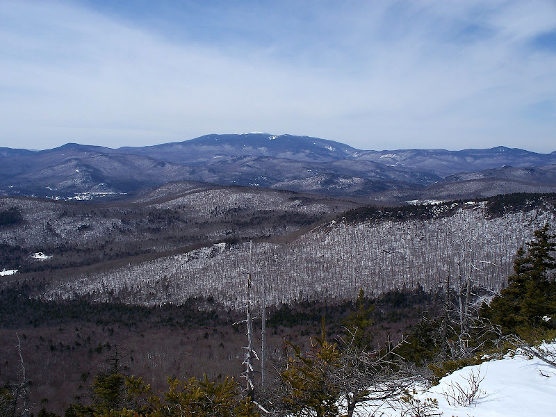
Don’t know if anyone is interested in playing a little game of “Mystery Photo ID”. But, nonetheless here goes. The photo below is obviously looking in the direction of Moosilauke, and the question is where was it taken from?

Perhaps this is too big of a hint, but to narrow down the guessing game, the photo was recently taken from ledges near the summit of a trailless peak that’s located somewhere to the S/SW of Mt. Tecumseh. This peak itself is not on any list that I’m aware of (but take into consideration that I’m not a list expert).
100_1084.JPG
 
Last edited:
Too much of a hint, given your (recent) trip report and my conversation with your hiking companion. No real need to look at the photo to answer.

Yes, some of us read trip reports and even (gasp!!) remember what we read :D
 
Hmmmmmm- might it be from a recent place you were in a recent trip report??
Too much of a hint, given your (recent) trip report and my conversation with your hiking companion. No real need to look at the photo to answer.

Yes, some of us read trip reports and even (gasp!!) remember what we read :D
Although no one has come out and said it, I think some folks might be guessing Bald Mountain because of a recent trip report that I filed about a bushwhack to that spot.
However, the photo was not taken from Bald Mountain.
 
Is it Hogback Mountain?
Thanks everyone for playing the game!

Yeah! Way to go Jason! All the other guesses were great guesses, but you nailed it!:)

The photo was taken from ledges west of the true summit of Hogback Mountain (located about midway between Mt. Tecumseh and Dickey Mountain). Hogback is on the opposite side of the Haselton Brook valley from Bald Mountain (the peak that was the subject of a recent TR that I filed).

My hiking partner Steve and I made our initial approach via a logging road. Then, the remainder of the bushwhack was through some fantastic open hardwoods that extended for miles along our route as we angled our way up and across the lower western slopes of Fisher Mountain on the way to Hogback.

On an aerial photo, Steve noticed a narrow ribbon of hardwoods that penetrated the conifers on the ridge leading to Hogback. We found this narrow "portal" quite easily, and this took us up into a higher open glade just below the Hogback ledges. Much to our surprise (and delight!), the woods remained open all the way to the col between the Hogback ledges and Hogback’s summit. A brief five minutes of moderately steep whacking through moderately thick conifers got us up onto the wide-open ledges.

These ledges provided a sweeping westerly vista (part of which is seen in my photo). There were also other nice views: northerly views toward Tecumseh; northwesterly views toward Cannon and Kinsmans; easterly views toward Sandwich Dome; southerly views toward Dickey Mountain and Fisher Mountain.
 
Last edited:
Very nice! Nice photograph! I really enjoy reading your reports because you include the stuff that interests me. Thanks for posting.

happy trails :)
 
Top