Papa Bear
New member
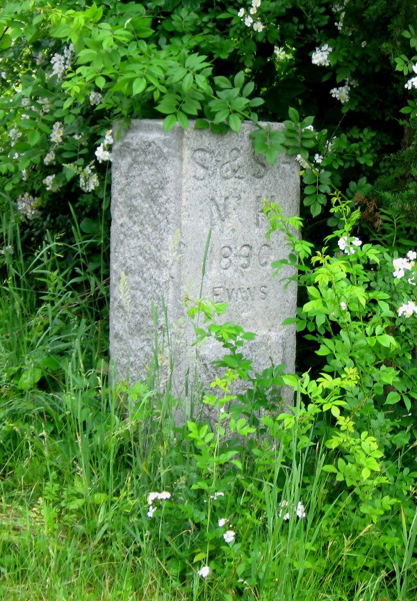
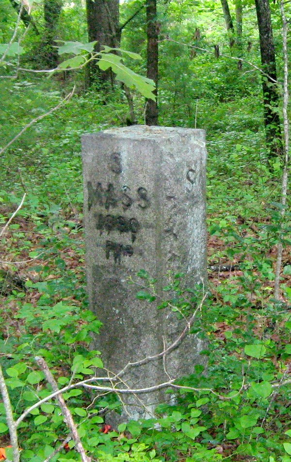
Benchmark Bagging - Peaks with Historic Survey Markers
A few years ago when I finished several of the popular peak lists, I thought "Well, what next". I quickly decided that the more comprehensive lists, like the New England 3000s or the Northeast 3000s (the 458 and the 770) were out, due to my finite life time") and other lists, like the Trailwrigjhts, Peaks with a Trail, Peaks with a View etc. didn't inspire me. I settled on "Benchmarks and Boundaries". That is to say,. find the peaks with survey markers and then actually find those markers when you bag the peak, or do the same for boundary monuments (which are often also Survey Markers). A lot of my hiking along the US Canadian border in Vermont, New Hampshire and Maine in the last 3 or 4 years has been in pursuit of these goals.
and other lists, like the Trailwrigjhts, Peaks with a Trail, Peaks with a View etc. didn't inspire me. I settled on "Benchmarks and Boundaries". That is to say,. find the peaks with survey markers and then actually find those markers when you bag the peak, or do the same for boundary monuments (which are often also Survey Markers). A lot of my hiking along the US Canadian border in Vermont, New Hampshire and Maine in the last 3 or 4 years has been in pursuit of these goals.
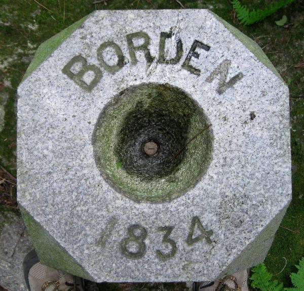
Starting last year I've concentrated on not just survey markers, but historic survey markers, loosely defined as those set in the 19th century, particularly in historically important surveys, such as the US Coast Survey's work from about 1830 - 1898 (from Calais Maine to New Orleans - most of the work on this survey for our area was done between about 1845 - 1860), or the Trigonometrical Survey of Massachusetts done in 1831 - 1836, (aka the "Borden Survey" the first survey of an entire state - and done by the Commonwealth, not the US Coast Survey).
In the last couple of months I've searched for a number of these peaks/markers in Massachusetts, New Hampshire and Maine, Some trips were with Roy, whose company and help I much enjoyed and appreciated, and some were solo. Here is the overall picture - details to follow. Dates indicate when a marker was set; two dates indicate two different markers were set. Where "everyone knows" where a peak is (like Monadnock) I've omitted the location.
June 16th:
Holt Hill (Andover, MA) 1833
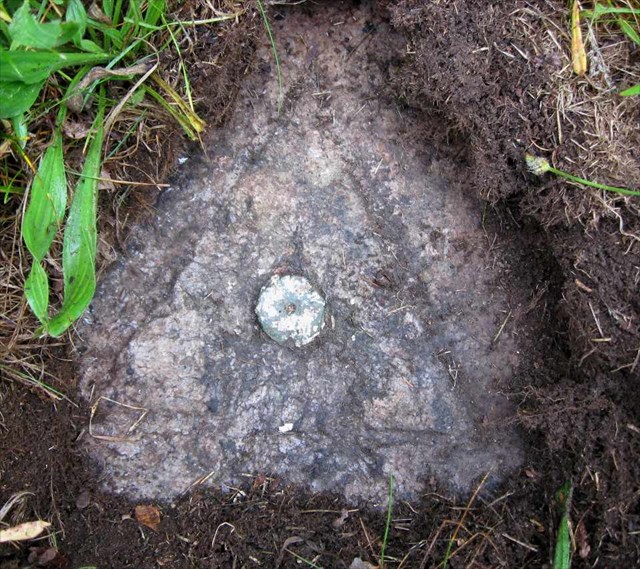
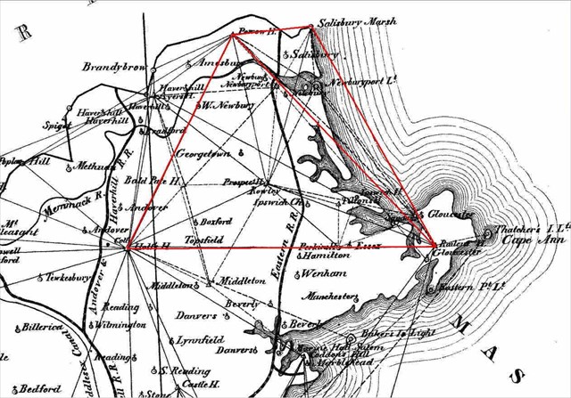
Powow Hill (Amesbury, MA) 1834, 1849
Railcut Hill (Gloucester, MA) 1834
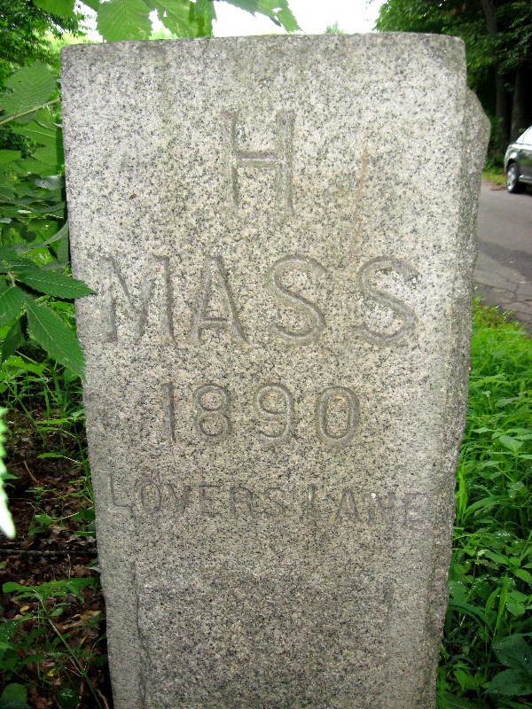
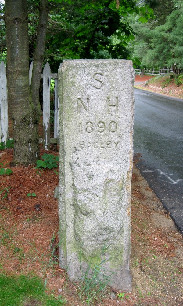
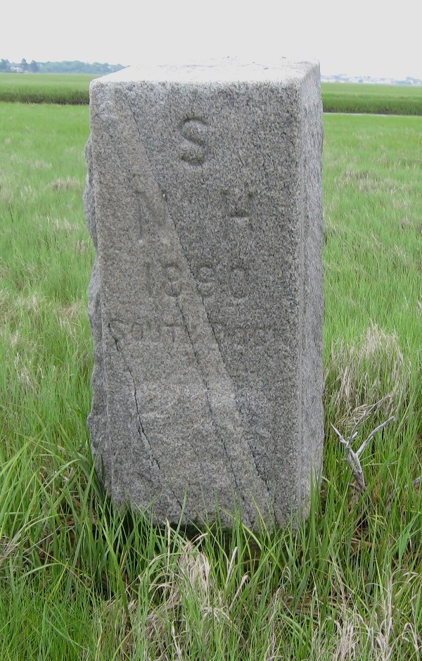
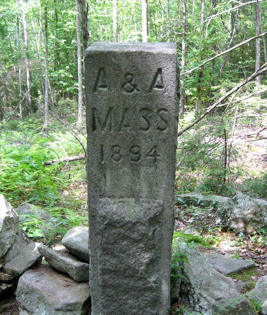
Various MA/NH State Line Monuments 1886
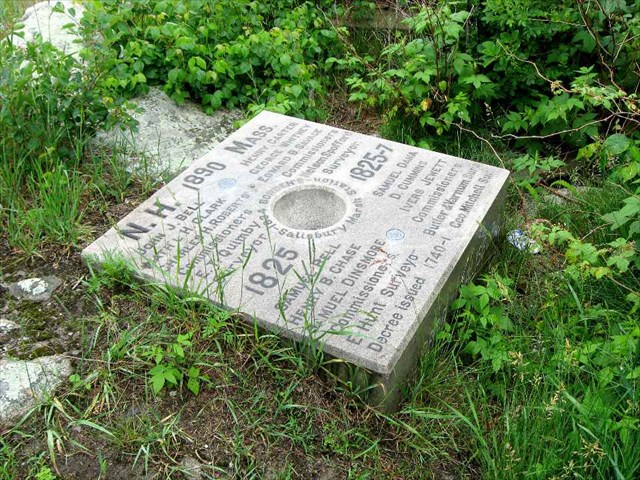
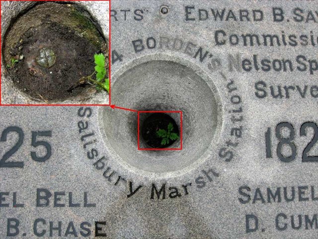
Salisbury Marsh Monument 1834
June 17th
Uncanoonuc (South Peak) 1848, 1959
Belknap Mt. 1860
Prospect Mt. (Waltham, MA) 1833
July 17th
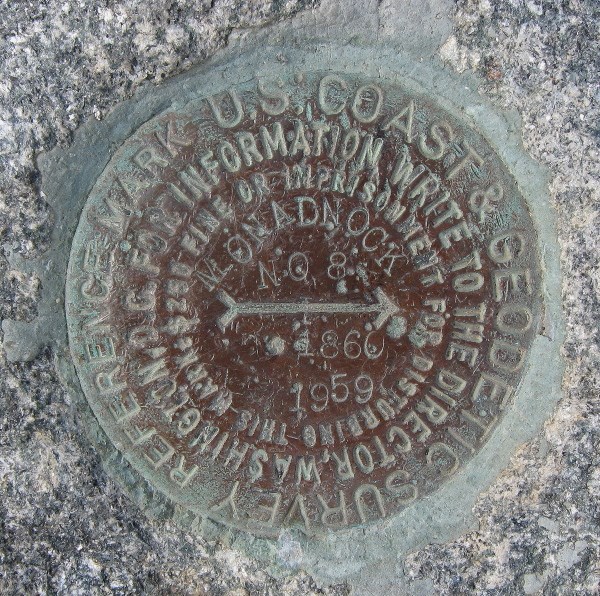
Monadnock 1834, 1860
Mt. Watatick 1833, 1897
Borden Boundary Monument 1834
July 18th
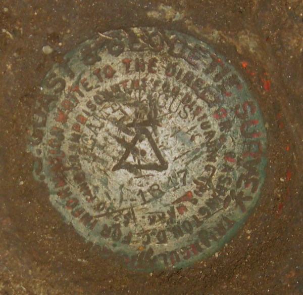
Mt. Agamenticus 1847
Ossipee Hill (Waterboro, ME) 1858
Mt. Pleasant (Denmark, ME) 1847?, 1851?
A few notes:
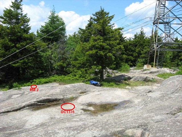
1) Most of these stations are described in an on-line database maintained by NOAA. The 6 character ID in the Google Map link is for this database.
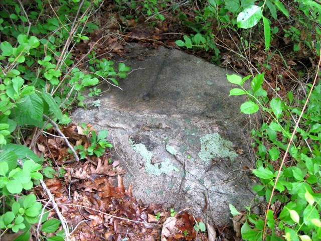
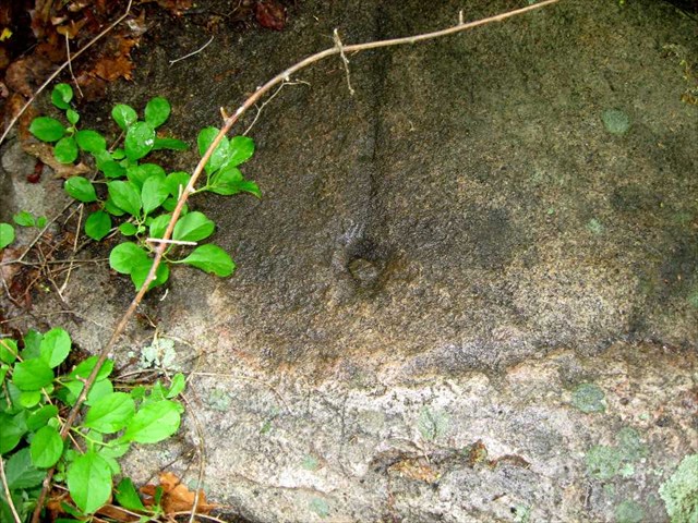
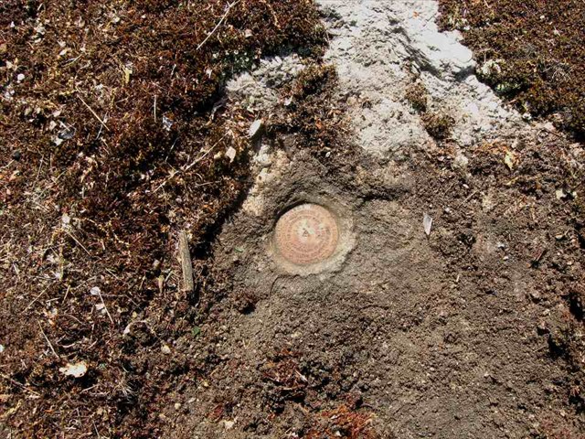
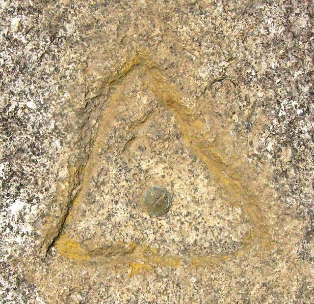
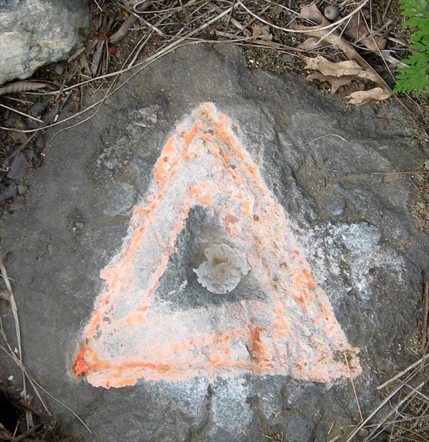
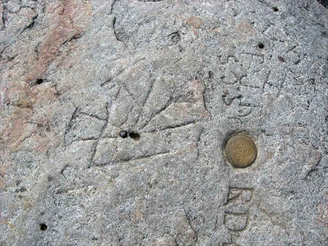
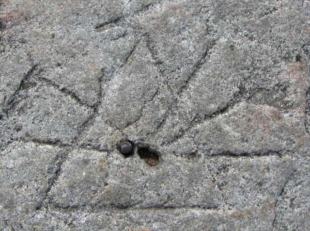
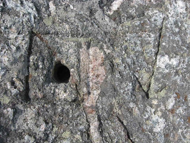
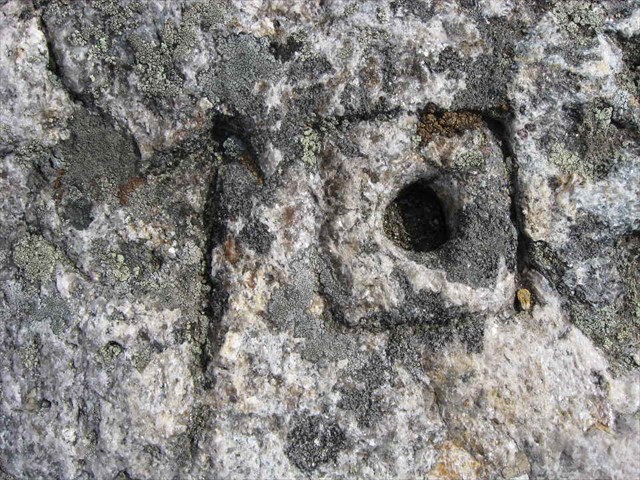
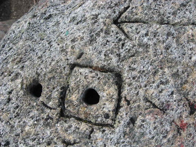
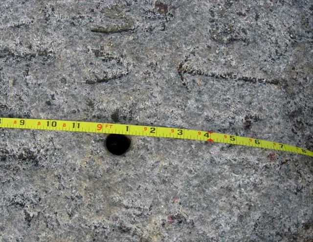
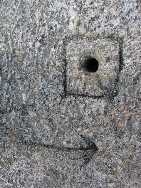
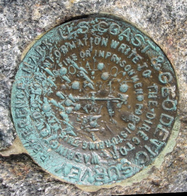
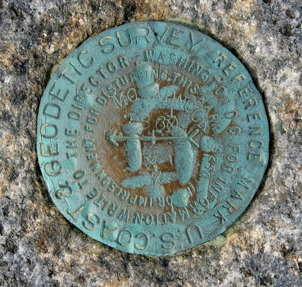
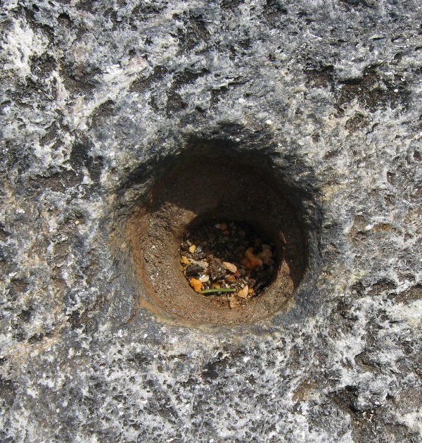
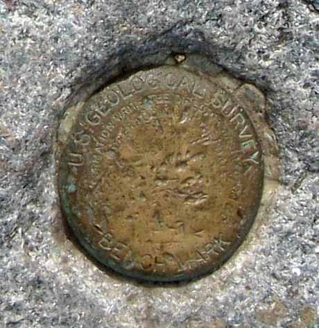
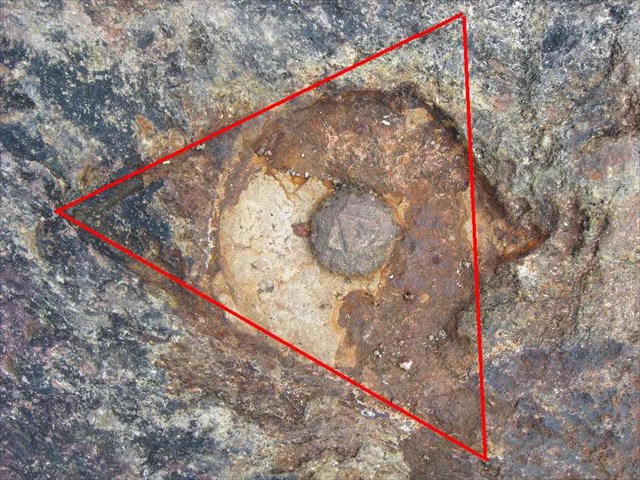
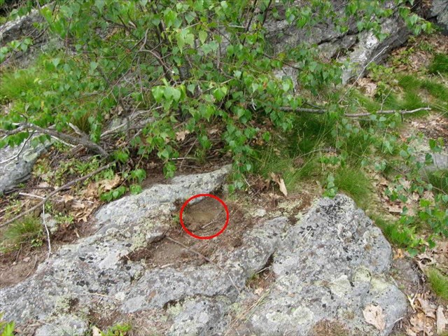
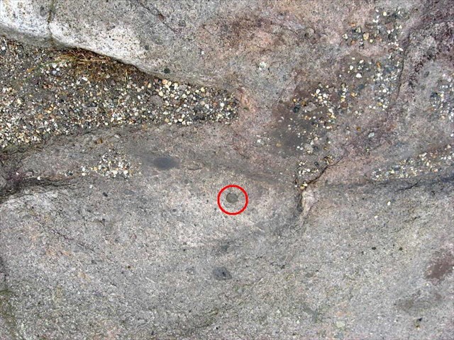
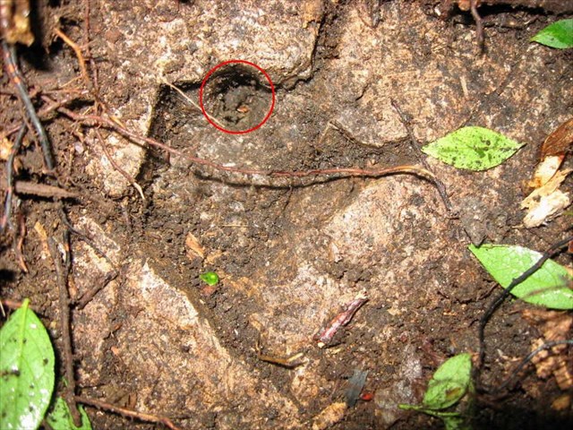
2) The original marks were usually a copper bolt, or just a hole in the rock. Later (in the 1930s - 1950s) some of these old marks were replaced with disks.
3) Most of these are also fire tower peaks (or one-time fire tower peaks)
4) The marks were often not on the highest point. Sight lines to other stations were more important.
5) There are some good sources of information on the net, but with some significant and frustrating gaps. Here are some of them (all but the first are fairly large):
NGS DATASHEET RETRIEVAL PAGE
CGS Special Publication No. 7 "Eastern Oblique Arc" (1902)
CGS Special Publication No. 46 "Triangulation in Maine" (1918)
CGS Special Publication No. 76 "Triangulation in Massachusetts" (1922)
Borden Survey of Massachusetts Map (1841) (on my web site)
Lastly, for each survey marker (or "Station" and they are often called), I have put in a link to a interactive Google Map that I have put together for that station. Use the map type selector in the upper right of the map to select Topo, Satellite, etc. and click the button under the title labeled "Show RMs" (if present) and all the reference marks around the station will be shown.
A few years ago when I finished several of the popular peak lists, I thought "Well, what next". I quickly decided that the more comprehensive lists, like the New England 3000s or the Northeast 3000s (the 458 and the 770) were out, due to my finite life time
and other lists, like the Trailwrigjhts, Peaks with a Trail, Peaks with a View etc. didn't inspire me. I settled on "Benchmarks and Boundaries". That is to say,. find the peaks with survey markers and then actually find those markers when you bag the peak, or do the same for boundary monuments (which are often also Survey Markers). A lot of my hiking along the US Canadian border in Vermont, New Hampshire and Maine in the last 3 or 4 years has been in pursuit of these goals. Starting last year I've concentrated on not just survey markers, but historic survey markers, loosely defined as those set in the 19th century, particularly in historically important surveys, such as the US Coast Survey's work from about 1830 - 1898 (from Calais Maine to New Orleans - most of the work on this survey for our area was done between about 1845 - 1860), or the Trigonometrical Survey of Massachusetts done in 1831 - 1836, (aka the "Borden Survey" the first survey of an entire state - and done by the Commonwealth, not the US Coast Survey).
In the last couple of months I've searched for a number of these peaks/markers in Massachusetts, New Hampshire and Maine, Some trips were with Roy, whose company and help I much enjoyed and appreciated, and some were solo. Here is the overall picture - details to follow. Dates indicate when a marker was set; two dates indicate two different markers were set. Where "everyone knows" where a peak is (like Monadnock) I've omitted the location.
June 16th:
Holt Hill (Andover, MA) 1833
Powow Hill (Amesbury, MA) 1834, 1849
Railcut Hill (Gloucester, MA) 1834
Various MA/NH State Line Monuments 1886
Salisbury Marsh Monument 1834
June 17th
Uncanoonuc (South Peak) 1848, 1959
Belknap Mt. 1860
Prospect Mt. (Waltham, MA) 1833
July 17th
Monadnock 1834, 1860
Mt. Watatick 1833, 1897
Borden Boundary Monument 1834
July 18th
Mt. Agamenticus 1847
Ossipee Hill (Waterboro, ME) 1858
Mt. Pleasant (Denmark, ME) 1847?, 1851?
A few notes:
1) Most of these stations are described in an on-line database maintained by NOAA. The 6 character ID in the Google Map link is for this database.
2) The original marks were usually a copper bolt, or just a hole in the rock. Later (in the 1930s - 1950s) some of these old marks were replaced with disks.
3) Most of these are also fire tower peaks (or one-time fire tower peaks)
4) The marks were often not on the highest point. Sight lines to other stations were more important.
5) There are some good sources of information on the net, but with some significant and frustrating gaps. Here are some of them (all but the first are fairly large):
NGS DATASHEET RETRIEVAL PAGE
CGS Special Publication No. 7 "Eastern Oblique Arc" (1902)
CGS Special Publication No. 46 "Triangulation in Maine" (1918)
CGS Special Publication No. 76 "Triangulation in Massachusetts" (1922)
Borden Survey of Massachusetts Map (1841) (on my web site)
Lastly, for each survey marker (or "Station" and they are often called), I have put in a link to a interactive Google Map that I have put together for that station. Use the map type selector in the upper right of the map to select Topo, Satellite, etc. and click the button under the title labeled "Show RMs" (if present) and all the reference marks around the station will be shown.
Last edited: