Jimmy Legs and Little D
New member
On Saturday May 15th we took a 12 mile round trip hike across Bob’s Hill in Cunningham Falls State Park; Thurmont, Maryland.
http://www.dnr.state.md.us/publiclands/western/cunningham.asp
Our route began at the Cat Rock trailhead along route 77.
We noticed about 5 millipedes on the rocks surrounding the parking area.
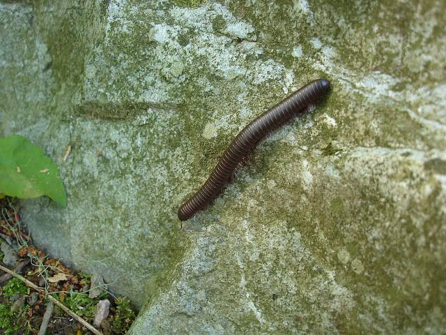
On previous hikes this spring, we’ve seen millipedes on every one. It must be the year of the millipede.
The trail is 1.5 miles to Cat Rock and was recently diverted to avoid a gully created by runoff. The new section meanders at a moderate grade through mixed forest and eventually meets once again with the old trail. The old trail follows a rocky fire road which narrows near an intersecting stream.
Just before the “Old Misery” Trail there was a large blow down that was cut so that hikers can pass.
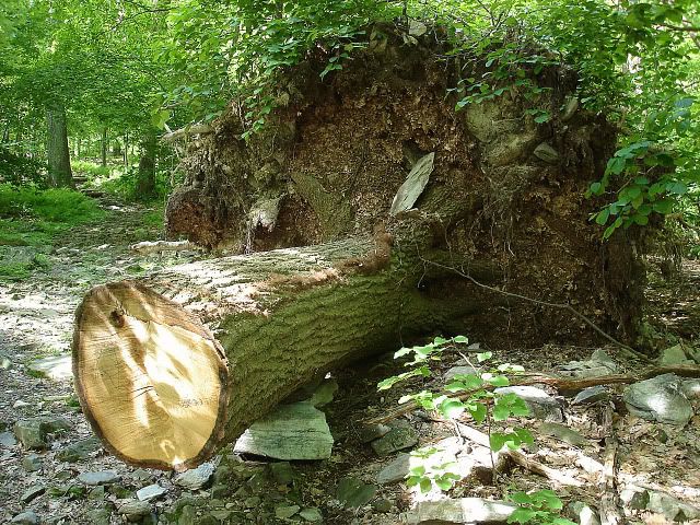
Some of the notable milestones were the Old Misery Trail (entering from the right and leading to the dam which creates Hunting Creek Lake), a power line and the spur trail leading to Cat Rock.
After a brief stop at Cat Rock we backtracked the 100 yards back to the Bob’s Hill Trail made a left and proceeded once again up a moderate grade. We stopped briefly to talk to an 80 year old hiker who was solo hiking a 14 mile loop. I just hope we will be doing the same thing when we reach that age.
The trail soon levels out and continues through mountain laurel which is just beginning to bloom.
The Bob’s Hill Trail merges with the Catoctin Trail at around mile 3. Here is a description of that trail by the Maryland Department of Natural Resources.
Catoctin Trail 27 miles - difficult
The Catoctin Trail, a spur of the Appalachian Trail, leads from Gambrill State Park through Frederick City Watershed, Cunningham Falls State Park and Catoctin Mountain Park. Nine miles of the trail are in Cunningham Falls State Park. The terrain is typical of Western Maryland with large sections canopied under dense forest cover.
The junction and summit of Bob’s Hill was soon reached and we took a spur trail left to a good view east.
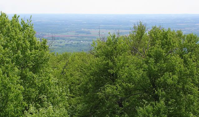
We backtrack once again and proceeded to the upper view from Bob’s Hill overlook. This is perhaps the better of the two and is reached by a 75 yard spur path. We stayed here for a short time to have a bite to eat. We began to see more people along the trail, many with children coming up from a shorter hike from the Manor side of Cunningham Falls State Park.
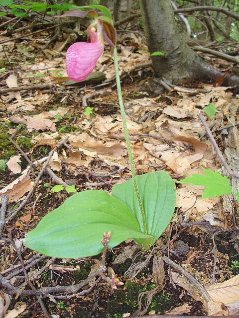
The trail descends steeply and then levels out for a half mile. It was here that we saw several pink lady slippers, some of which were past peak.
The trail continues to descend steeply with more and more of the white and pink Mountain Laurel in bloom. We soon reach the Manor Area, 5.5 miles from Route 77. Here there are picnic areas, a playground, a visitor center and an aviary where injured birds are kept. There were also some turtles just outside the visitor center one of which was a 46lb snapping turtle.
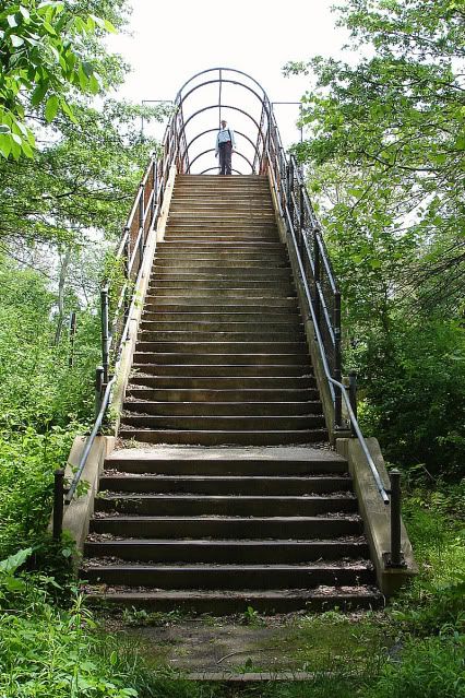
We continued on past the last parking lot to where the Catoctin Furnace Trail begins near Little Hunting Creek. After a short walk past several plaques explaining various aspects of the area we arrived at the concrete pedestrian bridge spanning Route 15. The stairs were quite steep.
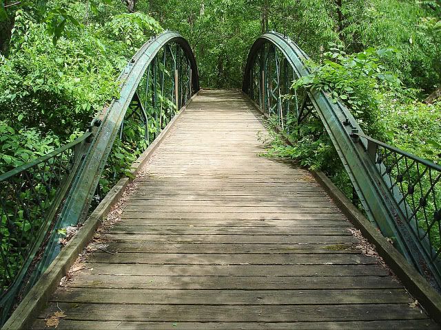
Reaching the other side the trail crosses over Little Hunting Creek via the Bowstring Arch Bridge, which was originally built to span Double Pipe Creek at Detour, Maryland.
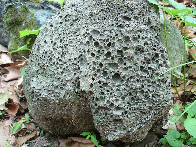
Passing the bridge and descending a set of wooden stairs there’s a plaque explaining what slag is and why there is so much of it in the surrounding area. When you pick up a piece of slag the first thing you notice is that it is quite light (in weight) relative to its size. Another thing you notice about it is the pock marks on its surface.
Walking past the remnants of the Iron Master’s House we finally reach the Catoctin Furnace located just off of Route 806 near Thurmont, Maryland. The structure consists of the furnace, named Isabella and the casting shed.
http://www.emmitsburg.net/history_t/archives/business/catoctin_furnace.htm
We walked around the grounds enjoying the warm spring weather and then finally decided to head back.
Heading back up the steep incline to the summit of Bob’s Hill, we once again ran into Mr. Dave the 80 year old hiker who was just about finished his hike. We chatted awhile and once again headed up the hill. Mr. Dave told us to be on the lookout for a snake he saw on rock beside the trail and lo and behold Donna spotted the reptile as I was taking a photo of a fern. The snake was a 4 foot Eastern Diamondback Rattlesnake. It had about 10 “rattles” on the tip of its tale.
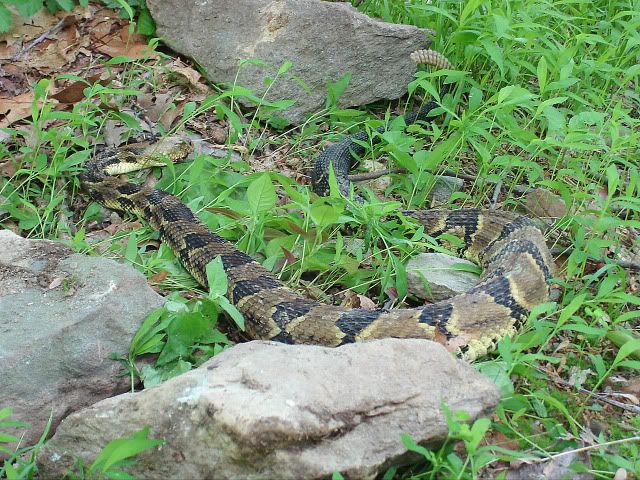
Unfortunately, someone had hit the snake on the head, probably with a rock, and it was near death. I picked up the snake with a stick and gently placed it behind a fallen tree so no one would be startled to see a venomous snake along the trail.
The rest of the hike was uneventful, but we kept thinking about the snake and why someone would kill a protected species; perhaps, because that particular trail is used by children and their parents. We will never know?
Mike and Donna
Straight to Slideshow: http://jimmylegs.smugmug.com/photos...Traverse-51510/12207094_XtiDS#869228423_V4yNp
http://www.dnr.state.md.us/publiclands/western/cunningham.asp
Our route began at the Cat Rock trailhead along route 77.
We noticed about 5 millipedes on the rocks surrounding the parking area.

On previous hikes this spring, we’ve seen millipedes on every one. It must be the year of the millipede.
The trail is 1.5 miles to Cat Rock and was recently diverted to avoid a gully created by runoff. The new section meanders at a moderate grade through mixed forest and eventually meets once again with the old trail. The old trail follows a rocky fire road which narrows near an intersecting stream.
Just before the “Old Misery” Trail there was a large blow down that was cut so that hikers can pass.

Some of the notable milestones were the Old Misery Trail (entering from the right and leading to the dam which creates Hunting Creek Lake), a power line and the spur trail leading to Cat Rock.
After a brief stop at Cat Rock we backtracked the 100 yards back to the Bob’s Hill Trail made a left and proceeded once again up a moderate grade. We stopped briefly to talk to an 80 year old hiker who was solo hiking a 14 mile loop. I just hope we will be doing the same thing when we reach that age.
The trail soon levels out and continues through mountain laurel which is just beginning to bloom.
The Bob’s Hill Trail merges with the Catoctin Trail at around mile 3. Here is a description of that trail by the Maryland Department of Natural Resources.
Catoctin Trail 27 miles - difficult
The Catoctin Trail, a spur of the Appalachian Trail, leads from Gambrill State Park through Frederick City Watershed, Cunningham Falls State Park and Catoctin Mountain Park. Nine miles of the trail are in Cunningham Falls State Park. The terrain is typical of Western Maryland with large sections canopied under dense forest cover.
The junction and summit of Bob’s Hill was soon reached and we took a spur trail left to a good view east.

We backtrack once again and proceeded to the upper view from Bob’s Hill overlook. This is perhaps the better of the two and is reached by a 75 yard spur path. We stayed here for a short time to have a bite to eat. We began to see more people along the trail, many with children coming up from a shorter hike from the Manor side of Cunningham Falls State Park.
The trail descends steeply and then levels out for a half mile. It was here that we saw several pink lady slippers, some of which were past peak.

The trail continues to descend steeply with more and more of the white and pink Mountain Laurel in bloom. We soon reach the Manor Area, 5.5 miles from Route 77. Here there are picnic areas, a playground, a visitor center and an aviary where injured birds are kept. There were also some turtles just outside the visitor center one of which was a 46lb snapping turtle.
We continued on past the last parking lot to where the Catoctin Furnace Trail begins near Little Hunting Creek. After a short walk past several plaques explaining various aspects of the area we arrived at the concrete pedestrian bridge spanning Route 15. The stairs were quite steep.

Reaching the other side the trail crosses over Little Hunting Creek via the Bowstring Arch Bridge, which was originally built to span Double Pipe Creek at Detour, Maryland.

Passing the bridge and descending a set of wooden stairs there’s a plaque explaining what slag is and why there is so much of it in the surrounding area. When you pick up a piece of slag the first thing you notice is that it is quite light (in weight) relative to its size. Another thing you notice about it is the pock marks on its surface.

Walking past the remnants of the Iron Master’s House we finally reach the Catoctin Furnace located just off of Route 806 near Thurmont, Maryland. The structure consists of the furnace, named Isabella and the casting shed.
http://www.emmitsburg.net/history_t/archives/business/catoctin_furnace.htm
We walked around the grounds enjoying the warm spring weather and then finally decided to head back.
Heading back up the steep incline to the summit of Bob’s Hill, we once again ran into Mr. Dave the 80 year old hiker who was just about finished his hike. We chatted awhile and once again headed up the hill. Mr. Dave told us to be on the lookout for a snake he saw on rock beside the trail and lo and behold Donna spotted the reptile as I was taking a photo of a fern. The snake was a 4 foot Eastern Diamondback Rattlesnake. It had about 10 “rattles” on the tip of its tale.

Unfortunately, someone had hit the snake on the head, probably with a rock, and it was near death. I picked up the snake with a stick and gently placed it behind a fallen tree so no one would be startled to see a venomous snake along the trail.
The rest of the hike was uneventful, but we kept thinking about the snake and why someone would kill a protected species; perhaps, because that particular trail is used by children and their parents. We will never know?
Mike and Donna
Straight to Slideshow: http://jimmylegs.smugmug.com/photos...Traverse-51510/12207094_XtiDS#869228423_V4yNp
