
Hello all, first time posting here on VFTT. Been a member for a while, but have yet to have time to really post (and after some arm twisting by Rocket21). I figured the best way to start myself off would be with a brief TR. Sooooo, here we go...
Date(s) Hiked: 6/13/2009
Destination(s): Carter Dome, Wildcat A, Carter Notch
Trail(s) Hiked: Bog Brook Trail, Rainbow Trail, Carter-Moriah Trail, 19 Mile Trail, Wildcat Ridge Trail, Wildcat River Trail, WMNF Carter Notch Rd.
Averaged Length: 13.9 Miles
Averaged Vertical: 4,320 Feet
Report: Over the past week I had been Facebook messaging Rocket21 about possibly going on a hike with him for this weekend, and it finally became a reality. Our original plans were leaning more toward a Bonds/Zealand traverse, but I wasn't sure that I was going to be up to it, so I chanced it see if he was interested in something shorter. We also discussed possibly going for the hike for BobC's 48th as well. Long story short we settled on Carter Dome and Wildcat A, firsts for me both for hiking the peaks as well as hiking anywhere in that range.
Meeting at the Bog Brook trailhead on Carter Notch Rd a little later than we had hoped, we were both on the trail around 9am. The first couple of miles of this trail were more or less flat with slight inclines here and there. I don't remember all of the brook crossings, but there were a bunch. Rocket made it over all of them without much trouble, but I on the other hand wasn't nearly as stealthy. On such crossing I ended up taking the boots off and wading across. I believe he probably has some decent photos that show my timidness.
Moving along we made good time getting to the Rainbow Trail, and were on our way up Carter Dome fairly quickly. I hadn't originally had a chance to look at the trail descriptions before I came out, as I knew that Jeremy had the route pretty well planned, so it was a bit of a surprise at how under-utilized this route was. While the trail was a bit grown in a slightly difficult to follow, the grade never exceeding anything over a moderate pitch. This long gentle route proved to be very rewarding upon reaching a viewpoint about a mile from the summit on a 4,300' shoulder of the mountain with views in virtually every direction.
After what seemed like 20 minutes later we were on the summit (of Carter Dome). Seeing this peak from different points I knew that views wouldn't be all that great, but Jeremy did show me the usual viewpoint a little northeast of the summit, where despite the haze good views were had from northwest to east. Finishing up lunch we continued on to our next and final peak of the day Wildcat A.
Meeting a few hikers along the way we made our way down the Carter-Moriah trail toward Carter Notch and the notch ponds (not sure of their actual names). The trail was in good shape the whole way and despite the overall drop from Carter Dome, it was never anything too tricky to get down. The trip on the way up Wildcat A was a bit more of a energy killer for me though, as we needed to stop many times so that I could catch my breath and allow my heart to slow down a bit (high-blood pressure).
The map also said that this was 0.7 miles from the 19 Mile Brook Trail, but I'm pretty sure that it's more. Between what my body thought of it as well as what the GPSr figured it as: it seemed to be more like a mile, but after downloading the data to my computer the GPSr said it was 0.87 miles. While the GPS isn't always that accurate, especially in deep tree cover, I would tend to believe it some in this case.
Reaching the summit of Wildcat A was a welcome reward for a great day so far worth of hiking. Seeing the high-point as well as the excellent view toward Carter Dome and points East was well worth it. We also met a few other hikers at the summit who it sounded had just begun their 4k-ers. After a fairly lengthy conversation with the hiker couple we headed back down the Wildcat Ridge Trail to toward the hut.
Since neither of us had been to this hut we had to stop in and have a look, as well as sample some of the refreshments available inside. Despite being only my 20th and 21st 4k mountains this is only the second hut that I've actually been to and visited, so it was a bit of a treat. After about 20 minutes or so of letting the feet rest and taking in the informational posters in the hut, we headed down the Wildcat River Tr back toward the trail head.
Remembering that the trail crossed the closed portion of the Carter Notch Rd, before another 0.7 miles back to the trailhead we opted to take the road back in order to avoid the brook crossings, adding approximately 0.2 miles to the day's total mileage. It seemed weird to us that this part of the road was closed because it was in much better condition than the lower part of the road and there were many places that would have made a much better trailhead than the present location of the Bog Brook trailhead. After a relatively long day it was a welcome site to see both the road gate and our cars after the extra 0.1 mile from the gate.
Overall a very nice hike - about 10 hours total including rests at Carter Dome summit, Wildcat A summit, Carter Notch hut, and my numerous 2 to 3 minute stops on the trail to catch my breath. My longest so far at about 13.9 miles, and a decent elevation gain. Also my first in the Carter Range or anywhere near Pinkham Notch for that matter. Looking forward to the next one perhaps this week if it's in the cards.
Some Photos:

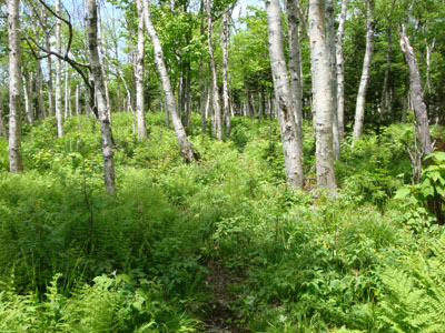
Trailhead


Rocket21 Leading the Way

View toward the Presidentials from 4,300' highpoint

Carter Notch from Wildcat A

The bridge my legs were waiting for!

GPS Elevation Profile
Full Gallery available here: Carter Dome/Wildcat A - 6/13/2009
Date(s) Hiked: 6/13/2009
Destination(s): Carter Dome, Wildcat A, Carter Notch
Trail(s) Hiked: Bog Brook Trail, Rainbow Trail, Carter-Moriah Trail, 19 Mile Trail, Wildcat Ridge Trail, Wildcat River Trail, WMNF Carter Notch Rd.
Averaged Length: 13.9 Miles
Averaged Vertical: 4,320 Feet
Report: Over the past week I had been Facebook messaging Rocket21 about possibly going on a hike with him for this weekend, and it finally became a reality. Our original plans were leaning more toward a Bonds/Zealand traverse, but I wasn't sure that I was going to be up to it, so I chanced it see if he was interested in something shorter. We also discussed possibly going for the hike for BobC's 48th as well. Long story short we settled on Carter Dome and Wildcat A, firsts for me both for hiking the peaks as well as hiking anywhere in that range.
Meeting at the Bog Brook trailhead on Carter Notch Rd a little later than we had hoped, we were both on the trail around 9am. The first couple of miles of this trail were more or less flat with slight inclines here and there. I don't remember all of the brook crossings, but there were a bunch. Rocket made it over all of them without much trouble, but I on the other hand wasn't nearly as stealthy. On such crossing I ended up taking the boots off and wading across. I believe he probably has some decent photos that show my timidness.
Moving along we made good time getting to the Rainbow Trail, and were on our way up Carter Dome fairly quickly. I hadn't originally had a chance to look at the trail descriptions before I came out, as I knew that Jeremy had the route pretty well planned, so it was a bit of a surprise at how under-utilized this route was. While the trail was a bit grown in a slightly difficult to follow, the grade never exceeding anything over a moderate pitch. This long gentle route proved to be very rewarding upon reaching a viewpoint about a mile from the summit on a 4,300' shoulder of the mountain with views in virtually every direction.
After what seemed like 20 minutes later we were on the summit (of Carter Dome). Seeing this peak from different points I knew that views wouldn't be all that great, but Jeremy did show me the usual viewpoint a little northeast of the summit, where despite the haze good views were had from northwest to east. Finishing up lunch we continued on to our next and final peak of the day Wildcat A.
Meeting a few hikers along the way we made our way down the Carter-Moriah trail toward Carter Notch and the notch ponds (not sure of their actual names). The trail was in good shape the whole way and despite the overall drop from Carter Dome, it was never anything too tricky to get down. The trip on the way up Wildcat A was a bit more of a energy killer for me though, as we needed to stop many times so that I could catch my breath and allow my heart to slow down a bit (high-blood pressure).
The map also said that this was 0.7 miles from the 19 Mile Brook Trail, but I'm pretty sure that it's more. Between what my body thought of it as well as what the GPSr figured it as: it seemed to be more like a mile, but after downloading the data to my computer the GPSr said it was 0.87 miles. While the GPS isn't always that accurate, especially in deep tree cover, I would tend to believe it some in this case.
Reaching the summit of Wildcat A was a welcome reward for a great day so far worth of hiking. Seeing the high-point as well as the excellent view toward Carter Dome and points East was well worth it. We also met a few other hikers at the summit who it sounded had just begun their 4k-ers. After a fairly lengthy conversation with the hiker couple we headed back down the Wildcat Ridge Trail to toward the hut.
Since neither of us had been to this hut we had to stop in and have a look, as well as sample some of the refreshments available inside. Despite being only my 20th and 21st 4k mountains this is only the second hut that I've actually been to and visited, so it was a bit of a treat. After about 20 minutes or so of letting the feet rest and taking in the informational posters in the hut, we headed down the Wildcat River Tr back toward the trail head.
Remembering that the trail crossed the closed portion of the Carter Notch Rd, before another 0.7 miles back to the trailhead we opted to take the road back in order to avoid the brook crossings, adding approximately 0.2 miles to the day's total mileage. It seemed weird to us that this part of the road was closed because it was in much better condition than the lower part of the road and there were many places that would have made a much better trailhead than the present location of the Bog Brook trailhead. After a relatively long day it was a welcome site to see both the road gate and our cars after the extra 0.1 mile from the gate.
Overall a very nice hike - about 10 hours total including rests at Carter Dome summit, Wildcat A summit, Carter Notch hut, and my numerous 2 to 3 minute stops on the trail to catch my breath. My longest so far at about 13.9 miles, and a decent elevation gain. Also my first in the Carter Range or anywhere near Pinkham Notch for that matter. Looking forward to the next one perhaps this week if it's in the cards.
Some Photos:
Trailhead
Rocket21 Leading the Way
View toward the Presidentials from 4,300' highpoint
Carter Notch from Wildcat A
The bridge my legs were waiting for!
GPS Elevation Profile
Full Gallery available here: Carter Dome/Wildcat A - 6/13/2009


 I enjoyed your descriptions and the pics too. I have thought of taking the Rainbow Trail. Now that I've read your report I would say it's a must do. Thanks for posting!