The weather forecast for Sunday was predicted to be Presidential and then some. As it turns out, it was Presidential but missing the "and then some." Still, we had occasional peeks of blue sky through a ceiling which was still far above the summit of Washington. The air was clearer than the haze of summer though. We started up Edmands path at the leisurely time of 10am.
Bear Paw shaped rock (Amanda), Hobblebush viburnum berries
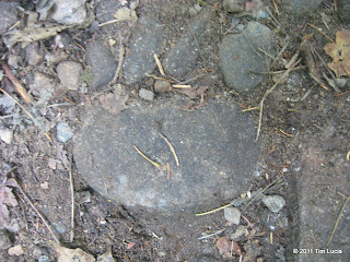
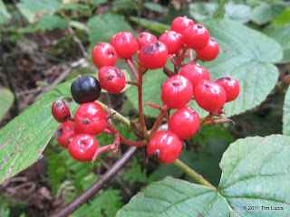
Down low, the hobblebush is turning dark red, and the occasional maple is turning bright red. Mixed together with occasional splashes of yellow and it made a delightful contrast with the predominantly green forest. Minor erosion from Irene was visible but for the most part, the trail was in excellent shape (thanks, Sabrina), and not yet filled in with fallen leaves. Amanda spotted this excellent rock formation which closely resembled a bear print. Since we have bears in our neighborhood, she actually knows what the prints look like.
Treeline on Edmands Path (with Mount Franklin), On the Eisenhower Loop
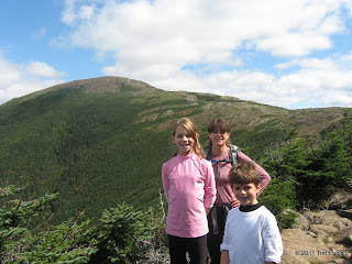
The first mile-plus is relatively flat, gaining approximately 750 feet, with the nearly double that coming on the approach to the ledge and waterfall. The trail was a bit wet here, but not icy or otherwise dangerous. Just beyond the ledge, the trail levels as it follows the contour around to the north, coming out on a talus field with awesome views towards Washington, Jefferson, Adams, and Franklin. Only Washington showed any hint of the rime from Saturday, or maybe it was new rime from Saturday night. Once on the Eisenhower loop, we got to feel the wind and while looking for a refuge to put on layers, we stumbled on Una Dogger and Silverfox sitting on a sunny rock. After a nice chat, they left for trail work and we sat down and had lunch.
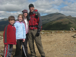
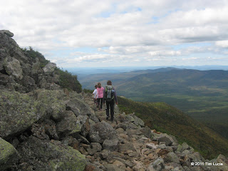
Peakbaggers , Back on Edmands Path on the descent
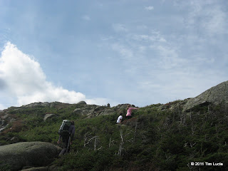
After lunch and some additional layers, we climbing the remaining 150 feet or so to the summit, which, as it turns out, was not as cold or windy as it was in the col with Franklin. After some pictures, a round of "name that peak" (I had to ask the questions out of fairness) and a short rest, we decided to head south on the Eisenhower Loop so I could red-line that section of the Crawford Path. The kids enjoyed the ladders - which I remember being built during the Presidential Traverse in July 2009. On the way down, we again encountered Una Dogger and Silverfox engaged in water bar clean up and brushing.
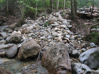
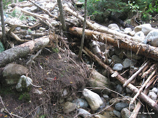
Back at Abenaki Brook, the kids took off their shoes and socks and got their toes wet. The worst of the damage from Irene was around this crossing. I vaguely recall the bridge had to be put back, although crossing it today was no problem, and could have been done without the bridge. Has the brook been rerouted, or would the more northerly branch ordinarily have water when levels were higher? The banks are scrubbed, many exposed roots are visible, rocks, trees, branches, and other debris are piled in various places.
All photos
Tim


Bear Paw shaped rock (Amanda), Hobblebush viburnum berries
Down low, the hobblebush is turning dark red, and the occasional maple is turning bright red. Mixed together with occasional splashes of yellow and it made a delightful contrast with the predominantly green forest. Minor erosion from Irene was visible but for the most part, the trail was in excellent shape (thanks, Sabrina), and not yet filled in with fallen leaves. Amanda spotted this excellent rock formation which closely resembled a bear print. Since we have bears in our neighborhood, she actually knows what the prints look like.


Treeline on Edmands Path (with Mount Franklin), On the Eisenhower Loop
The first mile-plus is relatively flat, gaining approximately 750 feet, with the nearly double that coming on the approach to the ledge and waterfall. The trail was a bit wet here, but not icy or otherwise dangerous. Just beyond the ledge, the trail levels as it follows the contour around to the north, coming out on a talus field with awesome views towards Washington, Jefferson, Adams, and Franklin. Only Washington showed any hint of the rime from Saturday, or maybe it was new rime from Saturday night. Once on the Eisenhower loop, we got to feel the wind and while looking for a refuge to put on layers, we stumbled on Una Dogger and Silverfox sitting on a sunny rock. After a nice chat, they left for trail work and we sat down and had lunch.


Peakbaggers
After lunch and some additional layers, we climbing the remaining 150 feet or so to the summit, which, as it turns out, was not as cold or windy as it was in the col with Franklin. After some pictures, a round of "name that peak" (I had to ask the questions out of fairness) and a short rest, we decided to head south on the Eisenhower Loop so I could red-line that section of the Crawford Path. The kids enjoyed the ladders - which I remember being built during the Presidential Traverse in July 2009. On the way down, we again encountered Una Dogger and Silverfox engaged in water bar clean up and brushing.


Back at Abenaki Brook, the kids took off their shoes and socks and got their toes wet. The worst of the damage from Irene was around this crossing. I vaguely recall the bridge had to be put back, although crossing it today was no problem, and could have been done without the bridge. Has the brook been rerouted, or would the more northerly branch ordinarily have water when levels were higher? The banks are scrubbed, many exposed roots are visible, rocks, trees, branches, and other debris are piled in various places.
All photos
Tim
