[size=+2]T[/size]he weather forecast for Saturday was for a picture-perfect day, and I was looking to get up into the mountains. I considered going up over the Bonds and just spending the evening at Guyot shelter, but then I saw that some VFTT folk were going up to do a loop over Goose Eye, in the Mahoosuc Range, which stretches northward from Shelburne, NH to Grafton Notch in Maine. And so when the alarm went off at 4:00am Saturday morning, I got my gear together and was on the road by 4:30 heading to MEB's house.
I got there at 6:30, moved my gear into her car, and joined her and Little Sister for the next part of the drive up to Berlin, NH. This drive was rife with amusement, searching for the passenger brake pedals, and blasting ABBA. I may be scarred for life. Finally, right at 9:00 we met up with SteveHiker and Arghman at a small park by the paper mill. We then found the start of Success Pond Road, an unimproved, dirt logging road, and drove up the many dusty miles, leaving a car at our expected endpoint and going further onward to the start, the Notch Trail.
 The Notch Trail is a fine, moderately graded, attractive route that ascends 800 feet over 2.2 miles, ended at the head of Mahoosuc Notch on the Mahoosuc Trail (A.T.). We cruised easily up this trail, arriving at the junction in a mere 45 minutes. After that burst of energy, we decided it was a good time to eat. The sun was shining through the trees, warm against the cool air, the sky blue between the leaves. After sandwiches (or Goo), we packed up and started the climb.
 The Mahoosuc Trail climbs straight up out of the notch on stone stairs and doesn't give up. It turns into the woods for a short, moderate section then it's a direct ascent up a pair of wooden ladders. It gets a little easier at that point as it crests Fulling Mill Mountain, having come up a thousand feet in only a quarter-mile.
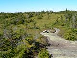
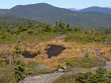
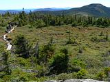
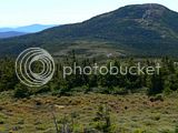
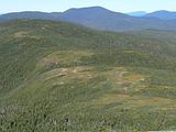
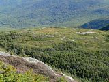
Here began one of the most amazing alpine ridge walks in the area. Over and over we descended into the trees then rose back up onto the ridge. The views were limitless in the clear blue sky. The wind, light and steady with small gusts, carried a chill that was countered by the sun reflecting off the warm exposed rock. It was otherworldly, especially with the half-moon still lingering in the blue sky.
 The ridges along the Mahoosuc are remarkable in that they hold water and do not drain well, and are thus patterned with small bogs, criscrossed with puncheons and rife with vegetation. We soon dropped down to Full Goose shelter, took another one of what would become many breaks, watched me (listened to me; felt the vibrations from) smash my head into the low-hanging roof so hard as to shake the entire lean-to, and then moved on towards the peaks of Goose Eye Mountain.
 We spread out as we hiked, different paces and interests taking over, but came back together at each vantage point to rest, socialize, and even nap. MEB surprised us on North Peak with a package of cup cakes to celebrate SteveHiker's and my individual accomplishments of finishing the 67 New England 4000-footers the previous weekend (and, we reminded her, her own anniversary just the day before).
 The Mahoosuc Trail is a remarkable combination of easy walking and rough ascents and descents. Having done this once before with a full overnight pack, I was very happy to only have a small day pack with me, especially for balancing down some tricky ledges, where a slip could turn into a tumble and quite the painful, if not extremely serious, injury. None of us had any problems, but the potential is certainly there. Don't misjudge how long it can take to make the mileage through the Mahoosuc Range; you'll work for it.
 We continued on across the ridge, up to East Peak, where we enjoyed another extended rest, eating and napping in the sun surrounded by the open views. We looked further south towards Mt. Carlo and entertained the idea of extending our loop: originally we had planned on taking the Goose Eye Trail back to the car, but spending more time in the Mahoosucs was far too tempting. We shouldered our packs to make the steep descent and ascent to West Peak. While on that summit we again met a gentleman hiking the range with his very happy dog, the subject of many of my photos as they made great subjects for distant shots, summit-to-summit. We found ourselves again lulled, but with a little coaxing got moving again, backtracking slightly off the summit to regain the Mahoosuc Trail and drop steeply back down into the sag, across another bit of ridge, then another deep sag and up to Mt. Carlo.
 From there it was all downhill into Carlo Col, and then a nasty piece of rock-stepping down the Carlo Col trail for about a mile until it eased into a cleaner descent. The trail spends its last half-mile or so on a grassy woods road, a nice finish to a great day. According to the White Mountain Guide we did 10.8 miles and 3450 ft of ascent. This is truly one of the finest loop hikes I've ever done and combined with the weather and companions merits the term "spectacular".
The full set of pictures from this hike is available here.
I must offer huge thanks to Arghman for organizing and planning this trip, and to MEB & Little Sister for carpooling me around.
I got there at 6:30, moved my gear into her car, and joined her and Little Sister for the next part of the drive up to Berlin, NH. This drive was rife with amusement, searching for the passenger brake pedals, and blasting ABBA. I may be scarred for life. Finally, right at 9:00 we met up with SteveHiker and Arghman at a small park by the paper mill. We then found the start of Success Pond Road, an unimproved, dirt logging road, and drove up the many dusty miles, leaving a car at our expected endpoint and going further onward to the start, the Notch Trail.


Here began one of the most amazing alpine ridge walks in the area. Over and over we descended into the trees then rose back up onto the ridge. The views were limitless in the clear blue sky. The wind, light and steady with small gusts, carried a chill that was countered by the sun reflecting off the warm exposed rock. It was otherworldly, especially with the half-moon still lingering in the blue sky.


The full set of pictures from this hike is available here.
I must offer huge thanks to Arghman for organizing and planning this trip, and to MEB & Little Sister for carpooling me around.
Last edited:


![Grand Teton Day Hikes and National Park Map [Map Pack Bundle] (National Geographic Trails Illustrated Map)](https://m.media-amazon.com/images/I/41DB0jvRnbL._SL500_.jpg)


![Yellowstone National Park [Map Pack Bundle] (National Geographic Trails Illustrated Map)](https://m.media-amazon.com/images/I/51kGuJ72qjL._SL500_.jpg)


