IQuest
New member
All winter I had big hopes of climbing at least one if not all of the 5k Presis but the stars never aligned for me and I was shut out once again. Oh well, there is always next year, or April. I finally got a decent forecast although it seemed to be shifting in the wrong direction as time went on. My plan was to head up the Jewell Tr for Jefferson and if all things were good continue the hike over Washington, on to Monroe, then descend along the Ammonoosuc Ravine Tr.
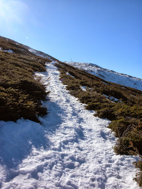
Marlie and I arrived at Marshfield Station at about 7:15 am and gathered our things. There were a couple of cars in the lower lot where we parked, but most were parking above and that lot was nearly full. Many were skiers. We headed up the road to the back of the station the descended the bank to the left where the Jewell Tr starts on the north side of the tracks. Two steps off of the pavement and I postholed up to my mid thigh. :twisted: I hope this wasn't going to be the trend for the day. After crossing the bridge and getting a better look at the trail I decided that I would start off with microspikes (carried snowshoes and crampons) as the temperature was below freezing and the monorail was firm. With careful foot placement I made it to treeline without any postholes.
As we climbed towards the Gulfside Tr the Jewell Tr was in better shape than in the summer, and the monorail was still supporting me with the micros on.
Jewell Tr
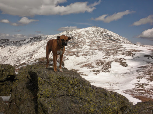
As we neared the Gulfside junction the wind was faint and the skies were blue. Marlie decided that we should cut the corner by ascending a snowfield and we joined the Gulfside Trail just north of the Jewell Tr junction. We then headed north towards Mt Jefferson. As I neared the spring loop on the side of Mt Clay I noticed a blue and black object at the bottom of another snowfield. I decided to descend the snowfield, grab it then cut back towards Sphinx Col. At first it looked like a sled, then a kite, then a tent. Once I reached it it turned out to be a sleeping bag (stuff sack not included). Complete with a half used fuel canister and about 3 pounds of ice. Now I had the dilemma of what to do with this sleeping bag. I couldn't just leave it there so once I reached the Gulfside Tr again I placed a rock on it to hold it in place and would make a decision upon my return.
Once in Sphinx Col the wind started to pick up. It was only around 20 mph but it was relentless. We continued towards Jefferson, Marlie running around on the snowfields and me taking many pictures. We soon reached the Loop Tr and made the final ascent. It was a mix of snow and rock, with little ice. Crampons would have been overkill and snowshoes would take a beating. The micros worked well.
Approaching Jefferson
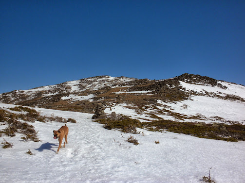
At the summit Marlie wanted to head for Mt Adams but I told her that would have to wait for another day.
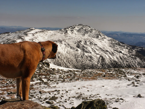
From the summit of Mt Jefferson, Washington looked far off with lots of uphill. I had planned on crossing over Clay as well but the northern slope was untracked and sloping pretty good. Plus the sleeping bag was still near the spring loop. The wind was still blowing steadily although we got a little relief between Jefferson's two summit knobs. There were no other hikers in sight.
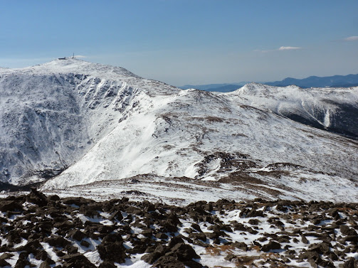
After a quick break we headed back through Sphinx Col, I grabbed the sleeping bag and climbed to the junction of the Jewell Tr. It was still windy but only 11 am and the clouds were scattered and high up. I decided to break off as much ice from the sleeping bag as I could, roll it up, attach it to my pack, and continue on towards Mt Washington.
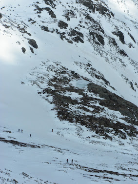
As I neared the Cog tracks, I saw a few skiers headed across to check out the Great Gulf. I believe that after probing for a bit they decided not to ski it. Soon the first hiker of the day that I would meet approached. It was Chris D who had joined us on the FOT48 hike. We chatted for a bit over the wind, the parted ways. Nearing the section where the Gulfside passes the top of the headwall of the Great Gulf the snow was starting to get a bit shiny and there was minimal rock down slope from us so I chose a route closer to the tracks.
That's close enough for me.
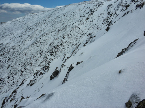
Great Gulf
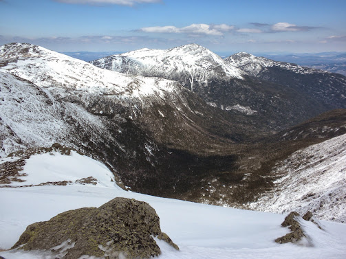
From there it was easy crusty walking to the summit, although the wind was pushing my pack with the sleeping bag quite a bit. Near the junction of the Trinity Heights Connector I met, another nice fellow, Robi, and we talked loudly for a bit over the wind.
Marlie leads the way.
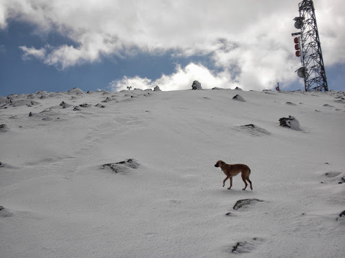
40 mwh wind, according to the MWO records.
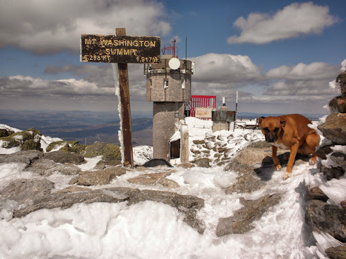
At the summit, skiers out numbered the hikers 4:1. I can't imaging climbing all the way up in ski boots and skis/snowboard strapped to my back. After several pictures, Marlie and I decided to head down the Crawford Path. Soon we unknowingly passed Raven on his way up to the summit and I asked him how the conditions were on the Ammonoosuc Ravine Tr. By now I was getting used to the wind and barely noticed it for the rest of the hike, although it was a bit less on this side of the mountain. About halfway to the hut I met Pepper and Me again. Twice in a row now. There were many skiers near the hut and we continued on to the Monroe Loop.
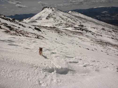
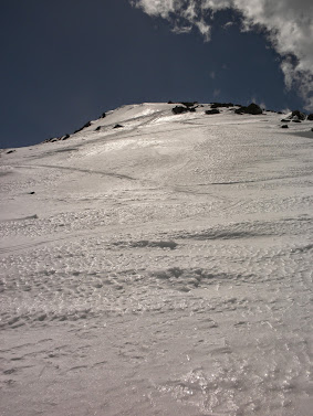
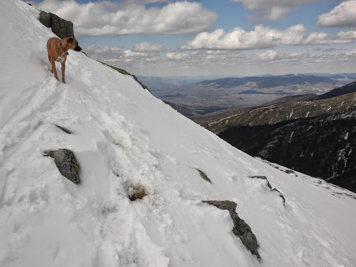
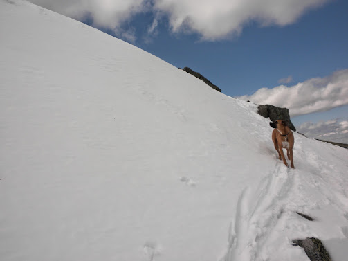
As I began to ascend Mt Monroe, I started hikimng up and chatting with another guy who was chipping away at the 48. We also met a woman heading down who I think said it was too steep for her. Perhaps this is what she was talking about.
Marlie and I arrived at Marshfield Station at about 7:15 am and gathered our things. There were a couple of cars in the lower lot where we parked, but most were parking above and that lot was nearly full. Many were skiers. We headed up the road to the back of the station the descended the bank to the left where the Jewell Tr starts on the north side of the tracks. Two steps off of the pavement and I postholed up to my mid thigh. :twisted: I hope this wasn't going to be the trend for the day. After crossing the bridge and getting a better look at the trail I decided that I would start off with microspikes (carried snowshoes and crampons) as the temperature was below freezing and the monorail was firm. With careful foot placement I made it to treeline without any postholes.
As we climbed towards the Gulfside Tr the Jewell Tr was in better shape than in the summer, and the monorail was still supporting me with the micros on.
Jewell Tr

As we neared the Gulfside junction the wind was faint and the skies were blue. Marlie decided that we should cut the corner by ascending a snowfield and we joined the Gulfside Trail just north of the Jewell Tr junction. We then headed north towards Mt Jefferson. As I neared the spring loop on the side of Mt Clay I noticed a blue and black object at the bottom of another snowfield. I decided to descend the snowfield, grab it then cut back towards Sphinx Col. At first it looked like a sled, then a kite, then a tent. Once I reached it it turned out to be a sleeping bag (stuff sack not included). Complete with a half used fuel canister and about 3 pounds of ice. Now I had the dilemma of what to do with this sleeping bag. I couldn't just leave it there so once I reached the Gulfside Tr again I placed a rock on it to hold it in place and would make a decision upon my return.
Once in Sphinx Col the wind started to pick up. It was only around 20 mph but it was relentless. We continued towards Jefferson, Marlie running around on the snowfields and me taking many pictures. We soon reached the Loop Tr and made the final ascent. It was a mix of snow and rock, with little ice. Crampons would have been overkill and snowshoes would take a beating. The micros worked well.
Approaching Jefferson

At the summit Marlie wanted to head for Mt Adams but I told her that would have to wait for another day.

From the summit of Mt Jefferson, Washington looked far off with lots of uphill. I had planned on crossing over Clay as well but the northern slope was untracked and sloping pretty good. Plus the sleeping bag was still near the spring loop. The wind was still blowing steadily although we got a little relief between Jefferson's two summit knobs. There were no other hikers in sight.

After a quick break we headed back through Sphinx Col, I grabbed the sleeping bag and climbed to the junction of the Jewell Tr. It was still windy but only 11 am and the clouds were scattered and high up. I decided to break off as much ice from the sleeping bag as I could, roll it up, attach it to my pack, and continue on towards Mt Washington.
As I neared the Cog tracks, I saw a few skiers headed across to check out the Great Gulf. I believe that after probing for a bit they decided not to ski it. Soon the first hiker of the day that I would meet approached. It was Chris D who had joined us on the FOT48 hike. We chatted for a bit over the wind, the parted ways. Nearing the section where the Gulfside passes the top of the headwall of the Great Gulf the snow was starting to get a bit shiny and there was minimal rock down slope from us so I chose a route closer to the tracks.
That's close enough for me.

Great Gulf

From there it was easy crusty walking to the summit, although the wind was pushing my pack with the sleeping bag quite a bit. Near the junction of the Trinity Heights Connector I met, another nice fellow, Robi, and we talked loudly for a bit over the wind.
Marlie leads the way.

40 mwh wind, according to the MWO records.

At the summit, skiers out numbered the hikers 4:1. I can't imaging climbing all the way up in ski boots and skis/snowboard strapped to my back. After several pictures, Marlie and I decided to head down the Crawford Path. Soon we unknowingly passed Raven on his way up to the summit and I asked him how the conditions were on the Ammonoosuc Ravine Tr. By now I was getting used to the wind and barely noticed it for the rest of the hike, although it was a bit less on this side of the mountain. About halfway to the hut I met Pepper and Me again. Twice in a row now. There were many skiers near the hut and we continued on to the Monroe Loop.

As I began to ascend Mt Monroe, I started hikimng up and chatting with another guy who was chipping away at the 48. We also met a woman heading down who I think said it was too steep for her. Perhaps this is what she was talking about.


