Double Bow
New member
- Joined
- Apr 29, 2005
- Messages
- 1,172
- Reaction score
- 219
On Sunday Shamie, Arghman, and I wrapped up our camping weekend by doing more in the Mahoosucs and getting what Arghman would describe as a "true" Mahoosucs experience by climbing Success, which Arghman had been up multiple times.
The drive in was easy as Success Pond Rd has been recently graded and is in really great shape. At the trailhead, we saw one other car and other than one couple, I don't think we saw anyone all day. Due to recent logging activity, the lower elevations are now a fairly open woods with large cuts visable from some sections. The day was bright and warm making it feel and look more like August 2 than October 2. The climb was steep at times but always pleasant. There were slabby parts that made for a slight challenge at times but, I enjoy that sort of thing.
We did the .3mi loop to take in the outlook and it was well worth it! It's a good destination in and of it's own right. It would really be a loss to not visit it while going up there. We stopped there and took a break and pictures. After continuing on, past more slabs and one scramble, we reached the upper reaches of the Success trail which are VERY muddy as in you could get lost forever in the mud muddy. I can only imagine what it's like in spring! It this area, there are interesting reminants of logging tools. I plan to get back up there and bushwhack around exploring... someday.
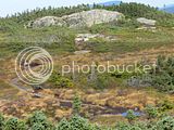
We were very happy when we passed the AT corridor cut and instantly found the forrest to be thicker. Soon we were on the Mahoosuc trail and then the summit which is rocky but is on a very boggy ridge. I'd never seen such a boggy ridge. No wonder Arghman likes it so much! He pointed out some interesting species including some late blooming bog laurel and we ate some mountain cranberries and reminised about this years best blueberry hikes. It really did feel like it was still summer.
After we had explored more of the ridge and the bogs, we headed down and I found the descent to be almost as pleasurable as the climb. As we left, I reflected that this had been a fitting end to the camping weekend as it truly had been a success.
Here are some pics. Hopefully, Arghman will share some of his as well.


![Grand Teton Day Hikes and National Park Map [Map Pack Bundle] (National Geographic Trails Illustrated Map)](https://m.media-amazon.com/images/I/41DB0jvRnbL._SL500_.jpg)


![Yellowstone National Park [Map Pack Bundle] (National Geographic Trails Illustrated Map)](https://m.media-amazon.com/images/I/51kGuJ72qjL._SL500_.jpg)


