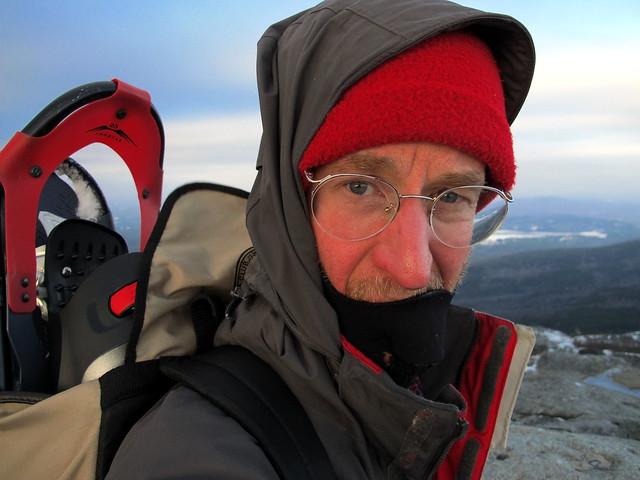
Old Ski Path on Monadnock

vftt.org

Help Support vftt.org:

This site may earn a commission from merchant affiliate links, including eBay, Amazon, and others.

Raymond

Well-known member
Joined
Sep 4, 2003
Messages
1,536
Reaction score
59
Location
My gut is telling me no... but my gut is also very
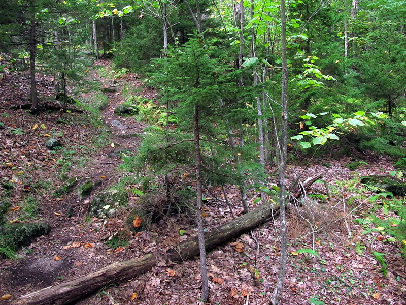
I was going to ask if this trail still exists, but I see by some old threads here that it does. So instead I will ask, where the heck is it? I’ve climbed the Red Spot Trail twice recently and haven’t seen any sign of the Old Ski Path.

In November, I saw some paint on a rock for the Smith Connecting Trail, but I never saw the Old Ski Path. I should probably have descended the White Dot Trail to look for the other end of the Old Ski Path, but I had gotten mixed up about which way the Old Ski Path went from Red Spot, and descended the Spellman Trail, instead. D’oh.

Descending Red Spot last Saturday, I went to an outlook down low on the trail which, according to my GPS track, may or may not coincide with the Old Ski Path, but I sure didn’t see any sign of a trail continuing beyond the viewpoint. If there was a trail there, it must be well hidden. (I was nervous about going down via the White Dot Trail on that hike, because I didn’t reach the summit of the mountain until quarter past three o’clock and was sure I was going to be benighted and didn’t want to have to walk miles up the road to the Gilson Pond parking lot in the dark.)
 
The Old Ski Path is most easily accessed from the White Dot. Just before you start up the steep ledge section which we call the Chute there is a flat section. OSP goes off to your right. This is just over 1/2 way up the White Dot if you are not real familiar with the WD. From the Red Spot after you cross the the Jct with Cascade Link you will cross a couple small brooks and then go up a short steep section of rock stairs. The trail then flattens out for a distance before the next longer steep section and the trail bends toward the right. Once you get up that the grade becomes moderate for 100 yds or so and about 50 yds up this section the OSP is on your left. There is a sign but it is most easily seen heading down the RS. I have attached a pic of the sign. From the White Dot side I believe there are paper in plastic signs right now.

As for Ravine Trail. I don't go over to Gilson Pond Campsite very often, but it is just a short trail from the north end of the pond to the perimeter (remote) campsite trail. 59 OST sign.jpg
 
001.jpg Here is a map of Gilson Pond area which I just found showing Ravine Trail. One more thing on RS Trail. If the painted blazes you describe are located just as you break out of trees you are way to high if you were looking for OSP in that area. Saw you other comment on the accomplishment thread. If you have any more trouble locating trails on M, just send an email and we'll help you out. There are well over 100 trails on M that we know of. We once did a hike and touched 33 different trails in one hike. All the solitude you could ever want if you know where to go.
 
Thanks, Kerry. I may have been paying too much attention to the ice and missed the sign. I think I know the area you describe along the Red Spot Trail. I went a short distance but didn’t see any trail continuing beyond thirty feet or so. Well, next month I’ll give it another go. I don’t usually hike from the main parking lot so I can avoid having to pay to park, but I could take Harling or Cascade Link to get to the White Dot, too. And probably the toll station isn’t manned at this time of year anyway.

When I was there last Saturday, the Halfway House parking lot was completely filled, that’s why I ended up at Gilson Pond. There were only two other cars there, although there was a berm I had to drive over, scraping the bottom of my car.
 
You don’t happen to know what the trail/herd path is off of Monte Rosa Trail, do you? I followed it a short distance back in September, but it was getting late so I didn’t go to its end. It must just hit the Old Cart Path or Mossy Brook Trail eventually, but I was curious about it.
 
And probably the toll station isn’t manned at this time of year anyway.

Nope. They man it year-round.

FYI: if you aren't from NH, you can buy a parks pass for $65 per year, and that gets you into any NH state park. I think NH residents are free at any NH park if you have the Parks license plate.
 
You don’t happen to know what the trail/herd path is off of Monte Rosa Trail, do you? I followed it a short distance back in September, but it was getting late so I didn’t go to its end. It must just hit the Old Cart Path or Mossy Brook Trail eventually, but I was curious about it.

I am assuming, based on the fact that you think it heads toward the OCP or MBT, that you were heading west down the ledges and that would be Great Pasture Trail and it does join up with MB. The one that goes off the SW corner doesn't have a name and joins up with the old Sweetwater Trail. The trail heading N is the old Smith Marlboro Ridge Link and of course the Monta Rosa Trail comes up from the S and Smith Summit heads of toward the summit in a NE direction. Those are the only ones I know of that originate from the top of Monta Rosa. There are several other old abandoned trails in that area and you'd need to give me more specific info.

As iagreewithjamie stated they do have a seasons pass, but as of last year they were only $60 for non-resident and it does get you into most NH state parks. I know it is not good at Hampton and I am sure there are others. They also have a coupon booklet which you can buy. Using coupons it is $4 a day instead of $5. Last I knew they didn't man the toll booth during the winter, only on weekends and holidays. There is an iron maiden at the Store for those who wish to donate. I will check tomorrow to confirm the season pass price, also check if NH residents get a better deal and if they collect fees on weekdays.

What time were you heading up Red Spot last Saturday. We came down it around 12-1 time frame and passed a few folks heading up. Passed a couple solo guys, where you one of them. We were three guys and a gal.
 
I think we did pass! I think there were two solo hikers and a group of four descending. I started from the parking lot about 1:40 p.m.

Here is what I looked like when I reached the top, maybe you’ll recognize me. I carried snowshoes in a backpack but didn’t need them.

11756836693_7fd3447277_z.jpg


The herd path I was thinking of off Monte Rosa Trail is probably the southwestern one you mentioned. I was heading up toward the upper junction with Fairy Spring Trail and saw a path that went to the left where the actual trail went right. It was blocked off with a log.

I think this is a picture of it:

11757416576_8bfe3994b8_c.jpg


Not much to go on, of course, from that picture. Nothing distinctive enough.

The first time I was on the summit of Monte Rosa, there was an enormous weather vane up there. I don’t think it was still there the next time I passed over. I don’t see how I could have missed it, anyway, but I was more concerned with following trails that time.

Thanks for all your help. It’s an interesting mountain, and the closest decent one to me, about a 75-minute drive.
 
Last edited:
Top