PETCH
New member
Date of Hike: 11/21/10
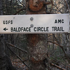
Peaks/Trails: South Baldface, North Baldface via Baldface Circle Trail clockwise
Cast of Characters: just me
Trail Conditions: Fairly dry up to Shelter. Ledges were icy. Small amount of icing on the way to South Baldface and up to North Baldface.The first 1/2 mile or so down from North Baldface was pretty nasty. Lots of ice. Also a lot of ice coming down from Eagle Crag. Once down in the woods, things were just wet. Lots of leaves covering puddles and rocks.
After injuring my knee last weekend, I've been laying low waiting for the swelling to go down. So, this weekend, I planned on just a short walk in the woods. If I had 1/2 a brain, I'd take it easy, surf the couch, and suck down a case of bons-bons. But, that's not how I roll, coupled with a fair amount of ADD and the inability to sit still for very long....gotta get outdoors. Some of my hiking comrads had the Moose and Chocorua planned for the weekend, but I figured I'd fly solo in case I needed to bail.
Original hike requirements:
- 5- 7 miles
- Less than 1000ft of ele gain
- hike for a few hours and be home for 4pm NE Pats kick off
Final hike stats:
- 9.8 miles
- 3600ft of elevation gain
- 5 hrs 35 min, home at 3pm, and the Pats won!
Tails From the Trail:
- Driving up Rt113, the skies were crystal clear and it was also crystal clear that this was Not going to be just a walk in the woods. This was going to be a "View" hike. I debated it with myself, and lost the debate in the first few minutes.
- Only a couple vehicles at trailhead (certainly not like summer)
- Made quick time up to the Shelter. 3 gents from Vermont were staying the weekend.
- Going up the icy ledges was a bit challenging. I thought about putting on the microspikes, but then decided to see if I could pick a non-icy route. So I took my time and chose my approach carefully and made it up.
- I haven't done this trail in a few years, and forgot just what a great view-hike it was. Outstanding views over to the Royces, Pleasant Mountain, and of course across the Wild River Valley to the Wildcat-Carter range. Washington and Boot Spur also clearly visible, along with Carrigain......it's what JustJoe calls "View Overload".
- I only saw one hiker up on the ridge, doing the loop counterclockwise and going down Slippery Brook trail instead of the ledges.
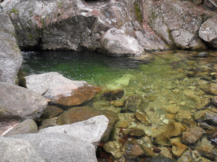
- A quick stop down at Emerald Pool on the way out. A little too cool for a swim.
- I'm sure the Whites were flooded with hikers on a day like this.
A few pics:
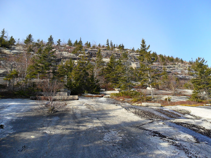
A look up at the ledges behind the Shelter
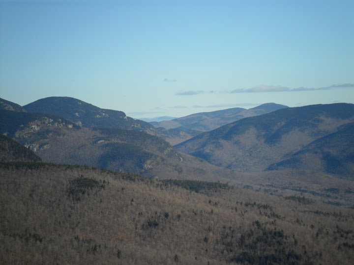
Evans Notch
On the way to South Baldface
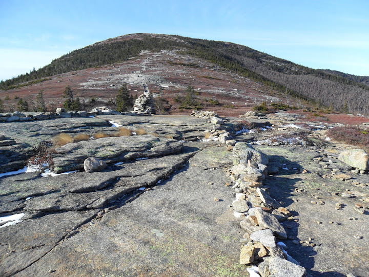
North Baldface from South Baldface
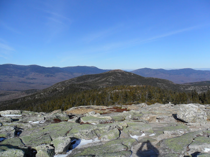
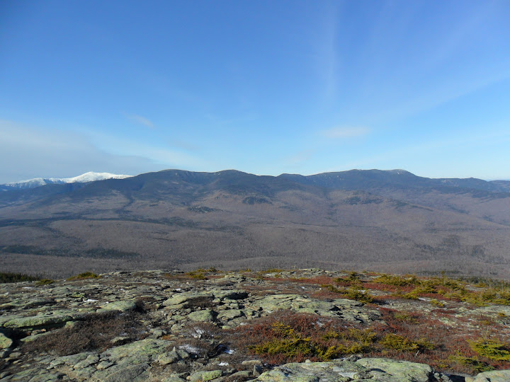
(L to R)Boot Spurr and Washington behind the Wildcats, Carter Dome, Hight, and S,M,N Carters
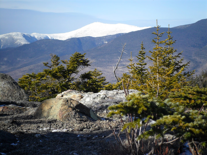
Big George behind the Wildcats
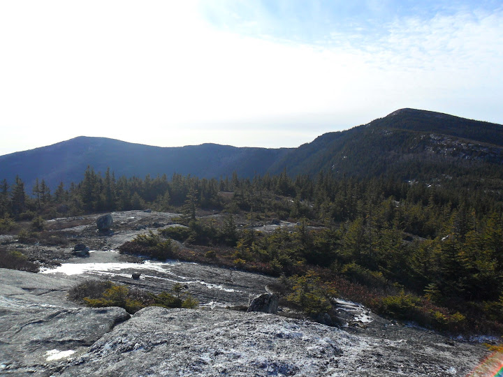
North Baldface and South Baldface from near Eagle Crag
Emerald Pool
Slideshow ^
hugs, kisses
Petch
Hiking Pictures:http://picasaweb.google.com/mpetcher
Ascent List:http://peakbagger.com/climber/climblistc.aspx?cid=1767[/quote]
Peaks/Trails: South Baldface, North Baldface via Baldface Circle Trail clockwise
Cast of Characters: just me
Trail Conditions: Fairly dry up to Shelter. Ledges were icy. Small amount of icing on the way to South Baldface and up to North Baldface.The first 1/2 mile or so down from North Baldface was pretty nasty. Lots of ice. Also a lot of ice coming down from Eagle Crag. Once down in the woods, things were just wet. Lots of leaves covering puddles and rocks.
After injuring my knee last weekend, I've been laying low waiting for the swelling to go down. So, this weekend, I planned on just a short walk in the woods. If I had 1/2 a brain, I'd take it easy, surf the couch, and suck down a case of bons-bons. But, that's not how I roll, coupled with a fair amount of ADD and the inability to sit still for very long....gotta get outdoors. Some of my hiking comrads had the Moose and Chocorua planned for the weekend, but I figured I'd fly solo in case I needed to bail.
Original hike requirements:
- 5- 7 miles
- Less than 1000ft of ele gain
- hike for a few hours and be home for 4pm NE Pats kick off
Final hike stats:
- 9.8 miles
- 3600ft of elevation gain
- 5 hrs 35 min, home at 3pm, and the Pats won!
Tails From the Trail:
- Driving up Rt113, the skies were crystal clear and it was also crystal clear that this was Not going to be just a walk in the woods. This was going to be a "View" hike. I debated it with myself, and lost the debate in the first few minutes.
- Only a couple vehicles at trailhead (certainly not like summer)
- Made quick time up to the Shelter. 3 gents from Vermont were staying the weekend.
- Going up the icy ledges was a bit challenging. I thought about putting on the microspikes, but then decided to see if I could pick a non-icy route. So I took my time and chose my approach carefully and made it up.
- I haven't done this trail in a few years, and forgot just what a great view-hike it was. Outstanding views over to the Royces, Pleasant Mountain, and of course across the Wild River Valley to the Wildcat-Carter range. Washington and Boot Spur also clearly visible, along with Carrigain......it's what JustJoe calls "View Overload".
- I only saw one hiker up on the ridge, doing the loop counterclockwise and going down Slippery Brook trail instead of the ledges.
- A quick stop down at Emerald Pool on the way out. A little too cool for a swim.
- I'm sure the Whites were flooded with hikers on a day like this.
A few pics:
A look up at the ledges behind the Shelter

Evans Notch

On the way to South Baldface

North Baldface from South Baldface

(L to R)Boot Spurr and Washington behind the Wildcats, Carter Dome, Hight, and S,M,N Carters

Big George behind the Wildcats

North Baldface and South Baldface from near Eagle Crag

Emerald Pool


Slideshow ^
hugs, kisses
Petch
Hiking Pictures:http://picasaweb.google.com/mpetcher
Ascent List:http://peakbagger.com/climber/climblistc.aspx?cid=1767[/quote]
