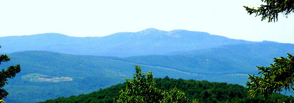
Plymouth Mtn, 2/12/2010

vftt.org

Help Support vftt.org:

This site may earn a commission from merchant affiliate links, including eBay, Amazon, and others.

Paradox

New member
Joined
May 29, 2006
Messages
2,268
Reaction score
314
Location
Holderness, NH, Avatar: Pine Marten on Mt Field
Inspired by Grousking's trip report from last June and a conversation with the local Police Chief, Zippy and I headed out to find the trail to Plymouth Mountain on this clear cool morning.

The trailhead is on Old Hebron Road about .1 miles West of the junction with Texas Hill Road in Plymouth. The trail well marked with blue blazing was packed solid today and no snowshoes required. I was glad I had put on microspikes as there are some glare ice patches, particularly in the lower third.

"Pikes Peak" is a granite ledge about 2 miles up the trail and it has wonderful views to the North and East. It is not marked but I have given it a waypoint on the Wikiloc Track. The summit has some nice views also.

Post hike checking of the area on Google maps shows some ledges to the south of the summit. It would be nice to check those out on my next trip up there.

Pictures in the Wikiloc track.
 
Last edited:
Congrats on even finding the TH from the Plymouth side!!! I drove around for more than an hour last year trying to find it. I finally went up the Bridgewater/Hebron side from Route 3A which was nice. I bushwhacked off the summit a bit (unintentionally - I lost the trail) into the wet ledges that day and took a few a$$-over-teakettle slides....:eek:
 
A couple of months ago I climbed Plymouth Mountain for the first time (a few years ago I had reached Pike's Peak and lost the trail to the summit): Plymouth Mountain. Since then it has replaced Mount Pemi as my short (about 2 miles each way, 1,500 feet) hike when I want a bit of exercise but do not want to do a "real" hike.

The footing is much better than that of either trail up Mount Pemi, and I can do any Plymouth based shopping I need on my way home :D

The trail has two very distinct parts: Up to Pike's Peak it is a very easy trail, excellent footing, lots of trail work to help with the few wet spots. From Pike's Peak to the summit it seems to go out of its way to go over every rocky ledge.

I am now about to finish my coffee, shave, get dressed, and hike it once more :)
 
Post hike checking of the area on Google maps shows some ledges to the south of the summit. It would be nice to check those out on my next trip up there.

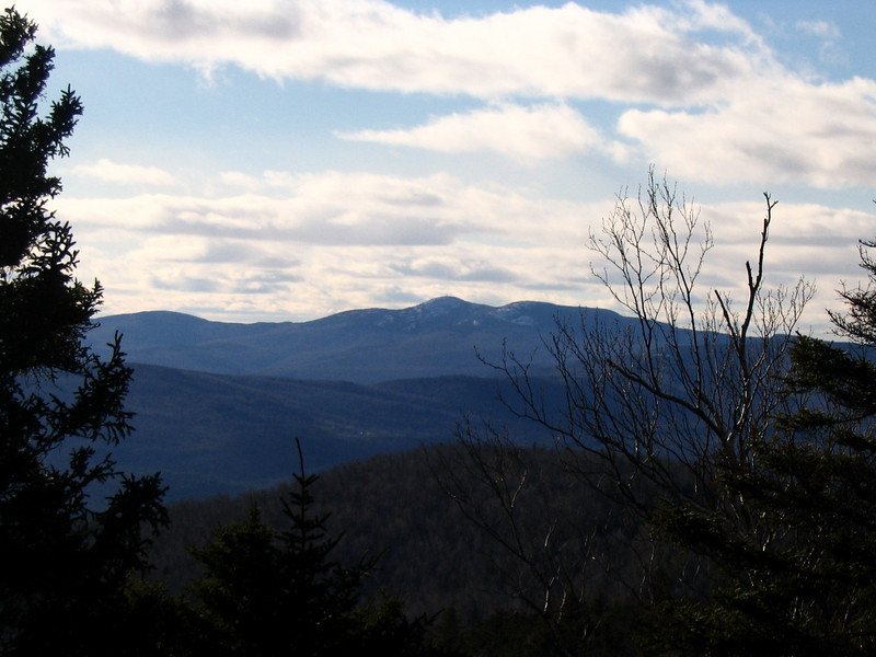
Those sound like the ledges I reached by a spur-path that heads SW from the summit for no more than 100 yards. While it is unblazed, it is marked by small cairns and not hard to follow. The view south over Newfound Lake to Mt. Kearsarge was obscured by foliage when I visited them last month, but there was a great view west to Cardigan and Firescrew:

907570319_72sbD-M-1.jpg


Becca M:

The route described by Paradox and Mohamed Ellozy is the Fauver Link Tr. for the first .4 mile, which then becomes the Sutherland Trail (which comes in at an angle from the NW - I gather there were issues with its beginning and that bit has effectively been abandoned). As Paradox indicates, the parking lot for the Fauver Link Tr. is only 100 or so yards west of the east end of Old Hebron Road and tough to miss, even though there was not sign that I noticed. (There is a sign at the actual trailhead, but you couldn't see it from Old Hebron Rd.) [Ed. - I see that M. E. has most of the foregoing details and many more on the website to which he attached a link.] That parking lot is fairly new and perhaps postdates your hike.

I second the praise of Paradox and Mohamed Ellozy. This was a real discovery for me.
 
Last edited:
Those sound like the ledges I reached by a spur-path that heads SW from the summit for no more than 100 yards. While it is unblazed, it is marked by small cairns and not hard to follow.
I have never climbed Plymouth Mtn over Pikes Peak, all of my ascents have been from Pike Hill Rd parking varying distances from Rte 3A depending on conditions. There are several Mowglis trails including one over the SW 1990 peak. But on one of my early hikes, I followed the line of cairns which did not end at the ledges but continued down to a house on what I think was Hunt Road. I then used another old road to loop back to Pike Hill Road.
 
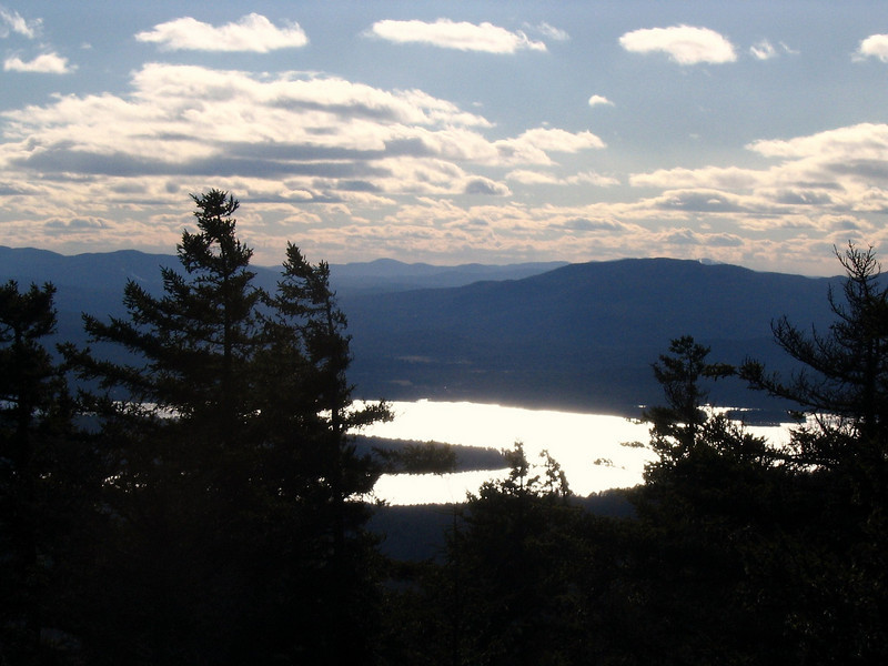
I visited those ledges all three times I hiked up Plymouth Mtn, but last June, I had a hard time finding what I was looking for. Perhaps I took a wrong turn last year...but in Dec of 2005 I got some nice views down to Newfound Lake and Cardigan, much similar to the pic posted above.

782901347_Y6zxU-L.jpg


is this Kearsarge way off in the distance in the center? I know I can see Newfound Lake nice and shiny.

782901481_NpKRa-L.jpg
 
I visited those ledges all three times I hiked up Plymouth Mtn, but last June, I had a hard time finding what I was looking for. Perhaps I took a wrong turn last year...but in Dec of 2005 I got some nice views down to Newfound Lake and Cardigan, much similar to the pic posted above.

....

is this Kearsarge way off in the distance in the center? I know I can see Newfound Lake nice and shiny.

Was your 2005 hike on the traditional Plymouth Mtn. Trail from the SW, that Roy Swkr mentions? It has ledges lower down that, according to Scudder, would have included both of your views. Your first, of Cardigan, much resembles mine from last month, but seems to me possibly taken from a bit lower altitude. I could see Newfound Lake a little through the trees, but not close to your second picture.

In fact, your second photo seems to reproduce closely part of a view Scudder describes from a ledge a quarter of the way down the Plymouth Mtn. Trail from the summit. His diagram identifies (1) the near mountain on the other side of the Lake, on the right, as Forbes Mtn., with the tip of Sunapee peaking over, to the right of its high-point, (2) the distant mountain in the middle as (I think) Lovewell Mtn. and (3) the range on your left, partially screened by foliage, as Ragged Mtn. Kearsarge would have been a little to the left of your left margin.
 
Last edited:
Was your 2005 hike on the traditional Plymouth Mtn. Trail from the SW, that Roy Swkr mentions? It has ledges lower down that, according to Scudder, would have included both of your views. Your first, of Cardigan, much resembles mine from last month, but seems to me possibly taken from a bit lower altitude. I could see Newfound Lake a little through the trees, but not close to your second picture.

In fact, your second photo seems to reproduce closely part of a view Scudder describes from a ledge a quarter of the way down the Plymouth Mtn. Trail from the summit. His diagram identifies (1) the near mountain on the other side of the Lake, on the right, as Forbes Mtn., with the tip of Sunapee peaking over, to the right of its high-point, (2) the distant mountain in the middle as (I think) Lovewell Mtn. and (3) the range on your left, partially screened by foliage, as Ragged Mtn. Kearsarge would have been a little to the left of your left margin.

I hiked it from the Texas Hill Rd side, but was exploring a bit to look for views to Mt Cadigan, because I had read there was a view over there. The time of year probably helped the view down to the lake though, since there are some deciduous trees near the top. You can see them on my cardigan view pic.
I was def on a ledge looking at Cardigan, and I'm pretty sure....that the other pic I posted was taken from the same area.

It is possible the view I got was the one Scudder described (wish I could find that book around here!!) In 2009 when I visited, I don't remember finding that ledge the same way it was in 2005, I believe it might be becoming grown in. Either that, or I just missed it, since I was going by memory. Plus the bugs were insane that day. :)

grouseking
 
Top