1HappyHiker
Well-known member
Although we are often times prone to off-trail adventures, a last second decision was made by Steve and me to embark upon an on-trail hike to The Horn. It was such a clear, sunny day it seemed appropriate to do a straightforward hike to a spot with terrific views. And, as most folks would agree, The Horn is certainly one of those spots!
As I said, this was an on-trail hike (well, most of the way, but more about that later). However, I still find it amazing that not all that many years ago, bushwhacking was the only way to get to The Horn and to The Bulge. It wasn't until the late 1980s that the Kilkenny Ridge Trail was built to provide an on-trail route to these peaks. Prior to the 1980s, the WMG contained the following description of how to get to The Horn:
"When climbing from the E, follow the Unknown Pond Trail about 2 mi. Then find the stream coming in from the W. Follow this upstream to the small pond shown, but not named on maps . . . (local name --- Bishop's Pond). From the pond, The Horn is in sight. Climb toward it, swinging L higher up to avoid the cliffs."
The route we selected for our journey was to take the Unknown Pond Trail from the trailhead on Mill Brook Road, and then follow the Kilkenny Ridge Trail from Unknown Pond to the summit of The Horn.
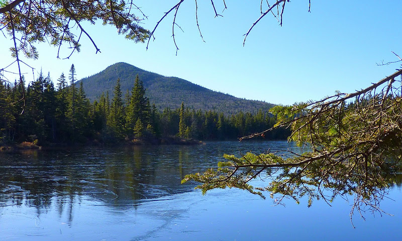
Upon arriving at Unknown Pond, we stopped to take the obligatory snapshots of The Horn from the shore of the pond. Similar snapshots have been posted many times before by others. Nonetheless here is one more! Maybe it's a little bit different in that the pond has a slight skiff of ice on it.
After the brief stop at Unknown Pond we stayed on-trail to the summit of The Horn which has a fine view, but it's not quite a 360 degree view. I hinted at the beginning of this report that this trek had an off-trail component. So, this is where that comes into play!
From the summit we whacked in a NNE direction to seek out the vista that's missing from the traditional summit view from The Horn.
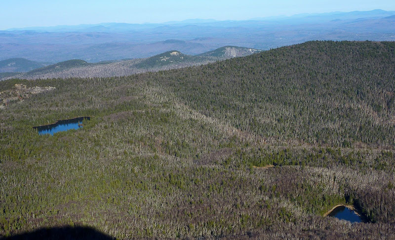
We were successful in finding the "missing view"! This vista included both Bishop's Pond (right side of photo below) and Unknown Pond (left side) with Roger's Ledge and Square Mountain in the background between these two ponds.
In the title of this report I mentioned "Shades and Shadows of November". Perhaps the next few photos will show what I meant by that. These photos are full of shadows, and shadowy silhouettes of mountains, plus various shades of brown that occur on many November days.
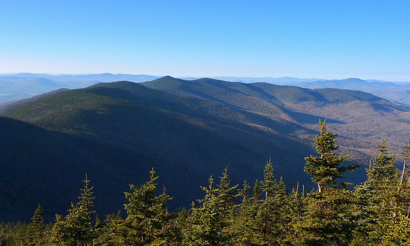
Below is a photo of a huge chunk of the Pilot Range. This view begins just a bit beyond The Bulge and looks northwesterly at all the humps, bumps, and lumps along the way to Hutchins Mountain and beyond.
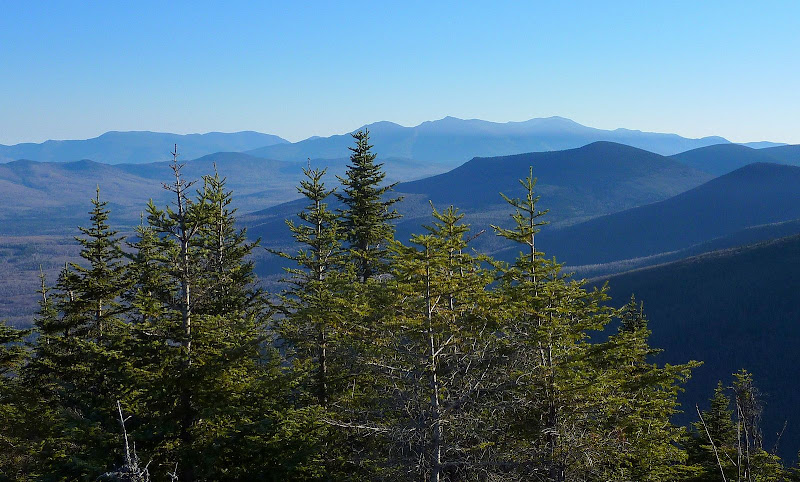
Below is a snapshot showing the shadowy silhouettes of the Presidential and Carter Range in the background, along with snippets of Terrace and The Weeks in the foreground.
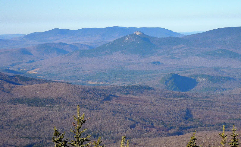
The snapshot below is a zoomed shot of the Percy Peaks in the top center of the picture, with North Percy particularly recognizable by its bare rock summit.
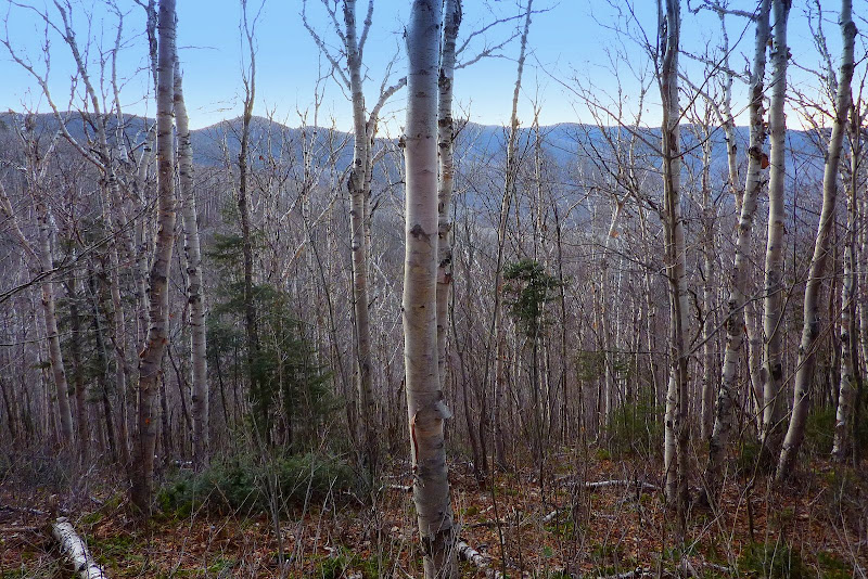
And last of all, the report needs to include a snapshot of the magnificent birches that are so prominent along the trail for large portions of this hike. The photo below was taken late in the day when the light was becoming very dim. My apologies to the birches for not having a better photo of them to post!
1HappyHiker
As I said, this was an on-trail hike (well, most of the way, but more about that later). However, I still find it amazing that not all that many years ago, bushwhacking was the only way to get to The Horn and to The Bulge. It wasn't until the late 1980s that the Kilkenny Ridge Trail was built to provide an on-trail route to these peaks. Prior to the 1980s, the WMG contained the following description of how to get to The Horn:
"When climbing from the E, follow the Unknown Pond Trail about 2 mi. Then find the stream coming in from the W. Follow this upstream to the small pond shown, but not named on maps . . . (local name --- Bishop's Pond). From the pond, The Horn is in sight. Climb toward it, swinging L higher up to avoid the cliffs."
The route we selected for our journey was to take the Unknown Pond Trail from the trailhead on Mill Brook Road, and then follow the Kilkenny Ridge Trail from Unknown Pond to the summit of The Horn.
Upon arriving at Unknown Pond, we stopped to take the obligatory snapshots of The Horn from the shore of the pond. Similar snapshots have been posted many times before by others. Nonetheless here is one more! Maybe it's a little bit different in that the pond has a slight skiff of ice on it.

After the brief stop at Unknown Pond we stayed on-trail to the summit of The Horn which has a fine view, but it's not quite a 360 degree view. I hinted at the beginning of this report that this trek had an off-trail component. So, this is where that comes into play!
From the summit we whacked in a NNE direction to seek out the vista that's missing from the traditional summit view from The Horn.
We were successful in finding the "missing view"! This vista included both Bishop's Pond (right side of photo below) and Unknown Pond (left side) with Roger's Ledge and Square Mountain in the background between these two ponds.

In the title of this report I mentioned "Shades and Shadows of November". Perhaps the next few photos will show what I meant by that. These photos are full of shadows, and shadowy silhouettes of mountains, plus various shades of brown that occur on many November days.
Below is a photo of a huge chunk of the Pilot Range. This view begins just a bit beyond The Bulge and looks northwesterly at all the humps, bumps, and lumps along the way to Hutchins Mountain and beyond.

Below is a snapshot showing the shadowy silhouettes of the Presidential and Carter Range in the background, along with snippets of Terrace and The Weeks in the foreground.

The snapshot below is a zoomed shot of the Percy Peaks in the top center of the picture, with North Percy particularly recognizable by its bare rock summit.

And last of all, the report needs to include a snapshot of the magnificent birches that are so prominent along the trail for large portions of this hike. The photo below was taken late in the day when the light was becoming very dim. My apologies to the birches for not having a better photo of them to post!

1HappyHiker
Last edited:
