Stratton (3940) [78/100] (8/100 for Matt) via the Long Trail, 7 miles, 1750 feet, 4:45

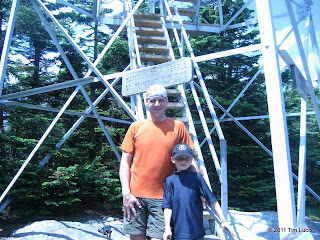
For my third trip to Vermont in about as many weeks, I picked Stratton. I left this one out because it is one of the closer ones I had left, and one of the easier ones. Matthew told me he was interested in going some time ago and the weather looked good for Independence Day, and so we went. The stories of Vermont trailheads being difficult to find held true here. And if the two-and-a-half hour predicted ride was not enough, we got caught in parade traffic going through Wardsboro. Stratton-Arlington (Arlington-Stratton at the other end) Road was easy to find, and Google Maps says go this way. The GPS says go further and then turn right at... nothing! So back to Stratton-Arlington and after some confusion over which trailhead was the right one, we were off. You want the trailhead right at the bridge over the river on the unpaved section of road.
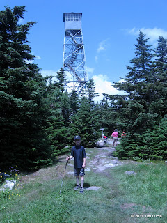
The first 1.5 miles or so are relatively flat. The trail was rather muddy up to the International Paper road, after which it gets both steeper and drier; it is by no means steep and the footing is pretty good. We met an AT through hiker ("Chainsaw", from Maryland, a retired firefighter) and talked to him for a while before he left us behind. A while later, Matthew wondered out loud "I wonder how far ahead Chainsaw is?" Not 5 minutes later, we came upon him filling and treating water bottles for lunch on the summit. He hiked the last half mile or so with us and told us some details about his trip, and asked questions about the Whites (he has never been this far north before.) On the summit there was another AT through hiker, some LT through hikers and a few AT section hikers. Also on the summit were the tourists who'd taken the gondola from the ski area and walked over. They formed a 20-person line to ascend the summit tower, which has a four-person limit. We sat in the shade and ate our lunch until the line dwindled. Several people congratulated Matthew on ascending under his own power.
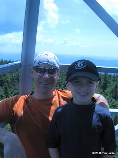
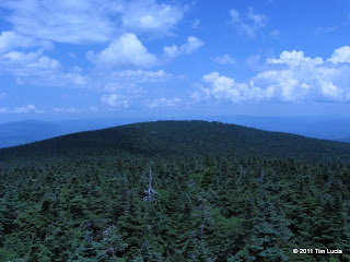
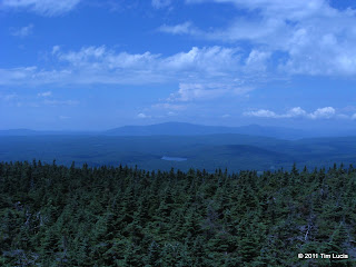
The views from the tower were great, even though visibility was clouded somewhat by haze. Given the tower is rather open, we didn't stay up there long since it was a bit scary for those with an aversion to heights. There is a caretaker there, and a guy with a ham radio repeater, and more bugs than the rest of the trip, but still not enough to break out the bug spray. A post-hike inventory reveals one bug bite (Matthew) so we did well. After descending the tower, we returned the way we'd come up.
All photos
Tim


For my third trip to Vermont in about as many weeks, I picked Stratton. I left this one out because it is one of the closer ones I had left, and one of the easier ones. Matthew told me he was interested in going some time ago and the weather looked good for Independence Day, and so we went. The stories of Vermont trailheads being difficult to find held true here. And if the two-and-a-half hour predicted ride was not enough, we got caught in parade traffic going through Wardsboro. Stratton-Arlington (Arlington-Stratton at the other end) Road was easy to find, and Google Maps says go this way. The GPS says go further and then turn right at... nothing! So back to Stratton-Arlington and after some confusion over which trailhead was the right one, we were off. You want the trailhead right at the bridge over the river on the unpaved section of road.


The first 1.5 miles or so are relatively flat. The trail was rather muddy up to the International Paper road, after which it gets both steeper and drier; it is by no means steep and the footing is pretty good. We met an AT through hiker ("Chainsaw", from Maryland, a retired firefighter) and talked to him for a while before he left us behind. A while later, Matthew wondered out loud "I wonder how far ahead Chainsaw is?" Not 5 minutes later, we came upon him filling and treating water bottles for lunch on the summit. He hiked the last half mile or so with us and told us some details about his trip, and asked questions about the Whites (he has never been this far north before.) On the summit there was another AT through hiker, some LT through hikers and a few AT section hikers. Also on the summit were the tourists who'd taken the gondola from the ski area and walked over. They formed a 20-person line to ascend the summit tower, which has a four-person limit. We sat in the shade and ate our lunch until the line dwindled. Several people congratulated Matthew on ascending under his own power.


The views from the tower were great, even though visibility was clouded somewhat by haze. Given the tower is rather open, we didn't stay up there long since it was a bit scary for those with an aversion to heights. There is a caretaker there, and a guy with a ham radio repeater, and more bugs than the rest of the trip, but still not enough to break out the bug spray. A post-hike inventory reveals one bug bite (Matthew) so we did well. After descending the tower, we returned the way we'd come up.
All photos
Tim
Last edited:
