
1HappyHiker
Well-known member
Date of Hike: 29-Apr-2009
Shown on AMC’s Map #4 (Moosilauke-Kinsman) of the White Mountain Guide is a peak, a summit, a high point (or whatever you want to call it). This point is named Moody Ledge, and it is due west of Cobble Hill and the Cobble Hill Trail. However, what is puzzling (at least to me) is that there is no ledge at this location! Perhaps a ledge of some sort was once there and has since been swallowed up by the forest over the years?
Anyway, prior to my hike, I knew from talking with others (and from GoogleEarth) that there is a definite ledge about 0.8 of a mile north of the spot named "Moody Ledge". It was this ledge that I sat off to conquer! (I don’t know if this ledge has a name, but perhaps some of the readers of the Trip Report will know.)
To access the ledge, I hiked the Cobble Hill Trail for about 1.5 miles and then headed off-trail in a northwesterly direction toward the ledge that’s north of the spot called Moody Ledge. It was a relatively easy bushwhack through predominately open woods. However, there were a few short-lived thick spots. And as a side note for Forestgnome (and other interested parties), there were many spots along the way that had lots of moose sign.
Probably at this point I should add a footnote to mention that although this ledge is on private land, it’s just a few hundred yards from WMNF land. The ledge is not posted, and other than the last few hundred yards, the entire trek can be done on WMNF land.
So, with the above footnote out of the way, I will say that the portion of the ledge that I visited is very broad, flat and good for lounging. Plus, the views from there are pretty darn good. There are other ledges in this same area that I did not have time to explore on this particular day. However, since it’s an easy whack, I plan to return on another day to explore the entire “ledge complex”.
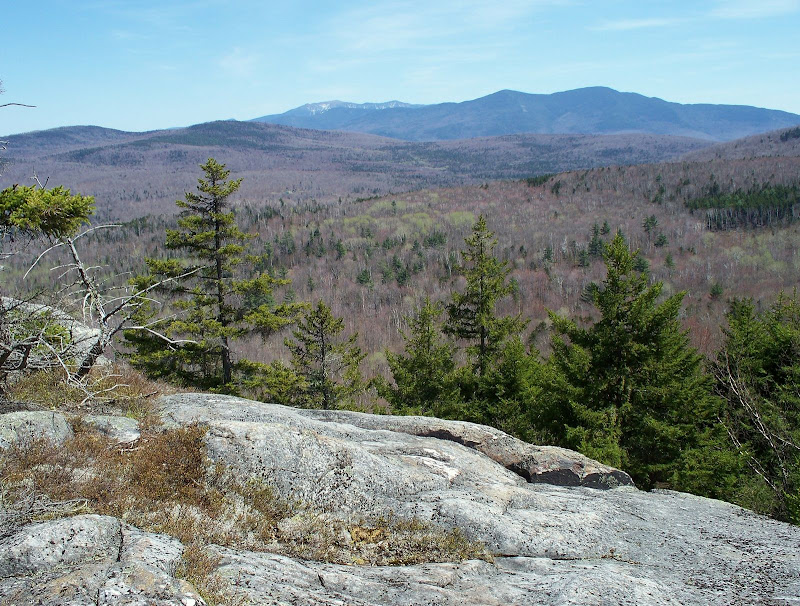
Regarding the views, the overriding view is to the east. The Kinsmans are in the foreground, with the top of the Franconia Range behind in the background. Below are two photos of this view.
East View from Ledge
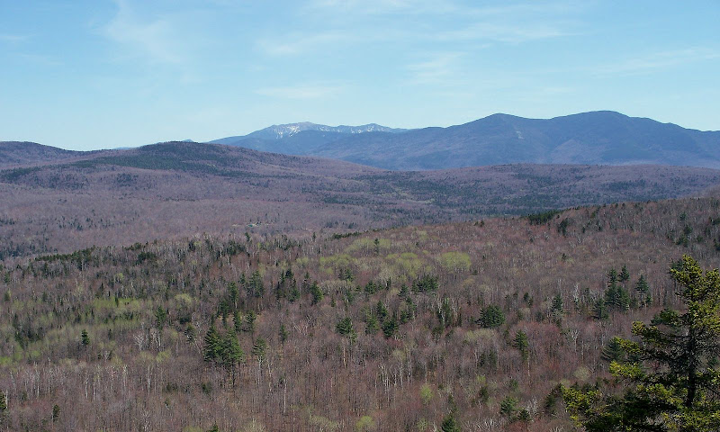
Same View as the Photo Above, But Slightly Zoomed and From Slightly Different Vantage Point
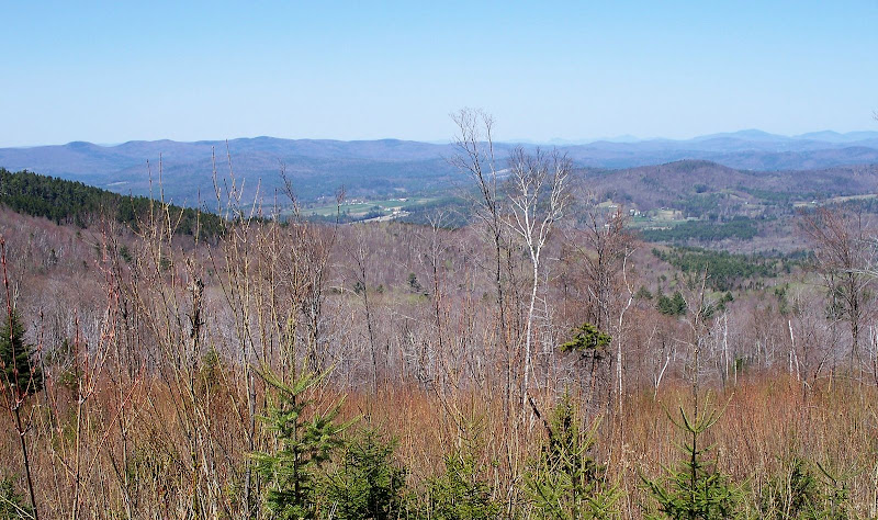
On the way to the ledge, I happened to come across a spot where I got a “through the trees” view to the north toward the village of Landaff Center (see photo below). This same view (and perhaps better) might be available from somewhere on the “ledge complex” that I have yet to explore.
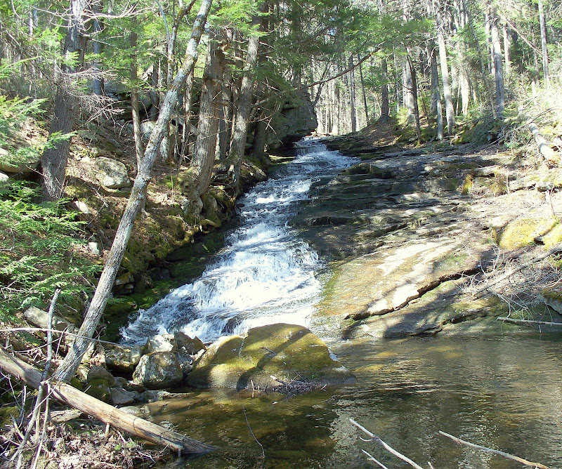
Below is one last photo. Right at the beginning of the Cobble Hill Trail is a picturesque cascade that’s worthwhile taking a moment to admire.
Perhaps there’s one other footnote that should be added. During the course of this hike, I also visited what I think is point on the map that is named “Moody Ledge”. My GPS said I was there, and if in fact I was there, I can personally confirm that there isn’t an obvious ledge at that location! So perhaps, was this “mountain” named for the ledge that’s located 0.8 of a mile north of this spot . . . er what??
1HappyHiker
Shown on AMC’s Map #4 (Moosilauke-Kinsman) of the White Mountain Guide is a peak, a summit, a high point (or whatever you want to call it). This point is named Moody Ledge, and it is due west of Cobble Hill and the Cobble Hill Trail. However, what is puzzling (at least to me) is that there is no ledge at this location! Perhaps a ledge of some sort was once there and has since been swallowed up by the forest over the years?
Anyway, prior to my hike, I knew from talking with others (and from GoogleEarth) that there is a definite ledge about 0.8 of a mile north of the spot named "Moody Ledge". It was this ledge that I sat off to conquer! (I don’t know if this ledge has a name, but perhaps some of the readers of the Trip Report will know.)
To access the ledge, I hiked the Cobble Hill Trail for about 1.5 miles and then headed off-trail in a northwesterly direction toward the ledge that’s north of the spot called Moody Ledge. It was a relatively easy bushwhack through predominately open woods. However, there were a few short-lived thick spots. And as a side note for Forestgnome (and other interested parties), there were many spots along the way that had lots of moose sign.
Probably at this point I should add a footnote to mention that although this ledge is on private land, it’s just a few hundred yards from WMNF land. The ledge is not posted, and other than the last few hundred yards, the entire trek can be done on WMNF land.
So, with the above footnote out of the way, I will say that the portion of the ledge that I visited is very broad, flat and good for lounging.
Plus, the views from there are pretty darn good. There are other ledges in this same area that I did not have time to explore on this particular day. However, since it’s an easy whack, I plan to return on another day to explore the entire “ledge complex”.Regarding the views, the overriding view is to the east. The Kinsmans are in the foreground, with the top of the Franconia Range behind in the background. Below are two photos of this view.
East View from Ledge
Same View as the Photo Above, But Slightly Zoomed and From Slightly Different Vantage Point
On the way to the ledge, I happened to come across a spot where I got a “through the trees” view to the north toward the village of Landaff Center (see photo below). This same view (and perhaps better) might be available from somewhere on the “ledge complex” that I have yet to explore.
Below is one last photo. Right at the beginning of the Cobble Hill Trail is a picturesque cascade that’s worthwhile taking a moment to admire.
Perhaps there’s one other footnote that should be added. During the course of this hike, I also visited what I think is point on the map that is named “Moody Ledge”. My GPS said I was there, and if in fact I was there, I can personally confirm that there isn’t an obvious ledge at that location! So perhaps, was this “mountain” named for the ledge that’s located 0.8 of a mile north of this spot . . . er what??
1HappyHiker
Last edited: