Umpteen-and-first GPS question: Trip odometer vs. track length

vftt.org

Help Support vftt.org:

This site may earn a commission from merchant affiliate links, including eBay, Amazon, and others.

Raymond

Well-known member
Joined
Sep 4, 2003
Messages
1,536
Reaction score
59
Location
My gut is telling me no... but my gut is also very
On The Garmin GPSMAP 60CSx, what’s the difference between trip odometer and track length? It seems to me that they should be the same thing, but when I go out for a walk and save the entire track, the track length is almost always shorter than what the trip odometer on the computer page indicated it would be. Once or twice thay’ve matched exactly, and I think one time it came out longer, but maybe I misread it.

For example, the trip odometer — which keeps a running tally of the distance I cover — says that I’ve walked 5.12 miles, but when I save the track, the track length comes out 5.00 miles.

It’s annoying when I think I've gone x miles and discover the official distance is shy of that by a few hundredths of a mile.

I’ve also noticed that if I transfer the track onto the National Geographic TOPO! map, it will say that the track length is even shorter than what the Garmin said it was.
 
The track length is going to be the length between all the points taken over time. If you stand still but have poor reception, you'll "wander" and those little distances can add up to make the track longer.

The track saves points in either distance, time, or auto mode. Depending on your mode, you may make movements that don't get reflected by a track point. The odometer is taking continuous readings while the track is more discrete, making the track seem shorter.

If you slow down in the horizontal direction (like if hiking and heading upward or even negotiating steep sections, going up but not forward), the GPS may think you're stopped. You can see this as "stopped time" vs "moving time" in the trip computer. If that happens, your odometer can seem different than the track as well.

Doug, didn't you do some experiments with yours in this regard?
 
Yeah, I've noticed that discrepancy once...

MichaelJ said:
The track saves points in either distance, time, or auto mode. Depending on your mode, you may make movements that don't get reflected by a track point. The odometer is taking continuous readings while the track is more discrete, making the track seem shorter.
That would be my suggestion... the odometer constantly takes readings and updates you mileage (as far as how often it does that, I am not sure). In track mode, depending on how often you have it set to mark points you will only get the distance between the points calculated. ie - if you were following a bearing and had to go around an obstacle... say a very large boulder... the odometer will catch your circling around the boulder, but if you have your tracking frequency set low it might mark a point before the boulder and then a point after, showing a straight line, and therefore a shorter distance.
 
MichaelJ said:
Doug, didn't you do some experiments with yours in this regard?
No. My experiments compared GPSes based upon their active tracks.

--------------------------

Raymond:

The active track is saved at any of a variety of user-settable intervals (all >= 1 sec on the 60CSx). When you save a track on the GPS, a user-selectable portion of the active track is compressed (some of the points are thrown away to save space--there is a maximum number of points on a saved track) and saved as a "saved track".

The track length is most likely the sum of the distances between recorded trackpoints.

The trip odometer is the distance traveled since you last reset it. (Resetting the odometer has no effect on the recorded tracks.) This is probably computed based upon 1-second position and velocity measurements.

Since the trackpoints (saved or active) may skip over some wiggles and cut corners on your path, it may be shorter the the odometer. And the length of a saved track would be expected to be <= than the length of the corresponding section of the active track.

Comparisons of the track lengths and odometer distances are only meaningful if they cover the exact same time interval. (And they don't have to...)

I presume that you are reading the track length off the GPS.

No two programs (including the one on the GPS) are required to give the same number. Different programs may handle track gaps differently. And any program can try to be clever (eg interpolate) and compute something other than the strict sum of the distances between the trackpoints if it so chooses--thus different programs can produce different track lengths.


If you want super accuracy, get a survey grade GPS.

Doug
 
Last edited:
I'd been meaning to try one of these days setting the tracking to its lowest setting, which would be every 1 second... but then again the track would only last for 2h 46min 40sec (the track maxs out at 10000 points). But then you'd have to be extremely fast between turning tracking on and resetting your odometer... impossibly fast :)

DougPaul said:
If you want super accuracy, get a survey grade GPS.
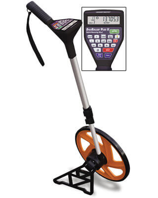
That's why I hike with one of these:
ES170-Calculated-Industries-DigiRoller-Plus-II-6425-Distance-Measuring-Wheel-md.jpg
 
NG Topo! always reports paths shorter than they actually are. Doesn't care whether the paths came from a GPS or were traced using the mouse. It's almost certainly 10% or more shorter than the actual distance. The more the elevation changes along the way, the shorter the track appears.

Note that it's usually pretty close (+/- 5%) on the elevation profile, but not always.

If you change zoom levels, you can see that your traced / GPS'd track doesn't always match the one at a higher or lower zoom level. Plus, the maps are generally out of date, even with the upgrade feature in place and in use.

A recent trip, up 19MBT, over CMT to Moriah and back down Stony Brook comes out to 17.9 miles and 5700', by adding up the segments in the WMG (27th ed, I think, don't have it with me), whereas TOPO gives this as 15.5 miles (13.5% shy) and 5113' (11% shy).

Tim
(I do not have a GPS BTW, but I do use NG Topo! 4.0 for amusement purposes.)
 
On any software a mouse-trace is going to be shorter because the map almost certainly doesn't show all the little wiggles the trail makes (which will eventually add up to something significant), and at least on software I've used the mouse-tracing feature does not have as high a resolution as the track is capable of.
 
cbcbd said:
I'd been meaning to try one of these days setting the tracking to its lowest setting, which would be every 1 second... but then again the track would only last for 2h 46min 40sec (the track maxs out at 10000 points). But then you'd have to be extremely fast between turning tracking on and resetting your odometer... impossibly fast :)
I used 30 sec for stationary, 5 sec for walking, and 1 sec for biking in my bakeoff #2 experiments.

That's why I hike with one of these:
ES170-Calculated-Industries-DigiRoller-Plus-II-6425-Distance-Measuring-Wheel-md.jpg
Careful: the distance measured will depend upon the diameter of the wheel.

There is no such thing as an exact length of a route such as a typical trail (fractals, etc). But we had that discussion in a previous thread...

Doug
 
DougPaul said:
Careful: the distance measured will depend upon the diameter of the wheel.
I know, you're right. That's why I use one with a 1" diameter wheel - not as accurate as you can get but that way I can count pebbles into the distance - hey, I'm walking over/up them so they should count :D
 
Thanks, everyone. I think I get it.

I always clear the track log then reset the computer page before beginning a walk. I’ve noticed that the saved track and the active log will both transfer onto the Garmin National Parks East map I also have on the computer, and while the tracks look identical, the track points themselves don’t coincide. There’s a flicker-effect if I rapidly switch between them, as the dots shift hither and thither.

I’ll also mention that the discrepancy between track length and trip odometer is greatest when I’ve worn the GPS while mowing the lawn. The trip odometer comes out more than a mile longer than the track, despite the track looking pretty dense and scribbly.
 
Raymond said:
I’ll also mention that the discrepancy between track length and trip odometer is greatest when I’ve worn the GPS while mowing the lawn. The trip odometer comes out more than a mile longer than the track, despite the track looking pretty dense and scribbly.
Makes sense with all that back-and-forth. The tracks probably miss many of the endpoints of the mowing lanes.

I'd hazard a guess that you have the track recording set to > 1 second.

A mowing experiment:
Try setting the track recording interval to 1 second and clearing both the odometer and active track as close to simultaneously as possible at the start (the small time difference shouldn't matter if you are stationary) and mow away. (The tracklog has a 2hr 46min (10000 point) limit as noted by cbcbd.) Then shut the GPS down ("use with GPS off" from the satellite page menu), take it inside and download the active track into mapsource. Now compare track length and odometer readings. They will probably be closer.

I normally leave my track recording interval set to "auto normal" for hiking, walking, skiing, and driving (ie everything except careful bakeoff experiments). Good enough for me, but I don't usually bother to save my tracks after the hike/walk/ski/drive.

Doug
 
Last edited:
DougPaul said:
A mowing experiment:
Try setting the track recording interval to 1 second and clearing both the odometer and active track as close to simultaneously as possible at the start (the small time difference shouldn't matter if you are stationary) and mow away. (The tracklog has a 2hr 46min (10000 point) limit as noted by cbcbd.) Then shut the GPS down ("use with GPS off" from the satellite page menu), take it inside and download the active track into mapsource. Now compare track length and odometer readings. They will probably be closer.
Actually, you just reminded me of "Use with GPS off". You could just put to "use with GPS off", clear your odometer, clear your track, set your track to 1sec intervals, turn tracking on, step outside, put to "Use with GPS on", wait for satellite lock, start mowing, finish mowing, turn off GPS, download data. That should ensure that the odometer and the tracking start at the same time.
 
cbcbd said:
Actually, you just reminded me of "Use with GPS off". You could just put to "use with GPS off", clear your odometer, clear your track, set your track to 1sec intervals, turn tracking on, step outside, put to "Use with GPS on", wait for satellite lock, start mowing, finish mowing, turn off GPS, download data. That should ensure that the odometer and the tracking start at the same time.
Good suggestion.

BTW, clearing your track does not turn recording the track off.

A minor improvment:
1. Set track recording interval to 1 sec.
2. Get a good lock.
3. "Use with GPS off"
4. Clear active tracklog and odometer.
5. When ready to mow: "Use with GPS on"
6. Mow
7. "Use with GPS off"
8. Dowload, analyze, etc
9. (Don't forget to restore your track recording interval to something practical.

The difference is that this procedure will cause a "hot start" allowing the GPS to get a good lock immediately.

You can do something other than mowing your lawn, if you prefer... :)

Doug
 
Hi Raymond,

I have the same GPS (Garmin 60csx) and the same Mapsource Topo Parks east, so I understand your frustration! However, after a long hike, I usually find the track is longer than the trip odometer, sometimes by several miles (especially on a long hike). This isn't always the case, but it has gotten so I took the trip odometer off the map screen so I am not misled by it. If I save the track in mid-hike, I can check the current mileage from the partial track against the odometer. I find (so far) that the track mileage matches the AMC guide lengths with some fair accuracy.

Regarding the Mapsource track uploads, the Active Log gives you the true amount of track points, while the secondary file is limited to 500 only. I just erase the secondary one since it is more compressed, and does not have the time stamp on each point, which I find very useful. If I have two tracks on the GPS, I upload them both, then rename the Active Log on the computer. After finding out which one it is, I go back on the GPS and delete that one, then upload again to Mapsource. This allows the second track to upload as an "Active Log" as well (Mapsource will only upload one Active Log at any one time), so you can get the full data from both tracks.

Hope this makes sense as I am writing in a hurry (headed back out the door) - send me a message anytime and perhaps we can share some learned info from this cool hiking device, or some gpx tracks for Google Earth! :)
 
Top