1HappyHiker
Well-known member
I realize that it would be impractical for mapmakers to assign a name to every cliff, ledge, bump & lump on the landscape. However, it's always been a bit of a curiosity to me as to why there is no official name for some very prominent features on the landscape. In some of these cases, an unofficial name used by the "locals" has crept into common usage.
So, with the above in mind, I'm just wondering if anyone cares to share unofficial names of prominent landscape features in the Whites that are unnamed on official maps?
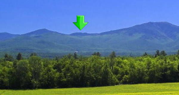
As an example, I learned awhile back that the "locals" have a name for a massive cliff that's located on one of the ridges leading up to Hutchins Mountain (Pilot Range). They refer to this spot as Owl's Head! (I suppose that when viewed from some perspective, it must resemble an owl's head? ) Regardless, this cliff is unnamed on any map I've seen, even though it is quite a prominent feature on the landscape which can be seen from many locations throughout the North Country. In the photo below, a red arrow points to "Owl's Head" as seen from a spot along Lost Nation Road.
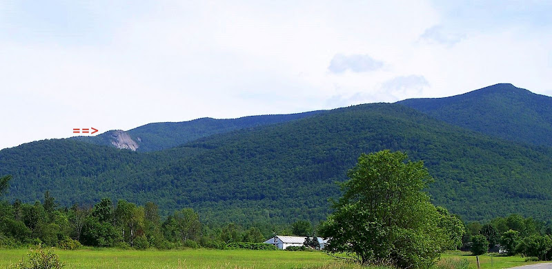
And while I'm on this topic, I'm curious if anyone knows if there is an unofficial name used by folks to refer to the cliffy prominence which is situated very close to the Davis Path trailhead on Route 302. (Shown below is a photo with a red arrow pointing to the feature that I'm talking about.)
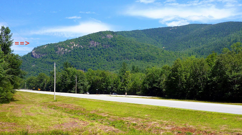
As a side-note, I recently bushwhacked to the cliff-face shown above . . . mainly just because "it's there"!
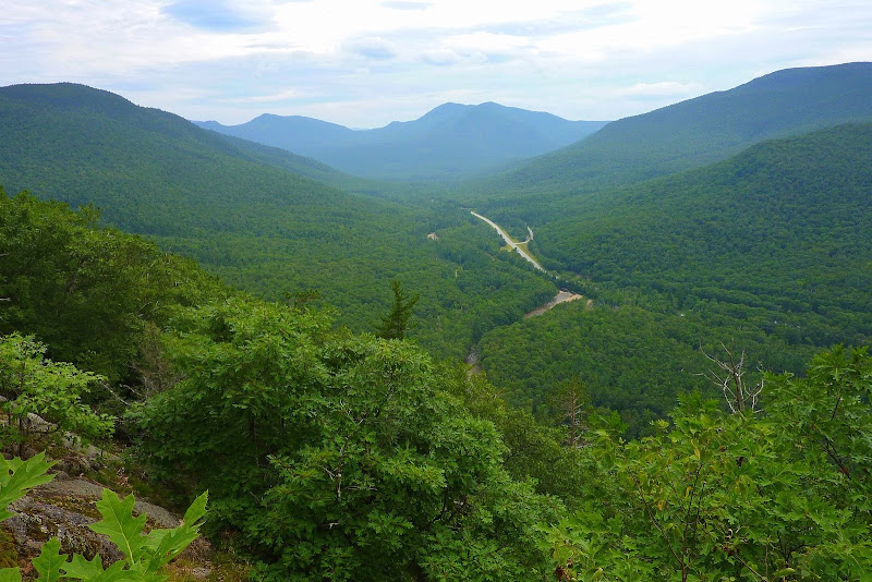
I didn't expect, nor did I get any blockbuster views. However, just in case anyone might be curious about the view from there, the snapshot below will give you some idea.
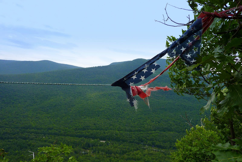
I'm thinking that this spot might have an unofficial name that's used by "locals" since I found evidence (fire ring, etc) that people do go up there. At one spot, I found a cable firmly anchored between two trees, and the tattered remains of an American flag were hanging from it.
So, with the above in mind, I'm just wondering if anyone cares to share unofficial names of prominent landscape features in the Whites that are unnamed on official maps?
As an example, I learned awhile back that the "locals" have a name for a massive cliff that's located on one of the ridges leading up to Hutchins Mountain (Pilot Range). They refer to this spot as Owl's Head! (I suppose that when viewed from some perspective, it must resemble an owl's head?
) Regardless, this cliff is unnamed on any map I've seen, even though it is quite a prominent feature on the landscape which can be seen from many locations throughout the North Country. In the photo below, a red arrow points to "Owl's Head" as seen from a spot along Lost Nation Road.And while I'm on this topic, I'm curious if anyone knows if there is an unofficial name used by folks to refer to the cliffy prominence which is situated very close to the Davis Path trailhead on Route 302. (Shown below is a photo with a red arrow pointing to the feature that I'm talking about.)
As a side-note, I recently bushwhacked to the cliff-face shown above . . . mainly just because "it's there"!
I didn't expect, nor did I get any blockbuster views. However, just in case anyone might be curious about the view from there, the snapshot below will give you some idea.
I'm thinking that this spot might have an unofficial name that's used by "locals" since I found evidence (fire ring, etc) that people do go up there. At one spot, I found a cable firmly anchored between two trees, and the tattered remains of an American flag were hanging from it.
Last edited: