Mudrat
Member
Date:2013 August 24
Benchmarks:
Start: 5:30, Marcy/Little Haystack saddle: 9:30, Grand Central Drainage: 10:30, Top of East Face (South Side): 13:30, Bottom of Grand Central: 16:30, End Bushwhack at Marcy/Little Hay col: 17:30, JBL: 19:30, Finish: 22:30 (rested over an hour at JBL)
Route: Garden to Interior Outpost & JBL, Haystack intersection on Phelps Trail, bushwhack south into Panther Gorge, base of Grand Central Slide, traverse base of East Face, climb east face 200’ to southern margin slide, climb to top, bushwhack north at about 29 degrees (true north) toward rock-fall, bushwhack approx. 326 degrees (true) to top of subsidiary slide, descend to Grand Central Slide, descend to cliff band, exit via southern woods/ledges, bushwhack north out of Panther Gorge to Garden.
East Face Exploration Day 2: .5 miles about 1050’ climbing day 2, 3.6 miles 1400’
Total Miles/Ascent/Duration: 18+ miles, 6,400 feet elevation gain, 15.5 hours
Nutrition: 6.5 litres water, brownies, starburst, assorted other stuff
Special thanks to Trailboss for the awesome background picture in the mosaic
PHOTOGRAPHS
VIDEO: SELECT "HD" and FULL SCREEN from YouTube tools
-----------------------------
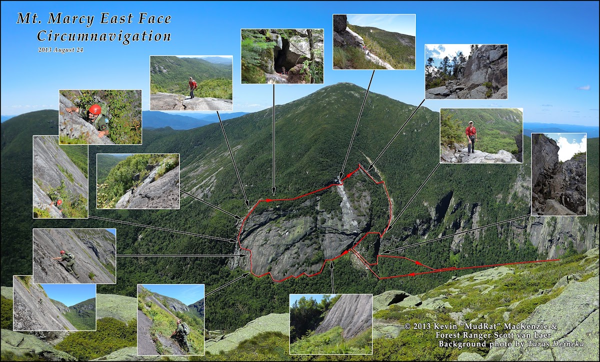
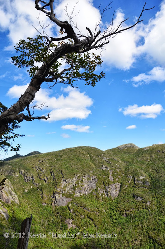
Panther Gorge is remote, stunningly beautiful, seemingly primeval and humbling. One has to explore it to understand the full depth of its beauty with its talus caves, drainages and hanging moss. You have to descend between the vertical cliffs of Little Haystack and Marcy to feel the power of the area. It doesn’t take long to feel completely alone: isolated. To then climb Marcy’s East Face and explore it from all sides cannot completely be described. If anywhere is my home away from home, this is it.
This was a day of learning since Azimuth (Forest Ranger Scott van Laer) was my partner. Spending a day like this with him gave me a deeper insight and renewed respect for his profession--his ethics and breadth of knowledge.
It’s difficult to top such a day…
-----------
I left the Garden at 5:30 a.m. My timing was perfect since I was later told that the lot was at capacity by 7:00 a.m. Temperatures hovered just below 60F and it was just approaching dawn. The walk up the South Side Trail faded quickly from memory in my pre-awake stupor; my body knew what to do—simply walk. What thoughts I mustered fell to what awaited atop the east face and what might have changed since last spring.
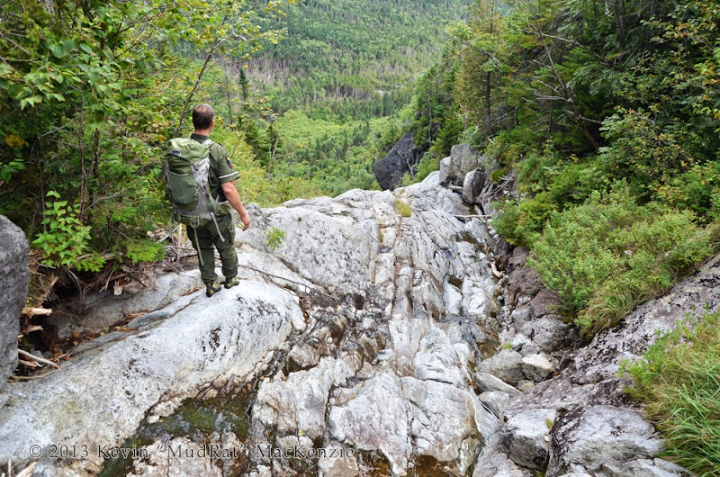
By the time I reached the Interior Outpost to meet Scott, I was awake and excited…like a kid at Christmas. It wasn’t long before we were off and making good time with a short break here and there while he checked each lean-to. By 9:30, we’d reached our jump-off point into Panther Gorge. Staying to the right of the primary drainage to avoid the boulders, we made good time given the tree growth and sod-holes. The first cliffs on Marcy weren’t too far down the drainage on the right-hand side…something I remembered from my last time down. A ten foot wide strip of ferns and grasses separated the rock from the balsam creating a pleasant descent for about 150 feet. The full-body workout began just after.
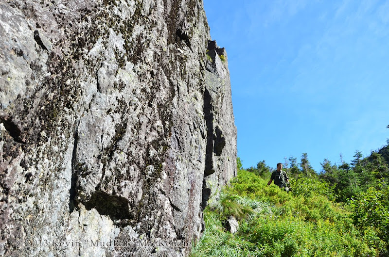
Forest Ranger Scott van Laer along the cliff.
Little Haystack was still draped in shadow, the minutiae of its cliffs seemingly flat in the light; we’d see them fully lit on the way out. I found the first sod-hole quickly and we continued the descent in good humor. I was amazed that I lost a small can of deet with all the compartments on my pack zipped. It would have remained as an artifact if Scott didn’t find it. I thanked him for not ticketing me for violating the leave no trace principle!
The gorge changed during the last year. There’s more blowdown and some of the drainages are a bit wider. Grand Central Slide’s drainage had more blowdown, something that kept me from recognizing it at first. A rock-fall a couple years ago destroyed the vegetation to the south of the slide drainage and filled the slope with blowdown…this was very familiar!
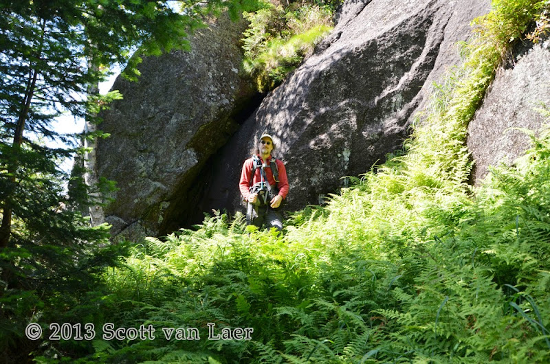
Ferns along the bottom of the face.
Along the Bottom and up the Face
I last traversed below the base in spring of 2012 just after the snow melted. We waded through 3 foot ferns this day…a beautiful green covering below the magnificent face of Marcy. Less than ½ hour later, we came to the southern margin slide. Greg Kadlecik (Krummholz) and I climbed up the margin from top to bottom last year. Scott and I opted for a different line and settled upon tackling the East Face proper, first up nice run of slab and then along a nice ramp. It wasn’t long before the magnitude of the climb began to sink in. I was home again.
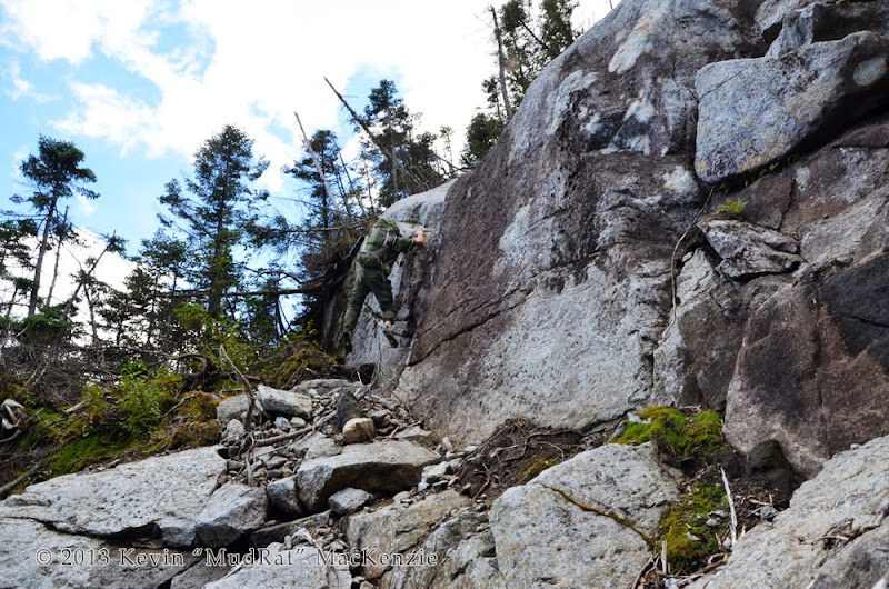
We chatted while preparing to take a bit of video. Scott said the face felt a bit like Chapel Pond Slab. I realized that the thought was also in the back of my mind and voiced my agreement. About 200 feet up and to the south, I traversed over to the rougher and cleaner rock along the margin. In and of itself this was a bit sketchy and involved perfect placement of feet and hands between bits of crumbly moss. Scott continued up the slab along an island of grass and balsam in search of his preferred line.
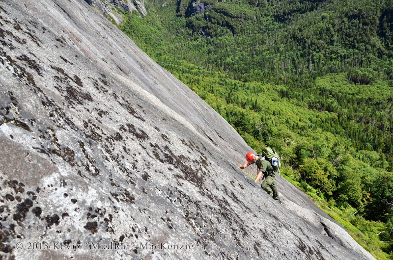
Scott along the ramp (hidden) getting ready for some exposed friction climbing.
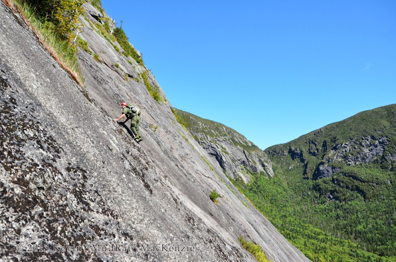
Photograph is of Scott from my traverse line about 200 feet up the face.
I looked over at his position and the slab above: the face grew a bit steeper with more tightly knit moss growth. The next bit of time found me setting up a belay from a tree as he descended about 30’ to some more contoured stone and roped in. Perhaps it wasn’t necessary, but the gorge is no place to test the limits and temp fate on crumbly moss. By the time he reached my position, it seemed that we’d gathered an audience on Haystack.
The remainder of the climb was still exposed, but with a completely different feel. It involved climbing through a weakness in the arching ledge that traverses the top of the face. Approaching it from the north as opposed to below (east), involved a few sketchy moves where long legs definitely helped. Thereafter, a series of shoulder height overlaps and small runs of slab led to an area of low angle slab. (Once you’re even with the top of the face proper, the slide continues for another hundred or so feet.)
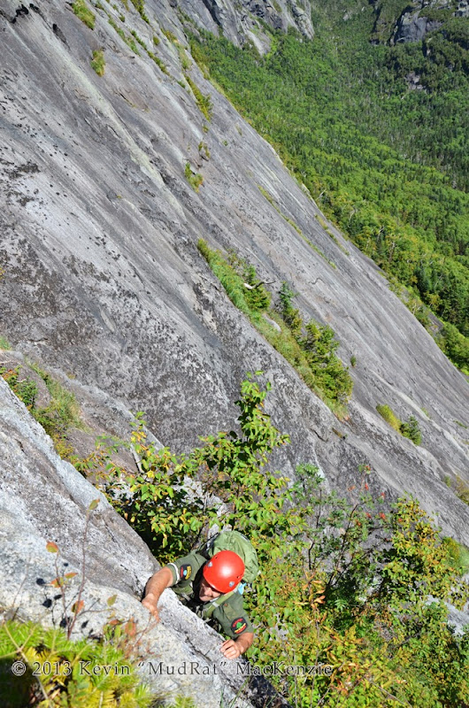
Deep into the climb up the slide along the margin of the face. This is a bit of a crux point.
Bushwhacking to Grand Central Slide
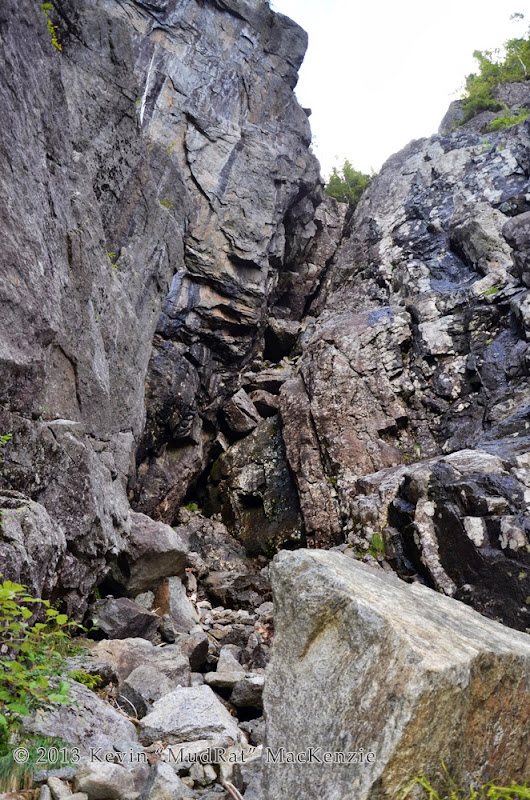
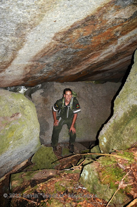
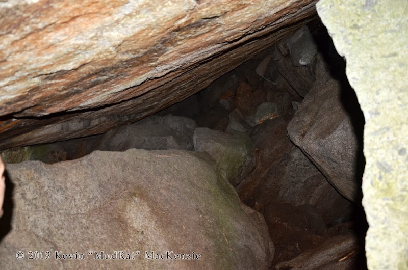
We took a short break at the top of the slide to drink, eat, study the topo and feed the blackflies. Earlier in the week, I noted a couple ‘problem’ areas on a photo of the face taken from Haystack. My goal was to stay below some small ledges a bit higher on the slope and close to the top of the face in hopes of finding a decent overlook. Some things are easier said than done. We struck off on a heading of about 29 degrees true. It’s thick, very thick in places. Various truck-sized pieces of Marcy had shifted position creating deep crevices…say 15’ in depth…and fracture caves. They, of course, host krummholz and moss much of the time. It’s a place of both potential dangers and exceptional beauty.
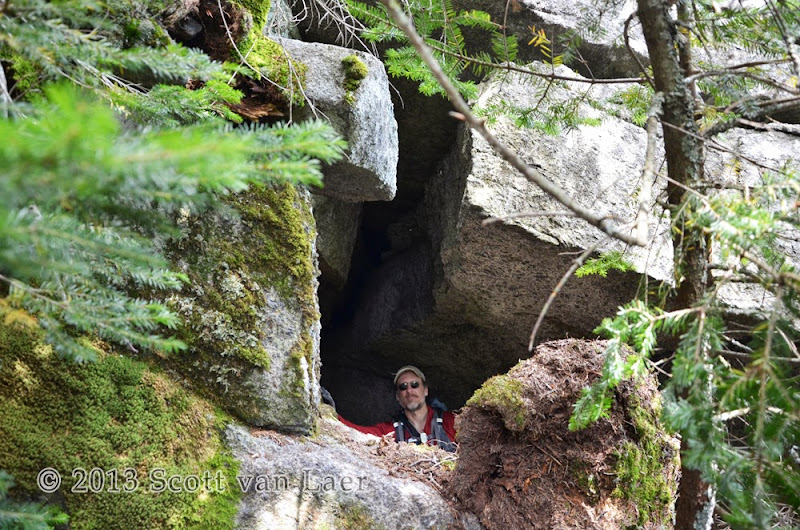
Large blocks form crevices and caves along the top of the face.
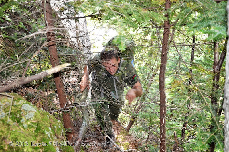
Good old ADK bushwhacking.
Roughly 35 minutes later (and halfway through the bushwhack), we approached an opening in the canopy along a 15 foot tall wall of anorthosite. One of two things would happen. We’d either have to go back and around or across the top of the rock-fall which seemed to have little protection below when we checked from below ( See permalink here. I caught my breath while Scott ventured forward and reported that it was fine to cross. To my surprise it was moderately angled. The catch was that a slip would send you tumbling down 400 feet of ever-steepening slab before the 100 foot cliff above the debris field where our circumnavigation began. The granular stone offered great traction and the view was inspiring. A nice breeze kept the blackflies at bay…darn late-season blood suckers!
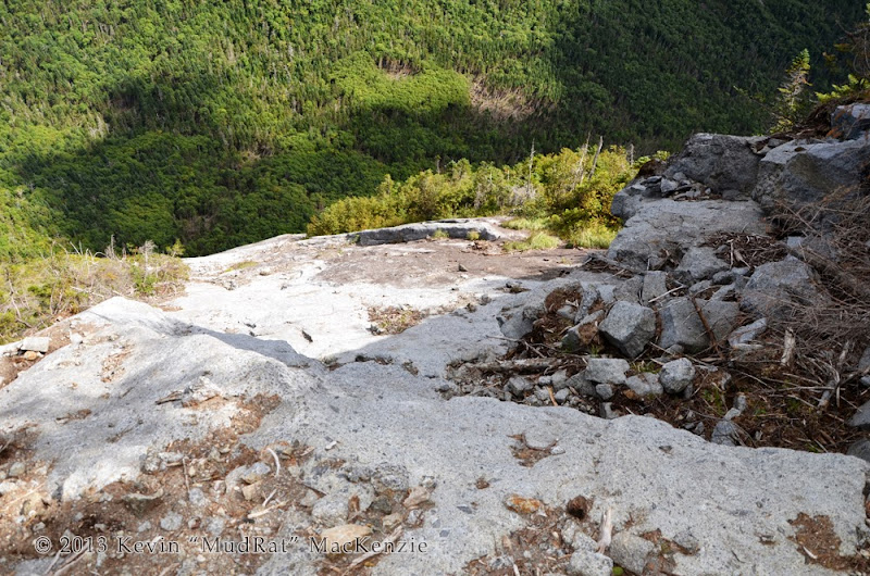
Looking down the face from the top of the rock-fall.
Benchmarks:
Start: 5:30, Marcy/Little Haystack saddle: 9:30, Grand Central Drainage: 10:30, Top of East Face (South Side): 13:30, Bottom of Grand Central: 16:30, End Bushwhack at Marcy/Little Hay col: 17:30, JBL: 19:30, Finish: 22:30 (rested over an hour at JBL)
Route: Garden to Interior Outpost & JBL, Haystack intersection on Phelps Trail, bushwhack south into Panther Gorge, base of Grand Central Slide, traverse base of East Face, climb east face 200’ to southern margin slide, climb to top, bushwhack north at about 29 degrees (true north) toward rock-fall, bushwhack approx. 326 degrees (true) to top of subsidiary slide, descend to Grand Central Slide, descend to cliff band, exit via southern woods/ledges, bushwhack north out of Panther Gorge to Garden.
East Face Exploration Day 2: .5 miles about 1050’ climbing day 2, 3.6 miles 1400’
Total Miles/Ascent/Duration: 18+ miles, 6,400 feet elevation gain, 15.5 hours
Nutrition: 6.5 litres water, brownies, starburst, assorted other stuff
Special thanks to Trailboss for the awesome background picture in the mosaic
PHOTOGRAPHS
VIDEO: SELECT "HD" and FULL SCREEN from YouTube tools
-----------------------------
Panther Gorge is remote, stunningly beautiful, seemingly primeval and humbling. One has to explore it to understand the full depth of its beauty with its talus caves, drainages and hanging moss. You have to descend between the vertical cliffs of Little Haystack and Marcy to feel the power of the area. It doesn’t take long to feel completely alone: isolated. To then climb Marcy’s East Face and explore it from all sides cannot completely be described. If anywhere is my home away from home, this is it.
This was a day of learning since Azimuth (Forest Ranger Scott van Laer) was my partner. Spending a day like this with him gave me a deeper insight and renewed respect for his profession--his ethics and breadth of knowledge.
It’s difficult to top such a day…
-----------
I left the Garden at 5:30 a.m. My timing was perfect since I was later told that the lot was at capacity by 7:00 a.m. Temperatures hovered just below 60F and it was just approaching dawn. The walk up the South Side Trail faded quickly from memory in my pre-awake stupor; my body knew what to do—simply walk. What thoughts I mustered fell to what awaited atop the east face and what might have changed since last spring.
By the time I reached the Interior Outpost to meet Scott, I was awake and excited…like a kid at Christmas. It wasn’t long before we were off and making good time with a short break here and there while he checked each lean-to. By 9:30, we’d reached our jump-off point into Panther Gorge. Staying to the right of the primary drainage to avoid the boulders, we made good time given the tree growth and sod-holes. The first cliffs on Marcy weren’t too far down the drainage on the right-hand side…something I remembered from my last time down. A ten foot wide strip of ferns and grasses separated the rock from the balsam creating a pleasant descent for about 150 feet. The full-body workout began just after.

Forest Ranger Scott van Laer along the cliff.
Little Haystack was still draped in shadow, the minutiae of its cliffs seemingly flat in the light; we’d see them fully lit on the way out. I found the first sod-hole quickly and we continued the descent in good humor. I was amazed that I lost a small can of deet with all the compartments on my pack zipped. It would have remained as an artifact if Scott didn’t find it. I thanked him for not ticketing me for violating the leave no trace principle!
The gorge changed during the last year. There’s more blowdown and some of the drainages are a bit wider. Grand Central Slide’s drainage had more blowdown, something that kept me from recognizing it at first. A rock-fall a couple years ago destroyed the vegetation to the south of the slide drainage and filled the slope with blowdown…this was very familiar!

Ferns along the bottom of the face.
Along the Bottom and up the Face
I last traversed below the base in spring of 2012 just after the snow melted. We waded through 3 foot ferns this day…a beautiful green covering below the magnificent face of Marcy. Less than ½ hour later, we came to the southern margin slide. Greg Kadlecik (Krummholz) and I climbed up the margin from top to bottom last year. Scott and I opted for a different line and settled upon tackling the East Face proper, first up nice run of slab and then along a nice ramp. It wasn’t long before the magnitude of the climb began to sink in. I was home again.
We chatted while preparing to take a bit of video. Scott said the face felt a bit like Chapel Pond Slab. I realized that the thought was also in the back of my mind and voiced my agreement. About 200 feet up and to the south, I traversed over to the rougher and cleaner rock along the margin. In and of itself this was a bit sketchy and involved perfect placement of feet and hands between bits of crumbly moss. Scott continued up the slab along an island of grass and balsam in search of his preferred line.

Scott along the ramp (hidden) getting ready for some exposed friction climbing.

Photograph is of Scott from my traverse line about 200 feet up the face.
I looked over at his position and the slab above: the face grew a bit steeper with more tightly knit moss growth. The next bit of time found me setting up a belay from a tree as he descended about 30’ to some more contoured stone and roped in. Perhaps it wasn’t necessary, but the gorge is no place to test the limits and temp fate on crumbly moss. By the time he reached my position, it seemed that we’d gathered an audience on Haystack.
The remainder of the climb was still exposed, but with a completely different feel. It involved climbing through a weakness in the arching ledge that traverses the top of the face. Approaching it from the north as opposed to below (east), involved a few sketchy moves where long legs definitely helped. Thereafter, a series of shoulder height overlaps and small runs of slab led to an area of low angle slab. (Once you’re even with the top of the face proper, the slide continues for another hundred or so feet.)

Deep into the climb up the slide along the margin of the face. This is a bit of a crux point.
Bushwhacking to Grand Central Slide
We took a short break at the top of the slide to drink, eat, study the topo and feed the blackflies. Earlier in the week, I noted a couple ‘problem’ areas on a photo of the face taken from Haystack. My goal was to stay below some small ledges a bit higher on the slope and close to the top of the face in hopes of finding a decent overlook. Some things are easier said than done. We struck off on a heading of about 29 degrees true. It’s thick, very thick in places. Various truck-sized pieces of Marcy had shifted position creating deep crevices…say 15’ in depth…and fracture caves. They, of course, host krummholz and moss much of the time. It’s a place of both potential dangers and exceptional beauty.

Large blocks form crevices and caves along the top of the face.

Good old ADK bushwhacking.
Roughly 35 minutes later (and halfway through the bushwhack), we approached an opening in the canopy along a 15 foot tall wall of anorthosite. One of two things would happen. We’d either have to go back and around or across the top of the rock-fall which seemed to have little protection below when we checked from below ( See permalink here. I caught my breath while Scott ventured forward and reported that it was fine to cross. To my surprise it was moderately angled. The catch was that a slip would send you tumbling down 400 feet of ever-steepening slab before the 100 foot cliff above the debris field where our circumnavigation began. The granular stone offered great traction and the view was inspiring. A nice breeze kept the blackflies at bay…darn late-season blood suckers!

Looking down the face from the top of the rock-fall.
Last edited:

