1HappyHiker
Well-known member
Using the Little River Valley as Part of a Loop to North & South Twin (25-Jun-2010)
This loop began at the trailhead for the North Twin Trail. Shortly after the third crossing of the Little River, I left the trail and bushwhacked southward along the Little River, and then whacked up the headwall at the end of the valley to intersect the Twinway (at a point just a few tenths of a mile NW of the Twinway/Bondcliff Trail junction). Once on the Twinway, it was a routine on-trail hike to South Twin, then North Twin, and onward from there back to the trailhead.
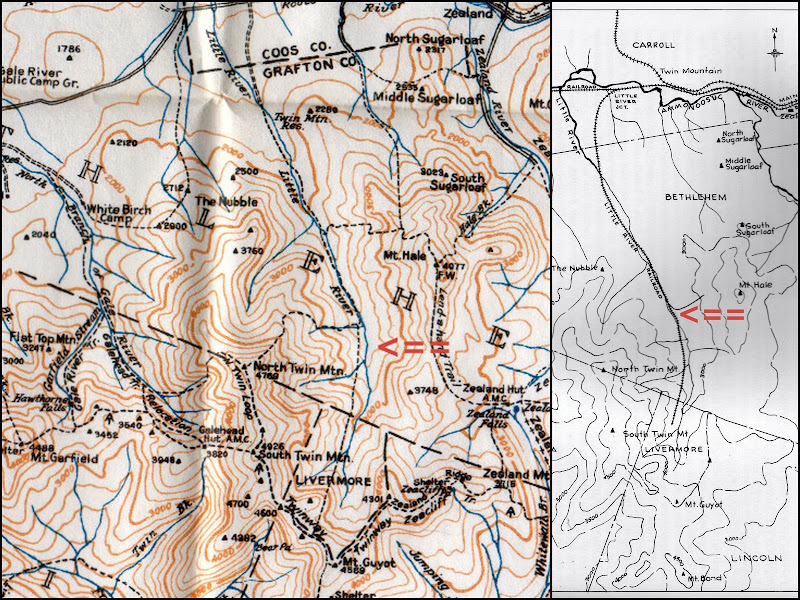
As many already know, there used to be an officially maintained trail that followed the same route described above for the bushwhack portion of my trek. It was called (appropriately enough!) the Little River Trail. In my 1940 edition of the WMG, the trail description for the Little River Trail indicates that it was 3.5 miles from the point where the trail left the present day North Twin Trail to the point where it joined the Twinway. Below is a portion of map from the 1940 WMG which shows this trail (see inserted red arrow pointing to trail).
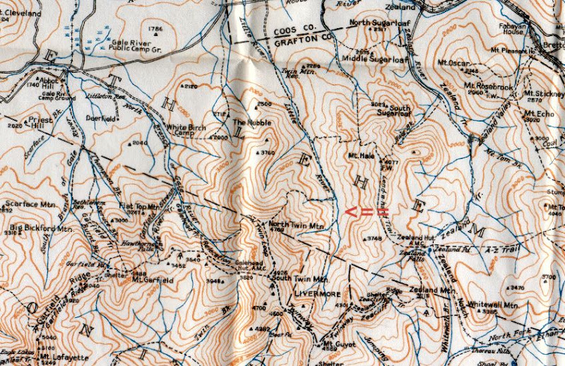
According to Guy Waterman's booklet (An Outline of Trail Development in the White Mountains 1840-1980), the Little River Trail was in bad shape in the 1950s and was officially abandoned in the early 1960s. (The trail was originally developed in the 1930s using an old railroad grade and logging roads.)
This 3.5 mile bushwhack was by far the longest bushwhack I've ever done, but oddly enough, it was also one of the easiest. The woods were open nearly the entire distance. Whenever some thick stuff was encountered, it seemed to be in narrow bands, and so it was easy to simply veer slightly left or right to quickly get back into open woods. As might be expected, the thickest parts were encountered on the way up the headwall.
This bushwhack was also one of the easiest in terms of navigation. There was the handrail of the Little River to the east which was nearly always within earshot, or in view. And upon leaving the Little River to climb the headwall, there was the assurance that I'd eventually hit the Twinway as long as I kept to a southerly compass bearing.
I must admit that I was not content to hit the Twinway at just some random spot. On my recent trek to Mt. Guyot, I made a short side trip to take a waypoint at a spot which appeared to be a good point to intersect the Twinway. My waypoint was used as a target to aim for while climbing the headwall. But as said earlier, one could easily do the whack up the headwall without the benefit of a waypoint, and still be assured of eventually hitting the Twinway just by keeping to a southerly compass bearing.
In terms of photos from the 3.5 mile bushwhack, it was a beautiful (and long) walk in a very attractive and remote part of the Whites. However, to my mind, it was a case of where "you had to be there" to truly appreciate the journey. I took a few snapshots of the woods and tributary brooks that feed into the Little River. However, when viewed out of context with the entirety of the surroundings, I feel they have little impact or meaning.
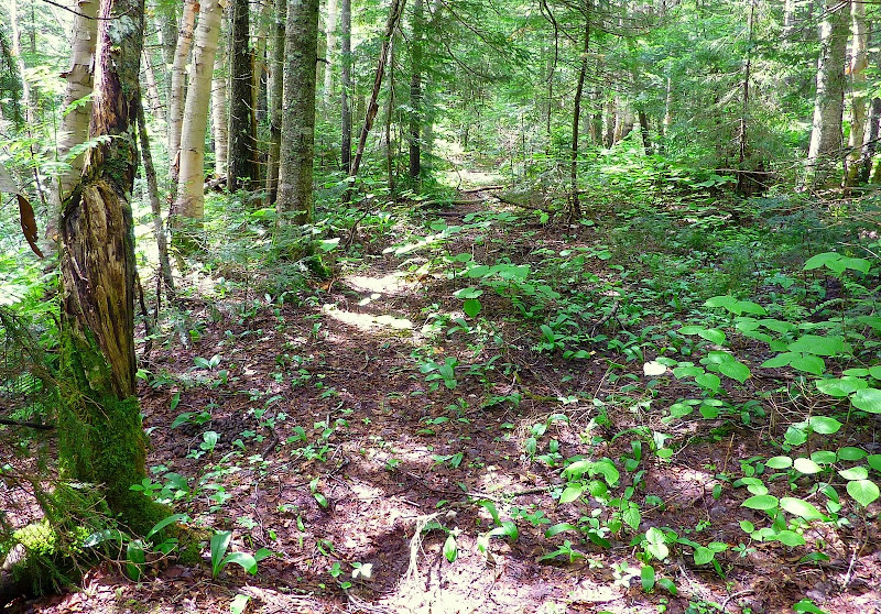
I did take a snapshot (shown below) of one of the many spots where I came upon segments of a trail. I have no proof that these random encounters were actually snippets of the abandoned Little River Trail. However, I can say that they appeared to be more than just a moose trail, and they were located where I think the old trail would have been.
In case you might be wondering, this 3.5 mile bushwhack took just slightly over 4 hours! I usually factor in a speed of about 1.0 mph for a bushwhack. This trek was obviously a bit slower than that, and I'm uncertain as to why, especially since the woods were so open and the navigation was extremely easy. However, I suspect that I actually bushwhacked more than 3.5 miles due to meanderings to avoid blowdowns, and working my way around a few thick patches, etc. Also, I was moving more slowly and deliberately than I normally do. I wanted to take every precaution to avoid injury that far off-trail.
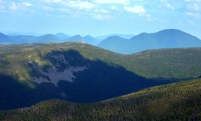
As with most of my hikes, the day I chose to do it was purely on a last minute whim. However, by pure chance, this hike was done 2 years to the day that I first contemplated doing it. When retrieving the photo below, I discovered that on the 25th day of June 2008, I'd done a short bushwhack to a ledge off the Hale Fire Warden Trail. From this ledge, there is a nice view of the Little River Valley. Upon seeing this view shown below, I thought WOW, what nice bushwhack that would be!
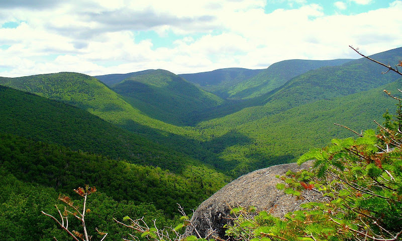
I had hoped I'd find a spot on the headwall where I could get a view similar to the one shown above, except looking up the Little River Valley from the opposite direction. If there is such a spot, I didn't come across it on this trek. Maybe next time!
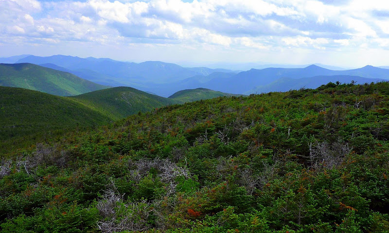
So, after reaching the Twinway, the hike then became a routine run-of-the-mill hike. I must say that after whacking for just over 4 hours, it was really nice to be on a trail for the remainder of my journey. In less than an hour, I was on the summit of South Twin. Although the distant peaks were visible, it wasn't a crystal clear viewing day. Don't get me wrong. The distant vistas were still nice, such as shown in the photo below.
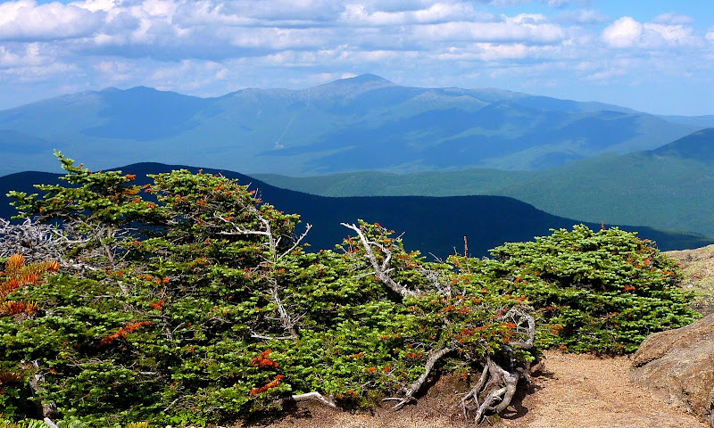
After lingering on South Twin for a short time, I headed over to North Twin. From here, I snapped a few photos, including the one of the Presidential Range shown below. I then headed off the mountaintop to begin the final leg of my journey back to the trailhead.
I arrived at the trailhead just over 10 hours from when I had started this loop. In terms of distance, I calculate that the loop was roughly about 12.5 miles, of which at least 3.5 miles was a bushwhack. For me, this was an enjoyable and very gratifying trek. However, I can completely understand why it would not be everyone's cup of tea.
1HappyHiker
This loop began at the trailhead for the North Twin Trail. Shortly after the third crossing of the Little River, I left the trail and bushwhacked southward along the Little River, and then whacked up the headwall at the end of the valley to intersect the Twinway (at a point just a few tenths of a mile NW of the Twinway/Bondcliff Trail junction). Once on the Twinway, it was a routine on-trail hike to South Twin, then North Twin, and onward from there back to the trailhead.
As many already know, there used to be an officially maintained trail that followed the same route described above for the bushwhack portion of my trek. It was called (appropriately enough!) the Little River Trail. In my 1940 edition of the WMG, the trail description for the Little River Trail indicates that it was 3.5 miles from the point where the trail left the present day North Twin Trail to the point where it joined the Twinway. Below is a portion of map from the 1940 WMG which shows this trail (see inserted red arrow pointing to trail).

According to Guy Waterman's booklet (An Outline of Trail Development in the White Mountains 1840-1980), the Little River Trail was in bad shape in the 1950s and was officially abandoned in the early 1960s. (The trail was originally developed in the 1930s using an old railroad grade and logging roads.)
This 3.5 mile bushwhack was by far the longest bushwhack I've ever done, but oddly enough, it was also one of the easiest. The woods were open nearly the entire distance. Whenever some thick stuff was encountered, it seemed to be in narrow bands, and so it was easy to simply veer slightly left or right to quickly get back into open woods. As might be expected, the thickest parts were encountered on the way up the headwall.
This bushwhack was also one of the easiest in terms of navigation. There was the handrail of the Little River to the east which was nearly always within earshot, or in view. And upon leaving the Little River to climb the headwall, there was the assurance that I'd eventually hit the Twinway as long as I kept to a southerly compass bearing.
I must admit that I was not content to hit the Twinway at just some random spot. On my recent trek to Mt. Guyot, I made a short side trip to take a waypoint at a spot which appeared to be a good point to intersect the Twinway. My waypoint was used as a target to aim for while climbing the headwall. But as said earlier, one could easily do the whack up the headwall without the benefit of a waypoint, and still be assured of eventually hitting the Twinway just by keeping to a southerly compass bearing.
In terms of photos from the 3.5 mile bushwhack, it was a beautiful (and long) walk in a very attractive and remote part of the Whites. However, to my mind, it was a case of where "you had to be there" to truly appreciate the journey. I took a few snapshots of the woods and tributary brooks that feed into the Little River. However, when viewed out of context with the entirety of the surroundings, I feel they have little impact or meaning.
I did take a snapshot (shown below) of one of the many spots where I came upon segments of a trail. I have no proof that these random encounters were actually snippets of the abandoned Little River Trail. However, I can say that they appeared to be more than just a moose trail, and they were located where I think the old trail would have been.

In case you might be wondering, this 3.5 mile bushwhack took just slightly over 4 hours!
As with most of my hikes, the day I chose to do it was purely on a last minute whim. However, by pure chance, this hike was done 2 years to the day that I first contemplated doing it. When retrieving the photo below, I discovered that on the 25th day of June 2008, I'd done a short bushwhack to a ledge off the Hale Fire Warden Trail. From this ledge, there is a nice view of the Little River Valley. Upon seeing this view shown below, I thought WOW, what nice bushwhack that would be!

I had hoped I'd find a spot on the headwall where I could get a view similar to the one shown above, except looking up the Little River Valley from the opposite direction. If there is such a spot, I didn't come across it on this trek. Maybe next time!
So, after reaching the Twinway, the hike then became a routine run-of-the-mill hike. I must say that after whacking for just over 4 hours, it was really nice to be on a trail for the remainder of my journey.

After lingering on South Twin for a short time, I headed over to North Twin. From here, I snapped a few photos, including the one of the Presidential Range shown below. I then headed off the mountaintop to begin the final leg of my journey back to the trailhead.

I arrived at the trailhead just over 10 hours from when I had started this loop. In terms of distance, I calculate that the loop was roughly about 12.5 miles, of which at least 3.5 miles was a bushwhack. For me, this was an enjoyable and very gratifying trek. However, I can completely understand why it would not be everyone's cup of tea.
1HappyHiker
Last edited:

