Cutting the lawn can wait another day.
Thanks to 1HappyHiker and MichaelJ for the ideas and tips.
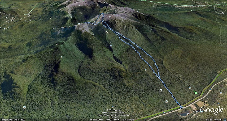
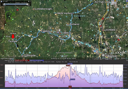
GPS track from a hike, viewed on Google Earth. Old and boring to a lot of folks, but it's new to me. Catnip for a map freak.
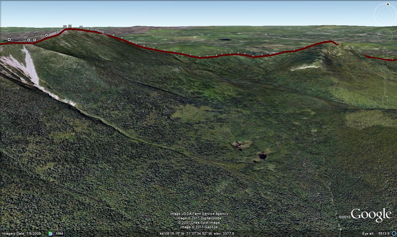
Looking west
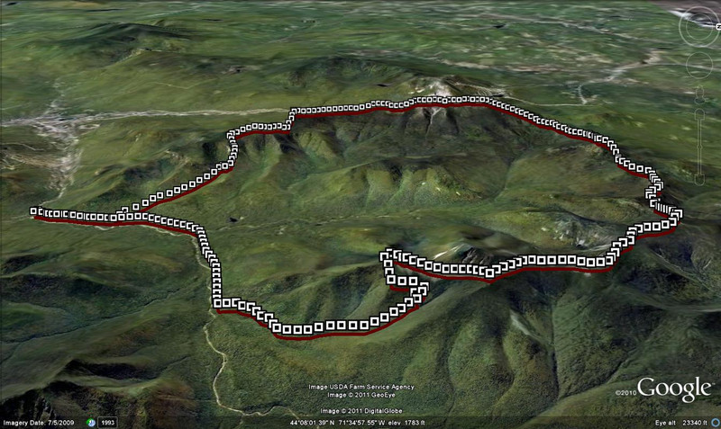
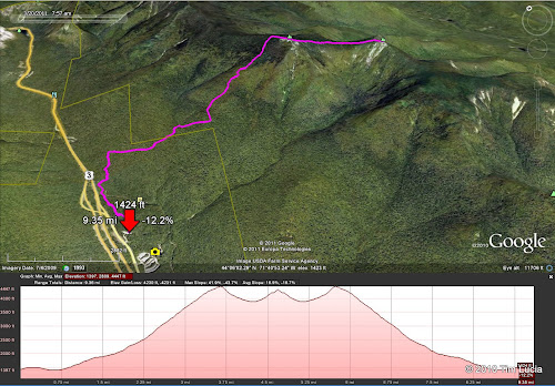
Bomber view
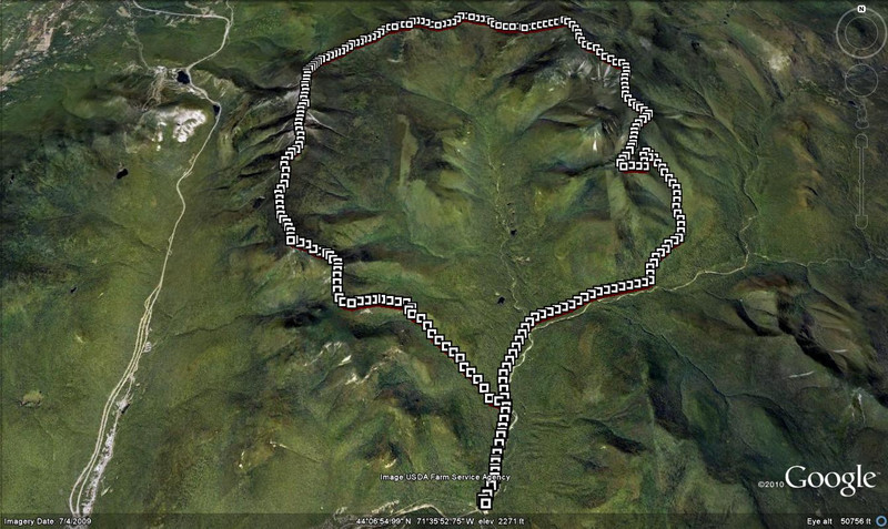
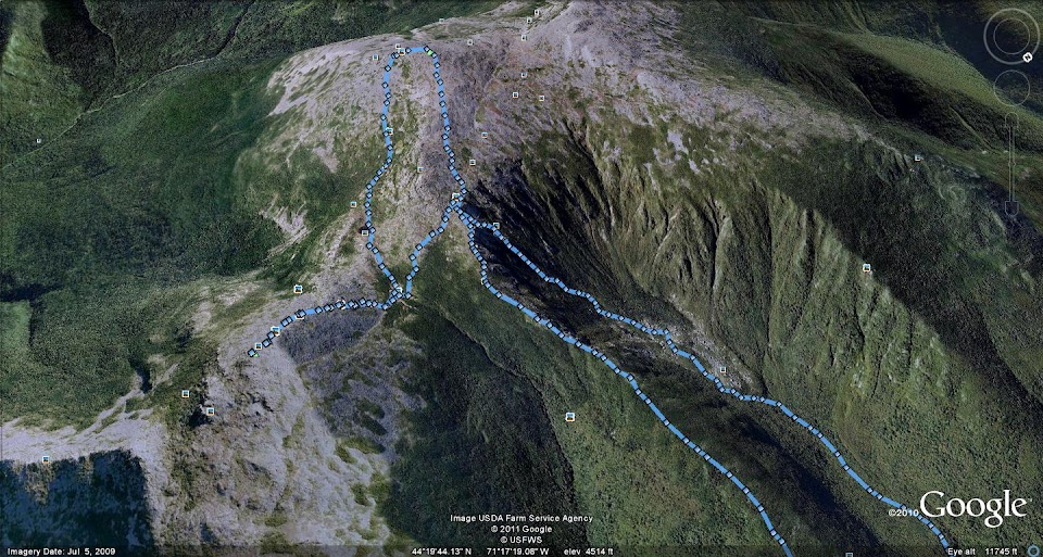
Garfield Ridge closeup
Thanks to 1HappyHiker and MichaelJ for the ideas and tips.
GPS track from a hike, viewed on Google Earth. Old and boring to a lot of folks, but it's new to me. Catnip for a map freak.
Looking west
Bomber view
Garfield Ridge closeup