Day 1 - Monday - Travel Day
On Labor Day Monday, I packed the car bright and early, including Gryffin (my puppy) and drove from my house in NH to my mother-in-law's in Wells, ME. There I left Gryffin with my wife and son, and headed north to Saco to meet Roberta, Whitney and Chris. We left three cars at the Park-and-Ride and just as it started raining, crammed clothing, gear, and enough food to feed a dozen thru-hikers into Roberta's truck. Roberta, the driver, was the only one without stuff piled on top of her. We drove north for 5 hours or so through various phases of a downpour to arrive at our home for the next 4 nights - Big Moose Cabins. Here we each grabbed a bunk, and Whitney and I set about making dinner for the first night - ribs, chicken, potato and garden salads. Making a charcoal fire in a camp grill was a challenge, but with creative wind/rain proofing from aluminum foil proved workable, and dinner was ready just as Mike and Stef pulled in. With not a lot else to do, we played some games and began denting the beer supply.
Day 2 - Tuesday - Easy/Rain Day
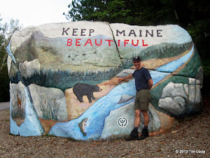
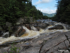
The famous landmark painted rock outside the park; Little Niagara Falls
The forecast for Tuesday was for a relatively warm day, but with a high chance of thunderstorms along with gusty winds and small hail. Since Wednesday and Thursday looked much better, and Mark wasn't due to arrive until Tuesday at dinner time, we opted to use our built-in buffer / weather day by doing a short park visit along the AT from Daicey Pond. Here we followed Nesowadnehunk Stream to Toll Dam, Little Niagara Falls and Big Niagara Falls. With all the rain from Monday, they were moving right along, producing significant white water and a decent roar. This is a well-documented "rainy day" / backup / half-day hike and worked out well.
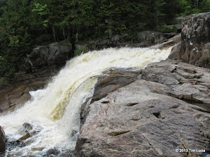
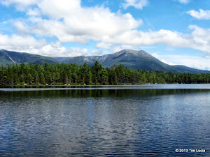
Big Niagara Falls; Katahdin from Daicey Pond (Library Dock)
Once back from the falls hike, we ate lunch at the trailhead and wandered up to Daicey Pond campground just to have a look. Contained herein is the library, which has many books, informational posters, and a pile of board games. We hung around the library, porch and dock, watching the fish jump in the pond as the clouds slowly cleared, revealing the first views we'd had of Katahdin. On the way out, we stopped at Togue Pond for our second swim of the day (took an early morning dip in Lake Millinocket behind the cabins). Mike and I swam out far enough to see Katahdin through a cove where the trees were shorter. Quite an impressive site. We tread water for 5 minutes or more and just looked it over. Mid afternoon found us back at the cabin where Mike and Chef Stef made spaetzle and goulash for dinner (outstanding!) Mark showed up a little after we'd finished and had some of the still-warm specialty. We discussed the forecast, again, at length and decided to wait for the early morning. At 4:30, we got up and made breakfast, checked the weather, and after a lot of discussion, Mike made the executive decision "I want to hike Katahdin!" With Wednesday being forecast windier than Thursday, but 15 degrees warmer, and given an extra day to dry out the Coe Slide for Thursday, we all agreed that this was the best course of action.
Day 3 - Wednesday - Katahdin
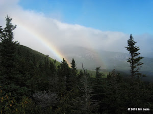
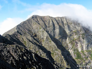
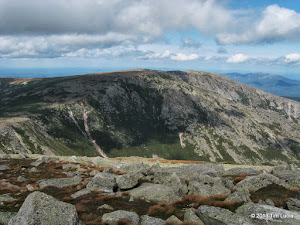
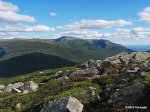
Double rainbow on Keep Ridge (Helon Taylor); South and Baxter Peaks from Pamola
Had the weather favored a Katahdin (Baxter) finish, we'd have gone counter-clockwise, but today we went with the flow and followed the traditional clockwise Knife Edge loop. We were at the gate at 5:55am, armed with one DUPR, which was completely unnecessary as there were 20 unclaimed spaces. We parked at Roaring Brook and were on the way up Keep Ridge via Helon Taylor by 6:40am. The skies had clouds, but also large patches of blue, and the forecast strongly suggested a morning undercast followed by afternoon clearing. This is exactly what we got. The overcast and 25 MPH wind (gusts to 46 per Mark's Kestrel anemometer) provided dramatic accents to the already spectacular scenery. At treeline, we were greeted by clouds spilling over the tablelands and these clouds formed a double rainbow, accented by bright red mountain ash berries all around the trail
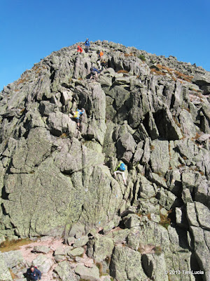
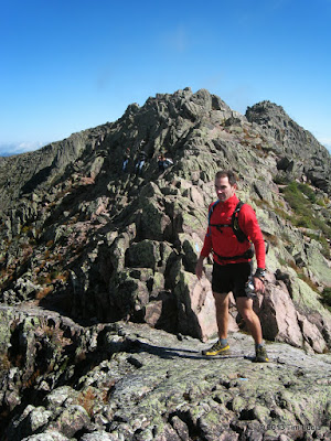
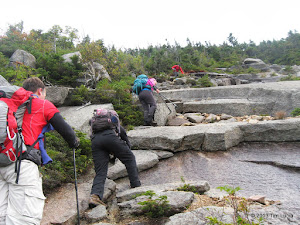
Stef down-climbing Pamola; Chris on the Knife Edge after Chimney Peak
Pamola Peak was the first summit of the day and was in the clear. Excitement was high as we could see the entire Knife Edge ahead of us. Only the tip-top of Baxter Peak was in the clouds. The contrast between the sunlit and shadows rocks hid many of the details until we got close. We down-climbed Pamola and then climbed Chimney Peak without incident. I had been told these were not as "bad" as the guides made them out to be, and found them to be challenging (on par or slightly more challenging than Huntington Ravine), but not scary. We made our way carefully along the Knife Edge, and while it was exposed, there are really only a few parts that are no-fall zones.
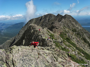
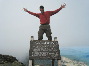
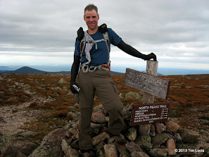
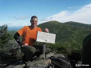
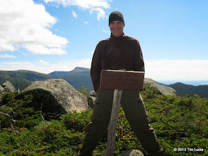
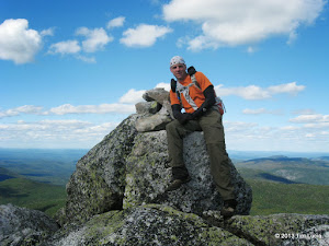
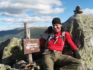
Chris almost at South Peak; Me on Katahdin
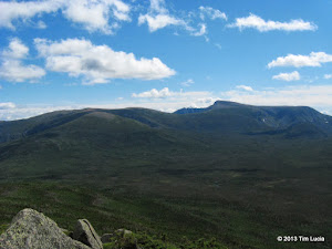
After Pamola and Chimney Peaks, the next named summit is South Peak. When we got there, it was just at the cloud level, with the views coming and going a few times per minute. We admired the Knife Edge route from above and marveled at what we'd just done. For all the times I've heard Katahdin and the Knife Edge exalted, it really is the gem of New England. The Great Basins are much bigger than the Great Gulf, and the walls are steeper and slabbier too. While waiting to regroup, we heard the joyous shouts of thru-hikers finishing their journey. Once all together, we completed the trek to the highest point in Maine, and got in line to take summit pictures. Baxter was #95 of 100 for me. It was the first time for Mike and Stef as well.
(continued)
On Labor Day Monday, I packed the car bright and early, including Gryffin (my puppy) and drove from my house in NH to my mother-in-law's in Wells, ME. There I left Gryffin with my wife and son, and headed north to Saco to meet Roberta, Whitney and Chris. We left three cars at the Park-and-Ride and just as it started raining, crammed clothing, gear, and enough food to feed a dozen thru-hikers into Roberta's truck. Roberta, the driver, was the only one without stuff piled on top of her. We drove north for 5 hours or so through various phases of a downpour to arrive at our home for the next 4 nights - Big Moose Cabins. Here we each grabbed a bunk, and Whitney and I set about making dinner for the first night - ribs, chicken, potato and garden salads. Making a charcoal fire in a camp grill was a challenge, but with creative wind/rain proofing from aluminum foil proved workable, and dinner was ready just as Mike and Stef pulled in. With not a lot else to do, we played some games and began denting the beer supply.
Day 2 - Tuesday - Easy/Rain Day


The famous landmark painted rock outside the park; Little Niagara Falls
The forecast for Tuesday was for a relatively warm day, but with a high chance of thunderstorms along with gusty winds and small hail. Since Wednesday and Thursday looked much better, and Mark wasn't due to arrive until Tuesday at dinner time, we opted to use our built-in buffer / weather day by doing a short park visit along the AT from Daicey Pond. Here we followed Nesowadnehunk Stream to Toll Dam, Little Niagara Falls and Big Niagara Falls. With all the rain from Monday, they were moving right along, producing significant white water and a decent roar. This is a well-documented "rainy day" / backup / half-day hike and worked out well.


Big Niagara Falls; Katahdin from Daicey Pond (Library Dock)
Once back from the falls hike, we ate lunch at the trailhead and wandered up to Daicey Pond campground just to have a look. Contained herein is the library, which has many books, informational posters, and a pile of board games. We hung around the library, porch and dock, watching the fish jump in the pond as the clouds slowly cleared, revealing the first views we'd had of Katahdin. On the way out, we stopped at Togue Pond for our second swim of the day (took an early morning dip in Lake Millinocket behind the cabins). Mike and I swam out far enough to see Katahdin through a cove where the trees were shorter. Quite an impressive site. We tread water for 5 minutes or more and just looked it over. Mid afternoon found us back at the cabin where Mike and Chef Stef made spaetzle and goulash for dinner (outstanding!) Mark showed up a little after we'd finished and had some of the still-warm specialty. We discussed the forecast, again, at length and decided to wait for the early morning. At 4:30, we got up and made breakfast, checked the weather, and after a lot of discussion, Mike made the executive decision "I want to hike Katahdin!" With Wednesday being forecast windier than Thursday, but 15 degrees warmer, and given an extra day to dry out the Coe Slide for Thursday, we all agreed that this was the best course of action.
Day 3 - Wednesday - Katahdin


Double rainbow on Keep Ridge (Helon Taylor); South and Baxter Peaks from Pamola
Had the weather favored a Katahdin (Baxter) finish, we'd have gone counter-clockwise, but today we went with the flow and followed the traditional clockwise Knife Edge loop. We were at the gate at 5:55am, armed with one DUPR, which was completely unnecessary as there were 20 unclaimed spaces. We parked at Roaring Brook and were on the way up Keep Ridge via Helon Taylor by 6:40am. The skies had clouds, but also large patches of blue, and the forecast strongly suggested a morning undercast followed by afternoon clearing. This is exactly what we got. The overcast and 25 MPH wind (gusts to 46 per Mark's Kestrel anemometer) provided dramatic accents to the already spectacular scenery. At treeline, we were greeted by clouds spilling over the tablelands and these clouds formed a double rainbow, accented by bright red mountain ash berries all around the trail


Stef down-climbing Pamola; Chris on the Knife Edge after Chimney Peak
Pamola Peak was the first summit of the day and was in the clear. Excitement was high as we could see the entire Knife Edge ahead of us. Only the tip-top of Baxter Peak was in the clouds. The contrast between the sunlit and shadows rocks hid many of the details until we got close. We down-climbed Pamola and then climbed Chimney Peak without incident. I had been told these were not as "bad" as the guides made them out to be, and found them to be challenging (on par or slightly more challenging than Huntington Ravine), but not scary. We made our way carefully along the Knife Edge, and while it was exposed, there are really only a few parts that are no-fall zones.


Chris almost at South Peak; Me on Katahdin
After Pamola and Chimney Peaks, the next named summit is South Peak. When we got there, it was just at the cloud level, with the views coming and going a few times per minute. We admired the Knife Edge route from above and marveled at what we'd just done. For all the times I've heard Katahdin and the Knife Edge exalted, it really is the gem of New England. The Great Basins are much bigger than the Great Gulf, and the walls are steeper and slabbier too. While waiting to regroup, we heard the joyous shouts of thru-hikers finishing their journey. Once all together, we completed the trek to the highest point in Maine, and got in line to take summit pictures. Baxter was #95 of 100 for me. It was the first time for Mike and Stef as well.
(continued)
Last edited:

