Cabins, East Shore Northwest Bay Lake George

vftt.org

Help Support vftt.org:

This site may earn a commission from merchant affiliate links, including eBay, Amazon, and others.
Joined
Sep 8, 2003
Messages
971
Reaction score
19
Location
Northwood
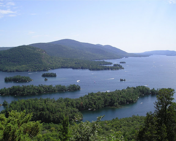
I paddled around Tongue Mountain Range this Sunday and was surprised to see two private properties on the East Shore of Northwest Bay...How long have they been there? The docks look new.

I was surprised because I have hiked the loop several times and never saw any trace of the properties.
 
At least a few years, according to Warren County records, but the oldest record I saw online was 2007. These are seaonal camps - they've probably been there a long time.

The trail swings a little ways away from these camps; it doesn't take a lot of woods to hide something.
 
Doug

Just to confirm....the east shore of the Northwest BAY, not the east shore of the mountain range.....

Edit: Ok....nm!
 
Last edited:
Doug

Just to confirm....the east shore of the Northwest BAY, not the east shore of the mountain range.....

Edit: Ok....nm!
Yes. I was talking about the east side of the BAY.

On the east shore of the mtn range the same map shows two clusters of buildings:
* ~5 buildings ~.4 mi from Montcalm Point
* ~10 buildings ~1.2 mi from Montcalm Point

FWIW, I have hiked part of the Northwest Bay Tr and the Tongue Mtn Range Tr. (different hikes--the two segments do not connect.)

Doug
 
There is a trail that traverses the entire length of the Tongue Mt range. You can pick it up on route 9L on the very northern end of TMR and it goes over Brown, FiveMile, Fifth, French Point and First Peak. The trail then drops steeply down to Montcalm Point, swings back along the western side of TMR along the eastern shore of Northwest Bay, hitting Clay Meadows and returning to the highway just north of the end of NW Bay.
Unless you're describing another trail, SP, they do connect.
I know the layout of the trails there.

I was describing the hikes that I have done, not the connectivity of the trails. I have done the northern part of the TMR Tr and part of the NWB Tr from 9N. Never been to the Point. FWIW, I have also been out to Deer Leap.

Doug
 
and the Tongue Mtn Range Tr.

When there I am always compelled to scream "STAY ALIVE, NO MATTER WHAT OCCURS, I WILL FIND YOU !" :)

P1010052.JPG


Remix said:
How long have they been there? The docks look new.

FWIW; the property rights and cabins must have been there a long time. Winter ice flow and flooding probably destroy the docks every few years. And I have been there when the entire lake was flooded several feet above normal. A bit unsettling thinking about the amount of water that would involve.
 
There is also a trail north of 5th peak that runs down to the main channel of the lake. Stayed there once and heard quite a few deer jumping into the water...
The stream near the bottom is fed by a beaver populated pond up top at the trail junctions to the leanto, to brown mountain, to montcalm point, and from clay meadows.

Oh, and FWIW, after October 12 paddle and camp on the islands without a permit. This information is from another paddler...I have not verified it.

I wonder if these camp owners got their rights by squatting...like those on the Hudson River.
 
"I was describing the hikes that I have done, not the connectivity of the trails."

I didn't want people confused by your post as the trails connect and are continuous up and over the range, down to Montcalm Point and then along NW Bay until reaching the Clay Meadow trail and out.
 
Top