Mudrat
Member
Disclaimer: or "Avoiding Death by Slide Climbing".
Duration: 10 hours
Mileage: about 10 miles
Temps: 15-25F
Partner: NP
Satellite Link
PHOTOS
Click here for full size mosaic.
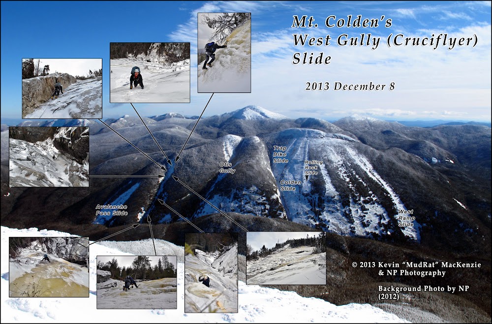
I’ll let the pictures do much of the talking for this report. In summary...
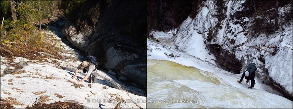
Our goal for the day was something on the west side of Colden, it didn’t really matter what as long as it was ‘in’. After finding another group ahead and two others behind at the Trap Dike, we opted for the solitude of the West Gully Slide aka The Cruciflyer. It promised over 1200 feet of elevation gain and some 2250 ground feet of climbing. Views of Wright and Algonquin were stunning from the aspect of the West Gully especially in combination with the double fall line of the slide.
The trail was a combination of ice, a thin coating of packed snow and exposed rock. Avalanche Lake was frozen solid. We arrived at the base of the gully at around 11:00 a.m. after starting from the Loj just after 8:00. Sean, the caretaker for the Lake Colden outpost, paid us a visit while we were gearing up…very nice person! By 11:30, we were climbing. I was thrilled to be moving to get some feeling back in my hands! Changing into crampons and readying the gear in winter is always a challenge.
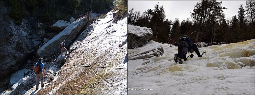
The nuances of the slide in the summer can be found here. In any season, it’s an intriguing climb. The dual slope (both north and west) of the gully makes certain areas rather challenging…side-sloping on ice in winter conditions. During much of it, a slip would find you crashing into the overhanging rock some 20-50 feet below. Not that that would be pretty, but other areas have much higher exposure. Conditions were perfect, though, with thick ice as a rule.
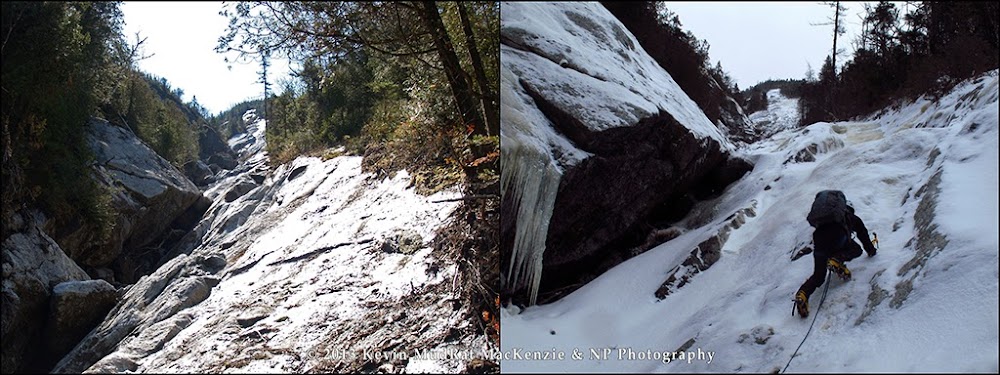
The slide is deceptively long on account of the left-hand overhangs. They effectively obscure a full length view. You tend to feel you’re nearing the top at about the halfway point at one of the protruding overhangs. When you climb around it, you get the full perspective and realize there is another 500-600 feet of elevation gain left.
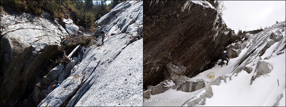
The top pitch required the most care; it was the steepest with the most exposure. This is the part of the slide that reaches toward the ridgeline as seen from the turnoff to the Loj from Route 73. Our line (about 350 feet long) started from the last massive overhang and followed a corner up for about 30 feet. Thereafter, it was climbing on bulges of pure ice broken by some consolidated snow. The top two pitches (150 feet combined) were the steepest as expected.
A 60 meter rope was tied to my harness; I’d been dragging it then entire time. It’s amazing the friction (and pressure) it creates when it is partially on snow. The solution…find a plateau, pull it up to your position and climb on. Though we didn’t use it for the climb itself, it was certainly helpful to rappel down several pitches. We either bushwhacked along the side or down-climbed along the edge on other areas. In all, we spent about 4 hours climbing and descending.
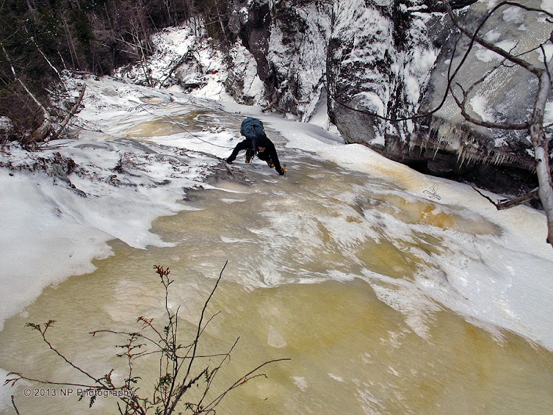
Kevin a few hundred feet up from the bottom.
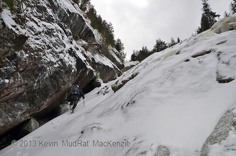
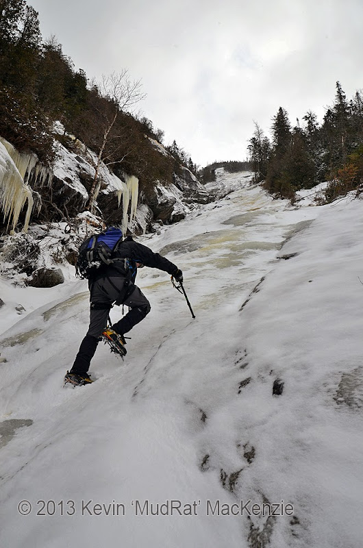
NP walking up a break in the ice. No view of the top from here.
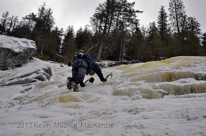
NP climbing around one of the larger stones (on the left) that was dislodged during Irene.
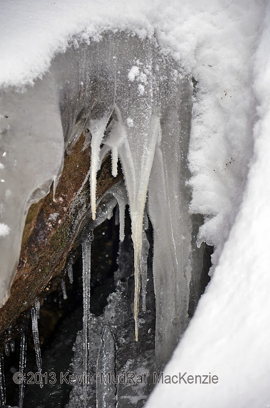
Nature's artistry.
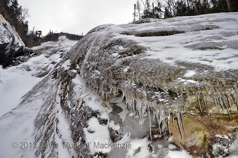
Looking toward the upper slide.
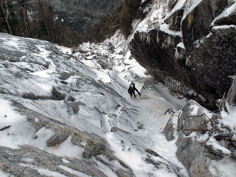
Below the top.
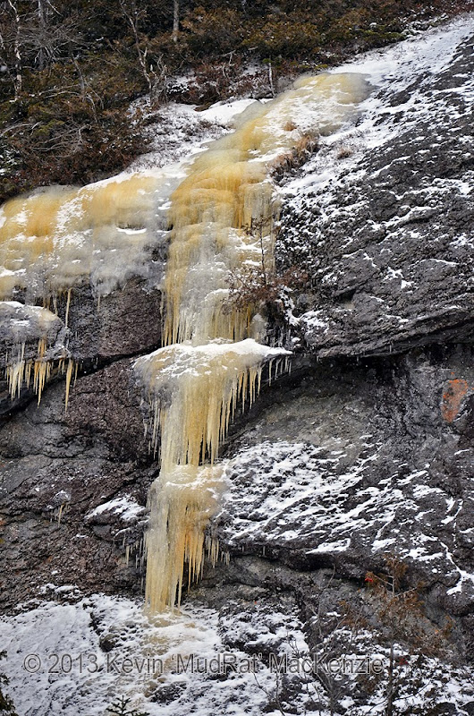
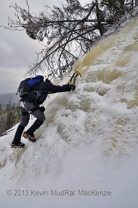
NP near the top.
Duration: 10 hours
Mileage: about 10 miles
Temps: 15-25F
Partner: NP
Satellite Link
PHOTOS
Click here for full size mosaic.

I’ll let the pictures do much of the talking for this report. In summary...
Our goal for the day was something on the west side of Colden, it didn’t really matter what as long as it was ‘in’. After finding another group ahead and two others behind at the Trap Dike, we opted for the solitude of the West Gully Slide aka The Cruciflyer. It promised over 1200 feet of elevation gain and some 2250 ground feet of climbing. Views of Wright and Algonquin were stunning from the aspect of the West Gully especially in combination with the double fall line of the slide.
The trail was a combination of ice, a thin coating of packed snow and exposed rock. Avalanche Lake was frozen solid. We arrived at the base of the gully at around 11:00 a.m. after starting from the Loj just after 8:00. Sean, the caretaker for the Lake Colden outpost, paid us a visit while we were gearing up…very nice person! By 11:30, we were climbing. I was thrilled to be moving to get some feeling back in my hands! Changing into crampons and readying the gear in winter is always a challenge.
The nuances of the slide in the summer can be found here. In any season, it’s an intriguing climb. The dual slope (both north and west) of the gully makes certain areas rather challenging…side-sloping on ice in winter conditions. During much of it, a slip would find you crashing into the overhanging rock some 20-50 feet below. Not that that would be pretty, but other areas have much higher exposure. Conditions were perfect, though, with thick ice as a rule.
The slide is deceptively long on account of the left-hand overhangs. They effectively obscure a full length view. You tend to feel you’re nearing the top at about the halfway point at one of the protruding overhangs. When you climb around it, you get the full perspective and realize there is another 500-600 feet of elevation gain left.
The top pitch required the most care; it was the steepest with the most exposure. This is the part of the slide that reaches toward the ridgeline as seen from the turnoff to the Loj from Route 73. Our line (about 350 feet long) started from the last massive overhang and followed a corner up for about 30 feet. Thereafter, it was climbing on bulges of pure ice broken by some consolidated snow. The top two pitches (150 feet combined) were the steepest as expected.
A 60 meter rope was tied to my harness; I’d been dragging it then entire time. It’s amazing the friction (and pressure) it creates when it is partially on snow. The solution…find a plateau, pull it up to your position and climb on. Though we didn’t use it for the climb itself, it was certainly helpful to rappel down several pitches. We either bushwhacked along the side or down-climbed along the edge on other areas. In all, we spent about 4 hours climbing and descending.

Kevin a few hundred feet up from the bottom.

NP walking up a break in the ice. No view of the top from here.

NP climbing around one of the larger stones (on the left) that was dislodged during Irene.


Nature's artistry.

Looking toward the upper slide.

Below the top.


NP near the top.

