1HappyHiker
Well-known member
The 26th of September 2009 was such a crystal clear day! My wife and I mulled over a number of possibilities to take advantage of these excellent viewing conditions. In the end, we opted to drive way up north above Pittsburg to do the short hike up to Mt. Magalloway. As an added incentive, neither of us had either been to this particular mountain. However, oddly enough, several years ago I had bushwhacked to West Magalloway on a cold December day (don’t ask, it’s a long story!!
 ).
).
As you might expect, the autumn colors are a bit farther along in the northern part of the North Country. And so, the drive itself resulted in a lot of eye-appealing scenery along the way.
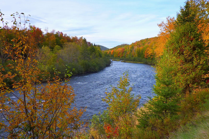
There were several views along the Connecticut River such as the one below.
And along the Connecticut Lakes, there were also some colorful vistas.
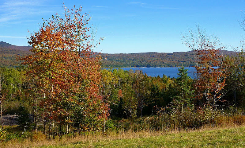
It was an enjoyable and leisurely drive. We made frequent stops to take snapshots, and also stopped at a roadside stand to enjoy an ice-cream cone while overlooking Lake Francis.
So, after a few hours of meandering our way up Route 3, we eventually came to the turn off for Mt. Magalloway. After leaving Route 3, it’s an 8.4 mile drive to the trailhead on a gravel road which can be very dusty (as it was on the day we were there!).
By the time we arrived at the trailhead, it was already about 3PM. And so we knew we had to give up the leisurely pace of earlier in the day if we wanted to have ample time to enjoy the hike and the views from the summit, PLUS still have sufficient time for the drive home before dusk (moose country, you know!! ).
).
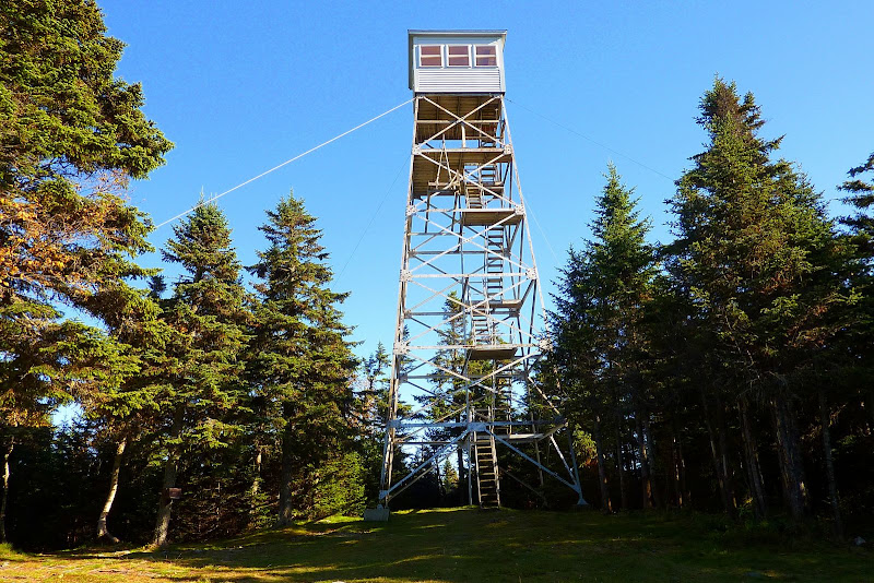
In less than book time, we made the 0.8 mile trek up the former jeep road which is now called the Coot Trail. Upon arrival at the top, we were greeted immediately by the very handsome fire tower which stands proudly in a grassy clearing at the summit (photo below).
There are many excellent views available from the fire tower, and from viewpoints along a 0.2 mile spur path along the mountain’s east cliff. Below is just a small sampling of the photos taken. And I’ll be the first to admit that these snapshots don’t do justice to the vistas. In my opinion, it’s a case of where there’s no substitute for being there in person. An actual “boots on the ground” experience is what’s needed!
My skills at identifying peaks are mediocre (at best) even when in more familiar territory. So, please take this into consideration when scrutinizing my “best guess” descriptions of the following photos!
Eastward View: (I think peaks such as Saddleback and Mt. Abraham are in there somewhere!)
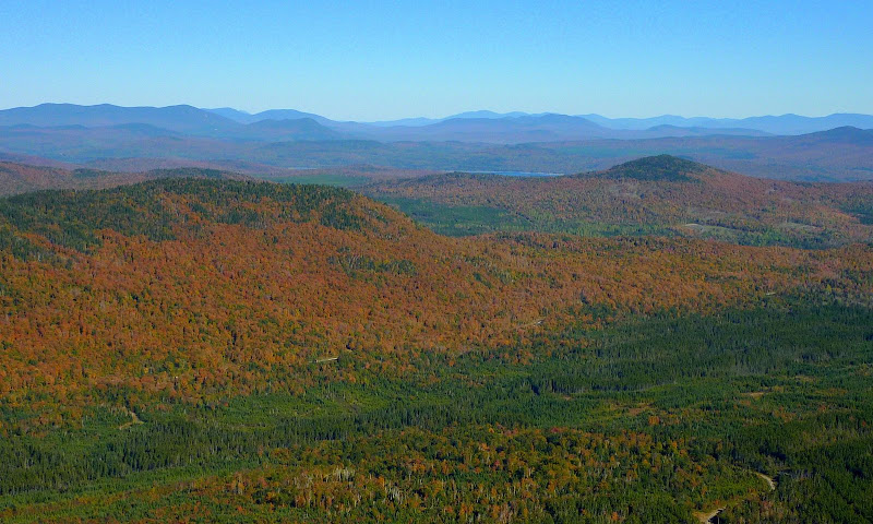
Northward View: (I think Mt. Megantic in Canada is the most distant ridgeline on the horizon over the 2nd Connecticut Lake; and the mountain on the far right with the sharp drop-off is possibly Rump Mtn in Maine.)
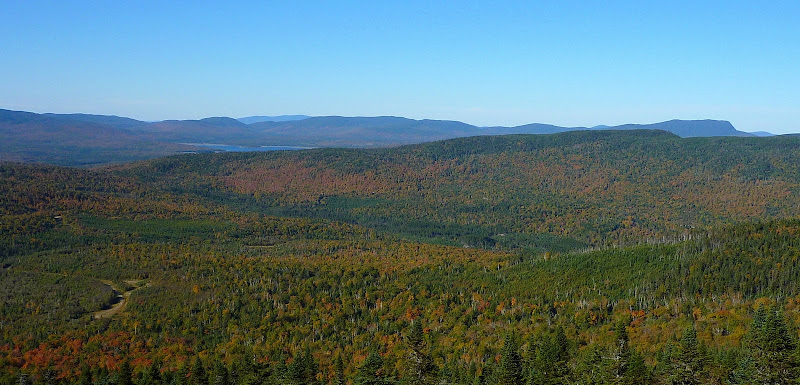
Southward View: (OK, I should have taken this photo from a higher landing on the fire tower to be farther above the trees. But anyway, the large mountains on the horizon contain peaks that are probably in the Presidential Range, and/or in the other major White Mtn ranges, such as the Carter-Moriahs, Mahoosucs, Pilot Range, etc. Sorry folks, that’s as far as I can take it! )
)
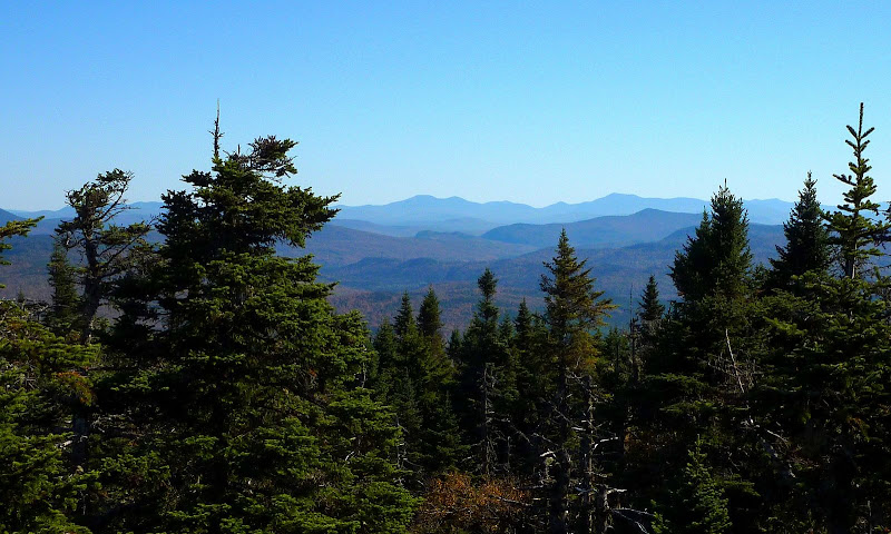
After a somewhat rushed visit to the many viewpoints on the summit, we decided to make a loop by descending Mt. Magalloway via a different route, i.e. the Bobcat Trail. This is a very pleasant trail, and is more like a “traditional” trail through the forest. Whereas, the Coot Trail (although a very nice trail) is a former jeep road.
Overall, it was an excellent day. We arrived home with barely an ounce of sunshine remaining.
We think we got our money’s worth out of this day!
1HappyHiker
As you might expect, the autumn colors are a bit farther along in the northern part of the North Country. And so, the drive itself resulted in a lot of eye-appealing scenery along the way.
There were several views along the Connecticut River such as the one below.

And along the Connecticut Lakes, there were also some colorful vistas.

It was an enjoyable and leisurely drive. We made frequent stops to take snapshots, and also stopped at a roadside stand to enjoy an ice-cream cone while overlooking Lake Francis.
So, after a few hours of meandering our way up Route 3, we eventually came to the turn off for Mt. Magalloway. After leaving Route 3, it’s an 8.4 mile drive to the trailhead on a gravel road which can be very dusty (as it was on the day we were there!).
By the time we arrived at the trailhead, it was already about 3PM. And so we knew we had to give up the leisurely pace of earlier in the day if we wanted to have ample time to enjoy the hike and the views from the summit, PLUS still have sufficient time for the drive home before dusk (moose country, you know!!
In less than book time, we made the 0.8 mile trek up the former jeep road which is now called the Coot Trail. Upon arrival at the top, we were greeted immediately by the very handsome fire tower which stands proudly in a grassy clearing at the summit (photo below).

There are many excellent views available from the fire tower, and from viewpoints along a 0.2 mile spur path along the mountain’s east cliff. Below is just a small sampling of the photos taken. And I’ll be the first to admit that these snapshots don’t do justice to the vistas. In my opinion, it’s a case of where there’s no substitute for being there in person. An actual “boots on the ground” experience is what’s needed!
My skills at identifying peaks are mediocre (at best) even when in more familiar territory. So, please take this into consideration when scrutinizing my “best guess” descriptions of the following photos!
Eastward View: (I think peaks such as Saddleback and Mt. Abraham are in there somewhere!)

Northward View: (I think Mt. Megantic in Canada is the most distant ridgeline on the horizon over the 2nd Connecticut Lake; and the mountain on the far right with the sharp drop-off is possibly Rump Mtn in Maine.)

Southward View: (OK, I should have taken this photo from a higher landing on the fire tower to be farther above the trees. But anyway, the large mountains on the horizon contain peaks that are probably in the Presidential Range, and/or in the other major White Mtn ranges, such as the Carter-Moriahs, Mahoosucs, Pilot Range, etc. Sorry folks, that’s as far as I can take it!

After a somewhat rushed visit to the many viewpoints on the summit, we decided to make a loop by descending Mt. Magalloway via a different route, i.e. the Bobcat Trail. This is a very pleasant trail, and is more like a “traditional” trail through the forest. Whereas, the Coot Trail (although a very nice trail) is a former jeep road.
Overall, it was an excellent day. We arrived home with barely an ounce of sunshine remaining.
We think we got our money’s worth out of this day!
1HappyHiker
Last edited:

