1HappyHiker
Well-known member
Bordering the Great Gulf Wilderness is the Hayes Copp Cross Country Ski Trail which is maintainted by the U.S. Forest Service. There are two plowed parking lots that can be used to access the trail. On access point is from the Great Gulf Wilderness parking area. But the most direct access is from the Dolly Copp Campground which is where I began my ski adventure.
I've thought about doing this trek, but up until today, that was as far as it went. However, upon hearing rave reviews about this trail from my friends Joanne & Kevin, I was prompted to put my thoughts into action. This adventure was perfectly suited for the few hours that I had available on this particular Tuesday.
Perhaps this is already well-known by most folks, but nonetheless I found it interesting that a large portion of this ski trail is located on the land which was once owned and farmed by Hayes Copp and his wife Dolly back in the mid 1800s. The Forest Service has some placards at a spot along the trail which give some details about the Copp family (see TWO photos below).
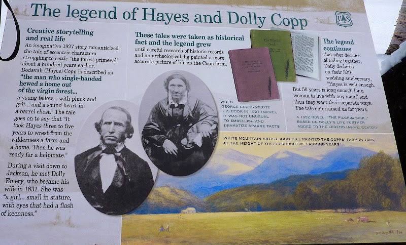
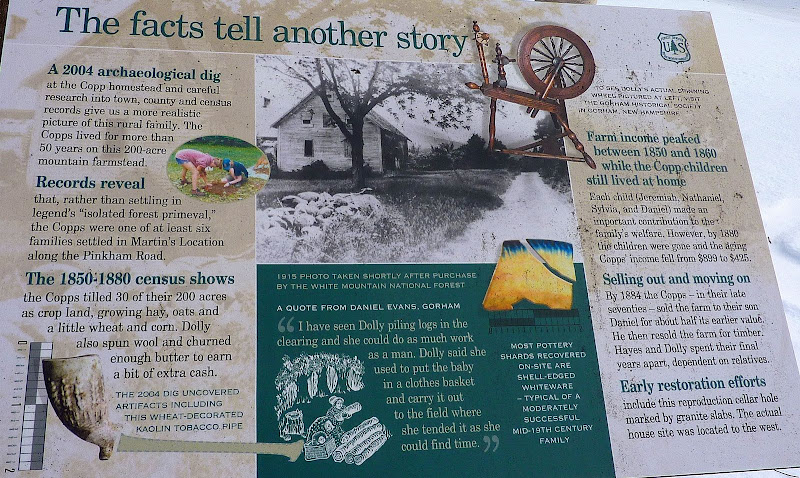
Well, enough about history! Although surface conditions were a bit icy for my personal preference, I cross-country skied it nonetheless, and I enjoyed it.
And now having done it, it's easy to understand why my friends had such nice things to say about this trek.
There are long stretches of trail that takes you along the banks of the Peabody River. Below is a snapshot showing the river that has been frozen by Old Man Winter.
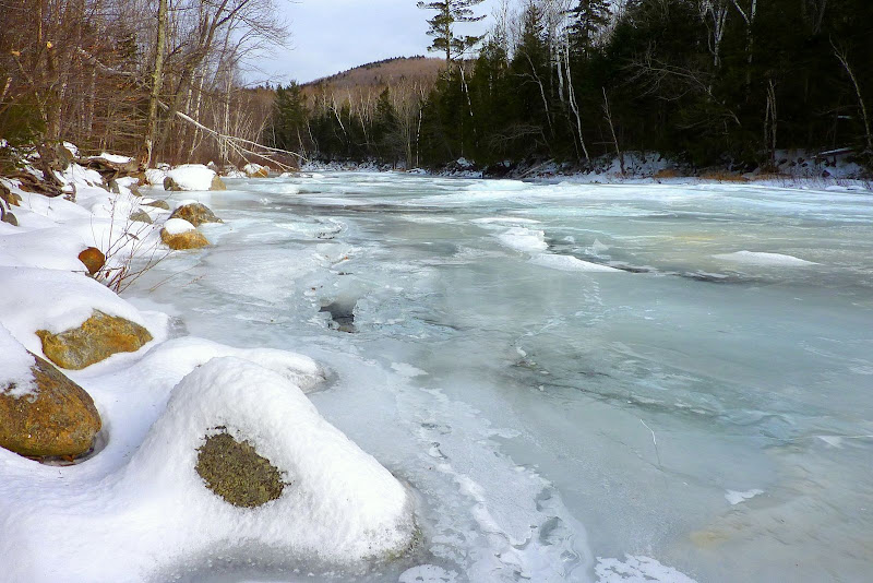
There are also many pleasant "peek-a-boo" vistas through the leafless trees, such as shown in the snapshot below of the Carter Notch peeking through the birches.
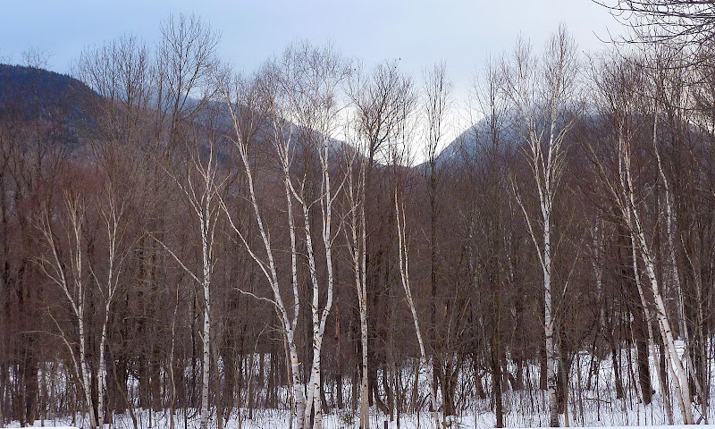
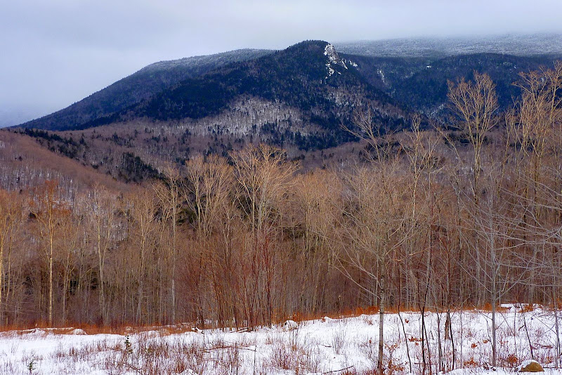
Also, there are several spots where there are views of the Imp Face cliff, such as shown in the snapshot below.
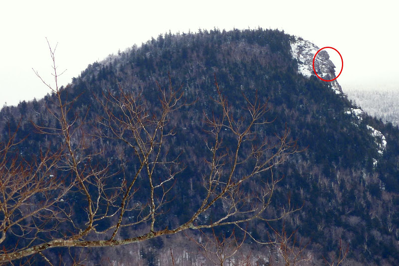
And, by zooming in on the cliff, you can actually see the small profile of the "face" of the "Imp".
So, there you have it! I had only a few hours to spend, and I thoroughly enjoyed every minute. No doubt, I'll be making a return trip once we get some "real" snow to refresh the surface conditions on the ski trail.
1HappyHiker
I've thought about doing this trek, but up until today, that was as far as it went. However, upon hearing rave reviews about this trail from my friends Joanne & Kevin, I was prompted to put my thoughts into action. This adventure was perfectly suited for the few hours that I had available on this particular Tuesday.
Perhaps this is already well-known by most folks, but nonetheless I found it interesting that a large portion of this ski trail is located on the land which was once owned and farmed by Hayes Copp and his wife Dolly back in the mid 1800s. The Forest Service has some placards at a spot along the trail which give some details about the Copp family (see TWO photos below).


Well, enough about history! Although surface conditions were a bit icy for my personal preference, I cross-country skied it nonetheless, and I enjoyed it.
And now having done it, it's easy to understand why my friends had such nice things to say about this trek.
There are long stretches of trail that takes you along the banks of the Peabody River. Below is a snapshot showing the river that has been frozen by Old Man Winter.

There are also many pleasant "peek-a-boo" vistas through the leafless trees, such as shown in the snapshot below of the Carter Notch peeking through the birches.

Also, there are several spots where there are views of the Imp Face cliff, such as shown in the snapshot below.

And, by zooming in on the cliff, you can actually see the small profile of the "face" of the "Imp".

So, there you have it! I had only a few hours to spend, and I thoroughly enjoyed every minute. No doubt, I'll be making a return trip once we get some "real" snow to refresh the surface conditions on the ski trail.
1HappyHiker
Last edited:
