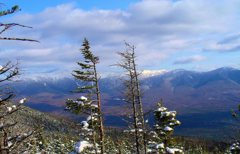
Currier Mtn in Jefferson

vftt.org

Help Support vftt.org:

This site may earn a commission from merchant affiliate links, including eBay, Amazon, and others.

peakbagger

In Rembrance , July 2024
VFTT Supporter
Joined
Sep 3, 2003
Messages
8,639
Reaction score
690
Location
Gorham NH
Out of curiosity has anyone climbed Currier Mountain in Jefferson NH? It is in the Dartmouth Range just west of Jefferson Notch road. On Google Earth there are open ledges facing east and potentially good views towards Jefferson and Adams. From a distance it has a similiar "look" to Haystack in Twin Mountain. Looking quickly through old AMC guides, there used to be two trails to it, one from the west and one from the east but these days the whole area looks like its a trial ground for various USFS cutting techniques. I expect with a GPS and a mountain bike, access via the logging roads in the area would get someone close by and maybe there may be a trace of the old Mill Brook Trail to the summit

This area has always interested me. Its a big block of forest that used to have fairly extensive hiking trails and a couple of interesting summits which has slowly reverted to raw forest land.

Probably an adventure to save up after the woods have thawed out and dried up.
 
Out of curiosity has anyone climbed Currier Mountain in Jefferson NH? . . . Probably an adventure to save up after the woods have thawed out and dried up.
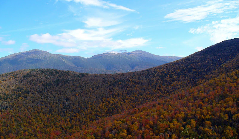
Peakbagger, I’ve been to Currier Mountain several times, and yes it would be a much better adventure once the woods have thawed and dried out a bit!:)

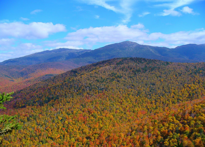
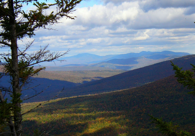
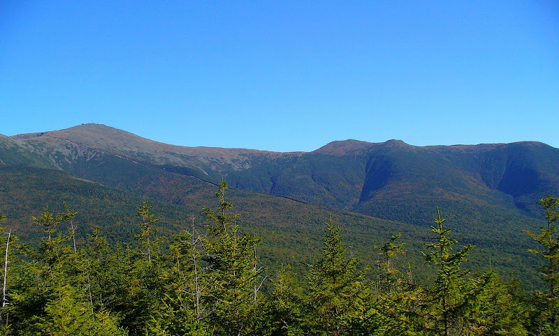
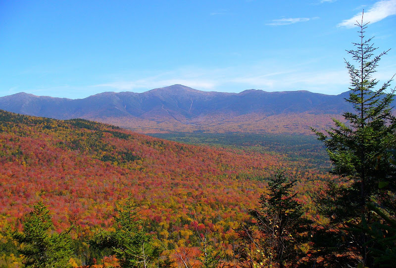
It’s a great little mountain with particularly interesting views toward Jefferson, Clay and Washington. Also, there is a view ENE toward the Mahoosucs. There is a sort of an overgrown herd path (or an old trail) that goes up to the summit in a southeasterly direction from the R11 Snowmobile Trail. I’ve also done a pure bushwhack without using the herd path. The woods are open and it is easy whacking!

Below are a few photos I’ve taken from this mountain.

Jefferson-Clay-Washington.JPG


Adams-Jefferson-Clay.JPG


Rt%202%20E_NE%20Toward%20Mahoosucs%202.JPG
 
Last edited:
John, those are some stunning autumn photos!!! I know where I'm going this fall!

Peakbagger, I've wondered myself about this area and was scoping out the "white spots" this winter to locate possible viewpoints. Sorry about the poor photo, but it gives a bit of an idea of just how many possibilities are available on the west side of the Caps Ridge parking area. Looks like there are many views to be found!

smallIMG_8791.jpg
 
Dartmouth Trail

Last summer we stayed at a cottage on Old Cherry Mt Road. I'd been exploring old USGS maps and was curious about old trail called Dartmouth Trail that runs in E-W direction from a point just south of height of land off Old Cherry Mt Rd. I located it and followed it for 1/3 mile. It is in pretty good shape. You very quickly it enters a clearing with lots of blueberries and a fire ring .... logging landing or campsite for hunters? The trail continues into the forest. It's a road really. fairly open. must provide access for loggers to logging areas. There's a bit of a parking spot near trail head. Could be muddy in wet weather.

Old USGS maps indicate now abandoned Mt Deception Trail used to descend from Mt Desception down to Currier Mt.
 
I have an old 1935 map that shows a trail going from the Israel Ranger station to Currier,which had a fire tower on it .The map also shows a Mill Brook trail off Cherry mt rd which intersects the old Dartmouth tr.Also an old trail called the Cold brook trail opposite the ranger station on the Notch rd that goes below Mt Bowman.On a traverse of the Dartmouth range we came upon the old Deception trail,which was quite usable,except where blowdown areas covered it up.
 
. . . I've wondered myself about this area . . . Sorry about the poor photo, but it gives a bit of an idea of just how many possibilities are available on the west side of the Caps Ridge parking area. Looks like there are many views to be found!
Chris, regarding the photo you posted, perhaps you & some other folks might be interested in the snapshots below that were taken from various points in the general area of your photo.

View from area near summit of Millen Hill
MillenHillVu.JPG

View from Mt. Little Deception
LittleDeceptionVu.JPG

View from area near summit of Mt. Deception (West Peak)
DeceptionWestVu.JPG
 
Last edited:
It used to say in the Dartmouth register that the alidade was still on Currier, but it vanished before I got there. My 2nd trip was with a fire tower fancier who was actually able to trace the route of the old phone line halfway to the guard station after which the trees that held it perhaps vanished in a more recent timber sale.

The Little Mt Deception Trail was being maintained by a bootleg ski group the last I knew.
http://docs.unh.edu/NH/mtws38sw.jpg
 
Last edited:
Great shots John! They bring back some very, very old memories! In the mid 70's, Donald Lennox took us on a bushwhack up the old logging roads behind our cabin (we lived on Valley Road) to Mt Dartmouth. You could only follow the old roads till they petered out but he knew it from there. There were still some discernible stone walls back there at one time as they bordered land with another farmowner. We even found an old rusty cow bell that we kept and we hung on our entrance door when we got home! We did not have as extensive a view like your shots at the time, but one thing I do remember was the Presis were in the clouds but you could see the Cog track. He then bushwhacked down to Jefferson Notch Road. We walked down it passing the spot where he said the old USFS station was and back down to Valley Road, we went left and headed home.

There are some great cellar holes on the way back home too! For reference sake, when travelling east on Valley Road right before the farmhouse near the old Carter Rd, there is a big section of pines on the left (popular party spot when in high school, "going to the Pines") and directly opposite the pines there used to be a big barn that burnt down during the arsonist years. If you hug the woods and follow the border you will find the ruins of an old one room schoolhouse.

Another one is almost right after you pass the old Highland Station there's a big clump of trees on the left before the Paschal's and opposite the old potato fields (spent a lot of time there). That used to be his house and we once found old coins there.

It is an interesting area and he spoke a lot of how the northern side of the Dartmouth Range had a good chunk cleared off for, of all things, farms.
 
Last summer we stayed at a cottage on Old Cherry Mt Road. I'd been exploring old USGS maps and was curious about old trail called Dartmouth Trail that runs in E-W direction from a point just south of height of land off Old Cherry Mt Rd. I located it and followed it for 1/3 mile. It is in pretty good shape. You very quickly it enters a clearing with lots of blueberries and a fire ring .... logging landing or campsite for hunters? The trail continues into the forest. It's a road really. fairly open. must provide access for loggers to logging areas. There's a bit of a parking spot near trail head. Could be muddy in wet weather.

Old USGS maps indicate now abandoned Mt Deception Trail used to descend from Mt Desception down to Currier Mt.

Jazzbo, found this in a 1936 Guidebook about the Dartmouth Trail, it reads:

"This trail starts from Cherry Mt Road, about .25m S of the height-of-land, 4.75m S of Jefferson RR station and 3.5m N of the site of the White Mountain House. It skirts the N side of the Dartmouth Range, through fine woods. At 2.1m the Mill Brook Trail enters from L and in 4.75m it crosses the Deception Trail. It ends at Jefferson Notch Road, about .5m S of the Israel River Ranger Station, 2 5/8m from the lower main highway in Jefferson and 10m from Crawford's."
 
Sounds like a future VFFT trip

I figured that such an intriguing spot had been visited by VFTT folks. I have paid my dues by bushwhacking the ridge from Cap Ridge parking to Dartmouth via Millen several years ago and wouldnt care to repeat it (due to the major blowdown patches) but would be up for a Deception to Currier trip when the woods dry out. Probably a nice one to do on a holiday weekend when all the other trails are crowded.
 
Hike up to Deception Ridge from Old Cherry Mt Road then down to Currier and return via old Dartmouth Road. Think we can do it in under 15 hours? :D

I've been looking this over in my 1936 AMC Guide and finding that such a route (back in the day of course) is charted at around 11.35 m and a time of about 8 +/- hours.
 
Top