
1HappyHiker
Well-known member
This tale will be of limited interest to some, and of no interest to most.
So, with that in mind, just read until your eyes begin to glaze over!")
On this particular day, I had the very modest objective of doing a low-intensity off-trail amble through some open woods, nothing more and nothing less. Knowing that Haystack Rd will soon be closed for the season, I decided to whack up the Little River Valley with no particular destination in mind. I got a 'crack of noon' start which is not unusual for me, and stayed on the North Twin Trail until I was about a tenth of a mile beyond the trail's 3rd crossing of the river. At this point I began heading southward.
It was great whacking with lots of open woods on a very nice autumn day. However, a "fly in the ointment" came about when I encountered the "not so little" brook that comes down the mountain from high up on the slopes of North Twin. I knew the brook was there, but had not anticipated that I'd have an issue with it.
Because of the severe downward angle of the brook bed, I was uneasy about attempting to cross on slippery rocks with a swift current. So, I thought (foolishly), I'll just try going upstream a bit to see if it flattens out somewhere. What was I thinking! By going upstream, I was also going uphill, and the angle only became more severe. I would've had a much better chance of finding a flat spot by going downhill. Duh!
Anyway, I did eventually find a spot upstream where a huge tree had fallen across the brook which I was able to use as a "crutch" to get across. By this time, I had invested some time and had gained a bit of altitude. Then, something popped into my head (which in retrospect, I wish it had popped right back out). I remembered that I had entered a waypoint into my GPS for a ledge that was somewhere in this general vicinity. I fired up my GPS and lo & behold, I was only 0.2 mile from the ledge. And even better yet, there were nothing but open woods as far as I could see in the direction I wanted to go. Off I went, and in about 10 minutes my GPS showed the ledge to be about 375 feet ahead.
Yeah! Well, what the GPS didn't say is that the 375 feet consisted of nearly impenetrable conifers intermingled with numerous blowdowns. But, I reasoned (again foolishly), how bad can it be to do battle for 375 feet. After about a half an hour of battle, and only knocking off about half of the 375 feet, I was faced with a dilemma. Do I turn around and fight my way back to the open woods, or do I continue with the quixotic hope that things will improve?
Well, Don Quixote lives! I opted to continue my quest! I eventually got to the ledge, and guess what? It turned out to be a complete bust! The views were so obstructed by trees that nothing noteworthy would show up photographically. OK, so now what do I do? I wanted to simply head due east and get back down to the Little River Valley. But, it was too steep for my comfort level to attempt this.
Hmmm! I detested the thought of retracing the tortuous course that I'd just taken. So, if in doubt, check the map! By looking at the contour lines, I could see that the descent would be slightly gentler if I angled off the ledge to the northeast. This northeast route did indeed provide me with a safe exit from the ledge, and it headed me in the general direction that I wanted to go. And as a "bonus", this route also gifted me with a slightly less intense battle with thick conifers and blowdowns.
Once I was back in the open woods, then in no time at all, I arrived at the west bank of the Little River. However, it was now getting late in the day. A lot of precious time had been squandered by looking for a safe crossing of the "not so little" unnamed brook. And of course, I foolishly chose to engage myself in a lengthy battle to reach a viewless ledge! So, I decided to call it a day and started heading northward along the west side of the Little River. It wasn't too long before I encountered the unnamed brook which had given me problems earlier in the day.
However, this time I followed it downstream to the point where it dumped into the Little River. The terrain was flatter here, and I probably could have found a way to cross the brook. However, I noticed something else at this point. The "not so little" unnamed brook truly dumps a lot of water into the Little River. The flow of the Little River is greatly diminished upstream of that "dumping point". And as a result, crossing the Little River here is a "piece of cake". So, I opted to return to the North Twin Trail by crossing to the east side of the Little River and whacking my way northward. This worked out fine. I was back on the North Twin Trail within a half an hour or so.
Overall, I cannot say that I had a bad day since I had no grandiose destination in mind from the outset. I was merely out for an off-trail amble through the woods on a beautiful autumn day. So, that's what I went for, and that's what I got. Never mind the unexpected battle to get to some godforsaken ledge with no view. That was a "bump in the road" of my own-making!
1HappyHiker
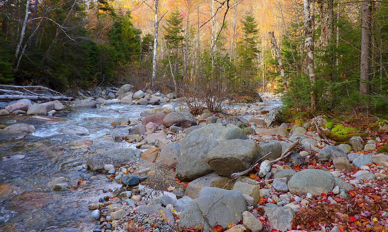
P.S. No photos of any consequence were taken on this trek. However, I suppose it would do no harm to include a photo taken somewhere along the Little River. If nothing else, it might help with visualizing the general setting for this trek.
So, with that in mind, just read until your eyes begin to glaze over!
On this particular day, I had the very modest objective of doing a low-intensity off-trail amble through some open woods, nothing more and nothing less. Knowing that Haystack Rd will soon be closed for the season, I decided to whack up the Little River Valley with no particular destination in mind. I got a 'crack of noon' start which is not unusual for me, and stayed on the North Twin Trail until I was about a tenth of a mile beyond the trail's 3rd crossing of the river. At this point I began heading southward.
It was great whacking with lots of open woods on a very nice autumn day. However, a "fly in the ointment" came about when I encountered the "not so little" brook that comes down the mountain from high up on the slopes of North Twin. I knew the brook was there, but had not anticipated that I'd have an issue with it.
Because of the severe downward angle of the brook bed, I was uneasy about attempting to cross on slippery rocks with a swift current. So, I thought (foolishly), I'll just try going upstream a bit to see if it flattens out somewhere. What was I thinking! By going upstream, I was also going uphill, and the angle only became more severe. I would've had a much better chance of finding a flat spot by going downhill. Duh!
Anyway, I did eventually find a spot upstream where a huge tree had fallen across the brook which I was able to use as a "crutch" to get across. By this time, I had invested some time and had gained a bit of altitude. Then, something popped into my head (which in retrospect, I wish it had popped right back out). I remembered that I had entered a waypoint into my GPS for a ledge that was somewhere in this general vicinity. I fired up my GPS and lo & behold, I was only 0.2 mile from the ledge. And even better yet, there were nothing but open woods as far as I could see in the direction I wanted to go. Off I went, and in about 10 minutes my GPS showed the ledge to be about 375 feet ahead.
Yeah! Well, what the GPS didn't say is that the 375 feet consisted of nearly impenetrable conifers intermingled with numerous blowdowns. But, I reasoned (again foolishly), how bad can it be to do battle for 375 feet. After about a half an hour of battle, and only knocking off about half of the 375 feet, I was faced with a dilemma. Do I turn around and fight my way back to the open woods, or do I continue with the quixotic hope that things will improve?
Well, Don Quixote lives! I opted to continue my quest! I eventually got to the ledge, and guess what? It turned out to be a complete bust! The views were so obstructed by trees that nothing noteworthy would show up photographically. OK, so now what do I do? I wanted to simply head due east and get back down to the Little River Valley. But, it was too steep for my comfort level to attempt this.
Hmmm! I detested the thought of retracing the tortuous course that I'd just taken. So, if in doubt, check the map!
By looking at the contour lines, I could see that the descent would be slightly gentler if I angled off the ledge to the northeast. This northeast route did indeed provide me with a safe exit from the ledge, and it headed me in the general direction that I wanted to go. And as a "bonus", this route also gifted me with a slightly less intense battle with thick conifers and blowdowns. Once I was back in the open woods, then in no time at all, I arrived at the west bank of the Little River. However, it was now getting late in the day. A lot of precious time had been squandered by looking for a safe crossing of the "not so little" unnamed brook. And of course, I foolishly chose to engage myself in a lengthy battle to reach a viewless ledge! So, I decided to call it a day and started heading northward along the west side of the Little River. It wasn't too long before I encountered the unnamed brook which had given me problems earlier in the day.
However, this time I followed it downstream to the point where it dumped into the Little River. The terrain was flatter here, and I probably could have found a way to cross the brook. However, I noticed something else at this point. The "not so little" unnamed brook truly dumps a lot of water into the Little River. The flow of the Little River is greatly diminished upstream of that "dumping point". And as a result, crossing the Little River here is a "piece of cake". So, I opted to return to the North Twin Trail by crossing to the east side of the Little River and whacking my way northward. This worked out fine. I was back on the North Twin Trail within a half an hour or so.
Overall, I cannot say that I had a bad day since I had no grandiose destination in mind from the outset. I was merely out for an off-trail amble through the woods on a beautiful autumn day. So, that's what I went for, and that's what I got. Never mind the unexpected battle to get to some godforsaken ledge with no view. That was a "bump in the road" of my own-making!
1HappyHiker
P.S. No photos of any consequence were taken on this trek. However, I suppose it would do no harm to include a photo taken somewhere along the Little River. If nothing else, it might help with visualizing the general setting for this trek.
Last edited: