1HappyHiker
Well-known member
Neither Zman nor I had ever done North Moat. So we decided to give it a try by doing the 10+ mile loop hike involving the Moat Mountain Trail and the Red Ridge Trail. The descriptions for both the Moat Mountain Trail and the Red Ridge Trail use the word “steep” a lot, and so we were mentally prepared for a “mountain goat” type of adventure. However, overall it was more or less just a typical hiking experience in the Whites. For certain, there were steep sections, but nothing extraordinary.
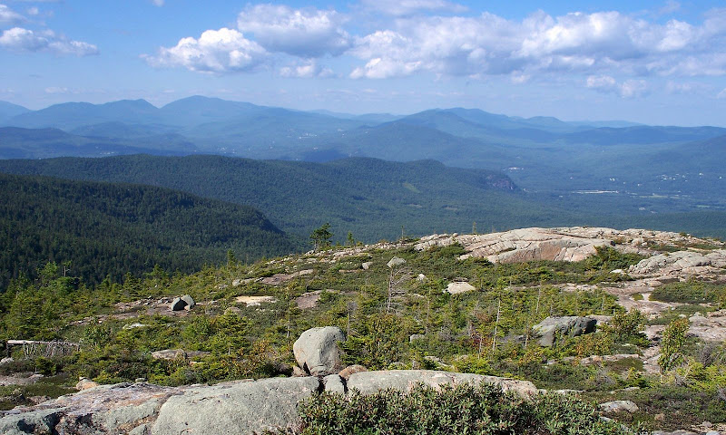
We did the loop by ascending via the Moat Mountain Trail, and descending via the Red Ridge Trail. Of the two trails, we enjoyed the Red Ridge Trail more. The upper end of the trail has a very long stretch of barren ridgeline that is very open and therefore it provides expansive views to keep you entertained on your descent. However, on the flip-side, once this open stretch of trail ends, the Red Ridge Trail seems to go on forever and ever, as you trudge your way to rejoin the Moat Mountain Trail and complete the loop.
Regarding the views from North Moat, the 360 degree views are simply stunning. And that is probably an understatement. In Laura and Guy Waterman’s “Forest and Crag” book, it’s stated that, as late as 1918, the Sweetser guidebook devoted over six pages to describing the views from North and South Moat. I have neither the talent nor the inclination to present a 6 page description of the views from North Moat. However, I will present just a small sample of photos taken during this trek.
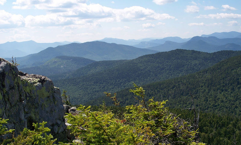
1) Below is a westward view with peaks such as Mt. Tremont and Bear Mountain in the foreground, and in the background is an expansive view that includes high peaks located in the huge swatch of real estate which extends from the northern Sandwich Range to the southern portion of the Pemigewasset Wilderness.
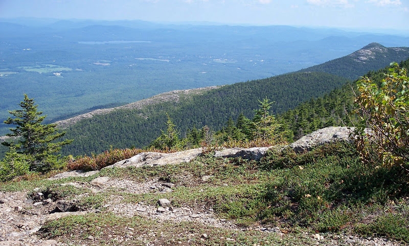
2) The photo below shows Middle Moat with the barren Red Ridge extending to the left of it.
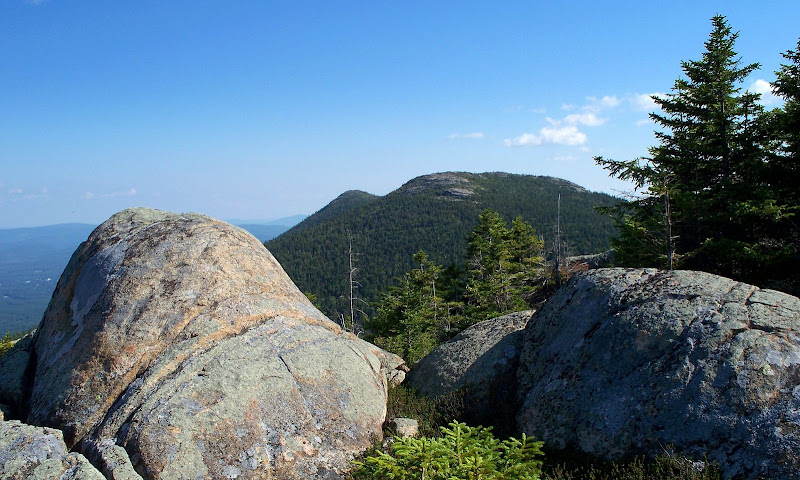
3) The next photo shows Middle and South Moat as seen from a point along the Red Ridge.
4) The following snapshot was taken from the Red Ridge, with the Carter Notch showing prominently on the upper left side of the photo.
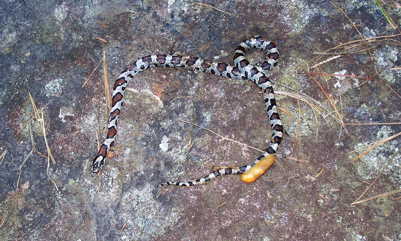
5) OK, the next photo is a view of a dead Milk Snake! It was spotted on the Red Ridge Trail at I think about 1,500± ft elevation. I have no idea what the brownish object is that is attached to the area near the tail end. Whatever it was, it also appeared to be lifeless, just like the snake. Does anyone have any thoughts/comments about what’s going on here? (Why do I have this sneaky suspicion that I’m going to feel really silly for posing this question?)
Oh! I also want to mention that on this trek we had the pleasure of meeting the VFTT dynamic duo known as “The Hikers”. You guys really live up to your screen-name!! It was impressive to hear about your recent hiking adventures, as well as those that you have planned.
1HappyHiker
We did the loop by ascending via the Moat Mountain Trail, and descending via the Red Ridge Trail. Of the two trails, we enjoyed the Red Ridge Trail more. The upper end of the trail has a very long stretch of barren ridgeline that is very open and therefore it provides expansive views to keep you entertained on your descent. However, on the flip-side, once this open stretch of trail ends, the Red Ridge Trail seems to go on forever and ever, as you trudge your way to rejoin the Moat Mountain Trail and complete the loop.
Regarding the views from North Moat, the 360 degree views are simply stunning. And that is probably an understatement. In Laura and Guy Waterman’s “Forest and Crag” book, it’s stated that, as late as 1918, the Sweetser guidebook devoted over six pages to describing the views from North and South Moat. I have neither the talent nor the inclination to present a 6 page description of the views from North Moat. However, I will present just a small sample of photos taken during this trek.
1) Below is a westward view with peaks such as Mt. Tremont and Bear Mountain in the foreground, and in the background is an expansive view that includes high peaks located in the huge swatch of real estate which extends from the northern Sandwich Range to the southern portion of the Pemigewasset Wilderness.

2) The photo below shows Middle Moat with the barren Red Ridge extending to the left of it.

3) The next photo shows Middle and South Moat as seen from a point along the Red Ridge.

4) The following snapshot was taken from the Red Ridge, with the Carter Notch showing prominently on the upper left side of the photo.

5) OK, the next photo is a view of a dead Milk Snake!

Oh! I also want to mention that on this trek we had the pleasure of meeting the VFTT dynamic duo known as “The Hikers”. You guys really live up to your screen-name!! It was impressive to hear about your recent hiking adventures, as well as those that you have planned.
1HappyHiker
Last edited:

