1HappyHiker
Well-known member
This barely deserves a Trip Report, but I decided to post one anyway. I’ve often wondered about the view from that little ledge on Cleveland Mountain (it’s the little 2,405 foot mountain residing a few miles due north of Cannon Mountain). The small ledge on the south-face of this mountain is visible from certain segments of I-93 and also from points along Route 3.
Since I’ve wondered about the view from there, I thought there might be a few others who have also wondered about it. So, as a public service , I went up there today and snapped a few photos. The view from Cleveland Mountain is very similar to that from its “twin-sister” Mt. Agassiz which is just a stone’s throw away. (As some of you know, you can walk to the top of Agassiz via a private road which is open to foot-traffic through the generosity of the land-owner.)
Concerning the route up to the ledges on Cleveland Mountain, you can do about 99% of the hike entirely on WMNF land. However, the actual ledge area itself is on un-posted private land. I began my hike from Trudeau Road and used snowmobile trails for maybe two-thirds of the hike, and bushwhacked the final third through generally open woods. The entire round-trip only took about 3 hours.
I do have a question which perhaps someone on this forum can answer. On some maps, a trail to Cleveland Mtn. is shown coming off the east side of Mt. Cleveland Road (which is a road off Route 142). However, private land is on either side of Mt. Cleveland Road. So, my question is this. Does anyone know if the land-owner allows off-road parking and permits use of this trail? (I know the trail is still there since it is quite evident from the back of the ledge where I was today.)
I’m glad I did this short hike for several reasons. For one thing, it was a perfect “fit” for the time available to me today. And secondly, I was able to satisfy my curiosity about the view from this particular ledge. However, since the view is so similar to that from Mt. Agassiz, I can see no reason to repeat this hike in the future. If I want that particular view, I’ll walk the road up to Agassiz.
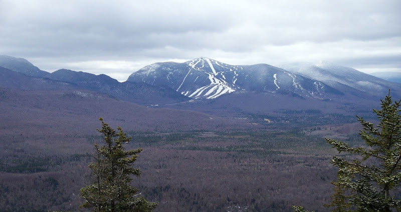
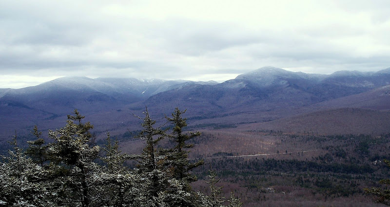
So, here are a couple of photos.
Looking South Toward Cannon

Looking East Toward Garfield & the Twins

1HappyHiker
Since I’ve wondered about the view from there, I thought there might be a few others who have also wondered about it. So, as a public service
Concerning the route up to the ledges on Cleveland Mountain, you can do about 99% of the hike entirely on WMNF land. However, the actual ledge area itself is on un-posted private land. I began my hike from Trudeau Road and used snowmobile trails for maybe two-thirds of the hike, and bushwhacked the final third through generally open woods. The entire round-trip only took about 3 hours.
I do have a question which perhaps someone on this forum can answer. On some maps, a trail to Cleveland Mtn. is shown coming off the east side of Mt. Cleveland Road (which is a road off Route 142). However, private land is on either side of Mt. Cleveland Road. So, my question is this. Does anyone know if the land-owner allows off-road parking and permits use of this trail?
I’m glad I did this short hike for several reasons. For one thing, it was a perfect “fit” for the time available to me today. And secondly, I was able to satisfy my curiosity about the view from this particular ledge. However, since the view is so similar to that from Mt. Agassiz, I can see no reason to repeat this hike in the future. If I want that particular view, I’ll walk the road up to Agassiz.
So, here are a couple of photos.
Looking South Toward Cannon

Looking East Toward Garfield & the Twins

1HappyHiker


