Garmin GPS 60CSx vs. the Etrex line

vftt.org

Help Support vftt.org:

This site may earn a commission from merchant affiliate links, including eBay, Amazon, and others.

adkayaker

New member
Joined
Nov 28, 2003
Messages
180
Reaction score
11
I'm looking for a $200 and under low to mid-range GPS for mainly emergency backtracking when bushwacking flat to elevated terrain in the Adirondacks, for nature photography. I am really not sure I need mapping capability and if so, would want to avoid spending excess extra funds on mapping software. I am looking to replace my now broken basic Etrex. If I get the 60CSX, not sure I would even buy the better maps. Looking at the Venture, Vista, Summit models as well. My primary requirement is not losing signal in dense woods so based on reviews, probably eliminating the Delorme brand.

Which moel might I consider . . .60CSX, Summit, venture, Legend, Vista . . . so many models hard to distinguish. Again, I don't plan on spending more than $200.
 
The only ones I'd consider are the Garmin Vista HCx or the Garmin 60CSx. Usually the Vista is less, but not at the moment - perhaps because Garmin is upgrading the 60 series. Amazon has the 60CSx for $200, the HCx as $235.

The 60CSx is a good value at $200.
 
That's a GREAT price for the 60CSx, and given its independent maps and expandability, you don't have to pay up front for it, and can always throw in a larger memory card and buy maps later in the future if you change your mind. It's like wearing layers for a hike! :)
 
If you get too-low a range GPS you are likely to be disappointed. I agree with Kevin's suggestions.

Let me add: get one with the memory card for map storage. Maps make the GPS much easier to use and you can get free maps from http://www.gpsfiledepot.com/. (The quality of the free maps varies, but they are much better than nothing.) Also, the Garmin 100K US topo maps (available for ~$80) are not locked so they can be used on any Garmin GPS which takes loadable maps.

The 60CSx is well tested and very good at dealing with less than perfect skyviews. (A great value at $200.) I have no experience with the Vista HCx, but it probably works well under degraded conditions too.

You might also be able to save some money with the 60Cx (same as the 60CSx minus the magnetic compass and barometric altitude sensor). I personally don't use the magnetic compass (my mechanical compass is better) but I do use the barometric altitude sensor (makes altitude readings more accurate).

You will find either of the above units to be a great improvement over your old basic eTrex.

Doug
 
Last edited:
I second the endorsements of the 60CSx. In two years, including many bushwhacks, some in ravines and other difficult locations, I've never lost reception (as far as I can tell from the track).

The built-in map won't do much for you, however, as it includes only major roads and highways and state lines. You can sometimes get the Garmin 100K Topo CD-ROMs on sale, relatively cheap.

The NatGeo Topo program offers far better maps. You can't download them onto the GPS, but you can use it for plotting and downloading waypoints before a hike (if that appeals to you) and downloading your track after a hike.
 
The size of the 60CSX is probably a downside when trying to manage pack volume?
 
The size of the 60CSX is probably a downside when trying to manage pack volume?
Yes the 60CSx is a bit bigger. But the larger display that comes with it is an advantage.

The older eTrexes had a problem with the glue that holds the edge rubber band (and push buttons) would become gummy and the band would slide out of position. There were also reliability problems with the click-stick. I don't know if these problems have been fixed.

Doug
 
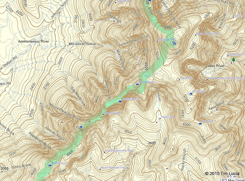
I received the 76CSx for Christmas. I wanted the floating / marine features, and I like the controls on top better. So far I have put the free New England topo on it from the reference above that Doug gave. One things I've noticed so far is that the trails don't appear to be on the map, even at the highest detail.

freemap.jpg


The Crawford Path has a blue square next to the name, and the AT is shown in green (as a national park), but the actual trail is not shown. Note that maybe it is a as yet undiscovered option, but it doesn't show on the GPS or on MapSource.

I realize there are other threads on this topic already - and I plan to read them more thoroughly before shelling out another $100-$129 for the 24,000 scale DVD-based maps (you can get them on the micro SD chips too, for a lot less, or so it seems from Googling...)

Tim
 
I received the 76CSx for Christmas. I wanted the floating / marine features, and I like the controls on top better.
Some people can get religious about buttons on the top vs buttons on the bottom. IMO, the bottom line is: people seem to be able to use either perfectly well and it is purely personal preference. I wouldn't choose between a 60 series or 76 series based solely upon the location of the buttons.

So far I have put the free New England topo on it from the reference above that Doug gave. One things I've noticed so far is that the trails don't appear to be on the map, even at the highest detail.
<pic snipped>

The Crawford Path has a blue square next to the name, and the AT is shown in green (as a national park), but the actual trail is not shown. Note that maybe it is a as yet undiscovered option, but it doesn't show on the GPS or on MapSource.
I have both the free 100K topo and the Garmin US topo (100K). IMO, the Garmin topo is better.

You can get trails from the link in http://www.vftt.org/forums/showthread.php?t=38643

I realize there are other threads on this topic already - and I plan to read them more thoroughly before shelling out another $100-$129 for the 24,000 scale DVD-based maps (you can get them on the micro SD chips too, for a lot less, or so it seems from Googling...)
The Garmin 100K scale US topo is pretty good covers the entire US for $80 (Amazon price). While the 24K topos are better I think the Garmin prices are exorbitant. (I have the National Parks East (24K), unfortunately discontinued.)

I prefer to get my maps on DVD or CD-ROM. That allows you to use your maps both on your computer (using MapSource) as well as in the GPS. Maps purchased on the micro-SD cards cannot be loaded into MapSource. (I understand that someone made a program available which can convert the data from a micro-SD card into a format compatible with MapSource, but I haven't tracked it down.)

And if you get a micro-SD card, I'd back it up. (It is my understanding that the data is locked to the card and cannot be used from any other card.)

Doug
 
The trails, as tracks, are handy, but not terribly convenient to load. Why aren't they included like roads on the map itself? I would assume they are on the Garmin Maps as I have seen them on other folks' GPSes.

Tim
 
...Why aren't they included like roads on the map itself? Tim

Because they were free? A year or two ago I downloaded the CA maps from GPSDepot - great maps, except ... no labels. As far as I'm concerned, a map with labels is worthless.

And loading ALL the tracks in the alltrails.gpx file isn't a solution, either. I doubt there's enough storage.

You may find it necessary to buy either the 100K series which contains the entire US (but not Canada - that's a separate mapset) or the 24K series, which usually contains several states, but not all.

And, getting a 2GB microSD chip for $6-8 from Amazon is necessary if you buy either the 24K or 100K maps.
 
The trails, as tracks, are handy, but not terribly convenient to load. Why aren't they included like roads on the map itself?
The maps were generated by do-it-yourselfers. Learn how and maybe you can add the trail tracks yourself (and perhaps post the resulting map back to the website).

Which is cheaper? Doing-it-yourself or buying it from Garmin?

I would assume they are on the Garmin Maps as I have seen them on other folks' GPSes.
Yes they are, however they are the standard USGS Topo trails and not as accurate or up-to-date as the tracks. (They also show some old trails which bushwackers tend to find handy...)

Doug
 
The crawford path and other trails are shown on the OSM routable map. I can't seem to get the OSM trails to show up on my garmin vista at the same as the NE Topo map, but that may be device specific or related to zoom settings, detail, etc. But the trails are there if I turn off the topo and just use the road map.

To the OP, I think either the 60csx or the vista hcx would meet your needs. I prefer the vista because it is smaller, lighter, and has better battery life. But the 60 csx has advantages too. I like having an altimeter as part of the GPS, so for mountain travel, I would look at the models that offer that (like the 60 csx and the vista).

It is a little funky getting and installing the OSM maps, but you select squares you want from this world view and then it will prepare and export those map sections for you. I have much of the northeast and canada.

http://garmin.na1400.info/routable.php
 
It is a little funky getting and installing the OSM maps, but you select squares you want from this world view and then it will prepare and export those map sections for you. I have much of the northeast and canada.
Interesting ... the OSM map for Switzerland loads as easily as the Garmin-supplied maps. I used it (and repayed by contributing new tracks) last summer.
 
I started with a grayscale Vista in 2004 and in 2007 I got the GPS Map76CSX. Hands down a winner over Vista. I liked the Vista, don't get me wrong, but it could NOT draw a signal as tight as the Map76. It frequently lost signals in cover and I couldn't get a signal in my house. The Map 76 doesn't seem to have any of these issues (It has a Quad helix antenna, whatever that is.) :rolleyes:
But if I were doing it all over again, I would go with the GPSMap76 (or 60 series - same innards)
 
Last edited:
I too have the 76 CSx, which I understand is like the 60 CSx. I also got CA maps from gpsfiledepot and am happy with them. When I got my GPSr, it was used and had an extra card and map. I really like the idea of putting maps on the cards.

As already mentioned, the free maps are made by site members, not professional mapmakers, although some of them may be that skilled, but for free, I'm certainly not complaining about any shortcomings.
 
Is there some trick to

Load all tracks (396)
Select the 5-10 track(s) for the area I am interested in (I can do this with shift-click on the name or the trail)
Send the 5-10 selected tracks to the GPS

It appears to always want to send the whole thing (396) which exceeds the 32K limit on track points. This is probably a MapSource question, but I read the help quickly and found nothing.

Thanks,
Tim
 
GPSBabel has a "simplify track" option. You could run the GPX file through that with different parameters, one of which is a very convenient "max number of points in the track", then bring it into MapSource.
 
Is there some trick to

Load all tracks (396)
Select the 5-10 track(s) for the area I am interested in (I can do this with shift-click on the name or the trail)
Send the 5-10 selected tracks to the GPS

It appears to always want to send the whole thing (396) which exceeds the 32K limit on track points. This is probably a MapSource question, but I read the help quickly and found nothing.

Thanks,
Tim

You can have multiple instances of MapSource going, so my suggestion is to load the "All Trails" file in one instance, highlight those 5-10, then copy and paste them into a second instance of MapSource.

As for reducing map points - also see the thread Paradox has started on Wikiloc.
 
Is there some trick to

Load all tracks (396)
Select the 5-10 track(s) for the area I am interested in (I can do this with shift-click on the name or the trail)
Send the 5-10 selected tracks to the GPS
Its a GPX file. Pure human-readable TEXT.

Just hand edit the parts you want (either from the AllTrails file or by combining individual trail files), fix up a few of the tags, and you have a new custom gpx file with your desired trails.

KISS

Doug


For those who might be unfamiliar with the acronym: KISS=Keep It Simple Stupid
 
Last edited:
Top