Mudrat
Member
Mileage/Elevation Gain: Route from/to camp: 4.5/4,300’; Trailhead to trailhead with route included: 18/6,300’
Duration: 14.5 hours, 19.5 for Rich McKenna as a dayhike
Pack Weight & Gear: 40 pounds to camp, 20 climbing. Harness, belay device, helmet, rock climbing shoes, fleece layer, sleeping bag, bivy sack.
Partners: Rich McKenna (WalksWithBlackflies), Greg Kadlecik (krummholz), Mike McLean (ensonik)
Route:
• St. Huberts
• Camp at 3,100 before Sawteeth/Pyramid col
• Pyramid-Pyramid/Gothics col to central Slab on East Face (Rainbow)
• Partial “Over the Rainbow” route to Goodwin-Stanley route
• Summit
• Gothics/Pyramid col
• Bottom of South Face
• Ascend via Original Route (5.4)
• Summit
• Descend True North 200 vertical feet-bushwhack to bottom of North Face
• New Finger Slide
• Summit
• Pyramid
• Camp-St. Huberts.
Benchmarks:
• Rich begins: 4:00 a.m.
• Kevin, Mike, Greg begin 6:00 a.m.
• Gothics/Pyramid col: 7:15 a.m.
• Bottom of Over the Rainbow: 8:30 a.m.
• Gothics’ Summit: 10:45 a.m.
• Bottom of South Face: 12:00 p.m.
• Top of South Face: 2:40 p.m.
• Gothics’ Summit: 4:00 (ish) p.m.
• Bottom of North Face: 4:30
• Gothics’ Summit: 7:00 p.m.
• Camp: 8:45 p.m.
• Rich/Mike back at car: 11:30 p.m.
Photos: East Face - South Face - North Face
Mike McLean's Blog
East Face Video
South Face Video
----------------------
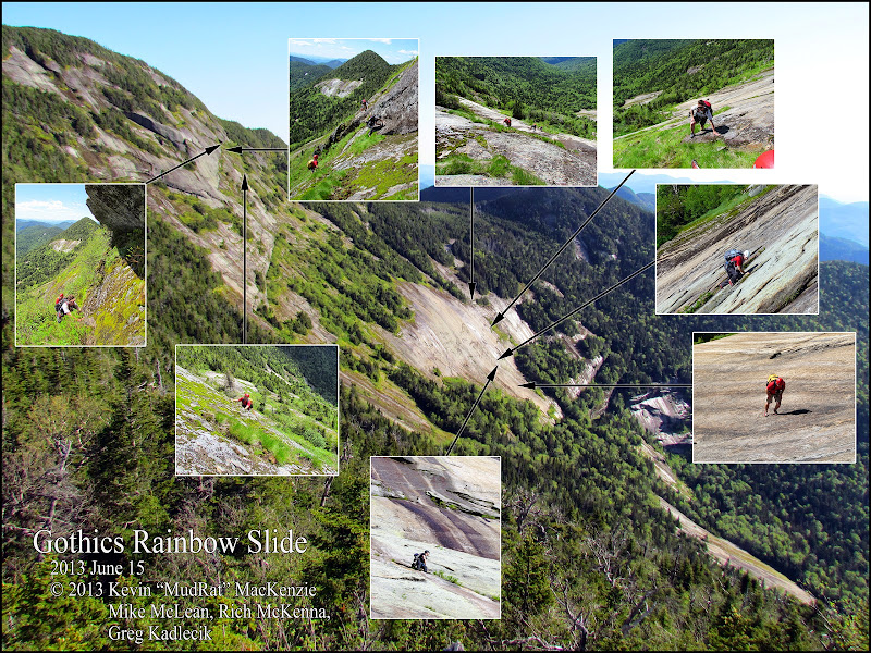
Sometimes there’s nothing that distracts me from the stressors of life compared to a big project looming on the horizon; the planning, preparation and, of course, the focus required during the outing. This was such a day. It is difficult to encapsulate this adventure in a trip report. There was much involved in the planning—schedules were arranged around complicated life-events and the weather cleared leaving us the perfect window between rainy days. The reality of the day fell both according to our design and in reaction to circumstances. Adapting to the moment is what makes Adirondack bushwhacking fun and keeps it adventuresome.
Given the conditions, technical nature and hours of harsh bushwhacking through krummholz, this turned out to be one of my most ambitious projects to date. The mental aspect and focus required to keep safe while working just short of our boundaries augmented it. This bridged a gap between slide climbing and technical rock climbing. The by-product was that it enhanced the sense of comraderie as we aided each other and reinforced the momentum to continue to the next face. In the end, we’d touch on both historic routes as well as relatively recent ones.
Connecting the Faces
We tried to arrange the climb to account for water availability (not a problem this time), the driest rock based on the exposure and time of day. Prior knowledge of each area worked in our favour.
East Face (Ascent to summit 900’)
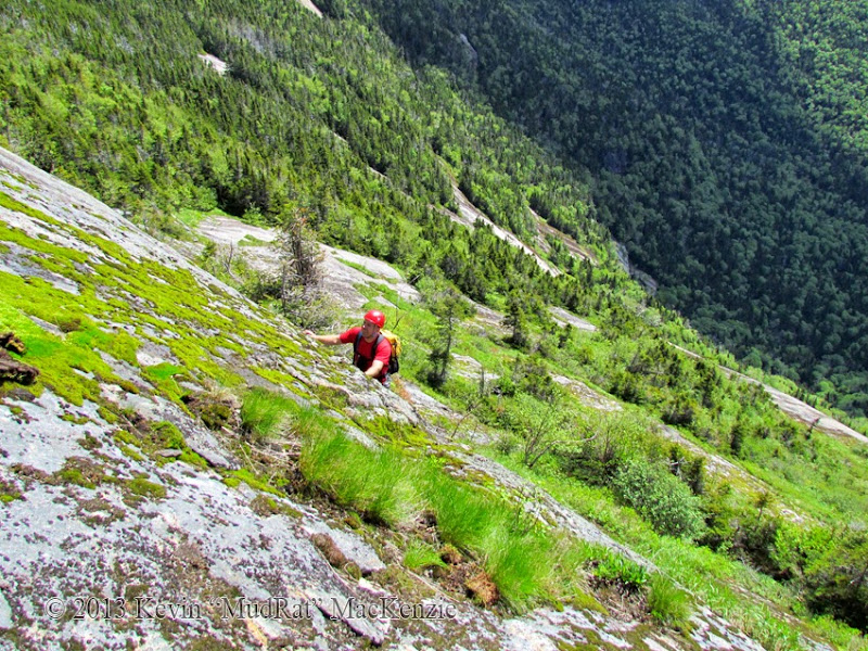
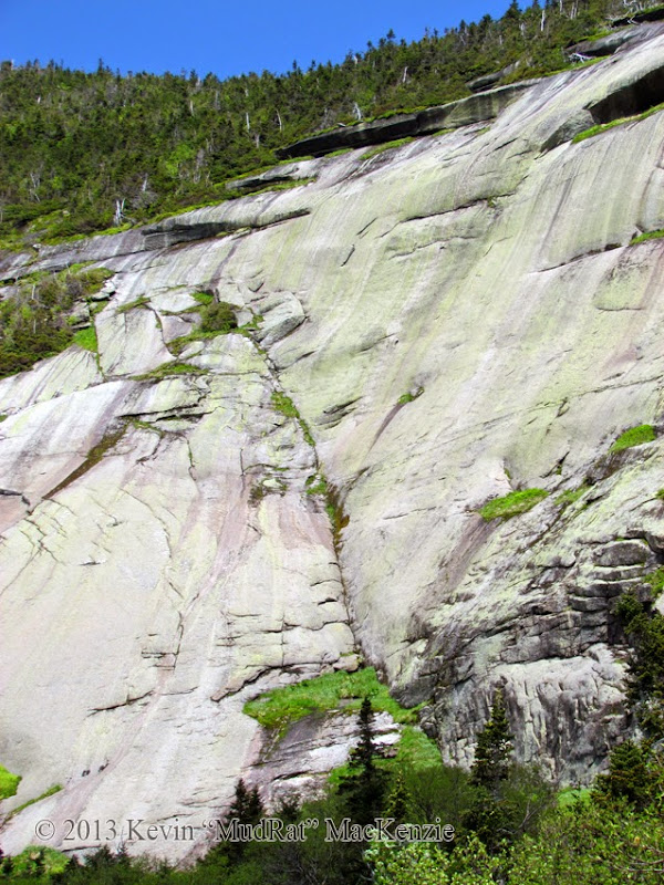
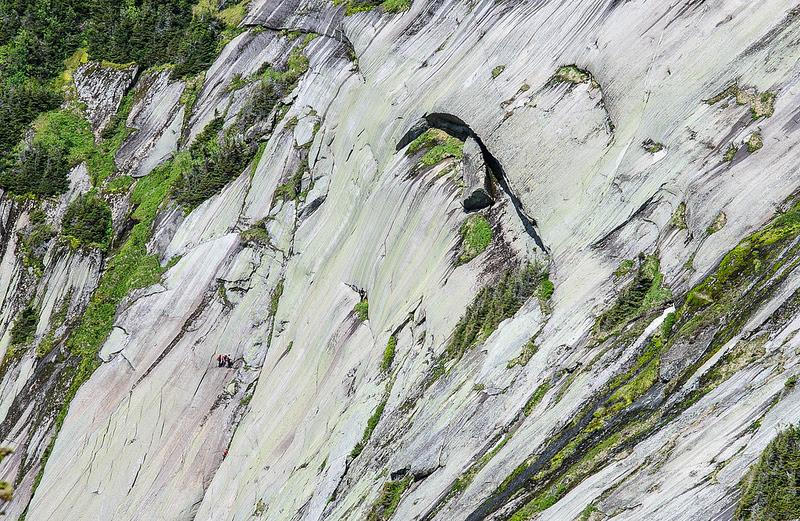
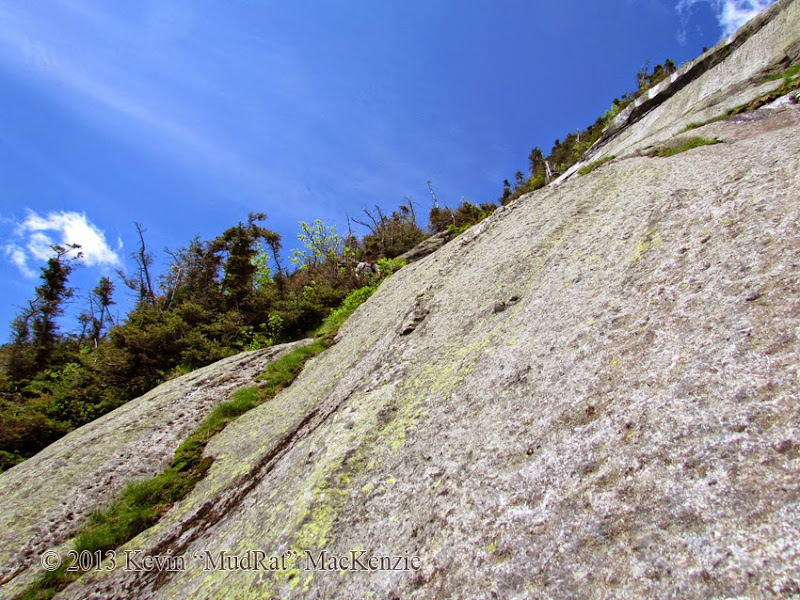
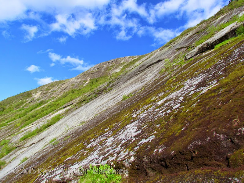
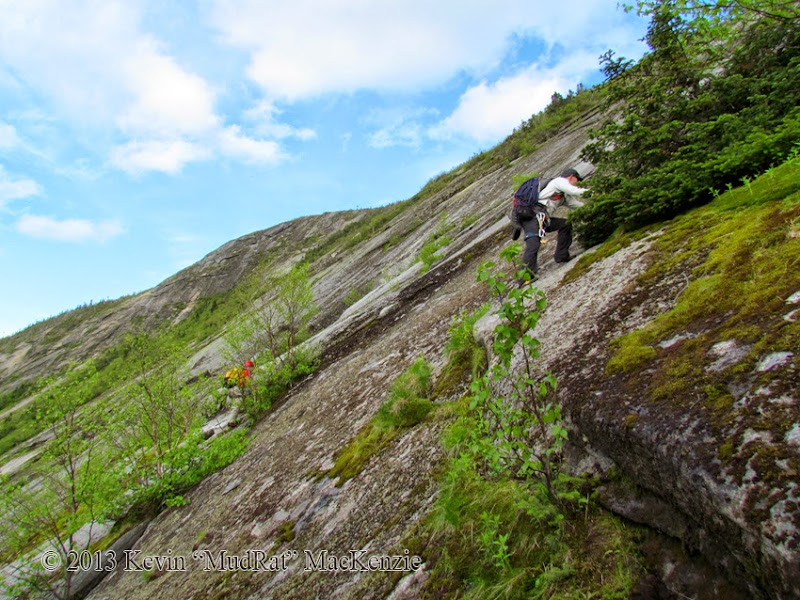
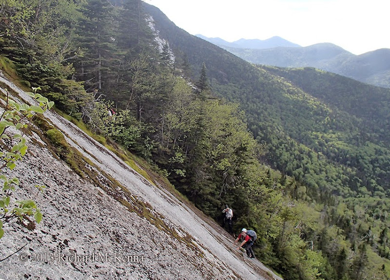
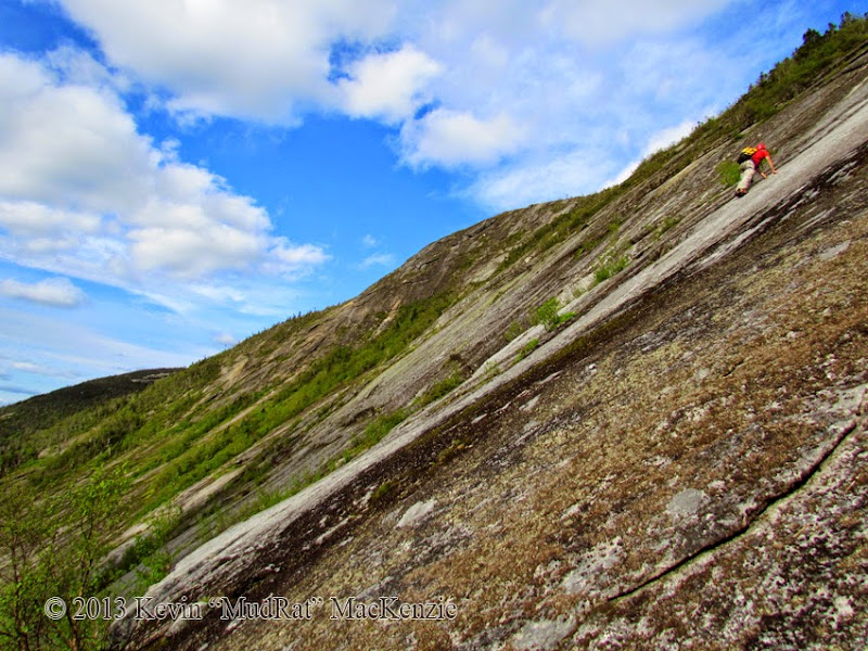
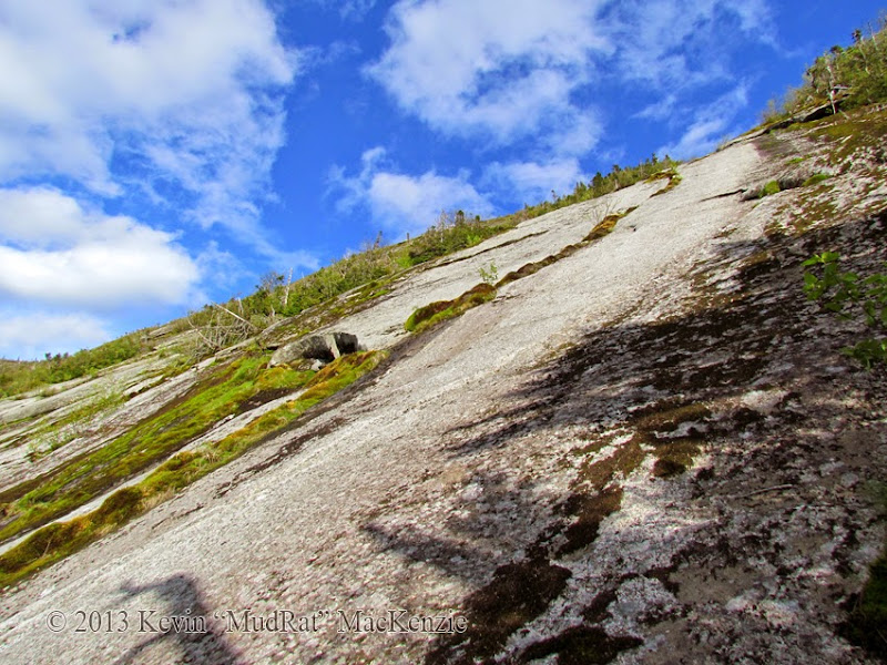
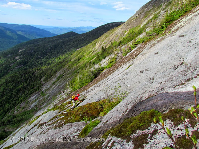
The east face or Rainbow Slide has several established climbing routes and scrambles. During the last three visits, I’ve followed the terrain and not a specific route. A February 2013 winter ascent up the left-hand side was a large deviation and much harder than the Goodwin-Stanley route. This time, we planned start from the central slab (about 3,850 feet in elevation) rather than from the low angle slab a couple hundred feet lower. This is home to several routes including one called “Over the Rainbow” which is rated 5.5 by Adirondack Rock. That was our starting point. We then intersected the upper portion of the 4th class Goodwin-Stanley Route for a close-up view of the dramatic overhanging ledge below the ridge. This was a mostly scrambling on moss-laden rock, still a significant challenge.
South Face (Ascent to summit 750’)
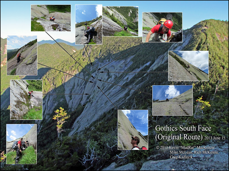
I first explored the South Face’s “Original Route” (First Climbed in 1896) during the winter of 2012. I’ve been planning a return since. Rich soloed the route in in the summer of 2012 and had a working knowledge of the details. After traversing the bottom of the face, the climb was about 300 vertical feet starting at roughly 4,100 feet in elevation.
North Face (Ascent to summit 1,300’)
The New Finger Slide (5.1) seemed like the best choice for an unprotected ascent. I’d skirted along this in 2009 with Neil Luckhurst, Mastergrasshopper and Electric-Man when we touched it at the top and bottom, but avoided the crux and central run, opting instead for a full bushwhack in the woods. The bottom of the route up a diagonal right-leaning crack begins about 3,750 in elevation (though the run-out starts about 3,300) and ends about 800 feet higher.
Friday Evening
Mike McLean, Greg Kadlecik and I struck out from St. Huberts at about 7:15 p.m. with plans to camp at an elevation of about 3,100 feet along the Weld Trail en route to the Sawteeth/Pyramid col. A small area of moderately sloped land after the final stream crossing held the promise of a suitable site.
Sometimes the best laid plans go astray quickly. It took nearly 20 minutes to find a level site with room for three. Blowdown was heavy and the slope was steep. By 11:00 p.m. We set up camp and settled in for the evening. I quickly drifted off into a deep dreamless sleep in the cool mountain air. The stars were out though it had rained only hours before.
The fluty tones of a resident wood thrush awakened me about 4:30 a.m. I drifted back to sleep while listening to its clear melodic tones, my favorite of all bird songs. The beeping of my alarm was a harsh contrast at 5:20 a.m. A little while later we were set to depart. The plan was to meet Rich on Pyramid’s summit, but I heard a faint whistle cut through the air. I knew he was calling and whistled back. Minutes later he tromped through the evergreens to our camp. The day had begun; I felt each of us vibrating with excitement and felt my own anxiety growing over a few unknowns. This, I knew, would help keep my decisions conservative. We first had to climb 1,400 feet to start the bushwhack/approach.
Climbing the East Face
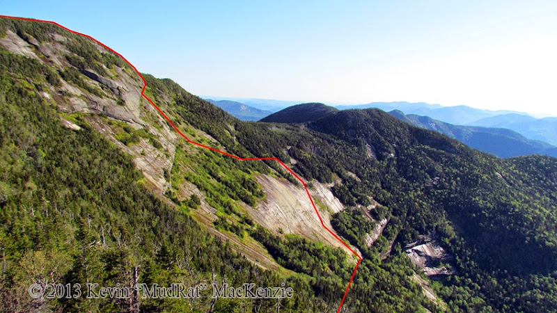
The route variation we followed.
The approach for the Rainbow is via the Gothics/Pyramid col. The descent is a relatively simple task on a hard crust in winter; snow covers the blowdown, sod-holes, ledges and slick slabs that make up the route. In winter, it takes roughly 20 minutes to descend. In summer, you can safely double that.
Part of the way down I jumped down from a ledge and felt what I thought was sweat on my lower back…then it flowed downward—my water bladder had burst. Two litres of water ran down my back, rear, legs and filled each shoe. The day hadn’t warmed yet, so it wasn’t exactly refreshing so much as startling. I, long ago, began carrying redundant items. Two Nalgene bottles were my backup. We stopped adjacent to the middle face and refilled our water supply in preparation for the first climb.
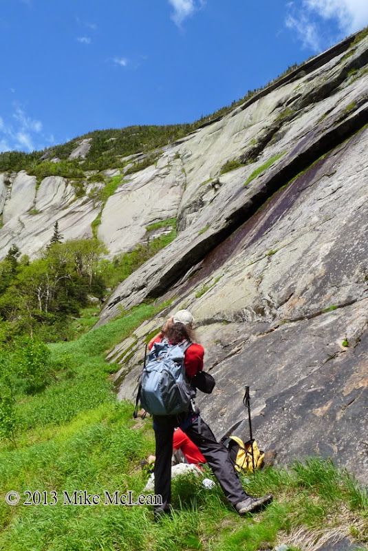
All the other times in this area, I’ve gone to the low angle slab at the bottom to soak in the stunning view and looming cliffs. Rich suggested we simply aim for the technical route. Thus we saved a little time and arrived at the lowest point of the slab at about 7:45 a.m. The next half-hour was spent assessing the route and gearing up. Mike was the most skilled technical climber in the group and brought all the necessary pro to keep us safe. My thought was to attempt a solo climb of the “easiest” route on the face called Over the Rainbow (rated 5.5). The best laid plans…
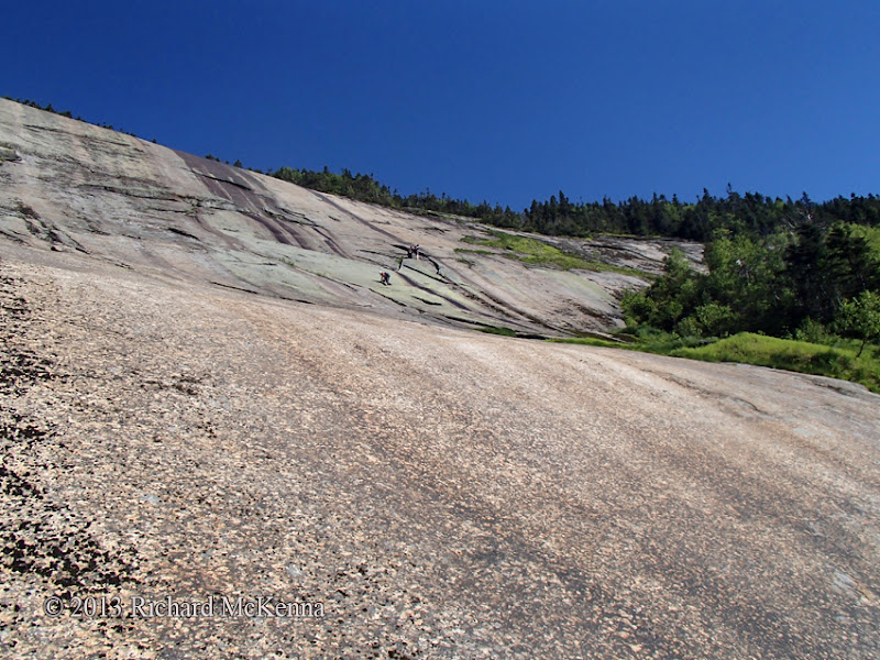
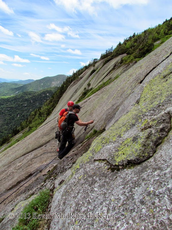
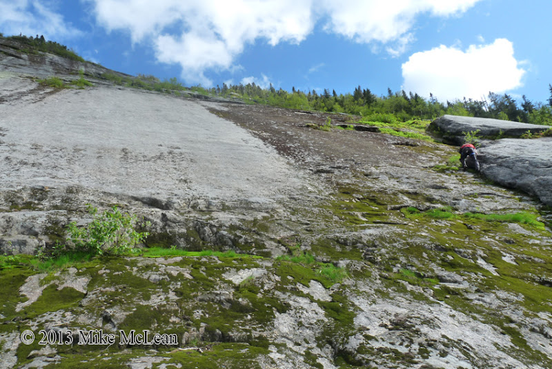
Kevin, Greg and Mike at the center of the slab.
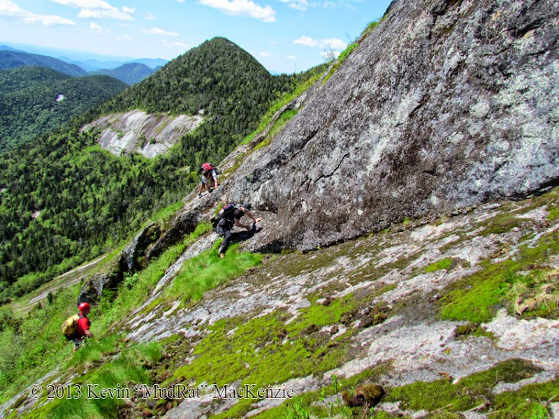
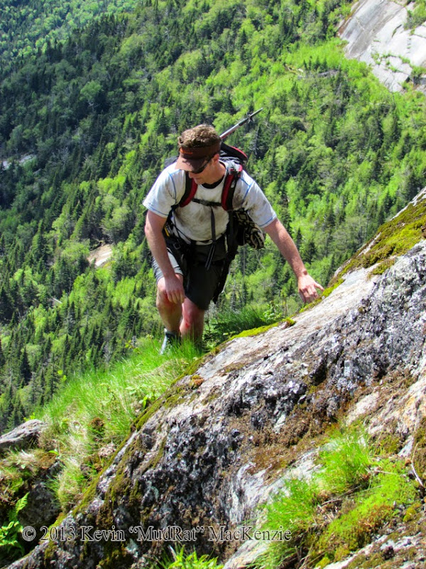
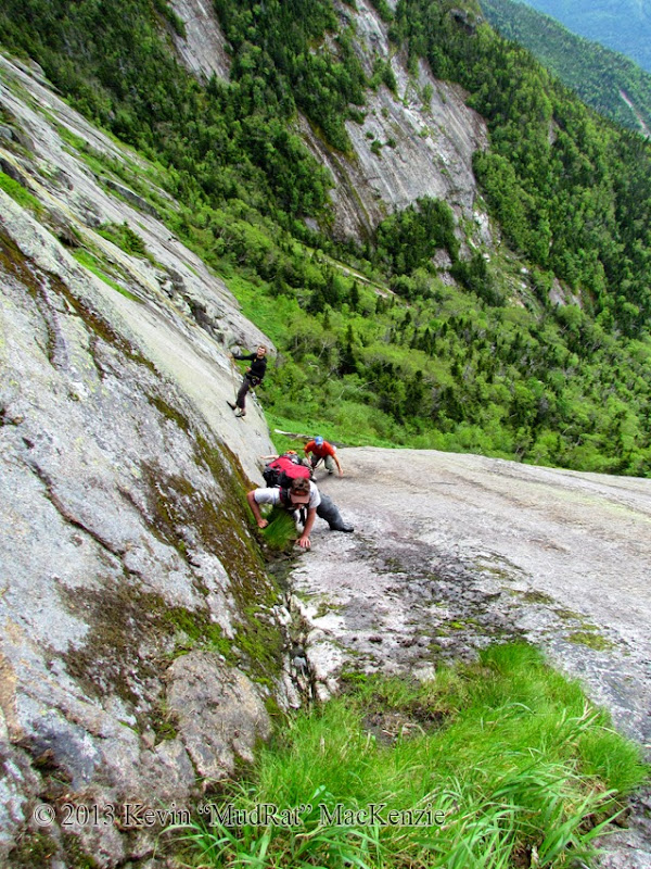
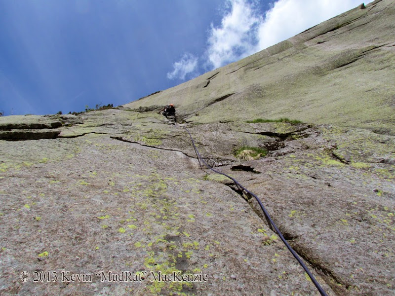
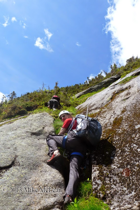
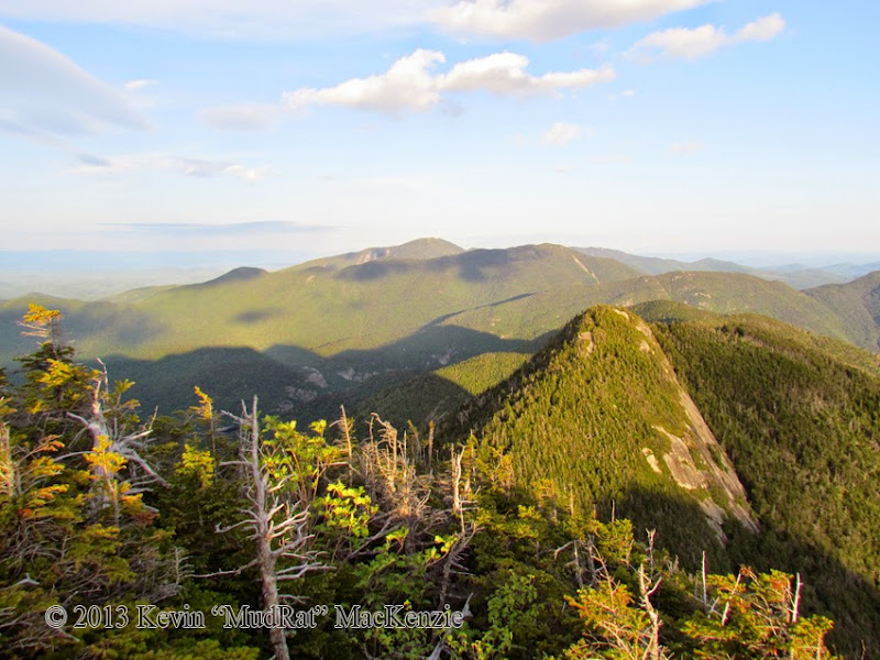
The face looked spectacular and dry except at the top where the moss was obviously still holding moisture from the rains over the last several days. We quickly climbed the first 5.4 rated pitch up to some flakes and a nice overlap. Things slowed down a bit after this point, but that’s what it’s all about…adapting to change and keeping safe. The four of us soloed the first 200 vertical feet (Over the Rainbow continued upward). We fell off route at this point for various reasons—this was fine since the day was about exploring the faces while keeping momentum. Mike and I traversed right over a sketchy area to small shelf of grass where he set up an anchor to belay Greg. This gave me a chance to sit back and enjoy the scenery.
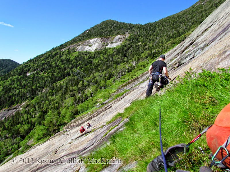
Mike throwing the rope for Greg to tie in. We're about 200 vertical feet up the slab.
Duration: 14.5 hours, 19.5 for Rich McKenna as a dayhike
Pack Weight & Gear: 40 pounds to camp, 20 climbing. Harness, belay device, helmet, rock climbing shoes, fleece layer, sleeping bag, bivy sack.
Partners: Rich McKenna (WalksWithBlackflies), Greg Kadlecik (krummholz), Mike McLean (ensonik)
Route:
• St. Huberts
• Camp at 3,100 before Sawteeth/Pyramid col
• Pyramid-Pyramid/Gothics col to central Slab on East Face (Rainbow)
• Partial “Over the Rainbow” route to Goodwin-Stanley route
• Summit
• Gothics/Pyramid col
• Bottom of South Face
• Ascend via Original Route (5.4)
• Summit
• Descend True North 200 vertical feet-bushwhack to bottom of North Face
• New Finger Slide
• Summit
• Pyramid
• Camp-St. Huberts.
Benchmarks:
• Rich begins: 4:00 a.m.
• Kevin, Mike, Greg begin 6:00 a.m.
• Gothics/Pyramid col: 7:15 a.m.
• Bottom of Over the Rainbow: 8:30 a.m.
• Gothics’ Summit: 10:45 a.m.
• Bottom of South Face: 12:00 p.m.
• Top of South Face: 2:40 p.m.
• Gothics’ Summit: 4:00 (ish) p.m.
• Bottom of North Face: 4:30
• Gothics’ Summit: 7:00 p.m.
• Camp: 8:45 p.m.
• Rich/Mike back at car: 11:30 p.m.
Photos: East Face - South Face - North Face
Mike McLean's Blog
East Face Video
South Face Video
----------------------

Sometimes there’s nothing that distracts me from the stressors of life compared to a big project looming on the horizon; the planning, preparation and, of course, the focus required during the outing. This was such a day. It is difficult to encapsulate this adventure in a trip report. There was much involved in the planning—schedules were arranged around complicated life-events and the weather cleared leaving us the perfect window between rainy days. The reality of the day fell both according to our design and in reaction to circumstances. Adapting to the moment is what makes Adirondack bushwhacking fun and keeps it adventuresome.
Given the conditions, technical nature and hours of harsh bushwhacking through krummholz, this turned out to be one of my most ambitious projects to date. The mental aspect and focus required to keep safe while working just short of our boundaries augmented it. This bridged a gap between slide climbing and technical rock climbing. The by-product was that it enhanced the sense of comraderie as we aided each other and reinforced the momentum to continue to the next face. In the end, we’d touch on both historic routes as well as relatively recent ones.
Connecting the Faces
We tried to arrange the climb to account for water availability (not a problem this time), the driest rock based on the exposure and time of day. Prior knowledge of each area worked in our favour.
East Face (Ascent to summit 900’)
The east face or Rainbow Slide has several established climbing routes and scrambles. During the last three visits, I’ve followed the terrain and not a specific route. A February 2013 winter ascent up the left-hand side was a large deviation and much harder than the Goodwin-Stanley route. This time, we planned start from the central slab (about 3,850 feet in elevation) rather than from the low angle slab a couple hundred feet lower. This is home to several routes including one called “Over the Rainbow” which is rated 5.5 by Adirondack Rock. That was our starting point. We then intersected the upper portion of the 4th class Goodwin-Stanley Route for a close-up view of the dramatic overhanging ledge below the ridge. This was a mostly scrambling on moss-laden rock, still a significant challenge.
South Face (Ascent to summit 750’)
I first explored the South Face’s “Original Route” (First Climbed in 1896) during the winter of 2012. I’ve been planning a return since. Rich soloed the route in in the summer of 2012 and had a working knowledge of the details. After traversing the bottom of the face, the climb was about 300 vertical feet starting at roughly 4,100 feet in elevation.
North Face (Ascent to summit 1,300’)
The New Finger Slide (5.1) seemed like the best choice for an unprotected ascent. I’d skirted along this in 2009 with Neil Luckhurst, Mastergrasshopper and Electric-Man when we touched it at the top and bottom, but avoided the crux and central run, opting instead for a full bushwhack in the woods. The bottom of the route up a diagonal right-leaning crack begins about 3,750 in elevation (though the run-out starts about 3,300) and ends about 800 feet higher.
Friday Evening
Mike McLean, Greg Kadlecik and I struck out from St. Huberts at about 7:15 p.m. with plans to camp at an elevation of about 3,100 feet along the Weld Trail en route to the Sawteeth/Pyramid col. A small area of moderately sloped land after the final stream crossing held the promise of a suitable site.
Sometimes the best laid plans go astray quickly. It took nearly 20 minutes to find a level site with room for three. Blowdown was heavy and the slope was steep. By 11:00 p.m. We set up camp and settled in for the evening. I quickly drifted off into a deep dreamless sleep in the cool mountain air. The stars were out though it had rained only hours before.
The fluty tones of a resident wood thrush awakened me about 4:30 a.m. I drifted back to sleep while listening to its clear melodic tones, my favorite of all bird songs. The beeping of my alarm was a harsh contrast at 5:20 a.m. A little while later we were set to depart. The plan was to meet Rich on Pyramid’s summit, but I heard a faint whistle cut through the air. I knew he was calling and whistled back. Minutes later he tromped through the evergreens to our camp. The day had begun; I felt each of us vibrating with excitement and felt my own anxiety growing over a few unknowns. This, I knew, would help keep my decisions conservative. We first had to climb 1,400 feet to start the bushwhack/approach.
Climbing the East Face

The route variation we followed.
The approach for the Rainbow is via the Gothics/Pyramid col. The descent is a relatively simple task on a hard crust in winter; snow covers the blowdown, sod-holes, ledges and slick slabs that make up the route. In winter, it takes roughly 20 minutes to descend. In summer, you can safely double that.
Part of the way down I jumped down from a ledge and felt what I thought was sweat on my lower back…then it flowed downward—my water bladder had burst. Two litres of water ran down my back, rear, legs and filled each shoe. The day hadn’t warmed yet, so it wasn’t exactly refreshing so much as startling. I, long ago, began carrying redundant items. Two Nalgene bottles were my backup. We stopped adjacent to the middle face and refilled our water supply in preparation for the first climb.
All the other times in this area, I’ve gone to the low angle slab at the bottom to soak in the stunning view and looming cliffs. Rich suggested we simply aim for the technical route. Thus we saved a little time and arrived at the lowest point of the slab at about 7:45 a.m. The next half-hour was spent assessing the route and gearing up. Mike was the most skilled technical climber in the group and brought all the necessary pro to keep us safe. My thought was to attempt a solo climb of the “easiest” route on the face called Over the Rainbow (rated 5.5). The best laid plans…

Kevin, Greg and Mike at the center of the slab.
The face looked spectacular and dry except at the top where the moss was obviously still holding moisture from the rains over the last several days. We quickly climbed the first 5.4 rated pitch up to some flakes and a nice overlap. Things slowed down a bit after this point, but that’s what it’s all about…adapting to change and keeping safe. The four of us soloed the first 200 vertical feet (Over the Rainbow continued upward). We fell off route at this point for various reasons—this was fine since the day was about exploring the faces while keeping momentum. Mike and I traversed right over a sketchy area to small shelf of grass where he set up an anchor to belay Greg. This gave me a chance to sit back and enjoy the scenery.

Mike throwing the rope for Greg to tie in. We're about 200 vertical feet up the slab.
Last edited:



![Yellowstone National Park [Map Pack Bundle] (National Geographic Trails Illustrated Map)](https://m.media-amazon.com/images/I/51kGuJ72qjL._SL500_.jpg)


![Grand Teton Day Hikes and National Park Map [Map Pack Bundle] (National Geographic Trails Illustrated Map)](https://m.media-amazon.com/images/I/41DB0jvRnbL._SL500_.jpg)
![Grand Canyon, North and South Rims [Grand Canyon National Park] (National Geographic Trails Illustrated Map)](https://m.media-amazon.com/images/I/419Y-ycyVUL._SL500_.jpg)