1HappyHiker
Well-known member
That song entitled “A Horse with No Name” kept running through my mind when doing a trek to “a pond with no name”. The pond I’m speaking of is in the Pemigewasset Wilderness about a half mile due south of the Zeacliff Trail. It’s shown in the map below with a white arrow pointing to it.
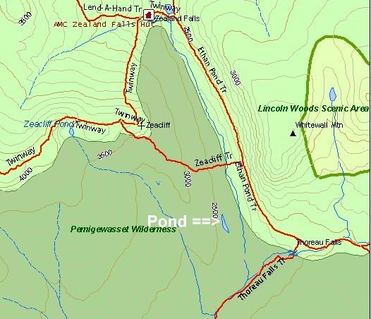
To get to this pond, I left the Ethan Pond Trail at its junction with the Zeacliff Trail and then took that trail for a short distance before heading off trail. It was easy going through very open woods, and I arrived at the pond in less than a half an hour. The pond rests in sort of a V-shaped depression. There’s probably a geologic term for this type of depression as well as for the type of pond contained by the depression. Perhaps this pond could be categorized as a tarn?
In terms of viewing this pond from up above, I checked with Steve Smith and he only recalls seeing it from one of the ledges on Whitewall Mountain. Has anyone else viewed it from any other location?
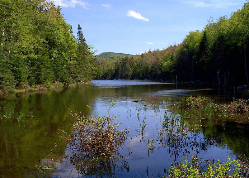
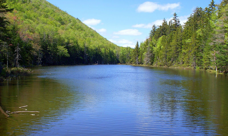
It’s an attractive little pond. I took photos from both its north and its south shore as shown below.
Un-Named Pond from North Shore
Un-Named Pond from South Shore
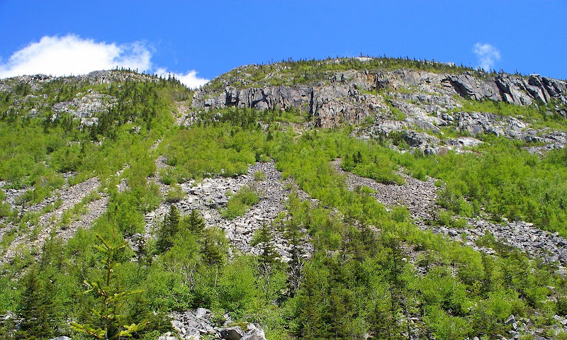
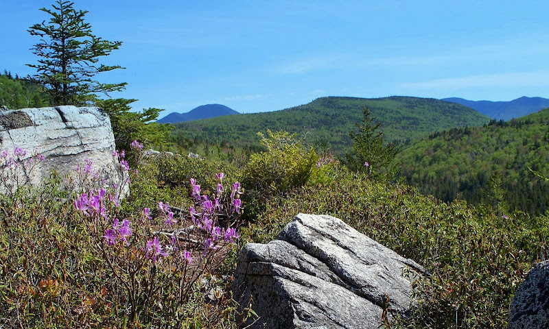
Exploring the un-named pond was certainly one purpose of my trek. However, another reason was simply to enjoy re-experiencing the scenic hike along the Zealand & Ethan Pond Trails en route to the pond. I think it’s particularly picturesque at the junction of the Ethan Pond & Zeacliff Trails. Below are a just a few of the many scenic vistas available from that location.
Whitewall Mountain
South View Toward Carrigain & Hancocks
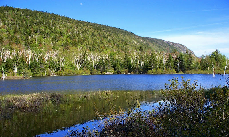
On my return trip, since I was already in a “pond-mode” frame of mind, I did a very short off-trail jaunt to the west shore of Zealand Pond to get a photo (shown below) looking southward from that location.
So there you have it . . . my adventure to an un-named pond in the Pemigewasset Wilderness!
1HappyHiker

To get to this pond, I left the Ethan Pond Trail at its junction with the Zeacliff Trail and then took that trail for a short distance before heading off trail. It was easy going through very open woods, and I arrived at the pond in less than a half an hour. The pond rests in sort of a V-shaped depression. There’s probably a geologic term for this type of depression as well as for the type of pond contained by the depression. Perhaps this pond could be categorized as a tarn?
In terms of viewing this pond from up above, I checked with Steve Smith and he only recalls seeing it from one of the ledges on Whitewall Mountain. Has anyone else viewed it from any other location?
It’s an attractive little pond. I took photos from both its north and its south shore as shown below.
Un-Named Pond from North Shore

Un-Named Pond from South Shore

Exploring the un-named pond was certainly one purpose of my trek. However, another reason was simply to enjoy re-experiencing the scenic hike along the Zealand & Ethan Pond Trails en route to the pond. I think it’s particularly picturesque at the junction of the Ethan Pond & Zeacliff Trails. Below are a just a few of the many scenic vistas available from that location.
Whitewall Mountain

South View Toward Carrigain & Hancocks

On my return trip, since I was already in a “pond-mode” frame of mind, I did a very short off-trail jaunt to the west shore of Zealand Pond to get a photo (shown below) looking southward from that location.

So there you have it . . . my adventure to an un-named pond in the Pemigewasset Wilderness!
1HappyHiker
Last edited:
