JustJoe
Active member
Webster gullies -- in the summer?
Not anytime of year. And there's hundreds of other spots.

Webster gullies -- in the summer?
I hiked solo into the ravine in 2011 looking for the falls. I reached the area described by you and Joe. Besides the blowdowns, you forgot to mention the heavily cravassed and mossy terrain obscuring many deep holes to fall into. It was difficult to tell which way is up in my photos with all the blowdowns pointing in all directions. I think I got pretty close to the falls, but hiking solo I got spooked by the terrain and decided to head for the exit which was not that easy to do. I hadn't left much info with my wife about where I was going and I didn't carry Spot in those days. I'd like to go back and try it again, but not couple it with hike to Garfield which is what I did back in 2011. It's not that big of an excursion if you de-couple it from hiking Garfield.
I can see why the trail was abandoned. Very nasty terrain in there and difficult to maintain.

Becca
I hiked solo into the ravine in 2011 looking for the falls. I reached the area described by you and Joe. Besides the blowdowns, you forgot to mention the heavily cravassed and mossy terrain obscuring many deep holes to fall into. It was difficult to tell which way is up in my photos with all the blowdowns pointing in all directions. I think I got pretty close to the falls, but hiking solo I got spooked by the terrain and decided to head for the exit which was not that easy to do. I hadn't left much info with my wife about where I was going and I didn't carry Spot in those days. I'd like to go back and try it again, but not couple it with hike to Garfield which is what I did back in 2011. It's not that big of an excursion if you de-couple it from hiking Garfield.
I can see why the trail was abandoned. Very nasty terrain in there and difficult to maintain.
I haven't been there, but I was thinking you could go downstream with rappel gear, and stay right in the stream all the way. You can get through and over (and under) a lot of rough terrain, blowdown, etc. on rappel...
HI - thanks all! I must have been a little east of the falls but I swear I was on the brook!!!! JustJoe - that's the exact junction I was at from your pic of the cascades- but what's so weird is that the stream seemed flat below the junction. It must not have been. I thought I checked all along the stream. I know my track doesn't look like I was on the stream, but, I was!!! I guess my next strategy is to search at exactly 3000'.
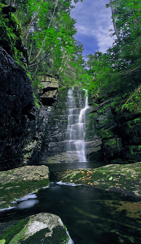
Chris Whiton (NeoAkela) recently posted photos and a video to Facebook about Hawthorne Falls.

The trouble with pictures like this is that they're not real. Beautiful in their own way but so different than the actual.I doubt you'll ever see that much of the sky again in there. Stunning!
Hawthorne Falls was one of my favorite bushwhacks. I enjoyed dropping down to Garfield stream to check out all the mini cascades and pools of water along the way. I only knew I was closing in on the falls when I could hear it, much louder than anything else while whacking parallel along the stream. If anyone is interested, here's my report and pics, included is an old map and 1922 guide book write up.
-Chris
Hi Chris, thanks for the link - think I remember reading that report back when you first posted it.
One thing: I've been having trouble viewing your site. I get an ad which pops up and says it will redirect to your site after 45 seconds, but it doesn't. Frustrating! Glad you've got sponsorship, but it's making it impossible to view your reports. I'm in Apple Safari, fwiw.
ON EDIT: Just tried it in Chrome and didn't have that problem, and again in Safari, where it did come up. Go figure.
I don't know what that is all about and I'm not sponsored by anybody! That's too bad about Apple Safari doing that, just have to stick with viewing it in Chrome I guess