Ed'n Lauky
Well-known member
- Joined
- Feb 15, 2007
- Messages
- 1,802
- Reaction score
- 168
On this vacation I’ve been reading books like A WALK IN THE WOODS, and AWOL ON THE AT TRAIL, and Winton Porter’s book JUST PASSING THROUGH about the folks he meets at Mountain Crossing at Neel Gap so I just had to give the AT a bit of a try. My wife dropped us off at Woody Gap and we headed to Neel Gap about 11 miles off.

The first ‘knob’ we reached gave some excellent views and Lauky headed over for a better look.

The North Georgia Blue Ridge Mts. are indeed beautiful.

And the trails, what can I say about the trails. They’re like sidewalks. It is generally a gentle up and down rolling walk with light to moderate elevation gain and loss. The trail in the picture was typical of 90% of the trail we did in that 11 mile stretch. Without even trying or pushing it at all we were walking along at about 2 mph. I can understand now how folks can report 3 mph. A person could get ‘hooked’ on trails like these. I actually missed a couple of landmarks like Pulpit Rock that I had planned to visit because about the time I was thinking I should see the trail I found I was miles past it.

As we neared Blood Mt., the highest point on the AT in GA we came on some blooming Azalea bushes

They were absolutely gorgeous.

As we charged up the final stretch we came on the famous Blood Mt. Shelter which had already been claimed by a group which had come up from Neel Gap.

Since for once we weren’t alone on the top I got someone to take our picture.

The views from the open ledges near the summit of Blood Mt are excellent.

I had read reports of how steep the descent was from Blood Mt. to Neel Gap. All the way down I kept expecting something steep but as we neared the Gap I realized that it wasn’t going to happen. Whoever, claimed the descent was steep obviously wasn’t from New Hampshire. A short distance before arriving at the gap we went off into the woods and logged the Blood Mt. Geocache then went on to the gap. My wife who had dropped us off at Woody Gap picked us up there and took the final picture.
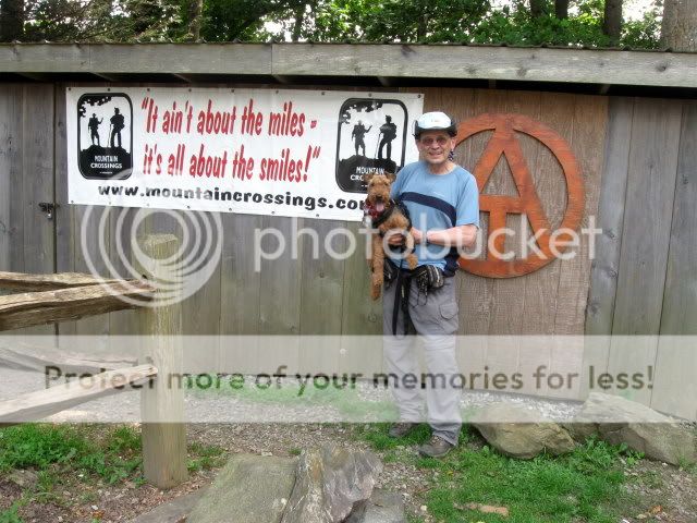
Even taking time to talk with folks along the trail and to look for the Geocache we still cruised in at about 2 mph. The entire time we had never pushed it, just kind of walked along. Our experience in both VA and GA has been very positive. And yes, oh yes, I would like to do more.
Distance: Roughly 11 miles
Elevation Gain: 2300'
[email protected]

The first ‘knob’ we reached gave some excellent views and Lauky headed over for a better look.

The North Georgia Blue Ridge Mts. are indeed beautiful.

And the trails, what can I say about the trails. They’re like sidewalks. It is generally a gentle up and down rolling walk with light to moderate elevation gain and loss. The trail in the picture was typical of 90% of the trail we did in that 11 mile stretch. Without even trying or pushing it at all we were walking along at about 2 mph. I can understand now how folks can report 3 mph. A person could get ‘hooked’ on trails like these. I actually missed a couple of landmarks like Pulpit Rock that I had planned to visit because about the time I was thinking I should see the trail I found I was miles past it.

As we neared Blood Mt., the highest point on the AT in GA we came on some blooming Azalea bushes

They were absolutely gorgeous.

As we charged up the final stretch we came on the famous Blood Mt. Shelter which had already been claimed by a group which had come up from Neel Gap.

Since for once we weren’t alone on the top I got someone to take our picture.

The views from the open ledges near the summit of Blood Mt are excellent.

I had read reports of how steep the descent was from Blood Mt. to Neel Gap. All the way down I kept expecting something steep but as we neared the Gap I realized that it wasn’t going to happen. Whoever, claimed the descent was steep obviously wasn’t from New Hampshire. A short distance before arriving at the gap we went off into the woods and logged the Blood Mt. Geocache then went on to the gap. My wife who had dropped us off at Woody Gap picked us up there and took the final picture.

Even taking time to talk with folks along the trail and to look for the Geocache we still cruised in at about 2 mph. The entire time we had never pushed it, just kind of walked along. Our experience in both VA and GA has been very positive. And yes, oh yes, I would like to do more.
Distance: Roughly 11 miles
Elevation Gain: 2300'
[email protected]
