1HappyHiker
Well-known member
Looking at Mt. Washington from There & There & There & There (18-Sep-2010)
Before we know it, the colors will peak for the autumn of 2010. The leaves are making their metamorphosis right now (as shown in the photo below).
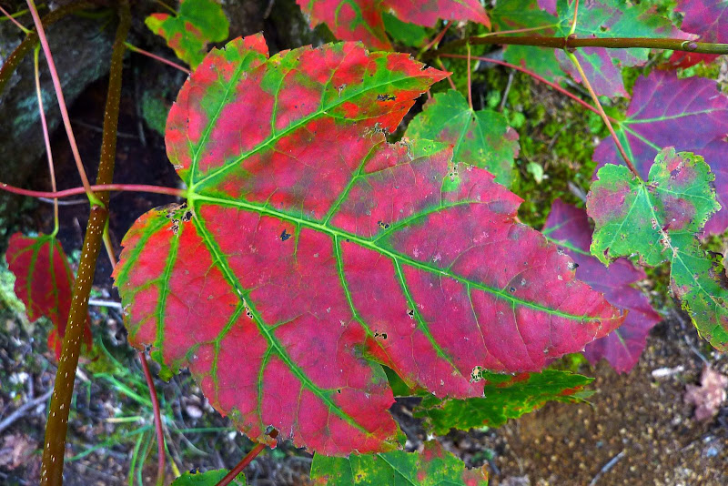
The snapshot shown above was taken during a loop hike that Zman & I did. This loop was part bushwhack and part on-trail hiking.
We started and ended our loop at the Jericho Road trailhead for the Rocky Branch Trail. A thumbnail sketch of our route is as follows.
We left the Rocky Branch Trail almost immediately to begin the approximate 2.3 mile bushwhack portion of the loop. This bushwhack took us over two unnamed peaks with terrific views. After completing the bushwhack portion, we joined the Mt. Parker Trail and followed it + the Davis Path + the Stairs Col Trail + the Rocky Branch Trail to complete our loop.
For round figures, the total mileage of our loop was about 9 miles, and the total duration for the hike was about 8 hours (includes breaks for snacks, picture-taking, etc).
A GoogleEarth schematic of our loop is shown below. The approximate route of the bushwhack is shown in red. The on-trail portion is shown in yellow.
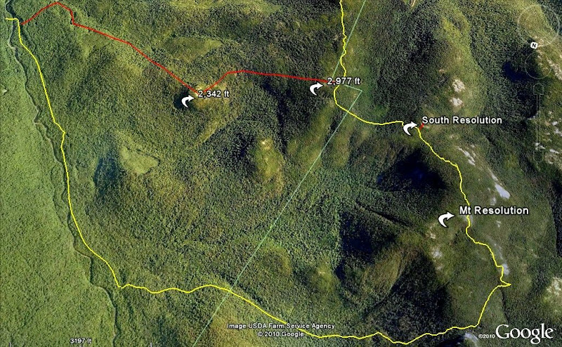
We hit four major viewpoints during our loop which (in order) were as follows: 2,342 ft unnamed peak; 2,977 ft unnamed peak; South Resolution (unofficial name); and Mt. Resolution. There are views of Mt. Washington and surrounding peaks from each of those four spots, and thus this report was entitled: "Looking at Mt. Washington from There & There & There & There"!
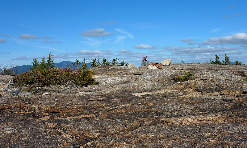
The photos below show examples of the Mt. Washington views from each of these four locations.
1) View from 2,342 ft Unnamed Peak
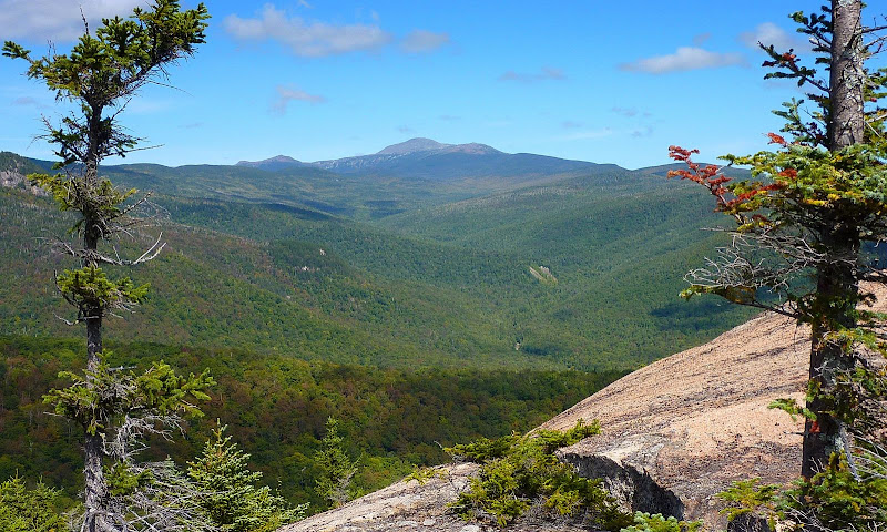
2) View from 2,977 ft Unnamed Peak
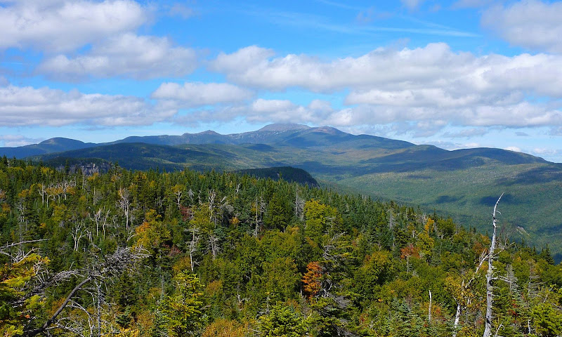
3) View from South Resolution (unofficial name for 3,250 ft knob south of Mt. Resolution)
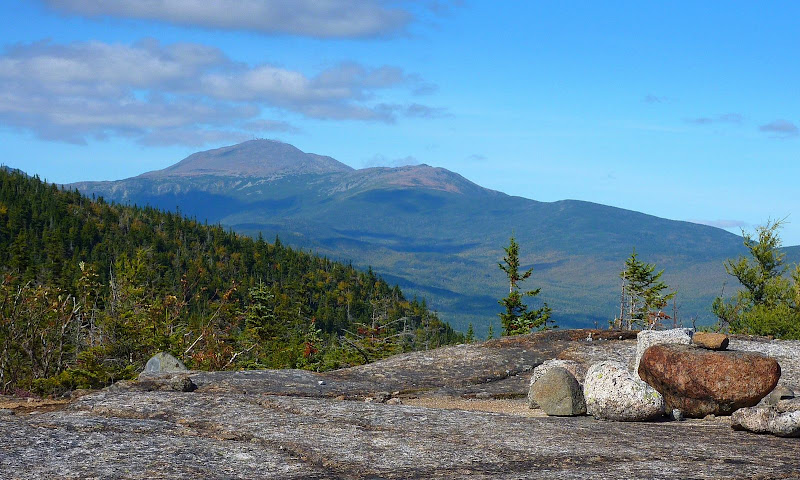
4) View from Mt. Resolution
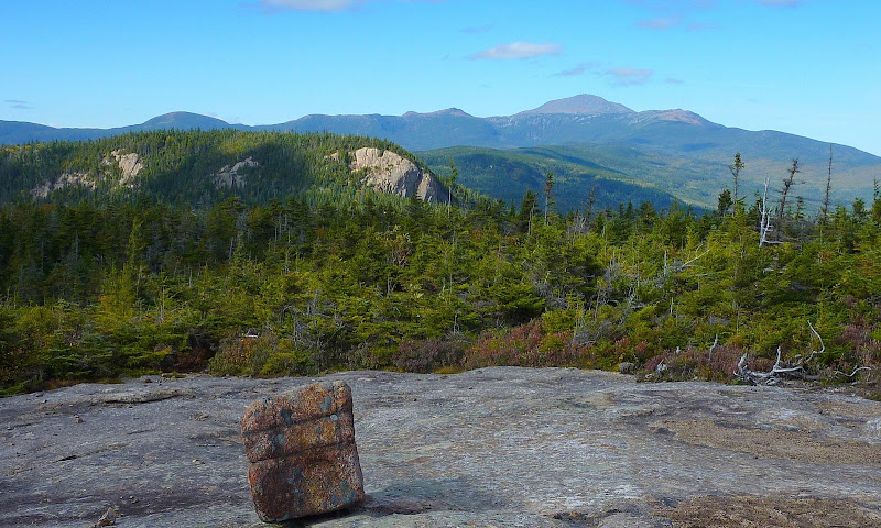
Besides the views toward Mt. Washington, there were loads of additional views in many directions. The photos below are just a sample of some of the other views we experienced at various points during our loop.
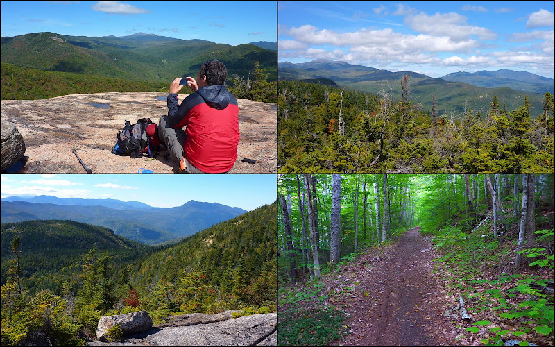
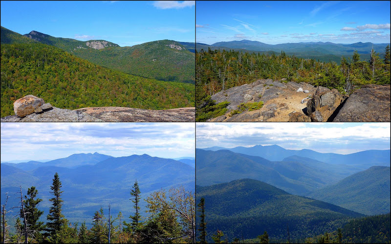
The on-trail portion of our hike was fairly routine, although it was somewhat remarkable that we met only one other hiker on a beautiful Saturday in the Whites!
Regarding the bushwhack portion, it was never overly steep, and there were a lot of open hardwoods along the way. Overall, it was pretty easy. But so as not to sugar-coat it too much, there were some short patches of prickly conifers here & there. Also, there was one humungous swath of blowdowns that seemed to go on forever, but in reality we probably endured this mess for less than a quarter mile. Regardless of the distance, this nasty patch slowed our progress to a crawl for awhile.
Perhaps this little side note is worth mentioning. The 2,977 ft. unnamed peak is just a few hundred feet east of the Mt. Parker Trail. Although this spot is marked with a large cairn, there is no obvious herd path leading to it. If you are hiking the Mt. Parker Trail, it's worth taking a moment to whack up to this great little viewpoint. It's located about midway between Mt. Parker and South Resolution.
Happy trails,
1HappyHiker
Before we know it, the colors will peak for the autumn of 2010. The leaves are making their metamorphosis right now (as shown in the photo below).

The snapshot shown above was taken during a loop hike that Zman & I did. This loop was part bushwhack and part on-trail hiking.
We started and ended our loop at the Jericho Road trailhead for the Rocky Branch Trail. A thumbnail sketch of our route is as follows.
We left the Rocky Branch Trail almost immediately to begin the approximate 2.3 mile bushwhack portion of the loop. This bushwhack took us over two unnamed peaks with terrific views. After completing the bushwhack portion, we joined the Mt. Parker Trail and followed it + the Davis Path + the Stairs Col Trail + the Rocky Branch Trail to complete our loop.
For round figures, the total mileage of our loop was about 9 miles, and the total duration for the hike was about 8 hours (includes breaks for snacks, picture-taking, etc).
A GoogleEarth schematic of our loop is shown below. The approximate route of the bushwhack is shown in red. The on-trail portion is shown in yellow.

We hit four major viewpoints during our loop which (in order) were as follows: 2,342 ft unnamed peak; 2,977 ft unnamed peak; South Resolution (unofficial name); and Mt. Resolution. There are views of Mt. Washington and surrounding peaks from each of those four spots, and thus this report was entitled: "Looking at Mt. Washington from There & There & There & There"!
The photos below show examples of the Mt. Washington views from each of these four locations.
1) View from 2,342 ft Unnamed Peak

2) View from 2,977 ft Unnamed Peak

3) View from South Resolution (unofficial name for 3,250 ft knob south of Mt. Resolution)

4) View from Mt. Resolution

Besides the views toward Mt. Washington, there were loads of additional views in many directions. The photos below are just a sample of some of the other views we experienced at various points during our loop.


The on-trail portion of our hike was fairly routine, although it was somewhat remarkable that we met only one other hiker on a beautiful Saturday in the Whites!
Regarding the bushwhack portion, it was never overly steep, and there were a lot of open hardwoods along the way. Overall, it was pretty easy. But so as not to sugar-coat it too much, there were some short patches of prickly conifers here & there. Also, there was one humungous swath of blowdowns that seemed to go on forever, but in reality we probably endured this mess for less than a quarter mile. Regardless of the distance, this nasty patch slowed our progress to a crawl for awhile.
Perhaps this little side note is worth mentioning. The 2,977 ft. unnamed peak is just a few hundred feet east of the Mt. Parker Trail. Although this spot is marked with a large cairn, there is no obvious herd path leading to it. If you are hiking the Mt. Parker Trail, it's worth taking a moment to whack up to this great little viewpoint. It's located about midway between Mt. Parker and South Resolution.
Happy trails,
1HappyHiker
Last edited:



![Grand Canyon, North and South Rims [Grand Canyon National Park] (National Geographic Trails Illustrated Map)](https://m.media-amazon.com/images/I/419Y-ycyVUL._SL500_.jpg)


![Yellowstone National Park [Map Pack Bundle] (National Geographic Trails Illustrated Map)](https://m.media-amazon.com/images/I/51kGuJ72qjL._SL500_.jpg)


![Grand Teton Day Hikes and National Park Map [Map Pack Bundle] (National Geographic Trails Illustrated Map)](https://m.media-amazon.com/images/I/41DB0jvRnbL._SL500_.jpg)


