SpencerVT
Member
The Ranger at the Baxter gate was so incredibly impolite and bitter.
I didn't even say anything, she just comes up to the car and is like: "Well I guess I'll deal with you next..."
How about "Welcome To Baxter State Park" next time??!
Then we informed her we were going to Slide Dam towards North Brother and she sharply quipped: "You know the trails to Katahdin are closed right!"
Didn't I just tell you we were going to a completely different part of the park than Katahdin and had no plans to climb Katahdin? What the hell was wrong with this Ranger?!@#$%!
A funeral during a foggy power blackout would have been more upbeat than this woman. She doesn't deserve to work at a beautiful place like Baxter. It would behoove Baxter to cultivate and hire welcoming polite Rangers. (There are certainly some there, but this one was not).
Anyhow, after we got past the rude spawn of Judge Judy and Hillary Clinton, we made it to Slide Dam and had an awesome ascent to North Brother in the best possible hiking weather.
Fort wasn't a bushwhack, but it's not really a trail either. I don't know what the hell you'd call it. A bushy foot-route maybe? Way overgrown on the sides like a whack, but a distinct path on the ground for foot placement.
Baxter State Park peaks are just replete with incredible views from virtually all the summits, so awesome.
My wife didn't feel like whacking over to Mullen (I can't imagine why!!) so she went back to North Brother and down to the Slide Dam and said she'd drive up to Nesowadnehunk Field to meet me there where I'd come out.
As Dennis C. advised me, the whack down to the Fort / Mullen col from the Fort / Brother col wasn't that bad. It was thick getting out of the Fort / Brother col, but from there the woods opened up decently and I had no problems getting down to the Mullen col.
Then that party ended when the ascent of Mullen was like reliving all the worst Adirondack PTSD whacks, and just like the worst parts of Barren too. The ascent was sharp Krummholz so my arms at work this morning look like I played with my cats all weekend, only if they were Bobcats not domesticated house cats.
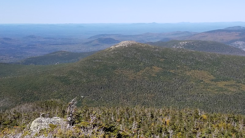
About 90% of the way up Mullen it becomes a boulder hop, which was welcome relief from the thick woods. I made it to the summit to be greeted by some of the best views of the 770. Just magical and awesome on a perfect cloudless Fall day.
The Fort/Mullen col is 2,650' and North Brother is 4,150', requiring 1,500' feet of gain to re-ascend from Mullen if you go back the way you came. It seems much better to descend back to the Wassataquoik trail and take that to the tote road at Nesowadnehunk field - instead of huge re-gain. This exit route from Mullen is 100% downhill and in fact proved to be gentle down hill most of the way.
Getting off Mullen was thick, but then the woods opened up decently all the way down to the **OLD** Wassataquoik Trail. There were some really awful bog parts and a couple thick areas, but otherwise it wasn't very bad at all getting back to the **OLD** part of the Wassataquoik trail.
From the **OLD** section of the Wassataquoik trail, I followed it until it met up with the new trail. This mile or so was very boggy and it felt like this old section of trail was discontinued in the 1950s as there was very little evidence in places of a trail having ever existed.
I passed an old metal barrel on the trail in the middle of nowhere which I thought was interesting; if you look in certain places, there is still some evidence of Baxter's logging past.
Once I got on the new section of the Wassataquoik, it was super short and fast to the Nesowadnehunk field where Renee was waiting for me and picked me up. The whole hike took me 10 hours and 15 minutes. It took us 7 hours to get home.
Mullen is a total gem and an awesome rugged, hard-to-reach mountain. I would say definitely the second toughest in Maine after Barren.
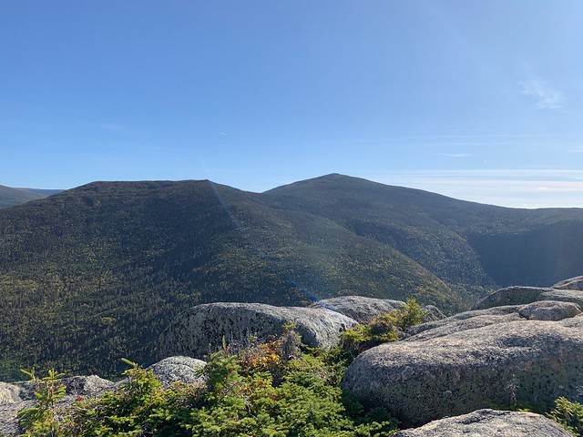
Looking from Mullen toward Fort and Brother, complete with strange blue streak from the lighting in the photo.

Last edited:

