Guthook
New member
- Joined
- Jan 19, 2009
- Messages
- 401
- Reaction score
- 28
Okay, I finally finished writing up Part 2 of the trip report for my five-week trip. We entered the Whites on October 4 at the north end of the Kilkenny Ridge, and ended on the 13th at the bottom of Sandwich Dome.
First, some links:
Part One of the trip report.
The Full Photo Gallery
And the day-by-day journal (not finished yet)
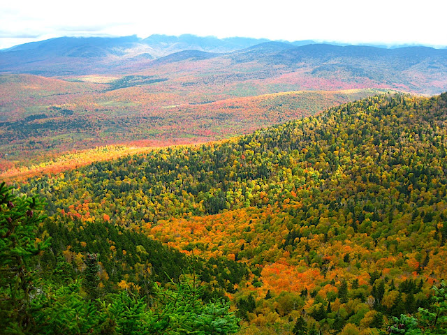
After a day off that brought torrential rains all day, we were back on the trail at the north end of the Kilkenny Range. We had a beautiful day to start, with cold wind and thick, fluffy clouds blowing overhead. There was a slippery, fun hike in the Devil's Hopyard, and distant views from Roger's Ledge, as far away as the Presidential Range. After the wet, viewless hiking on the Cohos Trail, the well-manicured trail up to Roger's Ledge, then down to Unknown Pond was pure luxury.
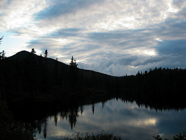
We set up our tarps at the Unknown Pond campsite-- relaxed, in good spirits, and looking forward to good weather and good views from our first two 4000-footers of the trip. During dinner we saw flashes of lightning in the distance, complete with grumbles of thunder. Inevitably, this thunderstorm would crash upon us just after bedtime, dumping bucketloads of rain and shaking us with tremendous thunderclaps. I've been using a tarp instead of a tent for four years now, but this was only the second or third time I've ridden out a large rain in it-- the storm lasted no more than an hour, and I stayed dry.
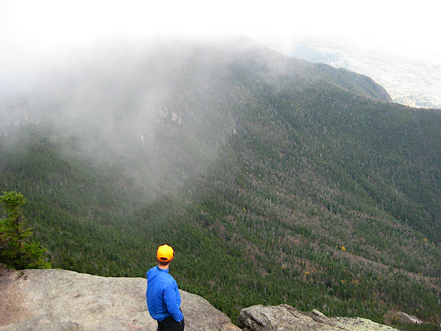
When I awoke in the night the full moon cast a bright light on the area, and I heard a moose wading in the pond. It was a good omen for the following day, I believed. I was wrong. For the tenth day of the trip, we walked eighteen miles in a cloud-- completely viewless over The Horn, The Bulge, Cabot, Waumbek and Starr King. Luckily there was no rain for the entire day, only brief sprinkling at times. Two 4000-footers, no views so far.
The wet trail caused me to slip and fall twice, resulting in a bloodied kneecap, a small rip in my rain pants, and an ugly, fist-sized bruise on my thigh. These would be the first of several epic, if mostly harmless, falls on the trail.
Tuesday morning started with more light rain and a stop in the Applebrook bed & breakfast in Jefferson. The B & B and the town were beautiful despite the clouds, but our walk for most of the day wasn't great for the dreary day. Pondicherry Wildlife Refuge was nice, but we had to walk through briars and one last snowmobile trail to get to the best part, and then through an area flooded by beavers to get out.
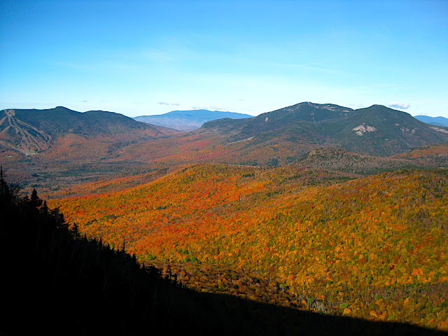
The high point of the day, both literally and figuratively, came with the extremely steep climb up the two peaks of Cherry Mountain-- Owl's Head and Mount Martha. Both of these provided spectacular views of the valleys, as well as some mountains to the south. The high peaks were completely clouded in, but with the fall colors burning brightly we were instantly in love with the little mountain. Another slip down a six-foot slab that left me with a long scrape on my elbow reminded me that we were still in the Whites, though.
Again, in the night a large, windy rainstorm blew into town. It stayed around for most of Wednesday while we walked up Mt Hale, our third viewless 4000-footer of three, and finally stopped while we waited for our friend at Zealand Falls hut. The sun came out for a few hours, but not enough to dry us out before the next torrential rains started to fall in the afternoon. We decided to stay at the hut rather than hike in the rain to Ethan Pond shelter.
Another day, another heavy rain in the night. The trails on Thursday were like rivers, so we were soaked once again. From Zealand hut we went up to the summits of Mt Tom, Field, and Willey, then down to Crawford Notch. Three more clouded-in, viewless 4000-footers.
At the Notch we got a ride to Don & Betsy's house in Conway, where we would stay for two nights, slackpacking one day and recovering in the evenings. As we drove out of the Notch, the black storm clouds parted and gave way to a cloudless, yellow-blue evening sky. Apparently there had been no rain or clouds in town for several days, while the mountains were drowning in rain.
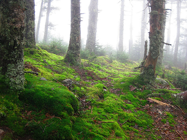
Friday was a pretty straightforward day. It was overcast and cloudy all day, but we were able to get something of a view from Mt Isolation. The trail was long, as is any trip to Isolation, but it was relatively easy, and very pretty. We took a route past Mizpah Hut, down into the Dry River Wilderness, then back up to Isolation and down the Davis Path. I'd never been in the Dry River Wilderness, and I was very pleasantly surprised at its beauty. The trail itself was in need of plenty of maintenance (as with most wilderness trails in the White Mountains), but the surroundings were lush and scenic.
After the fine views on Mt Isolation, we had diminishing views on Stairs and Crawford Mountains, and we made it to the road to meet Don just as the rain began again. Lucky us. Even luckier, the forecast for the next few days was that the rain would finally stop for a bit. I was looking forward to views from Mt Carrigain, since we'd been able to see the beast of a mountain for several days.
The next morning we got an early start-- and what a start it was. The Signal Ridge trail was easy, pretty, and most importantly the clouds were clearing as we ascended. Once again, the White Mountains weather threw us a last-minute surprise. The clouds came back at us as we neared the top, and we had no views from Carrigain. Eight 4000-footers, one view (Isolation). We descended Carrigain via the steep, treacherous Desolation trail, then traversed the damp Pemigewasset Wilderness to get to Mt Hancock. Due to some stomach issues we decided to not climb Hancock, even though the sun had finally cleared the clouds by late afternoon.
First, some links:
Part One of the trip report.
The Full Photo Gallery
And the day-by-day journal (not finished yet)
After a day off that brought torrential rains all day, we were back on the trail at the north end of the Kilkenny Range. We had a beautiful day to start, with cold wind and thick, fluffy clouds blowing overhead. There was a slippery, fun hike in the Devil's Hopyard, and distant views from Roger's Ledge, as far away as the Presidential Range. After the wet, viewless hiking on the Cohos Trail, the well-manicured trail up to Roger's Ledge, then down to Unknown Pond was pure luxury.
We set up our tarps at the Unknown Pond campsite-- relaxed, in good spirits, and looking forward to good weather and good views from our first two 4000-footers of the trip. During dinner we saw flashes of lightning in the distance, complete with grumbles of thunder. Inevitably, this thunderstorm would crash upon us just after bedtime, dumping bucketloads of rain and shaking us with tremendous thunderclaps. I've been using a tarp instead of a tent for four years now, but this was only the second or third time I've ridden out a large rain in it-- the storm lasted no more than an hour, and I stayed dry.
When I awoke in the night the full moon cast a bright light on the area, and I heard a moose wading in the pond. It was a good omen for the following day, I believed. I was wrong. For the tenth day of the trip, we walked eighteen miles in a cloud-- completely viewless over The Horn, The Bulge, Cabot, Waumbek and Starr King. Luckily there was no rain for the entire day, only brief sprinkling at times. Two 4000-footers, no views so far.
The wet trail caused me to slip and fall twice, resulting in a bloodied kneecap, a small rip in my rain pants, and an ugly, fist-sized bruise on my thigh. These would be the first of several epic, if mostly harmless, falls on the trail.
Tuesday morning started with more light rain and a stop in the Applebrook bed & breakfast in Jefferson. The B & B and the town were beautiful despite the clouds, but our walk for most of the day wasn't great for the dreary day. Pondicherry Wildlife Refuge was nice, but we had to walk through briars and one last snowmobile trail to get to the best part, and then through an area flooded by beavers to get out.
The high point of the day, both literally and figuratively, came with the extremely steep climb up the two peaks of Cherry Mountain-- Owl's Head and Mount Martha. Both of these provided spectacular views of the valleys, as well as some mountains to the south. The high peaks were completely clouded in, but with the fall colors burning brightly we were instantly in love with the little mountain. Another slip down a six-foot slab that left me with a long scrape on my elbow reminded me that we were still in the Whites, though.
Again, in the night a large, windy rainstorm blew into town. It stayed around for most of Wednesday while we walked up Mt Hale, our third viewless 4000-footer of three, and finally stopped while we waited for our friend at Zealand Falls hut. The sun came out for a few hours, but not enough to dry us out before the next torrential rains started to fall in the afternoon. We decided to stay at the hut rather than hike in the rain to Ethan Pond shelter.
Another day, another heavy rain in the night. The trails on Thursday were like rivers, so we were soaked once again. From Zealand hut we went up to the summits of Mt Tom, Field, and Willey, then down to Crawford Notch. Three more clouded-in, viewless 4000-footers.
At the Notch we got a ride to Don & Betsy's house in Conway, where we would stay for two nights, slackpacking one day and recovering in the evenings. As we drove out of the Notch, the black storm clouds parted and gave way to a cloudless, yellow-blue evening sky. Apparently there had been no rain or clouds in town for several days, while the mountains were drowning in rain.
Friday was a pretty straightforward day. It was overcast and cloudy all day, but we were able to get something of a view from Mt Isolation. The trail was long, as is any trip to Isolation, but it was relatively easy, and very pretty. We took a route past Mizpah Hut, down into the Dry River Wilderness, then back up to Isolation and down the Davis Path. I'd never been in the Dry River Wilderness, and I was very pleasantly surprised at its beauty. The trail itself was in need of plenty of maintenance (as with most wilderness trails in the White Mountains), but the surroundings were lush and scenic.
After the fine views on Mt Isolation, we had diminishing views on Stairs and Crawford Mountains, and we made it to the road to meet Don just as the rain began again. Lucky us. Even luckier, the forecast for the next few days was that the rain would finally stop for a bit. I was looking forward to views from Mt Carrigain, since we'd been able to see the beast of a mountain for several days.
The next morning we got an early start-- and what a start it was. The Signal Ridge trail was easy, pretty, and most importantly the clouds were clearing as we ascended. Once again, the White Mountains weather threw us a last-minute surprise. The clouds came back at us as we neared the top, and we had no views from Carrigain. Eight 4000-footers, one view (Isolation). We descended Carrigain via the steep, treacherous Desolation trail, then traversed the damp Pemigewasset Wilderness to get to Mt Hancock. Due to some stomach issues we decided to not climb Hancock, even though the sun had finally cleared the clouds by late afternoon.