Jazzbo
Well-known member
- Joined
- Jan 1, 2005
- Messages
- 1,199
- Reaction score
- 171
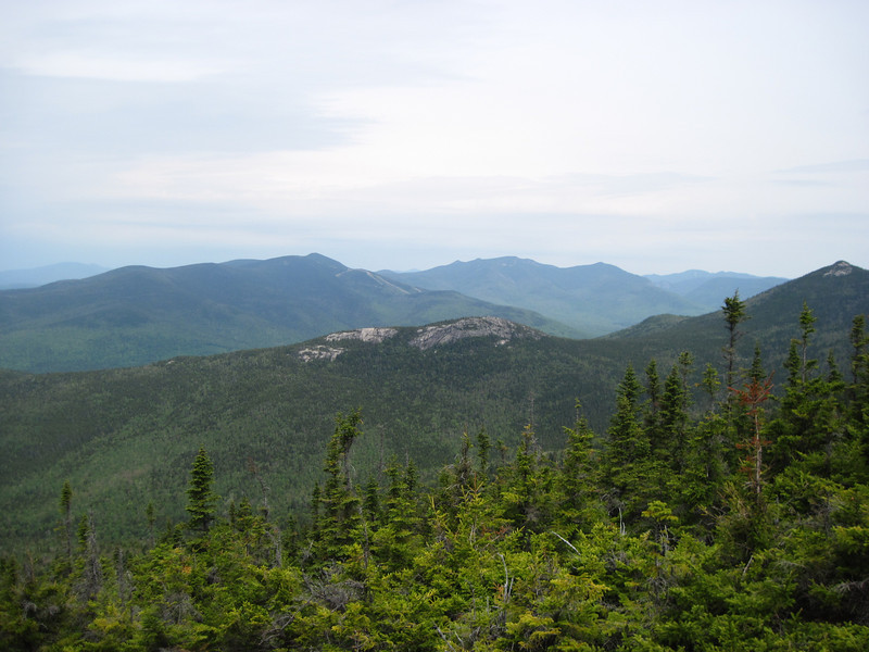
This TR will only be of interest to other bushwhackers and not even many of them because it doesn’t involve a list peak. Here is a view of Sachem Peak I took earlier this year from Algonquin Trail which follows ridge across the valley of Smarts Brook.
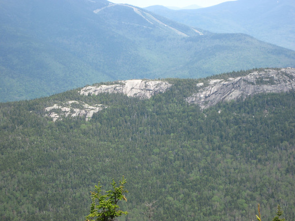
Zoomed shot needed to appreciate the neatness of the cliffs.
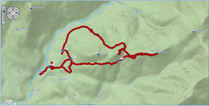
One thing with bushwhacks is time is harder to predict. I’d been up Sachem Peak on Acteon Ridge once before so I thought it would not take long to do this bushwhack. I was planning to take a more direct route than the route I’d taken going via Smarts Brook Trail. Here is GPS track of route I took this day.
I was planning to hike up a brook that snaked down around Bald Knob. I found the beginnings of the brook and started going off trail along the brook from the Yellow Jacket Ski Trail. The brook is not as obvious these days with the lack of rain. I lost it fairly quickly and then I saw the bull moose browsing in a cutover area. I attempted to get closer to them, but the thick trees wasn’t quite right. I hung around watching him browse for awhile and listening to him rustling the foliage from time to time. After 15 minutes I began to feel like the rabbit in Alice in Wonderland looking at my watch so I made a move to approach more closely. A young calf pops up and dashes away passing quite close to me no doubt trying to get to mama located somewhere else. I approach closer and the bull saunters away down what turned out to be a bootleg mountain trail. I slowly and cautiously follow him for a bit. He’s not trying too hard to get away from me, but then I eventually lose him.
I continue following the mountain bike trail and it takes me back to the Old Waterville Valley Road. I decide to follow the road with a view to coming at Sachem from the north slope instead. I reach a point where it’s time to start up the slope towards Sachem. I climb steadily through open hardwoods when GPS tells me I’m on the wrong spur ridge and will have to follow the contour eastward to make to slopes of Sachem Peak. The terrain is rocky and riddled with spruce and it’s fairly difficult. I should have been checking my directions more carefully because I end up summiting an unnamed knob which I don’t realize until I’m there. Oh well now it is past noon and more time has been wasted in what was supposed to be a quick trip. I could bail out now or push on to the correct summit. I decide to go for the Sachem Peak. I head directly for Sachem which turns out to be harder and longer than I figured on. I summit Sachem at 2:00 or so. So much for taking a nap on top. I grab a quick bite, take some pictures, and call my wife before heading back this time by the route I was supposed to go. Here are few pictures from my not good point & shoot camera.
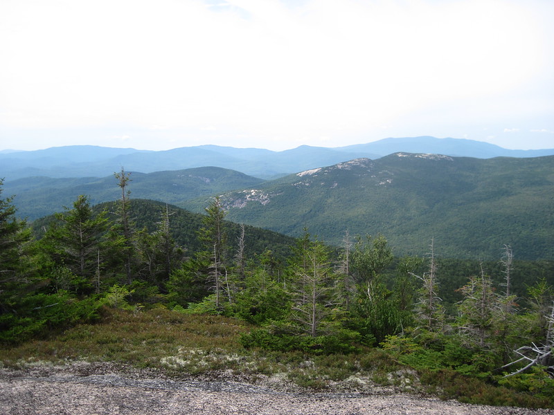
View towards Jenning Peak. Be nice to traverse entire ridge some time.
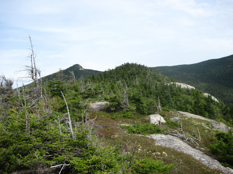
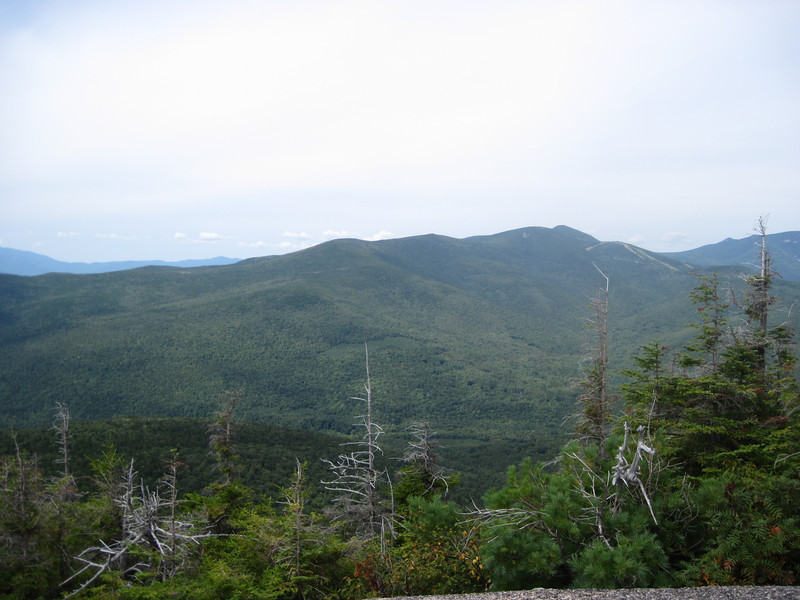
View towards Welch & Dickey
Continuation of ridge connecting Welch Dickey wtih Tecumseh:
I decide take a straight shot back passing to the south of the unnamed 2489' bump and find the beginnings of the unnamed brook I intended to follow on way up. The brook passes over ledge and is easy landmark to follow and in dry conditions I’m actually walking much of the time in the stream bed which courses over many bare rock slabs. I pass by a very large boulder and take a picture.
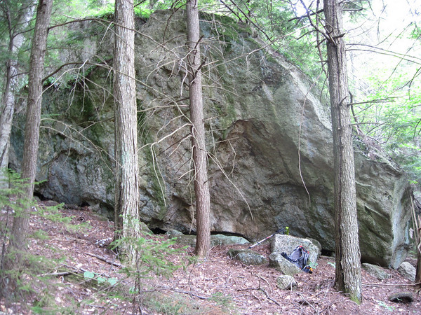
I later found this boulder showing up in Tdawg’s Webshots album of pictures of his trek to Bald Knob. We must have taken the same route here. I arrive back at the bootleg mountain bike trail and follow this for a while just to see where it goes and waste more time. I decide it’s late enough and whack directly back to the yellow Jacket Trail and hike double time back to Rt. 49 and my car time to head home!

Zoomed shot needed to appreciate the neatness of the cliffs.

One thing with bushwhacks is time is harder to predict. I’d been up Sachem Peak on Acteon Ridge once before so I thought it would not take long to do this bushwhack. I was planning to take a more direct route than the route I’d taken going via Smarts Brook Trail. Here is GPS track of route I took this day.

I was planning to hike up a brook that snaked down around Bald Knob. I found the beginnings of the brook and started going off trail along the brook from the Yellow Jacket Ski Trail. The brook is not as obvious these days with the lack of rain. I lost it fairly quickly and then I saw the bull moose browsing in a cutover area. I attempted to get closer to them, but the thick trees wasn’t quite right. I hung around watching him browse for awhile and listening to him rustling the foliage from time to time. After 15 minutes I began to feel like the rabbit in Alice in Wonderland looking at my watch so I made a move to approach more closely. A young calf pops up and dashes away passing quite close to me no doubt trying to get to mama located somewhere else. I approach closer and the bull saunters away down what turned out to be a bootleg mountain trail. I slowly and cautiously follow him for a bit. He’s not trying too hard to get away from me, but then I eventually lose him.
I continue following the mountain bike trail and it takes me back to the Old Waterville Valley Road. I decide to follow the road with a view to coming at Sachem from the north slope instead. I reach a point where it’s time to start up the slope towards Sachem. I climb steadily through open hardwoods when GPS tells me I’m on the wrong spur ridge and will have to follow the contour eastward to make to slopes of Sachem Peak. The terrain is rocky and riddled with spruce and it’s fairly difficult. I should have been checking my directions more carefully because I end up summiting an unnamed knob which I don’t realize until I’m there. Oh well now it is past noon and more time has been wasted in what was supposed to be a quick trip. I could bail out now or push on to the correct summit. I decide to go for the Sachem Peak. I head directly for Sachem which turns out to be harder and longer than I figured on. I summit Sachem at 2:00 or so. So much for taking a nap on top. I grab a quick bite, take some pictures, and call my wife before heading back this time by the route I was supposed to go. Here are few pictures from my not good point & shoot camera.
View towards Jenning Peak. Be nice to traverse entire ridge some time.

View towards Welch & Dickey

Continuation of ridge connecting Welch Dickey wtih Tecumseh:

I decide take a straight shot back passing to the south of the unnamed 2489' bump and find the beginnings of the unnamed brook I intended to follow on way up. The brook passes over ledge and is easy landmark to follow and in dry conditions I’m actually walking much of the time in the stream bed which courses over many bare rock slabs. I pass by a very large boulder and take a picture.

I later found this boulder showing up in Tdawg’s Webshots album of pictures of his trek to Bald Knob. We must have taken the same route here. I arrive back at the bootleg mountain bike trail and follow this for a while just to see where it goes and waste more time. I decide it’s late enough and whack directly back to the yellow Jacket Trail and hike double time back to Rt. 49 and my car time to head home!

