Mudrat
Member
Disclaimer+ Please...No one should interpret this report to mean that avalanche conditions are safe in the backcountry or on this slide. This is simply a report of our experience.
Round-trip distance/duration: 13.25 miles / 15 hours
Conditions: 30”-48” Powder with thin crust.
Partner: Alan Wechsler
Total elevation gain: 4,100 feet
PHOTOS
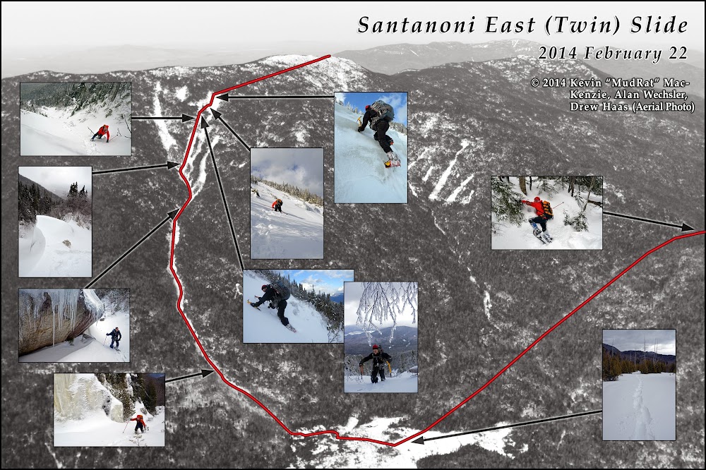
SINCERE THANKS TO DREW HAAS FOR THE USE OF THIS AERIAL PHOTO!
Friend, Alan Wechsler, and I made plans for a winter bushwhack of Santanoni Mt. a couple years ago. He needed the peak for his 46W and was seeking adventure. Thus we set a flexible climbing date of sometime in February; the exact date to be determined last minute based on conditions—a good thing since the avalanche conditions have been prime over the last few weeks (and still are depending on the area).
The drive to the trail head on sections of black ice and realization that I’d forgotten my gaitors (a first) was foretelling of how the day would go. I still hoped for a solid night’s sleep, but my mind worked overtime during the night on how to remedy the gaitor situation. I certainly couldn’t bushwhack without them. Sinus problems and a pounding headache allowed me a mere 2 or 3 hours of sleep, but I chalked the symptoms up to allergies like many times before. I later realized that I’d contracted a of flu-like bug…(my wife was in its grip as well when I returned home after the climb).
Awakenings
When the alarm went off at 4:45 a.m., I felt less than ambitious. As Alan had driven up from Albany so I planned to suck it up and hopefully walk off the headache. As for the gaiters—it took about 20 minutes to convert a mesh grocery bag (the reusable type available at the grocery store) and a nylon stuff sack into make-shift gaiters. I cut a hole in the edge of the bottom for the toe box of the boot to stick through. Several slits in the top allowed me to weave a shoelace through to secure each to my leg. Stylish, no, but I hoped they’d be functional.
Alan cooked a hearty breakfast and we left the trailhead at 6 a.m. Adventure awaited, how much we didn’t realize.
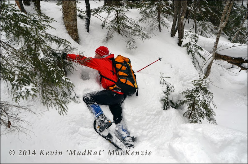
Alan at the beginning of the bushwhack...extricating himself from the drainage.
Bushwhacking
All trails were well packed and at 8:30 a.m. we began the ‘whack from the Santanoni Express following a minor drainage up to the left. I chose this route as it offers an “easy” crossing over the eastern ridge and avoids private land by a wide margin.
What I hoped might be supportive snow from rains the day before, was certainly not. The snow had a light unsupportive crust. Thus each step was of the “step, break through and let the snow settle before applying weight” variety. We’d plunge mid-shin to knee deep each time for the first mile. C’est la vie. The trail-breaking strategy began by alternating 100 pace leads. The regimen slowly relaxed and we simply broke trail until tired then switched.
We arrived at the crest of the ridge after about ½ hour. Gravity would help our journey over the next segment on descent to the swamp. The terrain funneled us into the drainage near the bottom-a problem since the snow was less consolidated and it was easy to break through air pockets and end up in snow to our armpits.
Several streams converge at the bottom where they jog to the east. We continued south after finding some open water and refilling our Nalgene bottles. The swamp was under foot at around 11:15 a.m. I knew it would be beautiful in winter—a more expansive version of Elk Pass en route to Nippletop. The series of beaver ponds were well frozen, the dead trees sticking up through the snow like barbed daggers. The distance had taken almost 3 hours.
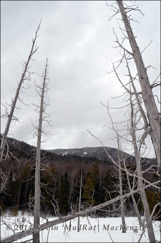
Walking across the beaver ponds through the alley of daggers (above) and toward the toe of the slide (below).
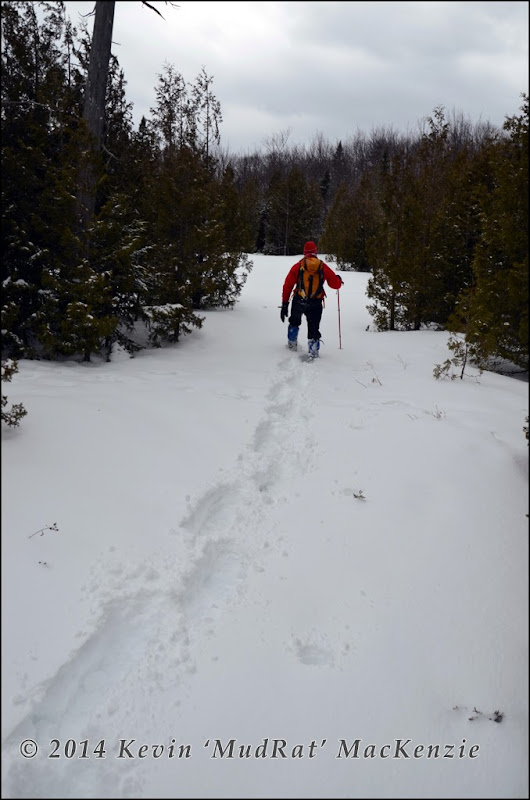
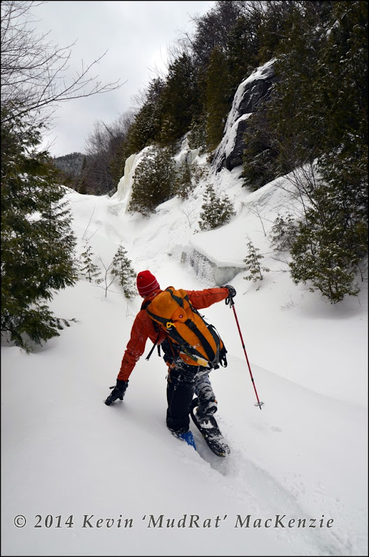
Plunging up the bottom of the slide.
Twin Slide
The real work began on the slide. My prayer for a trek up a wind-blown consolidated surface in the wide drainage was unanswered: a trial awaited. The “climbing” was really just a snow-slog as we sought the firmest surfaces, most of the time in vain. A wall on the right, beautiful in summer, was now a magnificent tapestry of ice set against the ever expanding view to the east.
The panorama would get better with elevation gain even if conditions didn’t.
With elevation came a bit of wind and spindrift to give the area trek an even more alpine feel. An overhanging outcrop of anorthosite just before the confluence of the tributaries was well iced, the drainage buried under 6 feet of snow. Alan and I took the opportunity to apply some dark humour—murder by icicle (see photo). With that out of our system, we climbed the central leg that extends closest to the summit. Our slog became more cumbersome.
Plunging through the crust into the snow didn’t gain us traction so we needed to try and stay on top by creatively distributing our weight. With a trekking pole laid flat in front of me I put both hands on it and spread my snowshoes as wide as possible. It shattered the crust somewhat, but did the job. Alan found a parallel route since my tactic effectively destroyed the traction for him. Several hundred feet higher a lookout rock was lightly corniced and the terrain became steeper. After ‘swimming’ uphill with no significant progress, we switched to crampons. Underneath the 36” was a variety of alder, sand, rubble etc.—one of the reasons we chose this slide. Yes, it could still avalanche, but it a bit less likely than on smooth slab.
The final pitch consists of slab in the summer and that’s where my concern regarding avalanches kicked into higher gear. Only a few ice bulges breached the surface as I looked across the snowscape. One was along the top left-hand side—the only exposed ice we were able to climb. The satisfying sound of a solid thunk sang back as axes plunged deep. Somewhere during our climb on the upper reaches of Twin Slide, the sun appeared lighting Mt. Colden and the High Peaks in full glory!
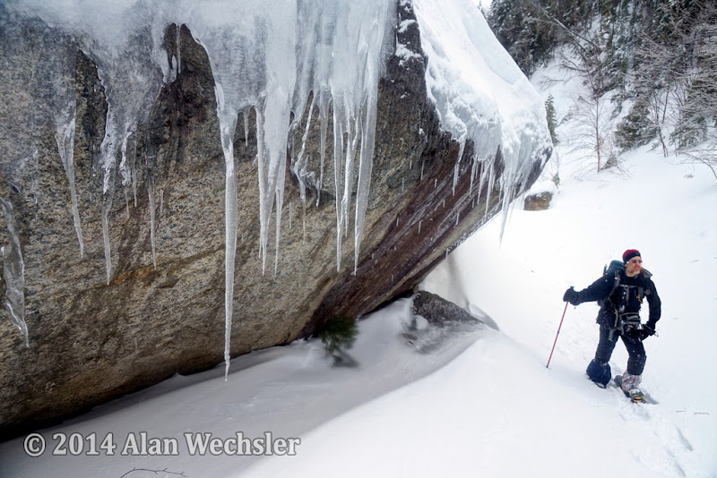
Passing below the overhang before the confluence of the tribs.
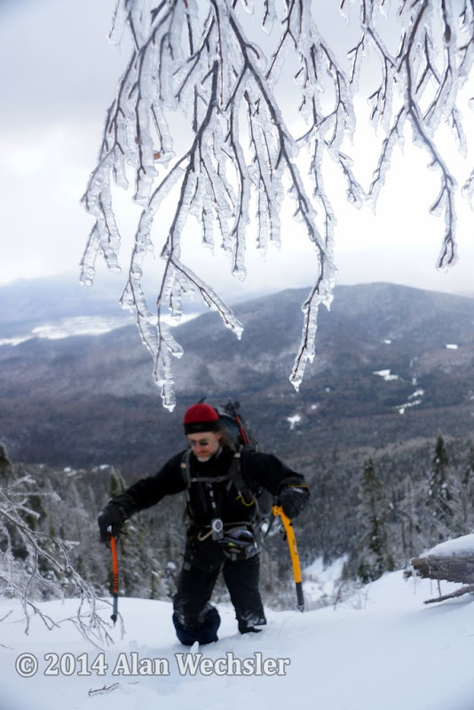
A couple hundred feet below the top.
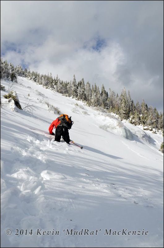
Bottom of the last pitch.
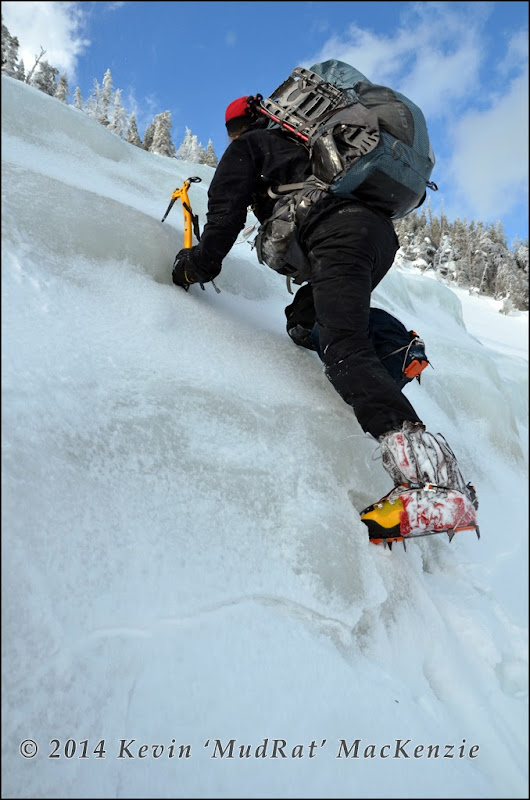
Enjoying the only ice en route.
Round-trip distance/duration: 13.25 miles / 15 hours
Conditions: 30”-48” Powder with thin crust.
Partner: Alan Wechsler
Total elevation gain: 4,100 feet
PHOTOS
SINCERE THANKS TO DREW HAAS FOR THE USE OF THIS AERIAL PHOTO!

Friend, Alan Wechsler, and I made plans for a winter bushwhack of Santanoni Mt. a couple years ago. He needed the peak for his 46W and was seeking adventure. Thus we set a flexible climbing date of sometime in February; the exact date to be determined last minute based on conditions—a good thing since the avalanche conditions have been prime over the last few weeks (and still are depending on the area).
The drive to the trail head on sections of black ice and realization that I’d forgotten my gaitors (a first) was foretelling of how the day would go. I still hoped for a solid night’s sleep, but my mind worked overtime during the night on how to remedy the gaitor situation. I certainly couldn’t bushwhack without them. Sinus problems and a pounding headache allowed me a mere 2 or 3 hours of sleep, but I chalked the symptoms up to allergies like many times before. I later realized that I’d contracted a of flu-like bug…(my wife was in its grip as well when I returned home after the climb).
Awakenings
When the alarm went off at 4:45 a.m., I felt less than ambitious. As Alan had driven up from Albany so I planned to suck it up and hopefully walk off the headache. As for the gaiters—it took about 20 minutes to convert a mesh grocery bag (the reusable type available at the grocery store) and a nylon stuff sack into make-shift gaiters. I cut a hole in the edge of the bottom for the toe box of the boot to stick through. Several slits in the top allowed me to weave a shoelace through to secure each to my leg. Stylish, no, but I hoped they’d be functional.
Alan cooked a hearty breakfast and we left the trailhead at 6 a.m. Adventure awaited, how much we didn’t realize.

Alan at the beginning of the bushwhack...extricating himself from the drainage.
Bushwhacking
All trails were well packed and at 8:30 a.m. we began the ‘whack from the Santanoni Express following a minor drainage up to the left. I chose this route as it offers an “easy” crossing over the eastern ridge and avoids private land by a wide margin.
What I hoped might be supportive snow from rains the day before, was certainly not. The snow had a light unsupportive crust. Thus each step was of the “step, break through and let the snow settle before applying weight” variety. We’d plunge mid-shin to knee deep each time for the first mile. C’est la vie. The trail-breaking strategy began by alternating 100 pace leads. The regimen slowly relaxed and we simply broke trail until tired then switched.
We arrived at the crest of the ridge after about ½ hour. Gravity would help our journey over the next segment on descent to the swamp. The terrain funneled us into the drainage near the bottom-a problem since the snow was less consolidated and it was easy to break through air pockets and end up in snow to our armpits.
Several streams converge at the bottom where they jog to the east. We continued south after finding some open water and refilling our Nalgene bottles. The swamp was under foot at around 11:15 a.m. I knew it would be beautiful in winter—a more expansive version of Elk Pass en route to Nippletop. The series of beaver ponds were well frozen, the dead trees sticking up through the snow like barbed daggers. The distance had taken almost 3 hours.

Walking across the beaver ponds through the alley of daggers (above) and toward the toe of the slide (below).


Plunging up the bottom of the slide.
Twin Slide
The real work began on the slide. My prayer for a trek up a wind-blown consolidated surface in the wide drainage was unanswered: a trial awaited. The “climbing” was really just a snow-slog as we sought the firmest surfaces, most of the time in vain. A wall on the right, beautiful in summer, was now a magnificent tapestry of ice set against the ever expanding view to the east.
The panorama would get better with elevation gain even if conditions didn’t.
With elevation came a bit of wind and spindrift to give the area trek an even more alpine feel. An overhanging outcrop of anorthosite just before the confluence of the tributaries was well iced, the drainage buried under 6 feet of snow. Alan and I took the opportunity to apply some dark humour—murder by icicle (see photo). With that out of our system, we climbed the central leg that extends closest to the summit. Our slog became more cumbersome.
Plunging through the crust into the snow didn’t gain us traction so we needed to try and stay on top by creatively distributing our weight. With a trekking pole laid flat in front of me I put both hands on it and spread my snowshoes as wide as possible. It shattered the crust somewhat, but did the job. Alan found a parallel route since my tactic effectively destroyed the traction for him. Several hundred feet higher a lookout rock was lightly corniced and the terrain became steeper. After ‘swimming’ uphill with no significant progress, we switched to crampons. Underneath the 36” was a variety of alder, sand, rubble etc.—one of the reasons we chose this slide. Yes, it could still avalanche, but it a bit less likely than on smooth slab.
The final pitch consists of slab in the summer and that’s where my concern regarding avalanches kicked into higher gear. Only a few ice bulges breached the surface as I looked across the snowscape. One was along the top left-hand side—the only exposed ice we were able to climb. The satisfying sound of a solid thunk sang back as axes plunged deep. Somewhere during our climb on the upper reaches of Twin Slide, the sun appeared lighting Mt. Colden and the High Peaks in full glory!

Passing below the overhang before the confluence of the tribs.

A couple hundred feet below the top.

Bottom of the last pitch.

Enjoying the only ice en route.

