Hello!!
I don't think I have the ADK NG map, and if I do, I can't find it!! When we did that loop a few years back, I'm pretty sure we went up the Weld Trail, did and out and back to Sawteeth, then continued over Gothics, Armstrong, Upper and Lower Wolfjaws and then went down the trail between the Wolfjaws. Unfortunately, I don't remember how long it took us (it was a long hike) but definately do-able
")
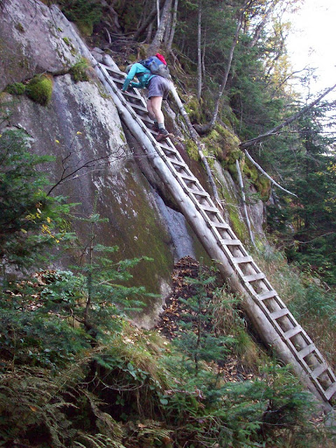
Other things I seem to remember.........there is a pretty large drop-off along the trail that requires climbing down a ladder (if you go the same direction we did). Nothing scary at all, but I remember walking along, looking around and then all of the sudden I'm at the edge of a cliff! Beautiful hike though, have fun! also, you might find some answers on
www.adkhighpeaks.com


![Grand Canyon, North and South Rims [Grand Canyon National Park] (National Geographic Trails Illustrated Map)](https://m.media-amazon.com/images/I/419Y-ycyVUL._SL500_.jpg)


![Grand Teton Day Hikes and National Park Map [Map Pack Bundle] (National Geographic Trails Illustrated Map)](https://m.media-amazon.com/images/I/41DB0jvRnbL._SL500_.jpg)


![Yellowstone National Park [Map Pack Bundle] (National Geographic Trails Illustrated Map)](https://m.media-amazon.com/images/I/51kGuJ72qjL._SL500_.jpg)
