Seward range advice needed

vftt.org

Help Support vftt.org:

This site may earn a commission from merchant affiliate links, including eBay, Amazon, and others.

Charlie

Member
Joined
Sep 4, 2003
Messages
146
Reaction score
2
Location
Upstate NY
Hello all, so I am finally back to pursuing my remaining peaks to complete the 46er's, and I am already looking at the calendar for a couple of challenging adventures I have ahead of me, namely all four of the Seward range and the 3 peaks in the Santanoni range. I'm looking at labor day weekend as my first opportunity to go and have 4 days available.

I've been scouring the forums and reading trip reports, one common theme for both of these treks seems to be mud, so I will be as prepared as possible for that, especially this year.

My main question is about best approach and route, parking areas and camping availability. I'm thinking of doing Seymour 1 day, and the Seward range the next, or vise versa. I don't hike too fast and can't see myself doing all 4 (21 miles) in a day, just not that young and ambitious anymore.

Any and all advice is greatly appreciated, I have a lot of time to plan so I'm attempting to do my homework.
 
Last edited:
So this is what I got from trail Boss on the ADK High Peaks forum, in case anyone else is looking for similar advice on this mountain range.

"Map: https://hiking.waymarkedtrails.org/#...4.1764!-74.216

​Practically speaking, there's only one "approach" and that's from the Seward Parking Area at the eastern end of Coreys Road.

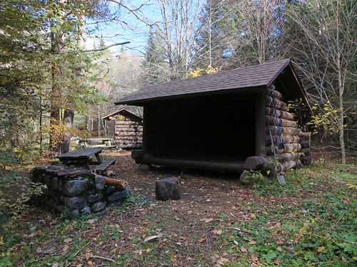
​Most people camp at either the Blueberry or Seward lean-tos in order to position themselves between Seymour and the Sewards for a 2-day trip. Please note you cannot pitch a tent within 50 yards of a lean-to, trail, or stream ... unfortunately many people do just that at the Blueberry and Seward lean-tos.

​My suggestion is to camp at the designated campsite along Calkins Brook Truck Trail.
http://www.openstreetmap.org/?mlat=4...8459/-74.24142
​It's much closer to the trailhead so you have less distance to carry overnight gear. It's close enough for a Friday evening arrival.

​Assuming you arrive on a Saturday morning, hike in to the site I mentioned, pitch your tent, day-hike the Sewards via the Calkins Brook Trail. Next day, day-hike Seymour, return to camp, pack your gear and hike out.

​Done and done."

Thanks!
 
We did the Sewards with a friend in 2015. I consider the 3 Sewards a good but long day hike. I'd also consider doing Seymour as a separate day hike (the next day) to avoid carrying a lot of stuff.

Free campsites along Corey Road before parking lot to trail head if you want an early start. If you don't want to go in and out from Corey's two days in a row, there's a lean-to and camping sites at Ward Brook at the start of herd path up Seward. Leave your gear, hike Seward, then Donaldson, then Emmons. Backtrack to Donaldson. Personally I would take the Calkins Brook herd path down, then loop around back to Ward Brook, although it adds some distance. Easier than climbing and descending Seward again. Do Seymour the next day, and if you're up to it hike out with your gear.

That link to OpenStreetMap took me to Orebed lean-to on the Great Range, very far away from the Sewards.
 
Here's the correct link to the designated campsite along Calkins Brook Truck Trail.
https://www.openstreetmap.org/?mlat=44.18459&mlon=-74.24141#map=18/44.18459/-74.24141

The habit of camping at Blueberry or Seward lean-tos is an old one. It predates the existence of the Calkins Brook Trail. It puts you close to the start of the Seymour and Seward trails. From Ward Brook Lean-to, it's 3.1 miles (out and back) to Seymour and 9 miles (out and back over the Sewards). However, the "back" portion of the Sewards trip involves re-climbing Seward. If you want to avoid re-climbing it, and make a loop via Calkins Brook, your choice will inflate 9 miles to 14.5 miles.

If you camp at the designated site, your backpacking portion is 2.9 miles (out and back). If you camp at Ward Brook Lean-to it's 11 miles (out and back). For some folks, that seals the deal, for others, not so much.

From the designated campsite, a tour of the Sewards via Calkins Brook is 12.8 miles and Seymour is 11.8 miles. Of course, these are (easier) day-hiking miles. In your case, with 4 days available, perhaps backpacking to Ward Brook Lean-to makes more sense.

BTW, if Ward Brook Lean-to is full or if you simply want peace and solitude (trust me, everyone and their dog goes to Ward Brook Lean-to) consider walking another 20 minutes east and staying at one of the two "Number Four" lean-tos.
https://www.openstreetmap.org/?mlat=44.17349&mlon=-74.15802#map=19/44.17349/-74.15802


The two "Number Four" lean-tos.

FWIW, I've done all four peaks in a day and it's a challenging trip. Camping along Coreys Road allows you to get an early start which is advisable because its tough to finish in under 12 hours. My best time was 11 hours (I was in far better physical shape) and the other two trips took about 13-13.5 hours. Splitting the Sewards and Seymour it into two separate day-hikes is a far easier proposition!
 
Last edited:
Thanks for the additional info, especially on the alternate lean-to's, I like a little solitude as well. It would be great if a lean-to was open as I would like to stay in one, but of course I'll be carrying my tent regardless. The more I look at it, I might make this only a 3 day trip doing Seymour the first day after dropping our gear, we'll see how early we get up there and how I feel after the backpack in.
 
Wierd maps. No contour lines, etc - or am I missing something??
 
Wierd maps. No contour lines, etc - or am I missing something??

Yeah, pretty basic, it's a collaborative site though so it's kinda cool. I also like to use CalTopo, much more powerful.

https://caltopo.com/map.html#ll=44.17779,-74.17993&z=15&b=mbt


Actually, OpenStreetMap (OSM), as a mapping resource, is far from basic. It's a collaborative repository for geographic information. Think "Wikipedia of Maps". What you see depends on the mapmaker's choice of what to display.

The default OSM map shows the minimum needed for urban route-finding. Topography isn't needed for getting from point A to B. http://www.openstreetmap.org/#map=16/40.7719/-73.9728

If you want to go cycling or hiking then topography becomes relevant. For that, you can refer to maps based on OSM data like OpenCycleMap, OpenTopoMap, and Thunder Forest Outdoors.

OpenCycleMap: http://www.openstreetmap.org/#map=14/44.1519/-74.2032&layers=C
OpenTopoMap: https://opentopomap.org/#map=14/44.15062/-74.19608
TF Outdoors: http://caltopo.com/map.html#ll=44.1634,-74.19389&z=14&b=oo

OSM is also used to produce vector-based maps that can be used offline on phones. The entire state of New York fits into ~275 Mb. Here's what the area around Whiteface Mountain looks like on my phone (in Locus Maps; zoomed out).

Map Theme - Hike and Bike.jpg

Maps derived from OSM show up in many places. For example, in GaiaMaps: https://www.gaiagps.com/map/?layer=GaiaTopoRasterFeet (note the "OpenStreetMap" credit in the lower right-hand corner) and Suunto's Movescount.

Caltopo is an excellent mapping tool. It can display and manipulate maps from several sources including OpenStreetMap, OpenCycleMap, and TF Outdoors. Caltopo's Mapbuilder Overlay displays trails sourced from OSM. Please note that the Overlay is updated perhaps twice a year at best so it may not contain the latest trail modifications and additions found in OSM.


OSM is used for many things including humanitarian purposes. For example, it's used to map areas devastated by natural disasters like disease, earthquakes and floods.
https://www.hotosm.org/
 
Last edited:
Trail Boss, I obviously didn't dig into OSM enough, I new it had the collaborative aspect, which I like ... thanks for the insight. We can never have enough tools, as long as we don't have to carry them in our pack. :)
 
Top