Papa Bear
New member
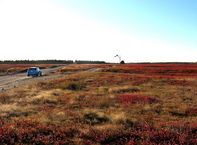
Some beautiful views in Down East Maine
October 23, 2008
Tunk Mountain, Burke Hill & Pigeon Hill plus
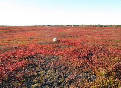
a special historic site in the blueberry barrens: the Epping Base Line.
About a week ago I was planning a trip to Northern New Hampshire to do some hike with Nate and bag a few peaks near the Canadian boundary. So I figured if I'm going to Pittsburg, NH (from NYC via my son's place in Natick, MA), why not stop off in Downeast Maine the day before, since it was almost on the way .
.
The New Hampshire hiking will be in another report, but here I will describe my one day in Milbridge Maine and environs.
What's there? Why go about 700 miles (rt) out of the way? This:
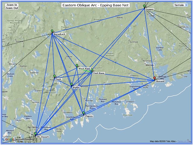
(click on this screen shot to get the interactive Google Map)
This is a map of survey points set in the 1850s by the US Coast Survey as part of the first accurate survey of the East Coast. Now each of those points had to be visible from other points connected by the lines on the map, so it's clear they chose peaks with great views. And they were right. Except for the two points on the Base Line (East and West Base) which are special, these are all very prominent peaks.
And I picked a great day - cold, clear with blue skies and views from the mountains to the Atlantic. Mt Desert (Cadillac Mtn), Humpback (Lead Mountain) and Tunk are known to most of us (they are in the Maine Mountain Guide in the chapter on peaks east of the Penobscot) but Burke abd Pigeon were delightful surprises.
Mt Desert (Cadillac) is not part of the report nor is Cooper or Howard (visited last year) but bring up the map and click on the icon and you can get a couple of links if you're interested. I did Humpback (Lead Mountain) about a month ago on my Katahdin trip and I'll add a note on that but the real reason for my visit were the 5 in the middle.
Tunk Mountain (1150')
I left Natick about 5:30 on Thursday morning, got to Bangor about 9:30, headed down to Ellsworth, then East on US Route 1, got onto Route 182 and by 11:00 AM I was at the Tunk trailhead.
I did not follow the directions in the MMG, but went in from the west side, which is probably an easier route (not sure - never did the MMG's route). After about 1.5 miles on dirt roads and a couple of miles on foot I got to the ridge line and the views just opened up.
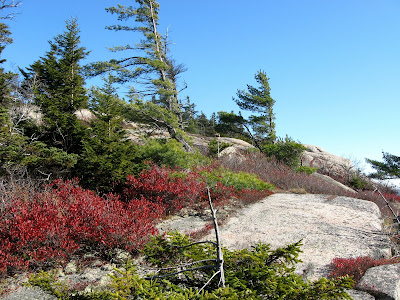
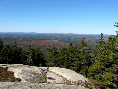
(click for larger images)
And here's the original survey marker, a copper bolt set into the ledge in 1859:
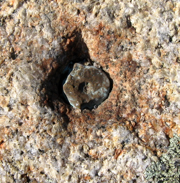
(click for larger image)
This is one of the hidden gems of downeast Maine with views at least as good as you might get on Cadillac, and what is more, no road, no gift shop and no crowds.
In 2 hours I was back at the car heading for Burke Hill.
Burke Hill (425')
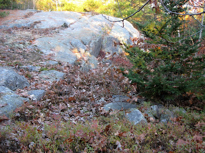
Towards the east end of route 182, there is a road off to the right signed the "Unionville Road", I took this right turn and drove about .7 miles to a place where there were open blueberry fields on the right of the road. I had a nice chat with and old fella who lived in the old farm house there. Seems he is the parson of a church in Harrington. "Course you kin climb the Hill, yep, been in the famly over 100 years". "How do you get to the top". "You jus gotta climb it!" . Turns out an old road led up through the blueberry fields and then an easy whack over mostly open ledges to the top. The Hill was lower than Tunk, but closer to the coast so the views were equally breathtaking.
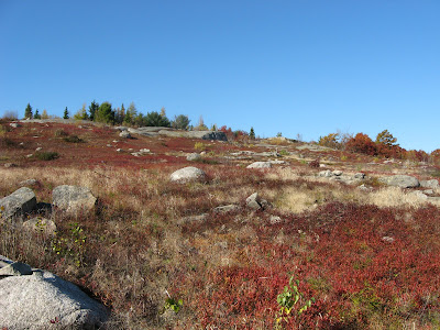
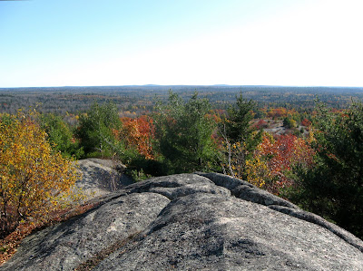
(click for larger images)
This was a quicky, less than an hour up and down, so now it was down to Pigeon, perched on a cape thrusting up into the coastal waters.
Pigeon Hill (317')
This was the lowest, the easiest to get to, but I'll be darned if it didn't have the best views.
There is some development going on on the west side of the hill (alas!) and a dirt road leads close to the top. The builder was working on the last house. He said times being what they were, he wasn't sure if he could sell it. I was a great setting, but alas it's pretty dead in this vicinity after Labor Day.
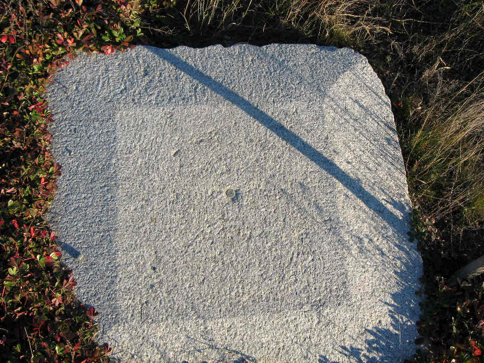
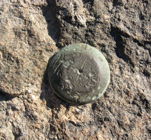
It was but a short trek to the top from this last house, and was it ever outstanding. Yes the 1855 mark was still in great shape (another copper bolt). A great finish for my 3 peaks in a day. (Little peaks with big views).
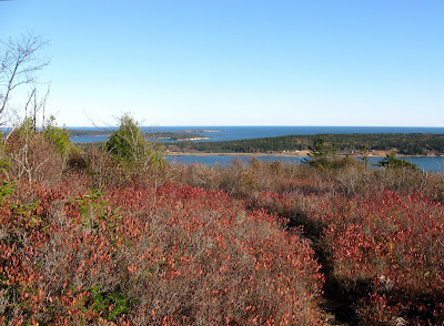
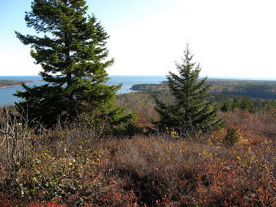
(click for larger images)
And here's the 1855 copper bolt:
(click for larger image)
Here's an album of all this stuff (minus the survey markers): Album
Notice the difference in foliage between Downeast Maine and northern New Hampshire. Yep!
And here are the logs on the benchmarking web site I belong to for these stations:
Log for Tunk
Log for Burke
Log for Pigeon
In the next note I'll explain a little about the "Baseline" and the important part it played in the survey.
October 23, 2008
Tunk Mountain, Burke Hill & Pigeon Hill plus
a special historic site in the blueberry barrens: the Epping Base Line.
About a week ago I was planning a trip to Northern New Hampshire to do some hike with Nate and bag a few peaks near the Canadian boundary. So I figured if I'm going to Pittsburg, NH (from NYC via my son's place in Natick, MA), why not stop off in Downeast Maine the day before, since it was almost on the way
The New Hampshire hiking will be in another report, but here I will describe my one day in Milbridge Maine and environs.
What's there? Why go about 700 miles (rt) out of the way? This:

(click on this screen shot to get the interactive Google Map)
This is a map of survey points set in the 1850s by the US Coast Survey as part of the first accurate survey of the East Coast. Now each of those points had to be visible from other points connected by the lines on the map, so it's clear they chose peaks with great views. And they were right. Except for the two points on the Base Line (East and West Base) which are special, these are all very prominent peaks.
And I picked a great day - cold, clear with blue skies and views from the mountains to the Atlantic. Mt Desert (Cadillac Mtn), Humpback (Lead Mountain) and Tunk are known to most of us (they are in the Maine Mountain Guide in the chapter on peaks east of the Penobscot) but Burke abd Pigeon were delightful surprises.
Mt Desert (Cadillac) is not part of the report nor is Cooper or Howard (visited last year) but bring up the map and click on the icon and you can get a couple of links if you're interested. I did Humpback (Lead Mountain) about a month ago on my Katahdin trip and I'll add a note on that but the real reason for my visit were the 5 in the middle.
Tunk Mountain (1150')
I left Natick about 5:30 on Thursday morning, got to Bangor about 9:30, headed down to Ellsworth, then East on US Route 1, got onto Route 182 and by 11:00 AM I was at the Tunk trailhead.
I did not follow the directions in the MMG, but went in from the west side, which is probably an easier route (not sure - never did the MMG's route). After about 1.5 miles on dirt roads and a couple of miles on foot I got to the ridge line and the views just opened up.


(click for larger images)
And here's the original survey marker, a copper bolt set into the ledge in 1859:

(click for larger image)
This is one of the hidden gems of downeast Maine with views at least as good as you might get on Cadillac, and what is more, no road, no gift shop and no crowds.
In 2 hours I was back at the car heading for Burke Hill.
Burke Hill (425')
Towards the east end of route 182, there is a road off to the right signed the "Unionville Road", I took this right turn and drove about .7 miles to a place where there were open blueberry fields on the right of the road. I had a nice chat with and old fella who lived in the old farm house there. Seems he is the parson of a church in Harrington. "Course you kin climb the Hill, yep, been in the famly over 100 years". "How do you get to the top". "You jus gotta climb it!"


(click for larger images)
This was a quicky, less than an hour up and down, so now it was down to Pigeon, perched on a cape thrusting up into the coastal waters.
Pigeon Hill (317')
This was the lowest, the easiest to get to, but I'll be darned if it didn't have the best views.
There is some development going on on the west side of the hill (alas!) and a dirt road leads close to the top. The builder was working on the last house. He said times being what they were, he wasn't sure if he could sell it. I was a great setting, but alas it's pretty dead in this vicinity after Labor Day.
It was but a short trek to the top from this last house, and was it ever outstanding. Yes the 1855 mark was still in great shape (another copper bolt). A great finish for my 3 peaks in a day. (Little peaks with big views).


(click for larger images)
And here's the 1855 copper bolt:

(click for larger image)
Here's an album of all this stuff (minus the survey markers): Album
Notice the difference in foliage between Downeast Maine and northern New Hampshire. Yep!
And here are the logs on the benchmarking web site I belong to for these stations:
Log for Tunk
Log for Burke
Log for Pigeon
In the next note I'll explain a little about the "Baseline" and the important part it played in the survey.
Last edited:

