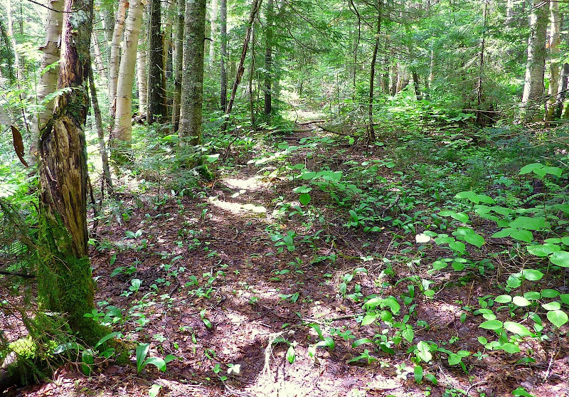
Twins approach via Little River logging road 10/28/10

vftt.org

Help Support vftt.org:

This site may earn a commission from merchant affiliate links, including eBay, Amazon, and others.

RoySwkr

New member
Joined
Sep 4, 2003
Messages
4,467
Reaction score
285
This was supposed to be an ascent of the Twins using the logging road on the W side of Little River and a short bushwhack to avoid the river crossings. I stubbed my toe packing up at home (need to wear plastic boots around house?) but drove up anyway to see how I felt. After limping 100 yards I knew there would be no summits that day, but decided to do a little scouting.

The first half mile was easy walking, but after that the culverts had been removed leaving annoying dips. I stopped at the major brook crossing something over a mile in, the bridge was gone but it wasn't that wide and could have been crossed dry on rocks. This brook drains a dogleg slide 1.5 miles long visible on satellite photos which was not visible from the
road. Right along the brook looked scrubby but there were hardwoods further away which would provide a route to the slide.

In summer this road might be overgrown but I might try it again in the spring or fall. It might also be a good winter route if the trail wasn't broken.


http://mapper.acme.com/?ll=44.21269...44.23438,-71.55020&marker4=44.24265,-71.55812
 
Roy, your adventure brought to mind a Trip Report from August 2008 filed by "Craig" (click on link below).
I don't know if you'll find anything useful in that report when making your plans for any future off-trail treks in the North Twin area.
If nothing else, it makes for an interesting read, especially some info provided by Craig in a follow-up reply toward the end of the thread.

http://www.vftt.org/forums/archive/index.php?t-24586.html
 
Last edited:
I attempted that slide last winter via the old logging road on the west side of the river. I was a little too eager and went too early in the season and ran into a mess on the drainage. I bailed from that attempt and never may it back.

I’ll check my notes tonight and provide some more detail. Saw tracks from a group that accessed (patn?) from the old logging road ascending the east ridge.
 
I parked at the end of Little River Rd and took the snow-mo trail to your marker B. From there it was an easy snow shoe walk to the slide drainage (marker A). I headed up the drainage and fought the deadfall and other hidden crap underneath the unconsolidated snow for a few hundred yards before I gave up. Turned around and went out the way I went in.

The question is, does the logging road continue further south than shown? I believe it does. I suspect it intersects the Twin Tr where it crosses the Little River (marker E).

http://mapper.acme.com/?ll=44.21949...ntersection of loggin road\, trail and river?
 
The question is, does the logging road continue further south than shown? I believe it does. I suspect it intersects the Twin Tr where it crosses the Little River (marker E).
http://mapper.acme.com/?ll=44.21949...ntersection of loggin road\, trail and river?
Craig, based upon my meanderings in that area, I agree with your suspicion that the logging road continues further south than shown.
And, just a side note (for whatever it's worth), this past summer I whacked the length of the Little River Valley and up the headwall to intersect the Twinway. I began the whack at about your "Marker E". At various points along the way, I found evidence of what could have been snippets of either the old Little River Railroad corridor, and/or the long-gone Little River hiking trail. The photo below shows what I'm talking about.
P1050846.JPG
 
Last edited:
I parked at the end of Little River Rd and took the snow-mo trail to your marker B. From there it was an easy snow shoe walk to the slide drainage (marker A).

The question is, does the logging road continue further south than shown? I believe it does. I suspect it intersects the Twin Tr where it crosses the Little River (marker E).
For some reason the link in your post numbers the spots differently than the one in mine

The satellite photo shows no cutting across the brook that the road ends just before so I suspect the road doesn't cross the brook. Possibly there is a herd path but I don't remember seeing one at that crossing. If I'd felt better, I'd know :)

this past summer I whacked the length of the Little River Valley and up the headwall to intersect the Twinway.
I've done that twice in winter, there is definitely part of the old grade and an old camp up there
 
Top