
Jazzbo
Well-known member
- Joined
- Jan 1, 2005
- Messages
- 1,199
- Reaction score
- 171
Mike S and I did W Scar yesterday via Loon. I snow-shoed Scar Ridge Peak from the Kanc back in February 2009, but our group only made it to the old summit. Skies were pretty clear for mid-July. The Walking Boss Ski Trails offered us excellent views to north. We could see White Mountains from Kinsmans all the way to Mt’s Washington and Carrigain.
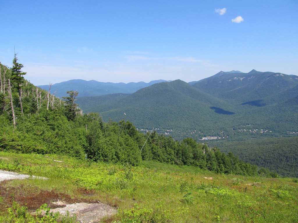
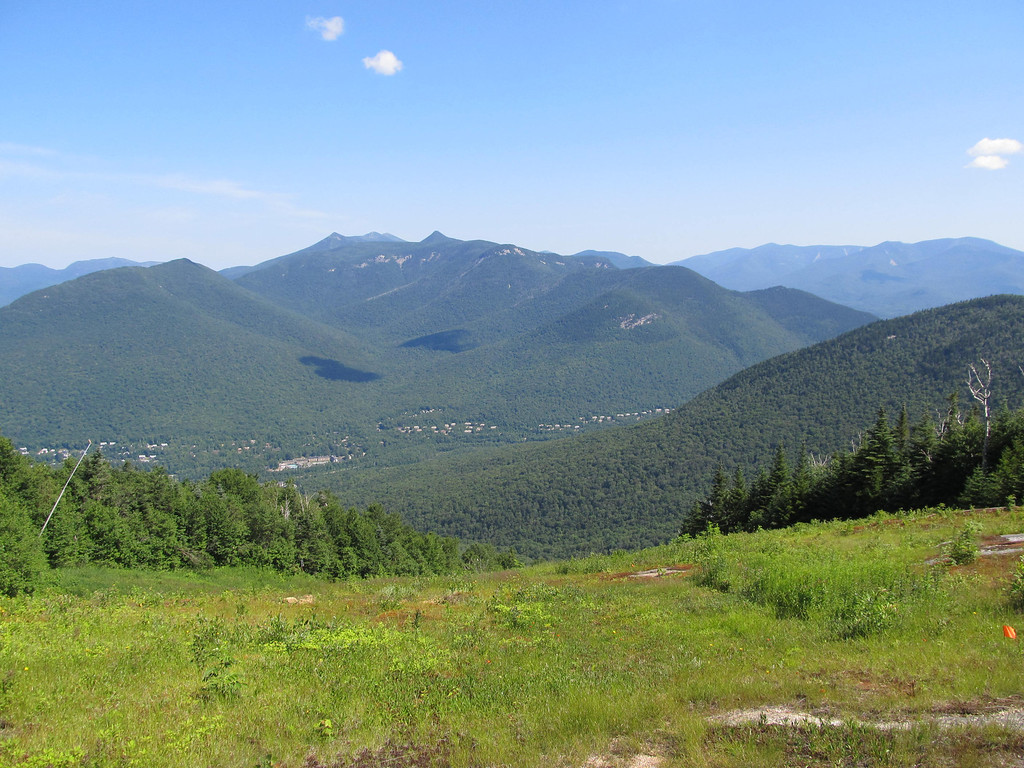
Loon Mountain Ski Area deserves credit for well maintained ski slopes. The Walking Boss Ski Trails have excellent vegetative cover and water erosion is virtually non-existent. Vast beds of wild flowers offered a riot of colors.

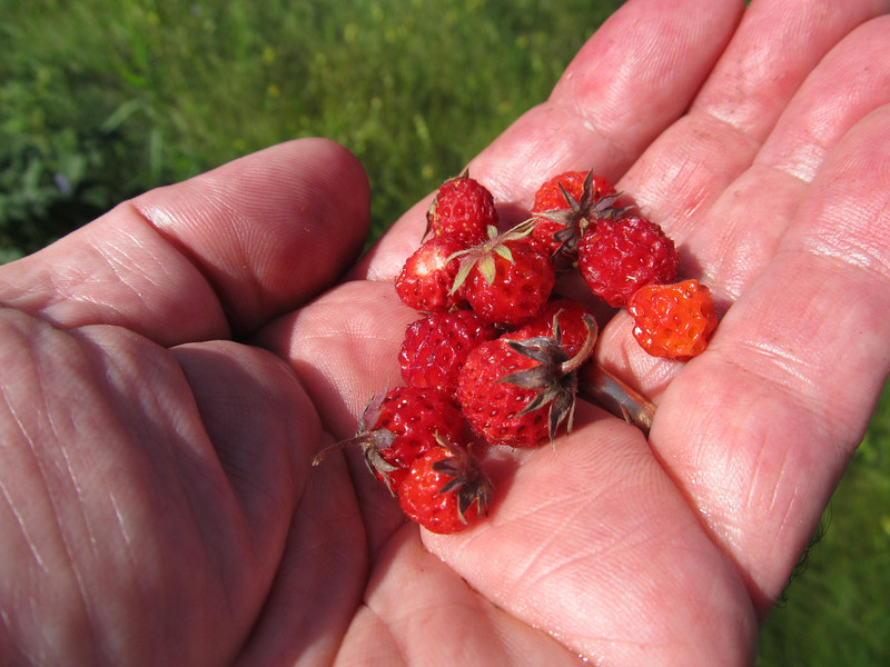
Strawberries were very plentiful and at the peak of ripeness. We stopped frequently to sample them. Stop and smell the roses? No Stop and eat the strawberries!
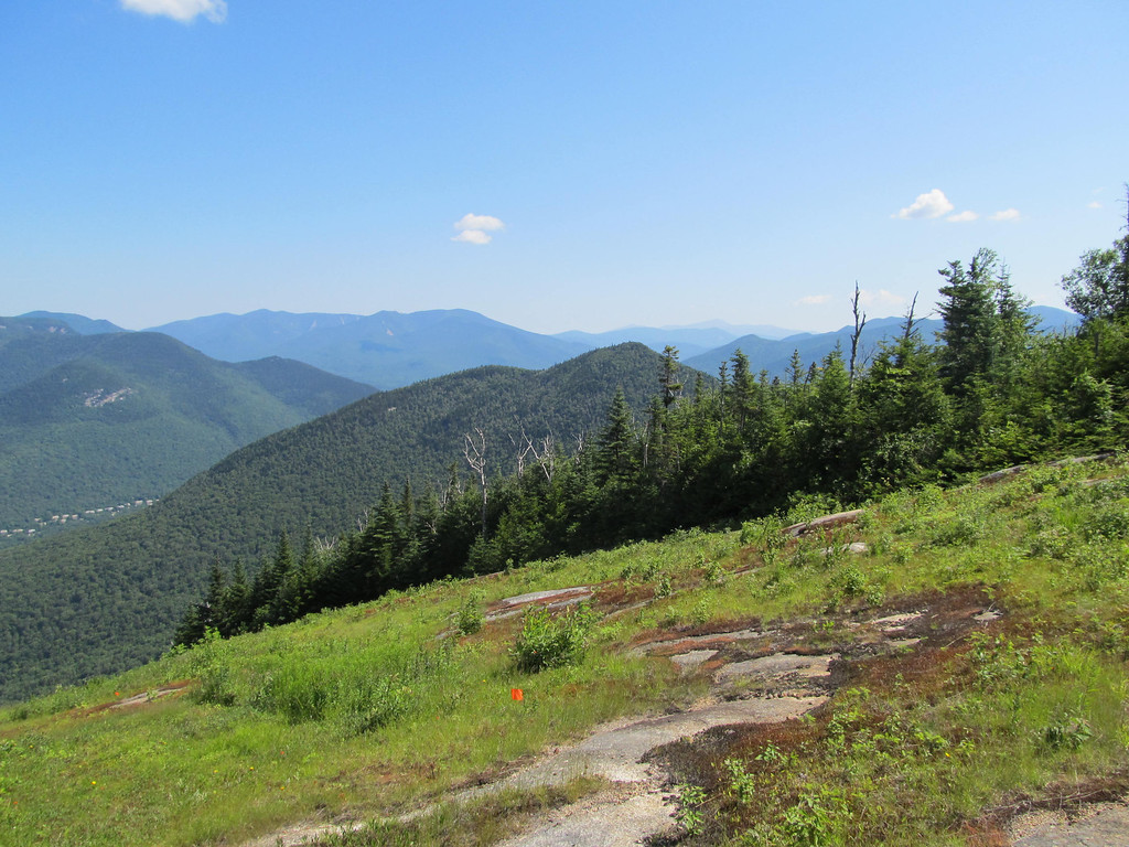
After a 20 minute break in the shade of the ski lift, we went looking for the ski trail. We found the Out of Bounds Ski Trail without much trouble. The entry to the ski trail is located not far from summit area. There is big blue thing on a pole and yellow caution sign. It is probably easier to penetrate in winter when there is 4’ of snow, but is thick with brush now. The herd path travels along at fairly constant bearing. The point at which it starts to turn northward towards Black Mt is fairly obvious. That’s where we began our whack.
The ascent to W Scar from the ski trail was pretty benign. We seem to have stumbled on non-thick route going up taking only 1.5 hours. We essentially followed the spine of the connecting ridge at approx. 3460’. We then headed due east hit the summit cone. The last 300’ to the summit is guarded by blow-downs that were somewhat difficult to get through.
Last visitors to West Scar was Beth and Steve’s party back in 5/22. Almost 2 months ago! Can’t imagine why more people don’t visit more often!
Our route down, although it didn’t differ that greatly from the way up, was awful. It took us 2.15 hours most of the time spent in dubious battle with varying combinations of thick spruce and blow-downs. We actually crossed over our original route. The terrain north of our ascent route was nasty and terrain south of the original route may have been worse.
There is a long steep ledge that runs south of and parallel to the ski trail. Stay away from that thing. We strayed too far south of our original route and had to climb over it at end of our whack to get back to the ski trail. It was not fun. To top it off, in the midst of all of this, I didn’t bring enough water and ran out and started experiencing painful leg cramps. Luckily Mike wisely brought along extra water and saved my butt.
We regained the ski trail and were back to the ski slopes in 20 minutes and descended those in one hour. The ice cream stand at the parking area was most welcome. If I ever go back to West Scar, I won’t make the same mistakes, but I think I’ve joined the ranks of those who don’t ever plan to re-visit West Scar Ridge Peak.
Loon Mountain Ski Area deserves credit for well maintained ski slopes. The Walking Boss Ski Trails have excellent vegetative cover and water erosion is virtually non-existent. Vast beds of wild flowers offered a riot of colors.
Strawberries were very plentiful and at the peak of ripeness. We stopped frequently to sample them. Stop and smell the roses? No Stop and eat the strawberries!
After a 20 minute break in the shade of the ski lift, we went looking for the ski trail. We found the Out of Bounds Ski Trail without much trouble. The entry to the ski trail is located not far from summit area. There is big blue thing on a pole and yellow caution sign. It is probably easier to penetrate in winter when there is 4’ of snow, but is thick with brush now. The herd path travels along at fairly constant bearing. The point at which it starts to turn northward towards Black Mt is fairly obvious. That’s where we began our whack.
The ascent to W Scar from the ski trail was pretty benign. We seem to have stumbled on non-thick route going up taking only 1.5 hours. We essentially followed the spine of the connecting ridge at approx. 3460’. We then headed due east hit the summit cone. The last 300’ to the summit is guarded by blow-downs that were somewhat difficult to get through.
Last visitors to West Scar was Beth and Steve’s party back in 5/22. Almost 2 months ago! Can’t imagine why more people don’t visit more often!
Our route down, although it didn’t differ that greatly from the way up, was awful. It took us 2.15 hours most of the time spent in dubious battle with varying combinations of thick spruce and blow-downs. We actually crossed over our original route. The terrain north of our ascent route was nasty and terrain south of the original route may have been worse.
There is a long steep ledge that runs south of and parallel to the ski trail. Stay away from that thing. We strayed too far south of our original route and had to climb over it at end of our whack to get back to the ski trail. It was not fun. To top it off, in the midst of all of this, I didn’t bring enough water and ran out and started experiencing painful leg cramps. Luckily Mike wisely brought along extra water and saved my butt.
We regained the ski trail and were back to the ski slopes in 20 minutes and descended those in one hour. The ice cream stand at the parking area was most welcome. If I ever go back to West Scar, I won’t make the same mistakes, but I think I’ve joined the ranks of those who don’t ever plan to re-visit West Scar Ridge Peak.
Last edited:
 Sadly they did not find the great woods you (as well as me and my friends when we did it) found and had a real rough time.


![Yellowstone National Park [Map Pack Bundle] (National Geographic Trails Illustrated Map)](https://m.media-amazon.com/images/I/51kGuJ72qjL._SL500_.jpg)


![Grand Teton Day Hikes and National Park Map [Map Pack Bundle] (National Geographic Trails Illustrated Map)](https://m.media-amazon.com/images/I/41DB0jvRnbL._SL500_.jpg)


![Grand Canyon, North and South Rims [Grand Canyon National Park] (National Geographic Trails Illustrated Map)](https://m.media-amazon.com/images/I/419Y-ycyVUL._SL500_.jpg)


