PETCH
New member
Date:03/5/10 (Friday)
Cast of Characters: Jerry, Kate, Keith (Kpmmbm), Crazy Bob, and Petch
Peaks/Trails: Mt Madison and Mt Adams via Valley Way Trail, Gulfside Trail, psuedo bushwacks to both peaks, Valley Way back down.
Trail Conditions: Valley Way is nicely packed out by snowshoe traffic. Above treeline, Gulfside Trail is hard packed with some drifting. Followed prior snowshoe traffic up to both peaks.
Commentary: Keith, Bob and I met Jerry and Kate up at Appalachia Friday morning, and began our hike at 8:30am. We were not sure how far we would go, and figured we’d make it up to the hut and decide from there. Jerry and Kate are both Doctors (Cardiologist, and ER doctor, respectively), so we figured we would be in good hands if any of us developed a medical issue. During a hike, I often feel like I’m going to have a heart attack, and usually end up driving my head into some branch at one point or another. Luckily, their skills would not be required on this trip.
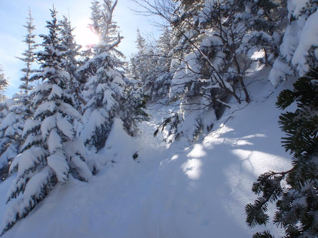
The Valley Way is in great shape with just minimal evidence of bare booting. We wore showshoes all the way up and down. The sun was shining through the hardwoods as we ascended. Weather conditions weren’t bad with sun, warm temps, and moderate winds up top.
Sun peaking through on the Valley Way
The Northern Presidentials are probably my favorite peaks. The elevation gain, the ruggedness of the landscape, the exposure……they are really awesome. But, all those characteristics can also make for a physically demanding and exhausting hike.
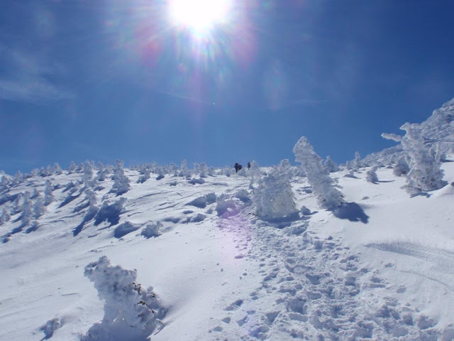
As the Valley Way steepened, I began to bonk and doubted I would be summiting anything today. The high snowpack coupled with the spruce branches were really reaking havoc with my ice-axe causing me to repeatedly get hung up everywhere. It was a bit exhausting. What was that, Bob was saying..”Move you’re a$$ and your mind will follow”? or was it the other way around? As we broke tree line and looked at the beautiful landscape, I began to feel better.
Breaking through the Spruces into the land of White
We made our way to the hut area and came across a couple groups doing a traverse. The winds at this point were minimal, but we layered up and decided to summit Mt Adams first. Keith needed Adams for his 48 list. It’s wild to see so much snow up there. I can count on a few fingers how many times I saw exposed rock. Where are the rocks? I thought there were Rocks on Top!
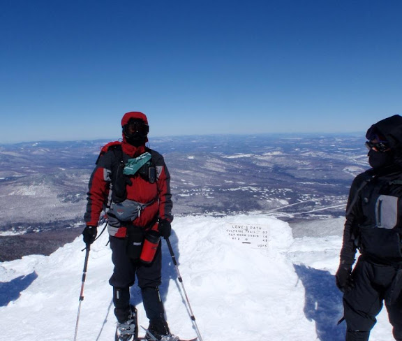
We went along the Gulfside trail and followed prior snowshoe traffic up to Mt Adams. It may have been the Airline trail. There is so much snow, who really knows….It was a long climb, and some of us were feeling it. Crazy Bob was the optimist/motivational speaker, encouraging the pace and talking about doing Mt. Madison afterwards. As much as I appreciated his words, if I could have reached my ice axe, I would have…….. and Kate’s skills would have been necessary . Actually, I owe Bob a lot. He has pushed me to some peaks where normally I would have turned around. Eventually, we peaked on Adams and enjoyed the views. We didn’t hang out long as the winds were whipping pretty good.
Keith and Crazy Bob on Adams
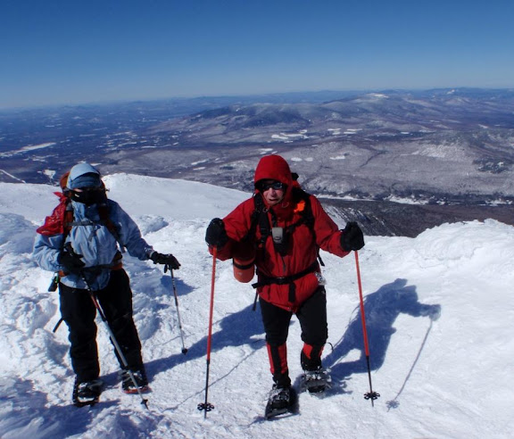
The Doc's (Kate and Jerry) up near Adams
Down Mt Adams we went and back tracked towards the hut. We could see a lone hiker coming down Mt. Madison. We stopped outside the hut and found out the lone hiker was MEB. She mentioned she is finishing the grid next month, then starting the AT down in Georgia in April. We wished her well. We had our lunch, then dropped our packs and headed up Madison. Although, I was pretty fatigued, I had enough in the tank to make it up.
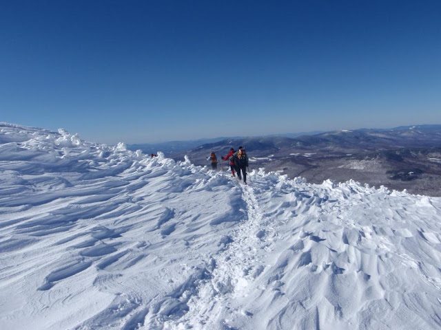
Wind swept Landscape
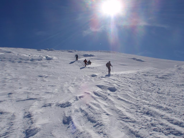
Cruising down Madison
We all summited, made it back down to the hut, and saddled up for the hike down at 2pm. The hike down went ok with some of us battling cramping. We took a break, refueled, and continued down. We made it down to the vehicles at 4pm.
A great hike with a great group of folks. #39 for Keith, and 2 more W48’s for all of us. Off to the Moat for a post hike brew and vittles, and then back to Maine.
Hiking stats: about 10 miles, 5000 ft of ele gain. 7 hrs, 30mins
Slideshow ^
Hiking Pictures:http://picasaweb.google.com/mpetcher
Ascent List:http://peakbagger.com/climber/climblistc.aspx?cid=1767
Petch
Cast of Characters: Jerry, Kate, Keith (Kpmmbm), Crazy Bob, and Petch
Peaks/Trails: Mt Madison and Mt Adams via Valley Way Trail, Gulfside Trail, psuedo bushwacks to both peaks, Valley Way back down.
Trail Conditions: Valley Way is nicely packed out by snowshoe traffic. Above treeline, Gulfside Trail is hard packed with some drifting. Followed prior snowshoe traffic up to both peaks.
Commentary: Keith, Bob and I met Jerry and Kate up at Appalachia Friday morning, and began our hike at 8:30am. We were not sure how far we would go, and figured we’d make it up to the hut and decide from there. Jerry and Kate are both Doctors (Cardiologist, and ER doctor, respectively), so we figured we would be in good hands if any of us developed a medical issue. During a hike, I often feel like I’m going to have a heart attack, and usually end up driving my head into some branch at one point or another. Luckily, their skills would not be required on this trip.
The Valley Way is in great shape with just minimal evidence of bare booting. We wore showshoes all the way up and down. The sun was shining through the hardwoods as we ascended. Weather conditions weren’t bad with sun, warm temps, and moderate winds up top.
Sun peaking through on the Valley Way

The Northern Presidentials are probably my favorite peaks. The elevation gain, the ruggedness of the landscape, the exposure……they are really awesome. But, all those characteristics can also make for a physically demanding and exhausting hike.
As the Valley Way steepened, I began to bonk
Breaking through the Spruces into the land of White

We made our way to the hut area and came across a couple groups doing a traverse. The winds at this point were minimal, but we layered up and decided to summit Mt Adams first. Keith needed Adams for his 48 list. It’s wild to see so much snow up there. I can count on a few fingers how many times I saw exposed rock. Where are the rocks? I thought there were Rocks on Top!
We went along the Gulfside trail and followed prior snowshoe traffic up to Mt Adams. It may have been the Airline trail. There is so much snow, who really knows….It was a long climb, and some of us were feeling it. Crazy Bob was the optimist/motivational speaker, encouraging the pace and talking about doing Mt. Madison afterwards. As much as I appreciated his words, if I could have reached my ice axe, I would have…….. and Kate’s skills would have been necessary
Keith and Crazy Bob on Adams

The Doc's (Kate and Jerry) up near Adams

Down Mt Adams we went and back tracked towards the hut. We could see a lone hiker coming down Mt. Madison. We stopped outside the hut and found out the lone hiker was MEB. She mentioned she is finishing the grid next month, then starting the AT down in Georgia in April. We wished her well. We had our lunch, then dropped our packs and headed up Madison. Although, I was pretty fatigued, I had enough in the tank to make it up.
Wind swept Landscape

Cruising down Madison

We all summited, made it back down to the hut, and saddled up for the hike down at 2pm. The hike down went ok with some of us battling cramping. We took a break, refueled, and continued down. We made it down to the vehicles at 4pm.
A great hike with a great group of folks. #39 for Keith, and 2 more W48’s for all of us. Off to the Moat for a post hike brew and vittles, and then back to Maine.
Hiking stats: about 10 miles, 5000 ft of ele gain. 7 hrs, 30mins

Slideshow ^
Hiking Pictures:http://picasaweb.google.com/mpetcher
Ascent List:http://peakbagger.com/climber/climblistc.aspx?cid=1767
Petch
