LRiz
New member
I must admit that I have a love-hate relationship with the White Mountains Hut Traverse. The route - which winds 49.4 miles from Carter Notch to Lonesome Lake across some of the most difficult terrain in the Whites - is gnarly, relentless, and a true test of character. After a very low-mileage week of training due to illness, I found myself itching to get in a final long run prior to beginning my taper for the Vermont 100 miler. Imagine my excitement when - after watching the weather forecast like a hawk - a weather window opened up that would make it possible for me to attempt the traverse! Rob kindly volunteered to join me, and I was psyched to finally have the opportunity to test out my new Garmin GPS watch in the mountains.
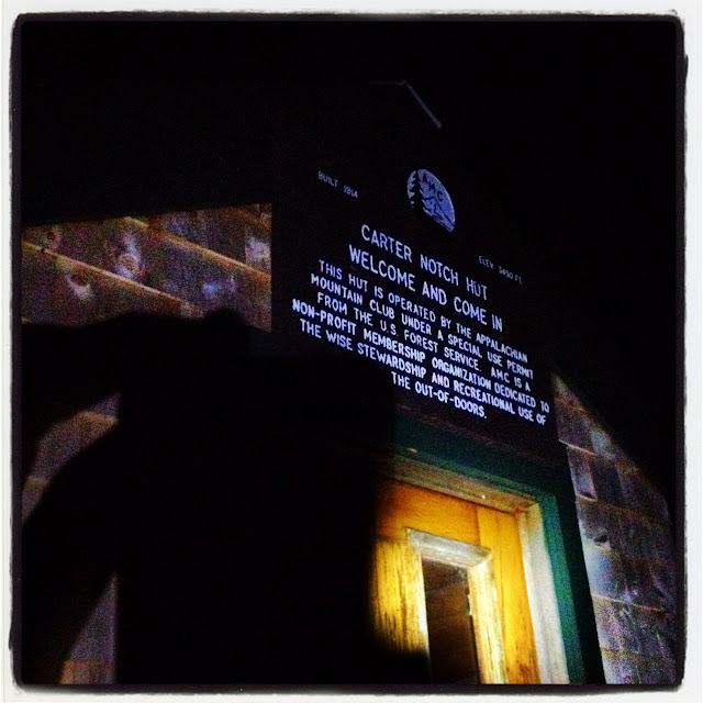
We began our hike/run at 1:15am on Sunday after a (sleepless though very recharging) 3-hour cat nap at Carter Notch Hut. The footing on the 19 Mile Brook trail seems to have deteriorated considerably since Hurricane Irene, which - coupled with a low-battery headlamp - made the run out difficult to route 16 difficult to negotiate in the dark. Fortunately, Rob and I both had spare batteries stashed in my truck at the trailhead, and after a quick break we were on our way up Madison. The Great Gulf trail is wonderfully "runnable," and I found myself spurred on by the brilliantly bright moon above us. We reached the Osgood trail junction decent time, and at that point I couldn't wait to get above treeline... as soon as we did, the sun peeked up above the horizon to welcome us.

Osgood ridge at sunrise

Windy conditions heading to Madison Hut
Upon reaching Madison Hut, we took a nice 20 minute break to refuel/rehydrate in anticipation of our trek across the Presis. Given the cool temperatures, I figured that it would not be necessary for us to stop at either Lakes of the Clouds or Mizpah Huts. Thus, we made sure to supply sufficiently for the 14 mile journey down to the Highland Center.
It really was a stunning morning to be above treeline, and we made sure to stop and take a few photo breaks...
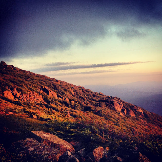
Alpenglow on Adams
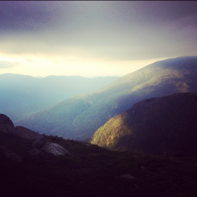
Beautiful morning light on the Gulfside
The run around Adams seemed to go by like a flash. I was amazed at how my speed/confidence had improved on the rocky Presidential terrain, thanks for the most part due to the running poles that I now sport religiously. However, as we made our way towards Jefferson we quickly found ourselves enveloped in clouds. Fortunately, conditions remained dry and our pace/morale were not impacted.
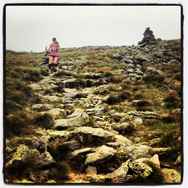
Running down the Gulfside towards Clay
As we made our way towards the Westside, I couldn't wait to set foot upon my adopted trail. The Southern Presidentials are a joy to run, and I knew that from this point onward we'd have a smooth trip down to the Highland Center. We reached Lakes of the Clouds Hut in good time...
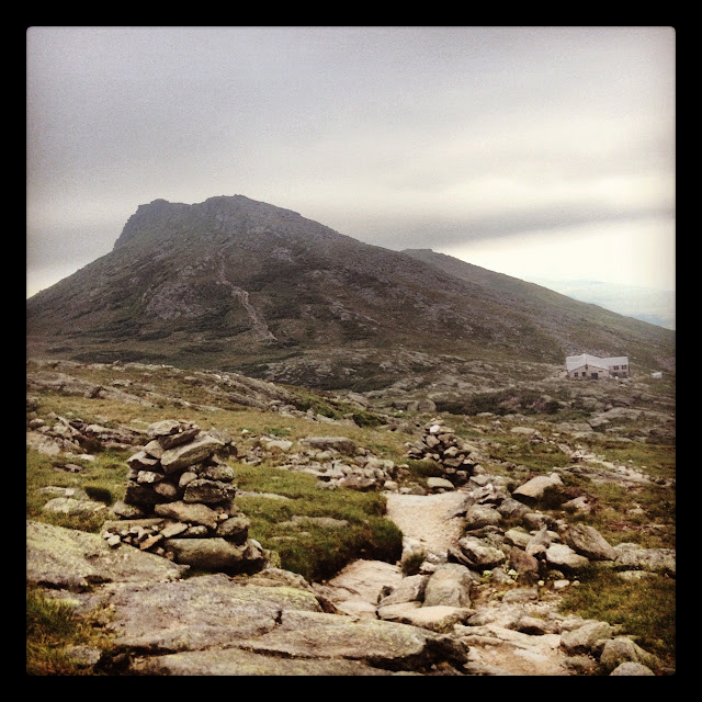
...and then flew across the remainder of the ridge. 8 hours and 5 minutes into our run, and we were at the Highland Center - the midpoint of our Traverse! My feet had gotten quite damp at that point, and I was happy to have a change of socks in my drop bag. Rob and I took ample time to resupply, and I wolfed down my first solid food of the day (two bananas) in anticipation of the tough 24.6 miles ahead of us. On our way down the Crawford Path I could feel the heat and humidity of the day making a brutal debut. I knew we'd really have to pay close attention to our fueling going forward, as we'd been blessed with unusually cool conditions for the first half of the traverse.
As predicted, the climb up A-Z was ferociously hot. It was a huge relief to reach the Tom Spur junction, though at that point I was somewhat dreading the initial gnarly descent down to Zealand Hut. As anticipated, the top section - with its mossy, slick rocks - was tedious at best, though once we'd lost a few hundred feet of elevation the footing improved considerably. Moreover, once we reached the ponds the views were just lovely.
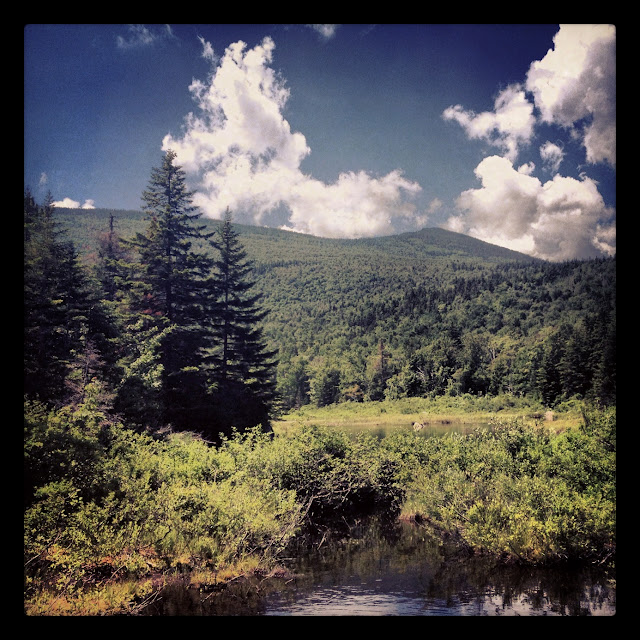
...five huts down, and three to go! Rob and I made sure to top off our water supplies at Zealand in anticipation of the 7.2 miles across the Twinway to Galehead Hut. Once again, the climb up to Zeacliff was brutal. I was sweating at a far higher rate than normal and became concerned about my electrolyte balance. Taking a couple of salt tabs seemed to help, but my head still remained in a bit of a cloudy state for much of the journey across the Twinway.
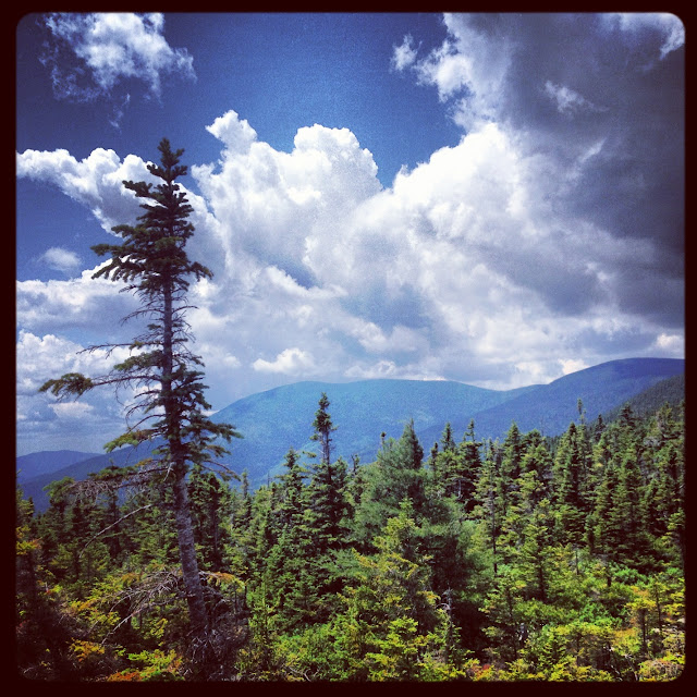
Looking towards the Bonds
Fortunately, by the time that we reached the Zealand Spur I had regained my stride. Nevertheless, even though recovered, the rocky nature of the Twinway as it descends and then ascends up to Guyot made for slow going... all worth it, though, as soon as we broke above treeline and were greeted with absolutely stunning views.
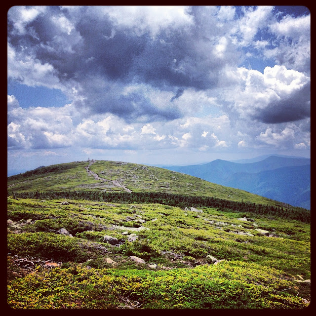
Upon reaching the Bondcliff trail junction, I found myself suddenly rejuvenated. The stretch of the Twinway heading up to South Twin is one of my favorite sections of trail to run in the Whites, and the fact that we had "less mileage and elevation than a Pemi" (as I joked with Rob) to complete at that point seemed unusually rewarding. South Twin was upon us in no time, though I made sure to be very careful on the steep trail down to Galehead Hut. In preparation for the slog over Garfield Ridge, I made sure to consume some additional solid food to ensure that my energy levels would remain steady. However, my efforts were seemingly all in vain, for as soon as we set foot back on the trail I almost instantly hit another low.
…Garfield seemed so very far away, and I felt as if my pace had slowed to a crawl. I tried to keep up with my fueling/hydration, but the humidity had crushed my appetite. All I wanted was to reach the steep waterfall heading up to the peak so that I could dunk my head in the cool water. I felt extremely lucky to have such a patient companion in Rob, as I struggled to regain my energy. Though even upon reaching the summit, my funk lingered. Muscling down a large mouthful of gel, I reminded myself of just how far we’d come thus far. Only two more significant climbs to go.
Heading up Lafayette, the skies suddenly – albeit briefly – broke loose upon us. The resulting rain cut through the humidity like a knife. Initially I became stressed about how the trails would slicken, but as the cool rain drenched me I found myself unexpectedly regaining composure. Focused, steady, consistent.
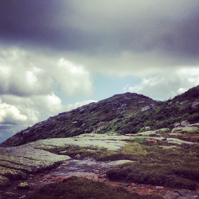
Almost at Lafayette
Upon reaching Lafayette, I told Rob that I wanted to make a single, final push to Lonesome Lake Hut – no stopping at Greenleaf. As predicted, conditions were a little slippery coming down from the summit (and I annoyingly broke one of my running poles in the process), but in no time at all were jogging our way below I-93 en route to the Lonesome Lake trail. 1.6 miles to go! Feeling strong, I made an effort to climb consistently up to the lake. Crossing over the final footbridge, I checked my GPS watch and was amazed to see that we were going to finish right around 17 hours… an hour faster than I’d anticipated! I let out a celebratory shout and sprinted up to the hut.
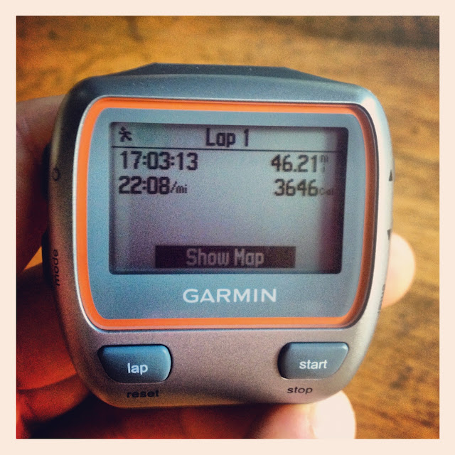
17 hours, 3 minutes, 13 seconds
It had truly been a spectacular - yet challenging - day. A huge thank you to Rob and the fantastic 2012 hut croos for enabling me to achieve my goal of completing the route in under 18 hours. The Hut Traverse is certainly not a trip to ever be underestimated!
GPS track, for those who are interested
Some Fun Facts...
Calories burned - 7,325
Total fuel consumed - 28 gels (19 Honey Stingers, 9 Vega Sport Gels), 6 packs of StrongerFasterHealthier Endurance Whey, 2 bananas, 3 Vega Sport Endurance Bars, 4,137 calories
Average HR - 130
Max HR - 161
Running poles broken - 1
Running poles stolen by some nefarious individual at Lafayette Place - 2

We began our hike/run at 1:15am on Sunday after a (sleepless though very recharging) 3-hour cat nap at Carter Notch Hut. The footing on the 19 Mile Brook trail seems to have deteriorated considerably since Hurricane Irene, which - coupled with a low-battery headlamp - made the run out difficult to route 16 difficult to negotiate in the dark. Fortunately, Rob and I both had spare batteries stashed in my truck at the trailhead, and after a quick break we were on our way up Madison. The Great Gulf trail is wonderfully "runnable," and I found myself spurred on by the brilliantly bright moon above us. We reached the Osgood trail junction decent time, and at that point I couldn't wait to get above treeline... as soon as we did, the sun peeked up above the horizon to welcome us.

Osgood ridge at sunrise

Windy conditions heading to Madison Hut
Upon reaching Madison Hut, we took a nice 20 minute break to refuel/rehydrate in anticipation of our trek across the Presis. Given the cool temperatures, I figured that it would not be necessary for us to stop at either Lakes of the Clouds or Mizpah Huts. Thus, we made sure to supply sufficiently for the 14 mile journey down to the Highland Center.
It really was a stunning morning to be above treeline, and we made sure to stop and take a few photo breaks...

Alpenglow on Adams

Beautiful morning light on the Gulfside
The run around Adams seemed to go by like a flash. I was amazed at how my speed/confidence had improved on the rocky Presidential terrain, thanks for the most part due to the running poles that I now sport religiously. However, as we made our way towards Jefferson we quickly found ourselves enveloped in clouds. Fortunately, conditions remained dry and our pace/morale were not impacted.

Running down the Gulfside towards Clay
As we made our way towards the Westside, I couldn't wait to set foot upon my adopted trail. The Southern Presidentials are a joy to run, and I knew that from this point onward we'd have a smooth trip down to the Highland Center. We reached Lakes of the Clouds Hut in good time...

...and then flew across the remainder of the ridge. 8 hours and 5 minutes into our run, and we were at the Highland Center - the midpoint of our Traverse! My feet had gotten quite damp at that point, and I was happy to have a change of socks in my drop bag. Rob and I took ample time to resupply, and I wolfed down my first solid food of the day (two bananas) in anticipation of the tough 24.6 miles ahead of us. On our way down the Crawford Path I could feel the heat and humidity of the day making a brutal debut. I knew we'd really have to pay close attention to our fueling going forward, as we'd been blessed with unusually cool conditions for the first half of the traverse.
As predicted, the climb up A-Z was ferociously hot. It was a huge relief to reach the Tom Spur junction, though at that point I was somewhat dreading the initial gnarly descent down to Zealand Hut. As anticipated, the top section - with its mossy, slick rocks - was tedious at best, though once we'd lost a few hundred feet of elevation the footing improved considerably. Moreover, once we reached the ponds the views were just lovely.

...five huts down, and three to go! Rob and I made sure to top off our water supplies at Zealand in anticipation of the 7.2 miles across the Twinway to Galehead Hut. Once again, the climb up to Zeacliff was brutal. I was sweating at a far higher rate than normal and became concerned about my electrolyte balance. Taking a couple of salt tabs seemed to help, but my head still remained in a bit of a cloudy state for much of the journey across the Twinway.

Looking towards the Bonds
Fortunately, by the time that we reached the Zealand Spur I had regained my stride. Nevertheless, even though recovered, the rocky nature of the Twinway as it descends and then ascends up to Guyot made for slow going... all worth it, though, as soon as we broke above treeline and were greeted with absolutely stunning views.

Upon reaching the Bondcliff trail junction, I found myself suddenly rejuvenated. The stretch of the Twinway heading up to South Twin is one of my favorite sections of trail to run in the Whites, and the fact that we had "less mileage and elevation than a Pemi" (as I joked with Rob) to complete at that point seemed unusually rewarding. South Twin was upon us in no time, though I made sure to be very careful on the steep trail down to Galehead Hut. In preparation for the slog over Garfield Ridge, I made sure to consume some additional solid food to ensure that my energy levels would remain steady. However, my efforts were seemingly all in vain, for as soon as we set foot back on the trail I almost instantly hit another low.
…Garfield seemed so very far away, and I felt as if my pace had slowed to a crawl. I tried to keep up with my fueling/hydration, but the humidity had crushed my appetite. All I wanted was to reach the steep waterfall heading up to the peak so that I could dunk my head in the cool water. I felt extremely lucky to have such a patient companion in Rob, as I struggled to regain my energy. Though even upon reaching the summit, my funk lingered. Muscling down a large mouthful of gel, I reminded myself of just how far we’d come thus far. Only two more significant climbs to go.
Heading up Lafayette, the skies suddenly – albeit briefly – broke loose upon us. The resulting rain cut through the humidity like a knife. Initially I became stressed about how the trails would slicken, but as the cool rain drenched me I found myself unexpectedly regaining composure. Focused, steady, consistent.

Almost at Lafayette
Upon reaching Lafayette, I told Rob that I wanted to make a single, final push to Lonesome Lake Hut – no stopping at Greenleaf. As predicted, conditions were a little slippery coming down from the summit (and I annoyingly broke one of my running poles in the process), but in no time at all were jogging our way below I-93 en route to the Lonesome Lake trail. 1.6 miles to go! Feeling strong, I made an effort to climb consistently up to the lake. Crossing over the final footbridge, I checked my GPS watch and was amazed to see that we were going to finish right around 17 hours… an hour faster than I’d anticipated! I let out a celebratory shout and sprinted up to the hut.

17 hours, 3 minutes, 13 seconds
It had truly been a spectacular - yet challenging - day. A huge thank you to Rob and the fantastic 2012 hut croos for enabling me to achieve my goal of completing the route in under 18 hours. The Hut Traverse is certainly not a trip to ever be underestimated!
GPS track, for those who are interested
Some Fun Facts...
Calories burned - 7,325
Total fuel consumed - 28 gels (19 Honey Stingers, 9 Vega Sport Gels), 6 packs of StrongerFasterHealthier Endurance Whey, 2 bananas, 3 Vega Sport Endurance Bars, 4,137 calories
Average HR - 130
Max HR - 161
Running poles broken - 1
Running poles stolen by some nefarious individual at Lafayette Place - 2
Last edited:
