Mudrat
Member
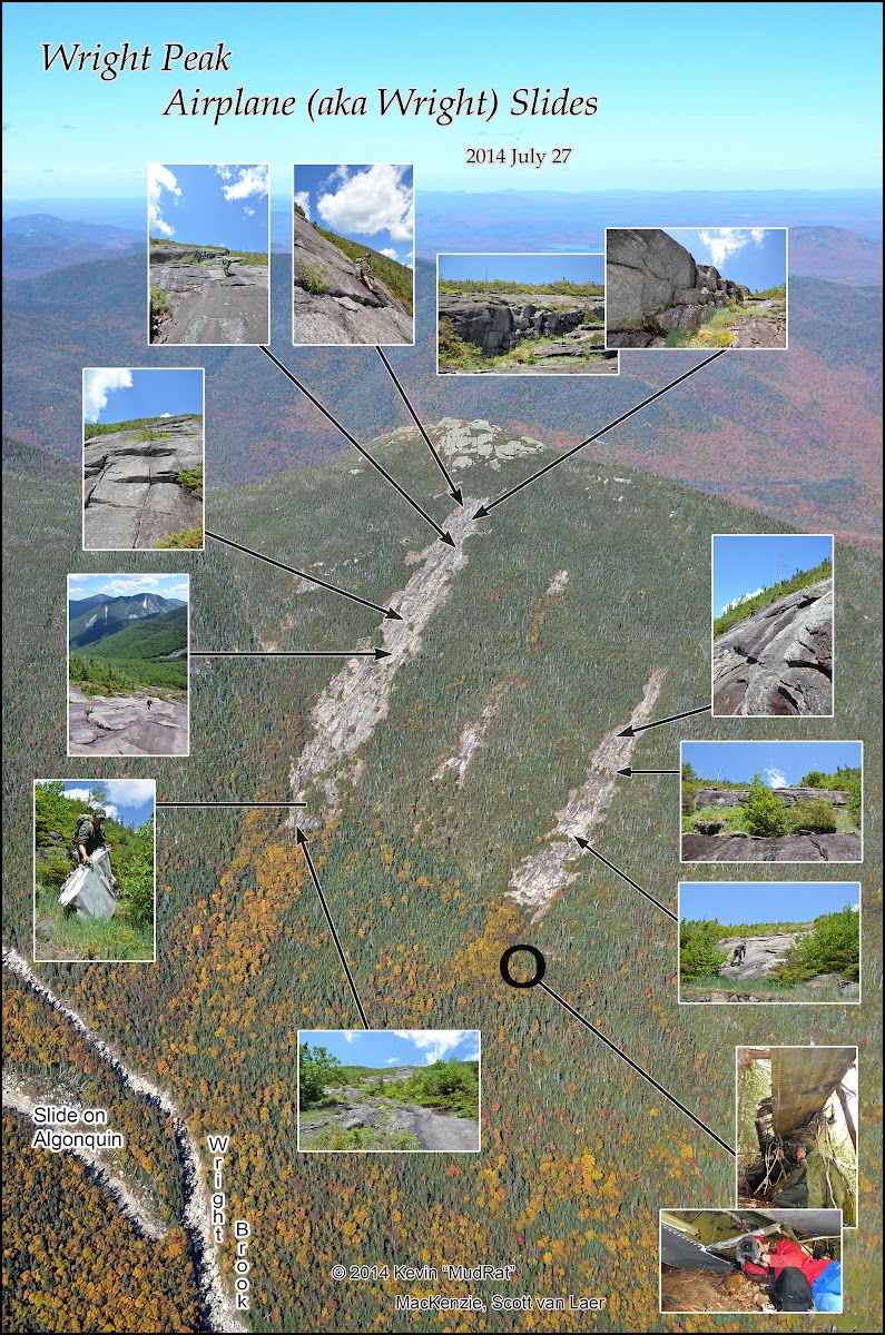
PHOTO SET
Forest Ranger Scott van Laer (Azimuth) approached me with an idea back in 2014. He wanted to find the wing wreckage of the B-47 that crashed into Wright Peak on January 16, 1962. I too had similar aspirations, but no real incentive until his email. The piece would give him valuable information for his upcoming book and presented an interesting challenge to set my sights on—even if it seemed like climbing a needle in a haystack. Plus it involved climbing a slide (or three as we did) so how could I refuse?
The main question was where to start? An article in the Winter 1982-1983 issue of Peeks detailed the trip of two men who searched the slide area in an attempt to find the elusive wing. They found numerous pieces, but not the wing. Perhaps someone knew the specific location, but our best information placed the segment near one of the slides...some saying at the top.
We began the trek from the Adirondack Loj and reached Marcy Dam where a quick stop at the Interior Outpost for a quick snack was in order. Thereafter, we followed the trail ½ mile past Marcy Dam toward Mt. Colden. The first trick to find the slide involves leaving the trail at the correct location; go slightly too far and you’ll end up on a lovely bushwhack near Avalanche Mountain or some other adjacent location. Thus we began the bushwhack as the trail veered left from Marcy Brook. The stream confluence lies one hundred feet upstream; Wright Brook enters from the right.
Locating the slides involves tracking one’s bearing, counting drainages, and looking for other terrain markers. We pondered the steps of those who walked before us; the rescue party from the wreck, loggers and Ranger West’s first ascent of the Left Wing slide in 1940. The larger slide 1939 while the right-hand track formed some years later. We found the debris field ½ mile upstream at 2,900 feet in elevation. This marks the continuation of Wright Brook up to the west-northwest. A nearly parallel drainage from Avalanche Mountain lies to the climber’s left.
Once a mossy Tolkeinish adventure through thick forest growth, the climb up the drainage is now an area of natural artistry—stone and water in harmony. We passed by the Right Wing slide’s small drainage at 3,500 feet in elevation without noticing its meager flow down the steep bank. Unbeknownst to us, we’d later find ourselves back at this location.
Higher up the drainage we scrambled up a small slide on Mt. Algonquin to scan Wright’s ridge and the relative position of the Wright slides. The search for a needle in the haystack began as we set a heading for the Right Wing slide. Our strategy was to start low and work upward staying about 200 feet apart.
The trees were dense though we each found debris after only a few minutes’ search. Unbeknownst to me I was climbing toward the slide drainage. Excited about a small find of twisted metal, I called to Scott. A larger piece was about 50 feet away, but I couldn’t tell what it was from my position and figured that I’d wait for my partner to share in the find.
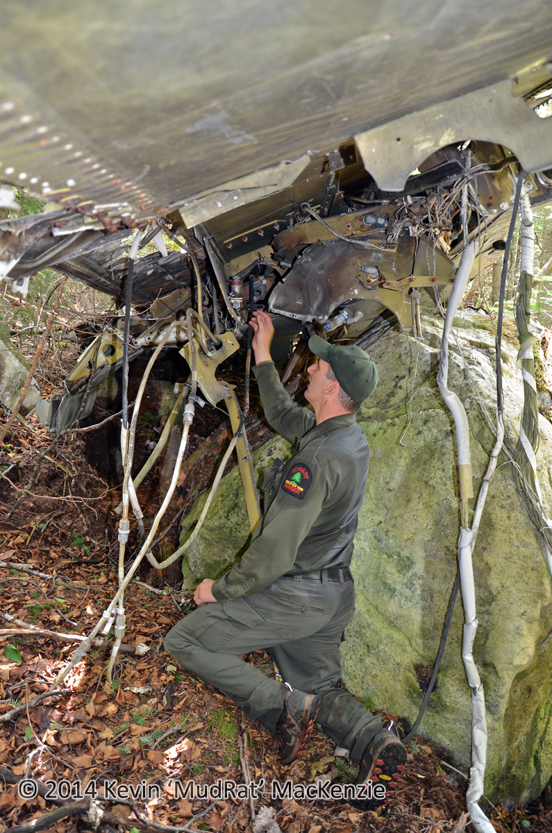
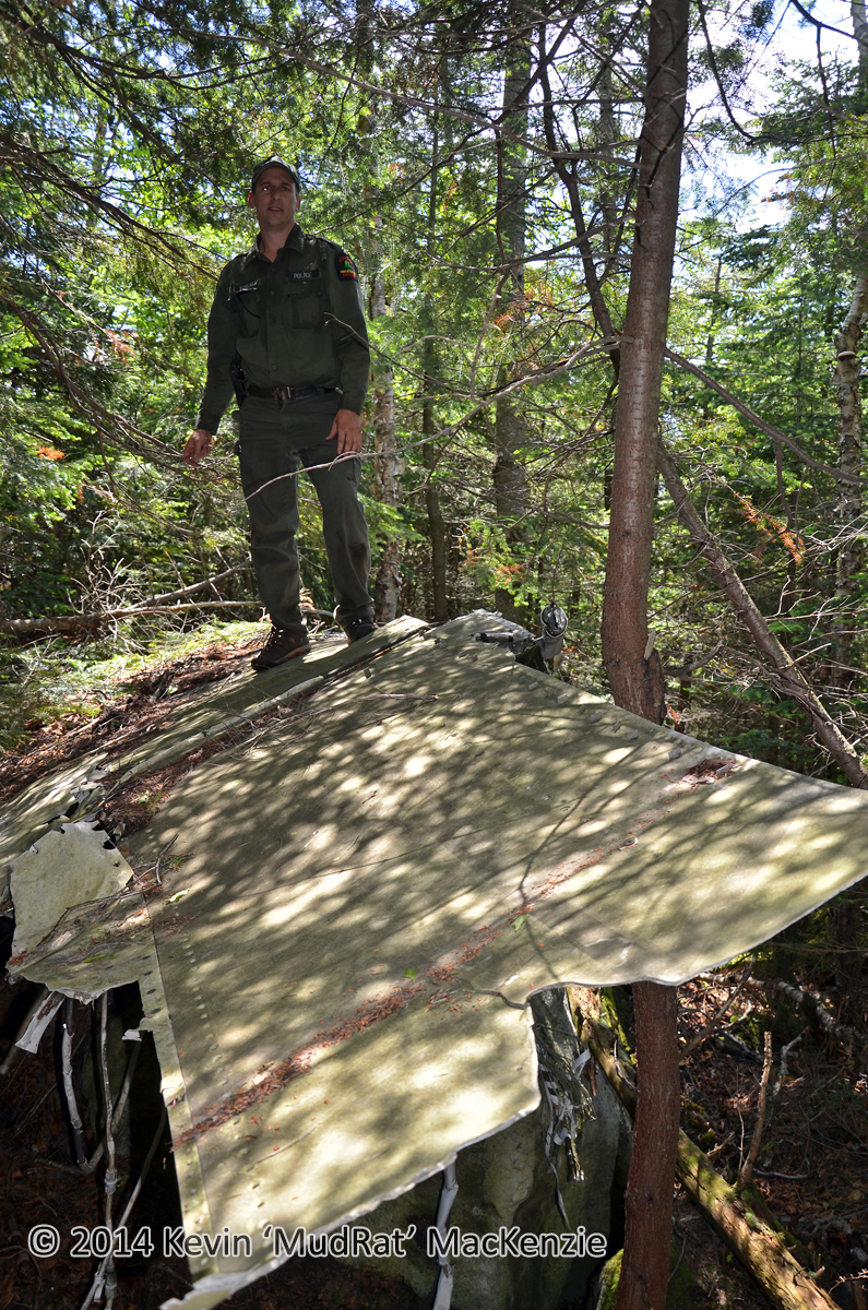
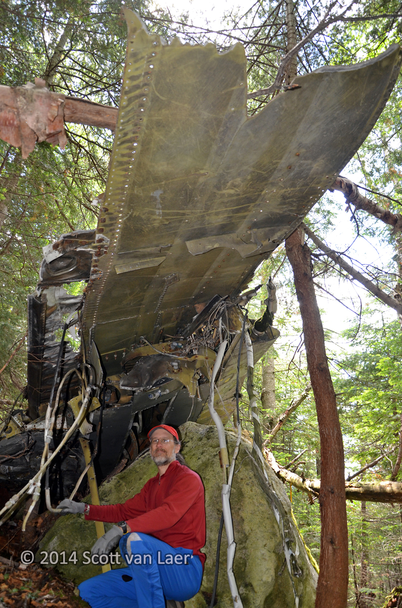
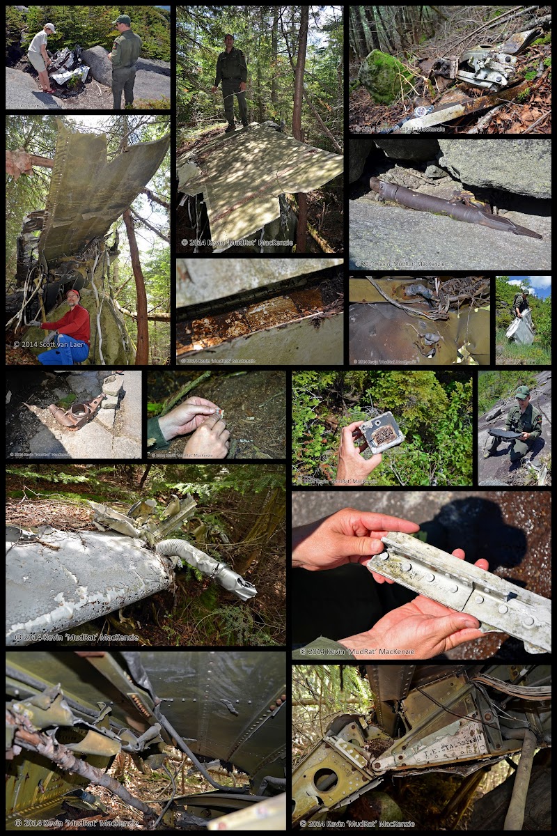
GPS in hand, Scott measured the piece of twisted metal and marked its location. I mentioned that there was something just downslope that we should investigate. A few steps toward the piece I knew it was significant by the change in Scotts demeanor—much like a child who’s received his favourite gift at Christmas. “I think we found the wing!” he stated as his pace quickened. It took a moment to sink in, but atop a boulder between a birch and some evergreens was the 35 foot wing section. It had taken less than 20 minutes which still seems almost anticlimactic since I expected to be poking around until dark.
We cleaned a layer of pine needles off and stood on top of it to look around before getting down to business for the next hour. Scott studied the wires, electrical diagrams, mechanics etc. while I crawled underneath and photographed it from various angles. We spent over an hour before moving on. I’ll let the photographs do the rest of the talking as to the description. Suffice it to say that we were elated with our goal accomplished so early in the day.
The wing lies at approximately 3,800 feet in elevation along the climber’s right of the drainage, the trickle that leaves Wright Brook at 3,500 feet in elevation. Note that the drainage goes underground and is not well defined at first. If you reach the slide, you’ve gone too far.
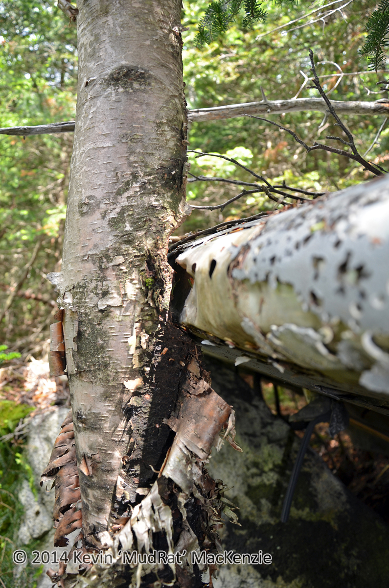
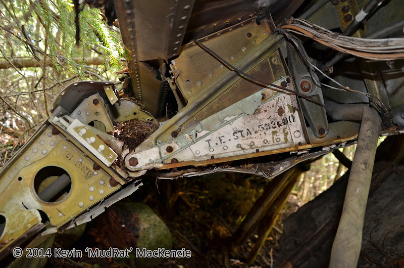
We followed the drainage to the slide’s bottom then climbed its textured face to the top. It’s a thinner less impressive version of the more popular adjacent track. More small pieces were scattered here and there about the slide. Once at the top, we down-climbed and followed the drainage back to Wright Brook.
Higher up the brook at 3,650 feet in elevation we easily found the 6 foot wide drainage that skirts below (but doesn’t lead to) the Left Wing. Two hundred feet higher we followed a smaller stream up to the right and emerged on the base of the dominant slide. Now grown in at the base, this must have been impressive in 1940 when it touched Wright Brook.
The Left Wing is well documented so I’ll just say that we had a blast climbing and zig-zagged about looking for other small pieces of wreckage. Once on the summit we listed to a summit steward talk about the various alpine plants and walked down to the engine before the third leg of the trip.
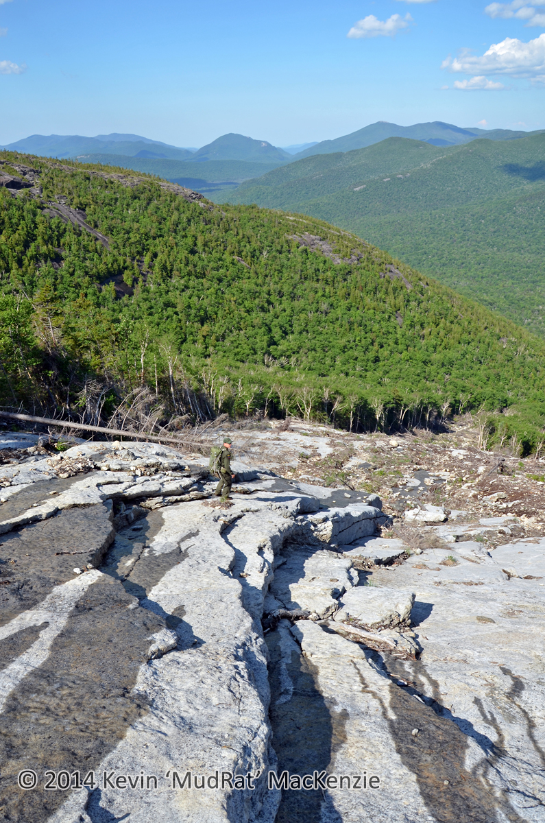
We still had energy and headed over to the new Angel Slide from 2011. After a while of bushwhacking we emerged at the top and made quick careful descent while enjoying the late-afternoon view of Marcy Dam. It was a thrilling day involving one of the Adirondack's most famous wreckages and multiple slides--the best of both worlds with a friend whose outdoor passion equals if not surpasses my own. Thanks for including me in that adventure, Scott!
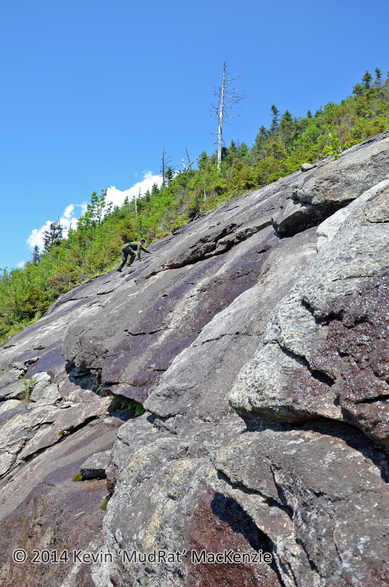
PHOTOS BELOW, 1. Scott ascending the RIGHT Wing, 2. Descending the new Angel slide, 3. Collage of various debris photos from the day.
Last edited:
