2 Short Days & 2 Short Hikes (Dec 9 & 10, 2010)

vftt.org

Help Support vftt.org:

This site may earn a commission from merchant affiliate links, including eBay, Amazon, and others.

1HappyHiker

Well-known member
Joined
Jan 18, 2007
Messages
1,973
Reaction score
405
Location
Bethlehem, NH
Although 2 consecutive days were available for hiking, only a limited amount of time was available on each of those days. On the first day, I took the opportunity to XC-ski into the Pondicherry area near the Whitefield, NH airport. It was a nice time of year to be there before the snowmachine season really gets going.

The second day was spent doing a quick exploration of the Lake Willoughby area of Vermont. It's less than an hour's drive from my home in Bethlehem. I've driven through that area, but never had the opportunity to explore it on foot. I only had time to scratch the surface. It's a lovely area, and I'll likely be doing some other forays to that vicinity at some point.

There's really nothing more to say. And so, in keeping with this report's title of short days & short hikes, this is a SHORT report!:)

For what it's worth, below are a few snapshots from the two locations. Both days were quite overcast and so the "point & shoot" photos are a bit flat due to low lighting.

DAY 1: PONDICHERRY AREA (NH)

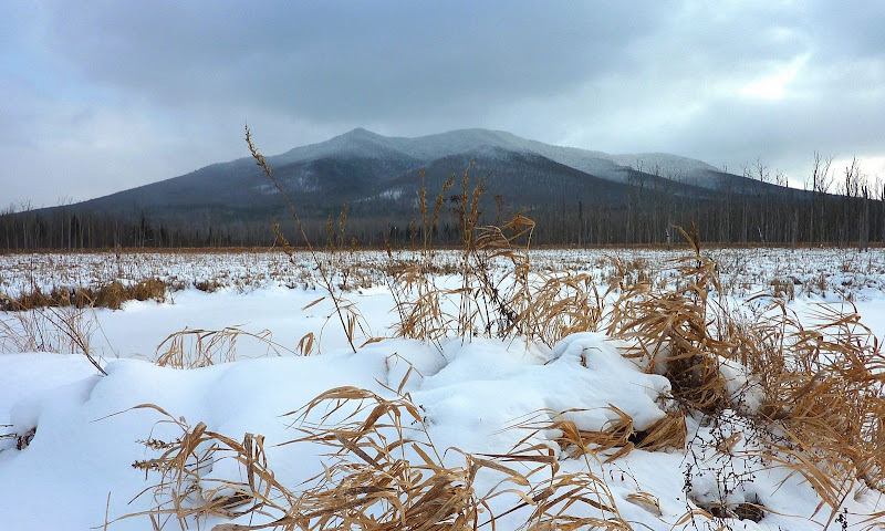
Cherry Mountain from Moorhen Marsh area of Pondicherry
P1080259.JPG

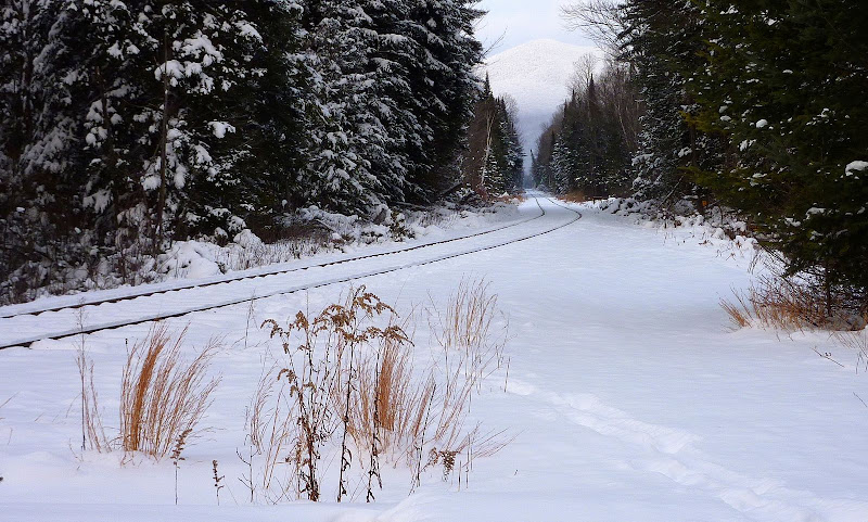
Train Track Running Through Pondicherry Area
P1080260.JPG

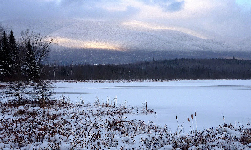
Looking Across Cherry Pond toward the Pliny Range
P1080269.JPG

= = = = = = = = = = = = = = = = = = =

DAY 2: LAKE WILLOUGHBY AREA (VT)

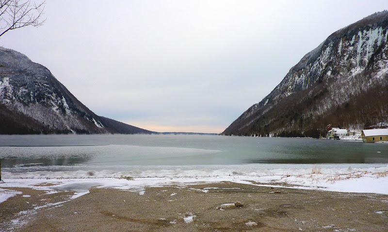
View from South End of Lake Willoughby
P1080272.jpg

Another View from South End of Lake Willoughby
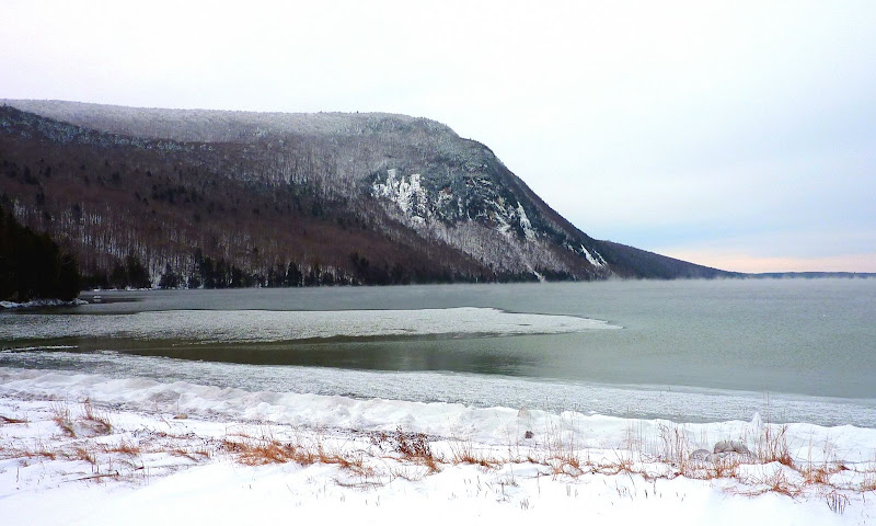
P1080274.jpg

Scene from a Viewpoint above Lake Willoughby
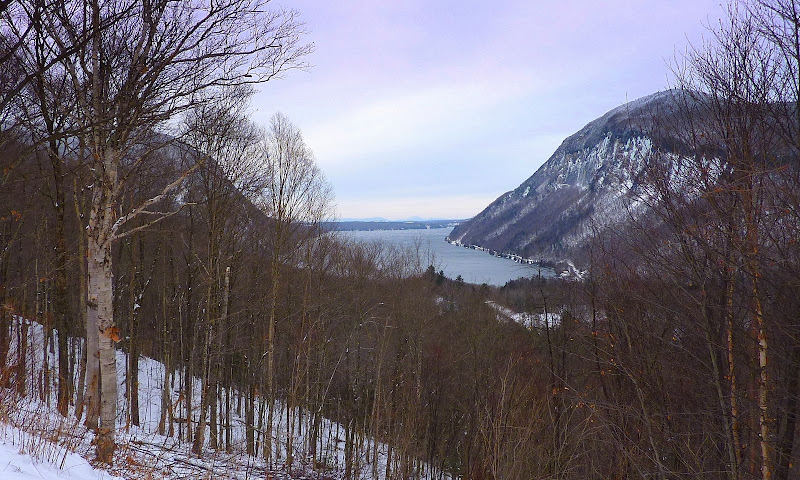
P1080276.JPG

1HappyHiker
 
Last edited:
Love the Cherry Pond pictures, beautiful! Too bad it is all washing away..
 
Willoughby is a great area for hiking! MY first "real" hike was up Pisgah as part of a class trip in ...3rd grade? There are a lot of nice places to go up there. I always like Bald Mtn.

Best bang for the buck around Willoughby is Wheeler Mt... dunno what it's like this time of year though. Think of the Dickey ledges only moreso. It was a 3-generation climb this year, ages 79 to 12.

We also climb Pisgah and Hor almost every year, and Bald or Burke (don't miss the West peak) when we can. Haystack is a traditional first hike with the younger kids, this year we led an expedition (4 under 14) up the new-ish Moose Mt trail - and also got over to Jay Peak.

1HappyHiker: there's a great viewpont from a pullout partway up the CCC road, but the angle of your shot looks wrong. (Well, different.) Where were you? Other favorite viewpoints are the North Beach, partway up 5A north of the Lake (but the phone wires are in the way), and in the little park opposite the Westmore church, looking west at Wheeler.
 
Willoughby is a great area for hiking! MY first "real" hike was up Pisgah as part of a class trip in ...3rd grade?
Wow! I wish my 3rd grade class would have done things like that!
Love the Cherry Pond pictures, beautiful! Too bad it is all washing away..
Matt . . . glad you liked the Cherry Pond photos. It's a scenic spot all year round. And regarding the rainy forecast . . . gheez . . . let's hope that the snow-god/goddess will quickly repair the damage so we can continue onward with winter!:)
1HappyHiker: there's a great viewpont from a pullout partway up the CCC road, but the angle of your shot looks wrong. (Well, different.) Where were you?
Hmmm! Where was I? Well, the answer to your question is probably longer than my entire report!:eek: I parked at the trailhead off Rt 5A near the south end of Lake Willoughby. The gate was open for the CCC Road. However since it didn't look drivable to me, I set out on foot. The map I have (which probably isn't the best) shows no branches off the CCC Road until AFTER the trailhead for the Hawkes Trail. HOWEVER, well before the Hawkes Trail, I encountered a fork in the road. One fork continued straight ahead, whereas the other fork went right and paralleled the western shore of Lake Willoughby. I followed the right fork for a short distance. It was somewhere along this fork that I snapped the photo that I posted.

Just as a side-note, I only had a few hours to hike, and so my main objective for this short day was merely to do some scouting for future hikes when I have more time. I wanted to familiarize myself with the trailhead locations, and to sort of get a feel for the trails in the area. To do this, I hiked a short distance on the Hawkes Trail + the South Trail leading to Mt. Pisgah + most of the South Shore Trail. I had also hoped to get a feel for the trails off Wheeler Mountain Road (i.e. the trail to Wheeler Mtn, and the one to Moose Mtn). However, I ran out of useable daylight before I could get to that location.
 
Last edited:
HOWEVER, well before the Hawkes Trail, I encountered a fork in the road. One fork continued straight ahead, whereas the other fork went right and paralleled the western shore of Lake Willoughby.

The road straight ahead is the Bartlett Mt Road, I have never driven it. The right fork is the CCC road. There's a pullout along there, with a large boulder on the edge - stand on the boulder for one of the classic postcard views of Willoughby and the Pisgah cliffs.

Maps can be a bit of a problem. The recent GMC Northeast Kingdom map is good. I have a Map Adventures Northern Vermont hiking map (2d edition) which is missing some roads, and worse yet shows some roads that do not exist on the west side of Willoughby. I believe there's a 3rd edition of this map but I don't know whether they fixed these errors.

The Wheeler Mt Rd is generally maintained from the south - from Rt 5 - and that is the way to go. The northern approach - from Rt 16 - passes over some very bad road, I made it in a 2-wheel drive normal-clearance vehicle a few years ago but I don't recommend it!

If/when you go to Moose Mt, make sure to go all the way out to the lookout spur. Similarly, on the Hawkes Trail, make sure to hit all 3 lookouts: each one has its own unique (and some of them spectacular) view.
 
What an excellent shot of Lake Willoughby! It was here on Robert Roger's retreat from the St Francis Raid that he made the pivotal decision (just south of Lake Willoughby) to avoid any remaining part of the Passumpsic River route that John Stark told him in advance was a main route of Abenaki war party travel. In actuality, he had made the decision shortly after the dividing of command at Sherbrooke, but was tempted to rejoin it south of Willoughby. Stark's advice was on the nose when the survivors of another retreating party from the Raid (Avery's) rejoined Roger's and told them how they had been ambushed while travelling upon it. From here, he bore southwest, crossed the SE foot of Bartlett Mt and took his tracks into the Dolloff Ponds where they could be lost to any pursuers.

Excellent job once again John! Making history come alive is but one of a piece of your forte'. (in addition to unique hikes and excellent photography)
 
The road straight ahead is the Bartlett Mt Road, I have never driven it. The right fork is the CCC road. There's a pullout along there, with a large boulder on the edge - stand on the boulder for one of the classic postcard views of Willoughby and the Pisgah cliffs.

The Wheeler Mt Rd is generally maintained from the south - from Rt 5 - and that is the way to go. The northern approach - from Rt 16 - passes over some very bad road, I made it in a 2-wheel drive normal-clearance vehicle a few years ago but I don't recommend it!

If/when you go to Moose Mt, make sure to go all the way out to the lookout spur. Similarly, on the Hawkes Trail, make sure to hit all 3 lookouts: each one has its own unique (and some of them spectacular) view.
Thank you Willoughby for posting that very useful information! Very much appreciated! There's just no substitute for first-hand knowledge such as yours!
Nice pic of Mt. Martha/Owl's Head, John.
Thanks Todd for the positive feedback!
What an excellent shot of Lake Willoughby! It was here on Robert Roger's retreat from the St Francis Raid that he made the pivotal decision (just south of Lake Willoughby) to avoid any remaining part of the Passumpsic River route that John Stark told him in advance was a main route of Abenaki war party travel. In actuality, he had made the decision shortly after the dividing of command at Sherbrooke, but was tempted to rejoin it south of Willoughby. Stark's advice was on the nose when the survivors of another retreating party from the Raid (Avery's) rejoined Roger's and told them how they had been ambushed while travelling upon it. From here, he bore southwest, crossed the SE foot of Bartlett Mt and took his tracks into the Dolloff Ponds where they could be lost to any pursuers.

Excellent job once again John! Making history come alive is but one of a piece of your forte'. (in addition to unique hikes and excellent photography)
Scott . . . thanks for the kudos!
Regarding "making history come alive", folks like me can't help but be inspired by folks like you with such an in-depth knowledge of New England history. The info you posted about the Lake Willoughby area was both interesting and brand new to me!
 
Last edited:
Awesome John. I've never been to Cherry Pond, but those views really are top notch. And there is no climbing, I assume? It looks like a perfect place to bring a date who isn't all that keen on climbing mountains, but is still curious about the mtns, correct? Can you tell I'm scheming? haha

And for Lake Willoughbuy...that is hands down, my favorite part of VT. Back in the Lyndon State Days, we did a hike up Mt Pisgah with the American Meteorological Society club, and the views are absolutely stunning, down to the lake, and beyond. I just love the glacial lake...it kind of reminds me of what a fjord looks like. But is in my opinion, the most dramatic glacial lake in the east. Just be careful not to stumble on the nude beach, like I did. :eek:

Glad you were able to get up there!
 
You went to Lake Willoughby in the winter* and you went HIKING? Can't you see all that beautiful ICE up on the cliffs?

* Yeah, I know, not according to AMC rules. Ice knows no such rules!
 
Awesome John. I've never been to Cherry Pond, but those views really are top notch. And there is no climbing, I assume? It looks like a perfect place to bring a date who isn't all that keen on climbing mountains, but is still curious about the mtns, correct? Can you tell I'm scheming? haha
Yup! You're correct . . . there's no climbing involved for Cherry Pond. Hope your "scheme" works out!;)
And for Lake Willoughbuy...that is hands down, my favorite part of VT . . . Just be careful not to stumble on the nude beach, like I did. :eek:
Phil, I had to laugh out loud when I read your warning about not stumbling upon the nude beach at Lake Willoughby. Many years ago my wife & I attended a wedding that was held at an island location in the Caribbean. Me being me, I'm always on the lookout for a trail/path wherever I go. I spotted a path which my wife and I followed for a short distance. Yes, we stumbled upon a nude beach.:eek::eek: I still get some razzing about that one!:D
You went to Lake Willoughby in the winter* and you went HIKING? Can't you see all that beautiful ICE up on the cliffs?
* Yeah, I know, not according to AMC rules. Ice knows no such rules!
Wow! I'm learning more from this thread than was ever anticipated. Thanks to Willoughby, I've learned some of the finer points about where to hike in this region of VT, and thanks to FisherCat, I've learned some interesting history about the area, and now thanks to you I've learned that the cliffs on Lake Willoughby are used by folks for ice climbing. I'm not an ice-climber, but it's still fascinating info.
 
Top