1HappyHiker
Well-known member
What delightful weather it was on 21-June! Mostly sunny skies, low humidity, and the air temperature and wind were both moderate! To make the most of these terrific conditions, I wanted to do a trek that would take me above tree-line, and would incorporate a trail that I'd never hiked.
The hike I decided to do was a 9.3 mile loop that goes around the tops of the walls surrounding the King Ravine, plus this trek also incorporated a trip to the summit of Mt. Adams. And, I was able to include a trail in this loop that was new to me, i.e. the Spur Trail. This trail ascends the west wall of King Ravine. It leads from the Randolph Path (just above the junction with the King Ravine Trail) to Lowe's Path (just below Thunderstorm Junction).
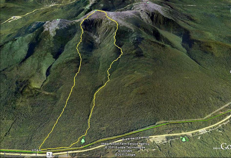
Shown below is a GoogleEarth image of King Ravine with my route highlighted in yellow. The trails involved in my loop were: The Link; Amphibrach; Randolph Path; Spur Trail; Lowe's Path; Gulfside Trail; Air Line Trail.

I realize that many folks are busy and/or uninterested in this type of hike, and therefore only one photo is shown below. If you have an interest in reading more about this hike and seeing a few more photos, then please click HERE to access my Blog.
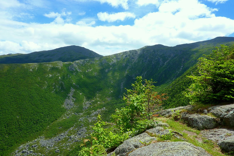
King Ravine (as seen from Upper Crag viewpoint along the Spur Trail)

The hike I decided to do was a 9.3 mile loop that goes around the tops of the walls surrounding the King Ravine, plus this trek also incorporated a trip to the summit of Mt. Adams. And, I was able to include a trail in this loop that was new to me, i.e. the Spur Trail. This trail ascends the west wall of King Ravine. It leads from the Randolph Path (just above the junction with the King Ravine Trail) to Lowe's Path (just below Thunderstorm Junction).
Shown below is a GoogleEarth image of King Ravine with my route highlighted in yellow. The trails involved in my loop were: The Link; Amphibrach; Randolph Path; Spur Trail; Lowe's Path; Gulfside Trail; Air Line Trail.

I realize that many folks are busy and/or uninterested in this type of hike, and therefore only one photo is shown below. If you have an interest in reading more about this hike and seeing a few more photos, then please click HERE to access my Blog.
King Ravine (as seen from Upper Crag viewpoint along the Spur Trail)

Last edited:
